logo

1783. L'Amerique divisee Par Grands Etats . . . 1783

  • L'Amerique divisee Par Grands Etats . . . 1783

L'Amerique divisee Par Grands Etats . . . 1783 information:

Year of creation: 
Resolution size (pixels): 
 11930x8619 px
Disk Size: 
 19.731MiB
Number of pages: 
 1
Place: 
 Paris
Author: 

Print information. Print size (Width x height in inches):
Printing at 72 dpi 
  165.69 х 119.71
Printing at 150 dpi 
 79.53 х 57.46
Printing at 300 dpi 
 39.77 х 28.73

An example of detailing the file of this map of in a printable high-resolution:

Click to open in high resolution (open in new tab).
Attention! this is just the central piece (central area 960x960 px) of the map file!
This is an example, so that you can see and study the level of detail of a given map. The entire Map will be fully available after payment!

L'Amerique divisee Par Grands Etats . . . 1783

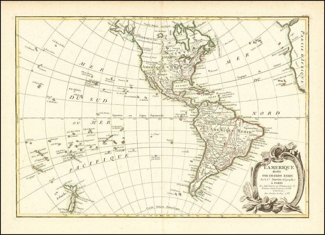
Fascinating Alaska Configuration

1783 edition of Janvier's map of America, issued in the same year that the United States was formally granted its independence from England.

The mythical Sea of the West is no longer shown, replaced by a curious depiction of the Alaska region.

Hawaii appears for the first time on the map (Isles Sandwich), along with a primitive rendition of New Zealand, both based upon the discoveries of Captain James Cook.


Special conditions for students!

If you are a student, write to us in telegram: @antiquemaps and indicate what material you need and for what work you need a map in high detail. We are ready to provide material on special terms. For students only!

Item information:

Year of creation:
Size:
11930x8619 px
Disk:
19.731MiB
Number of pages:
1
Place:
Paris
Author:
Jean Janvier.
$14.99

Related item