
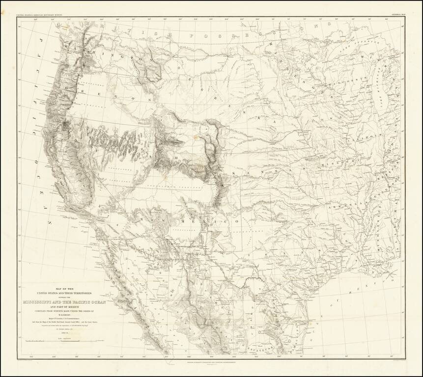
Emory's Map of the Transmississippi West. Marvelously detailed map of the Western Territorial US, published by W.H. Emory in his Report of the United States and Mexican Boundary Survey. The map is one of the fundamental post-Gadsden Purchase maps of...
![[Matagorda Bay: Pictorial Letter Sheet]](/map/small/40810.jpg)
Rare Letter Sheet View Drawn From Original Sketches By Helmuth Holtz Fine early Texas lettersheet, with 6 views of Matagorda, Texas. The views show six buildings, with eagle and flags at top of page. The buildings represented are: a church...
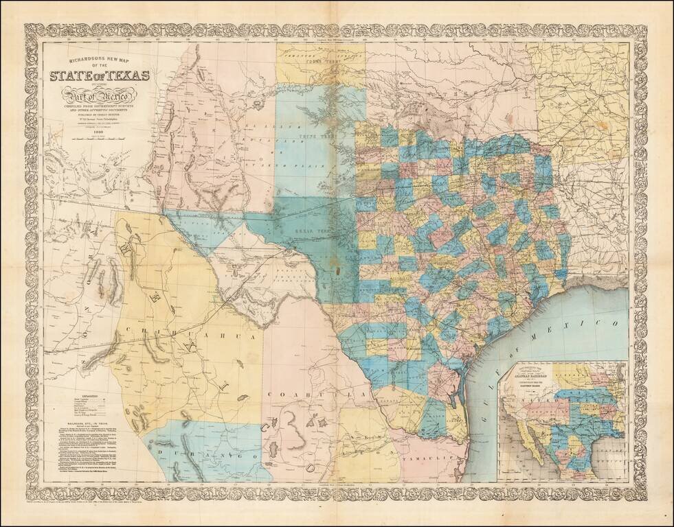
Fine large format map of Texas, published in 1860. Richardson's map was one of the best and most accurate maps of Texas on the eve of the Civil War. Hand Colored by counties, it is of particular not for its excellent depiction of the existing and...
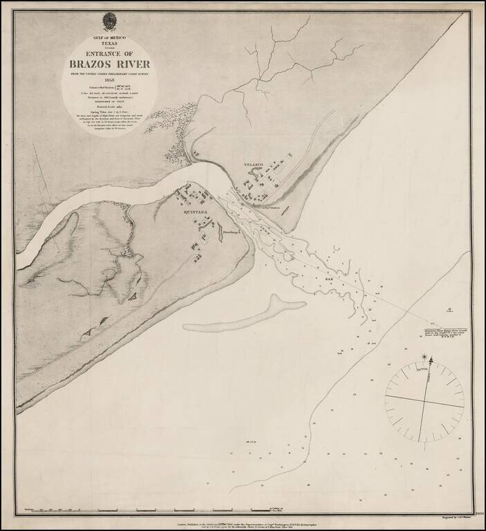
Extremely rare British Admiralty Sea Chart of the Mouth of the Brazos River, first surveyed by the US Coast Survey in 1858. The mouth of the river includes the towns of Velasco and Quintana, including an Observation Station and PIlots Range and...
Scarce map of Texas, published at the beginning of the American Civil War. We have dated the map based upon the configuration of Edwards County, which lasted until January 1862.
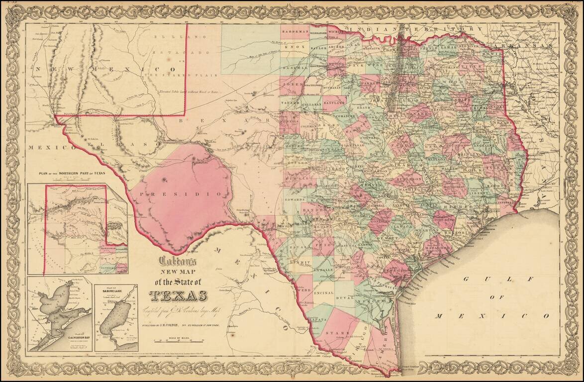
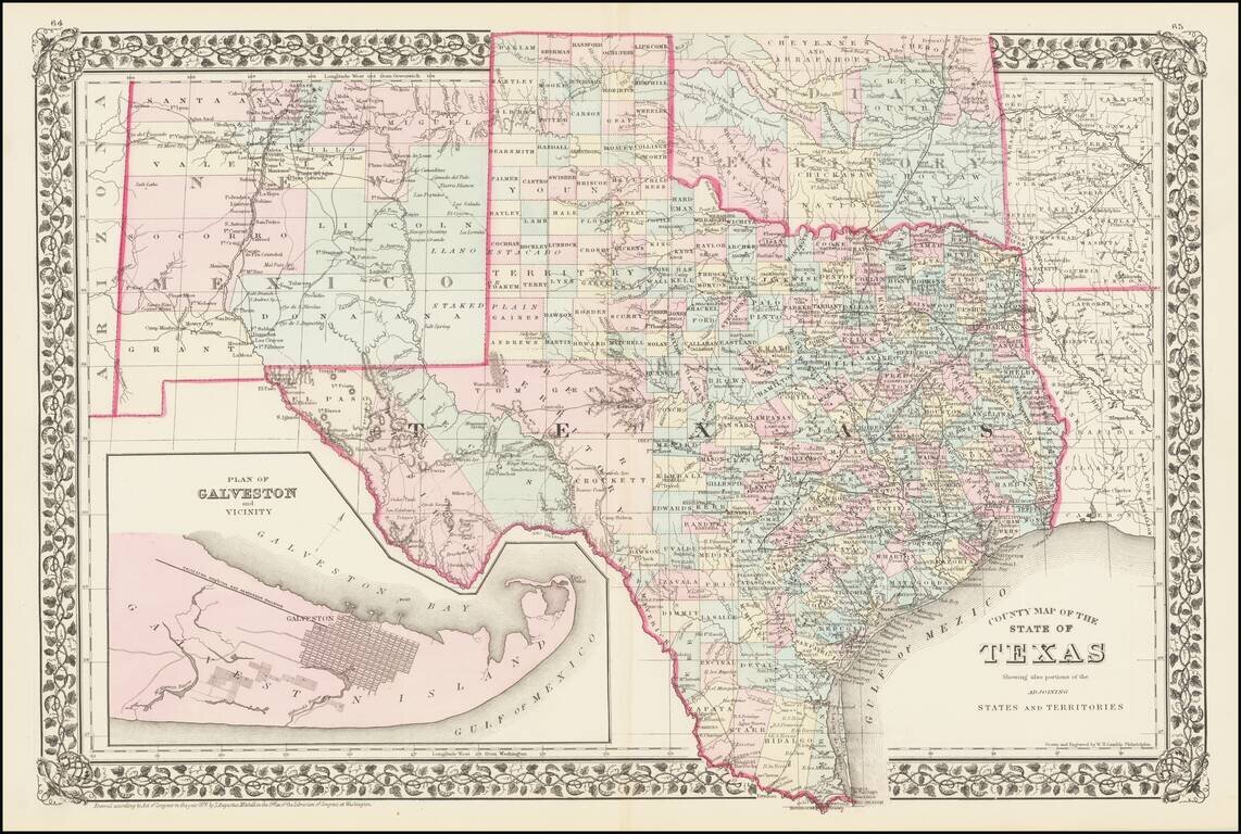
A striking large format map of Texas, colored by counties, with large insets of the northern panhandle, Galveston and Sabine Lake. The map reflects the relative expansion of the Counties of Texas, with more or less the current configurations in the...
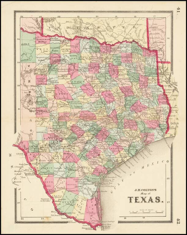
Detailed map of Texas, colored by counties and showing the primitive county configurations in the west. The map is based upon Jacob De Cordova's seminal map of the state, which was first issued in 1849. The map illustrates many early roads, towns,...
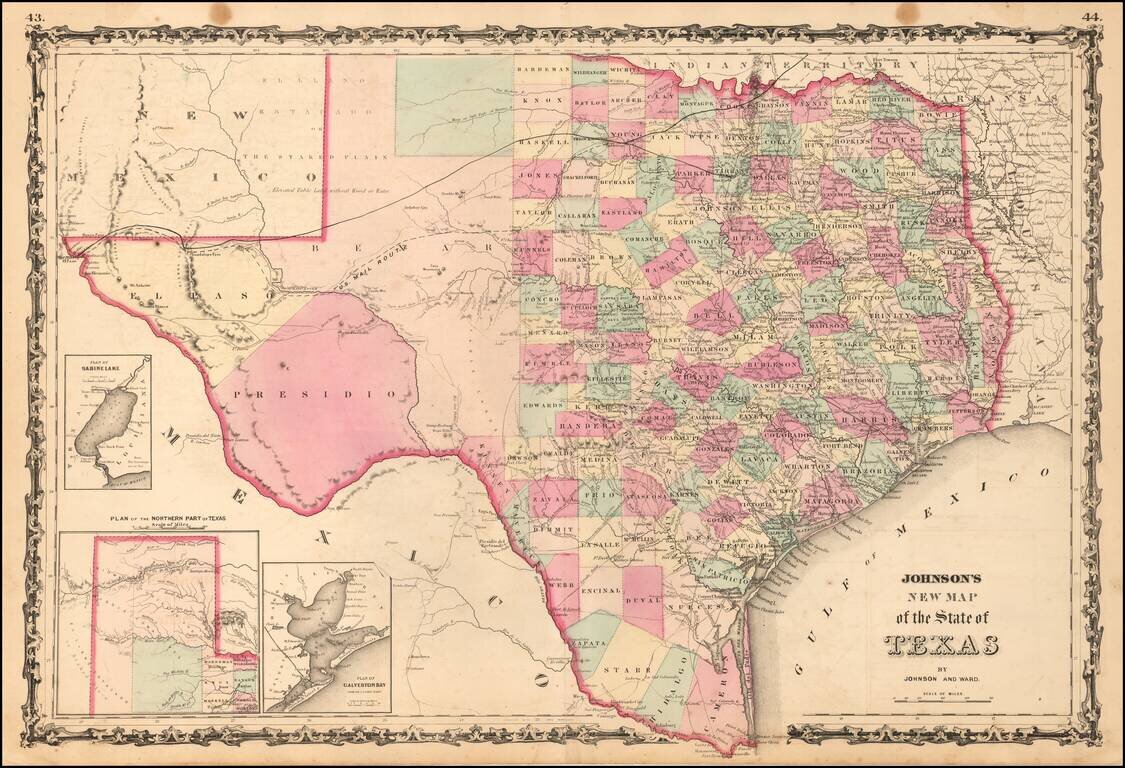
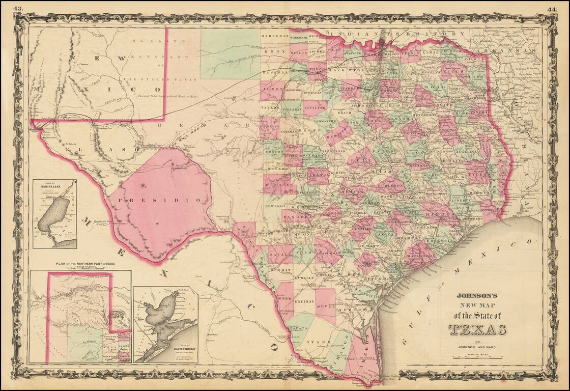
A striking large format map of Texas, published by Johnson & Ward. The map is colored by counties, with large insets of the northern panhandle, Galveston and Sabine Lake. The map reflects the relative expansion of the Counties of Texas, with more...
![[Arizona below New Mexico] Mexique d'apres le grand Atlas Dresse Par A.H. Dufour Grave par ch Dyonet Pubie par A. Le Chevalier . . . 1863](/map/small/64395.jpg)
Scarce map of Mexico and the American Southwest, etc., published in Paris. The map provides nice detail in Texas and along the Rio Grande, with emphasis on the roads and towns. The French Colony In Texas (Col. Francaise) is shown, along with a number...
Rare late edition of Jacob De Cordova's important map of Texas and the first edition to be revised to identify the place of publication as Austin. The most obvious update is that the inset map has changed from a rectangle to an oval, still showing the...
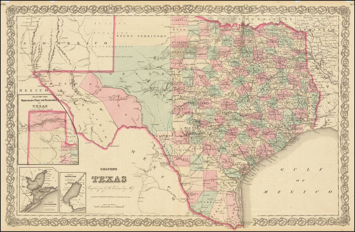
Large format detailed map of Texas, with large insets of the northern panhandle, Galveston and Matagorda Bays and Sabine Lake. The map reflects the relative expansion of the counties of Texas, now plentiful in the east but virtually non-existent in the...
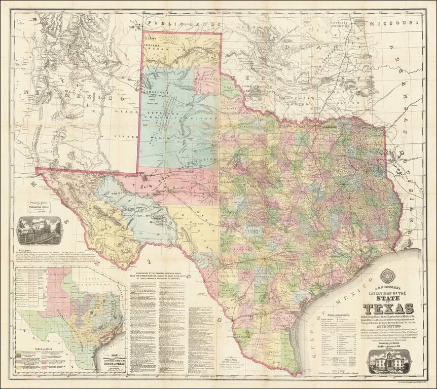
“Texas is, or will be, the wealthiest state in the Union, possessing as she does great agricultural capabilities, all the varieties of soils, minerals and useful rocks known to exist in the world.” (Roessler, “Some Account of the Mineral Wealth...
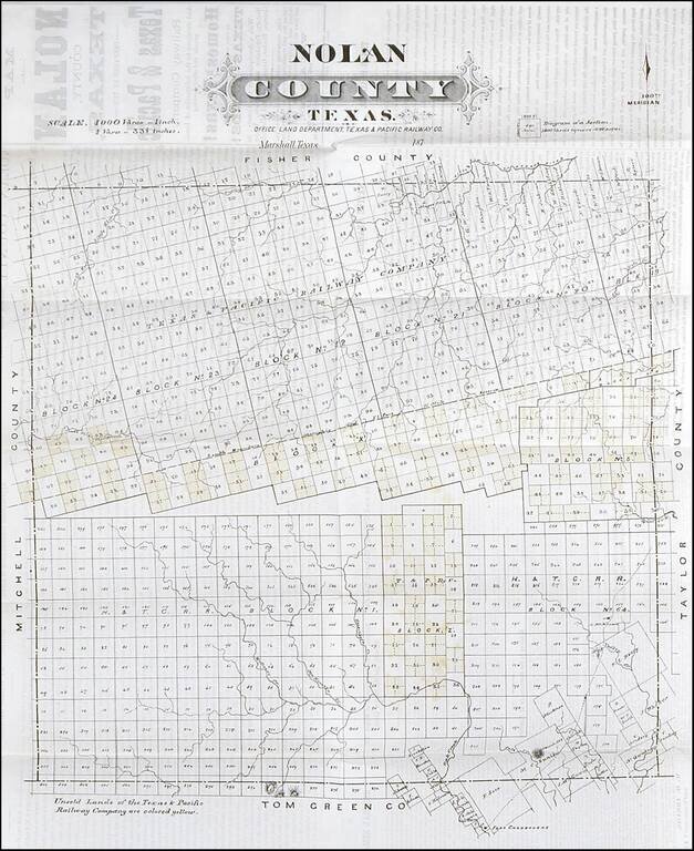
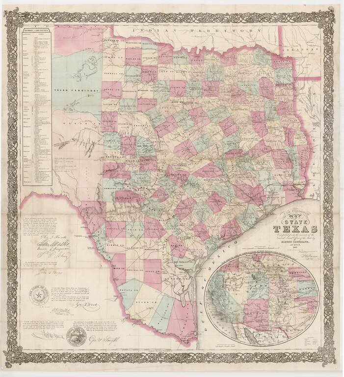
Rare early map of Nolan County, Texas, published by the Texas Pacific Railway Company. The Texas & Pacific Railway was chartered March 3, 1871, with the right to build a trans-continental line from Marshall, TX., to San Diego, CA. Work on the line...
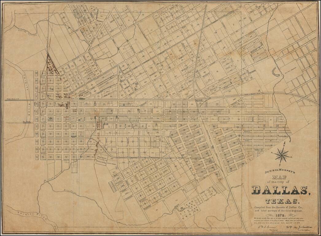
The Second-Earliest Printed Map of Dallas. One of Only Two Known Copies. Separately-issued lithographed map of Dallas, Texas by Dallas-based mapmaker Jones & Murphy. This is the second printed map of Dallas, following F. E. Butterfield and C. M....
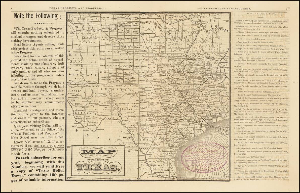
Rare Early Dallas Publication Volume 1, number 1 of this rare Texas promotional newspaper, "Devoted to the Industrial, Immigration and Educational Interests of Texas." This 16 page promotional work was used to promote emigration to Texas. The...
A detailed map of Texas, colored by counties and showing most of Indian Territory and New Mexico. The counties of Texas are still incomplete in the west. The map shows towns, railroads, rivers, springs, forts, and other important details throughout...