
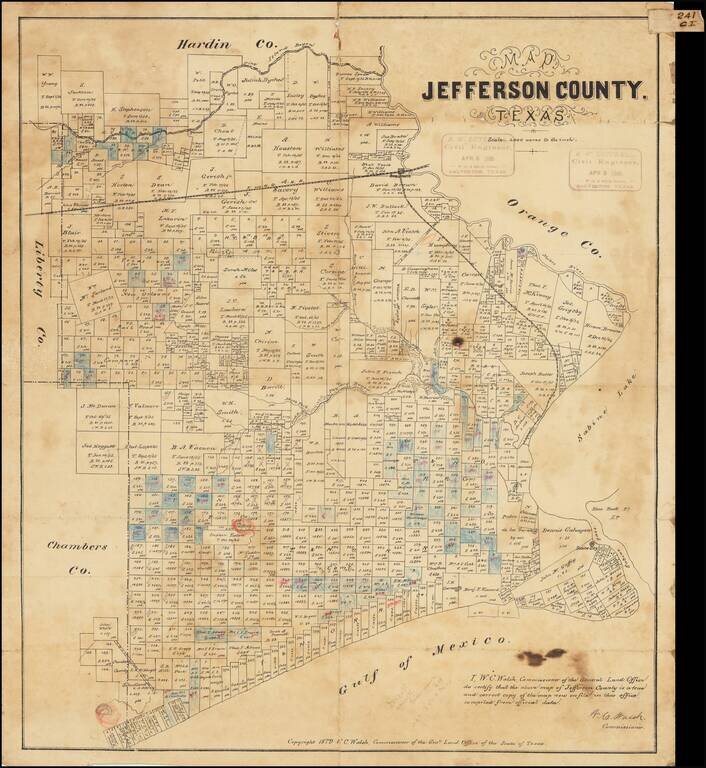
Antique Texas General Land Office map of Jefferson County, Texas. The map was prepared in 1879 by W.C. Walsh, Commissioner of the Genl. Land Office. This example of the map has manuscript annotations related to land sales and the oil industry. Three...
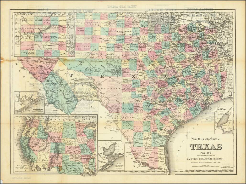
Scarce separately-issued version of Albert Hanford's map of Texas, originally published for his Texas State Register of 1879. The map was prepared by G.W. & C.B. Colton. The map includes a number of good insets: Plan of Sabine Lake; Plan of...
![[Texas] Map showing the route of the Corpus Christi, San Deigo & Rio Grande Railroad, and its connections.](/map/small/70187.jpg)
Rare Texas Railroad Map Interesting map of Texas, illustrating the route of the Corpus Christi, San Diego & Rio Grande Railroad and connecting routes, including an extension into Mexico. The map was prepared to illustrate a US government...
Scarce early map of Texas, focusing on the Railroad Lines then in operation. The map also shows a number of early towns, roads, mountains, lakes, mining regions and other important details. This is the first time we have offered the map for sale and...
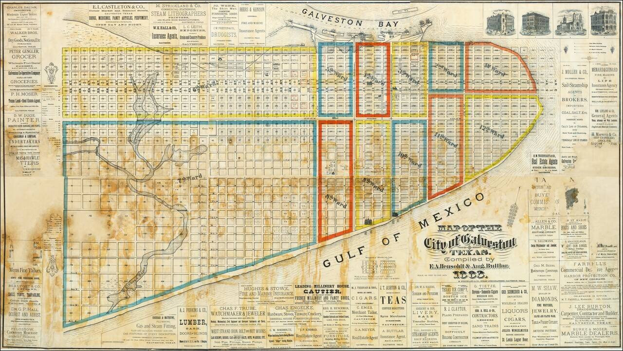
An Exceptional Wall Map of Galveston. The Only Known Copy. The only known copy of Hensoldt & Buttlar's massive six-sheet hand-colored lithographed wall map of Galveston, Texas. The map is replete with advertisements for local businesses,...
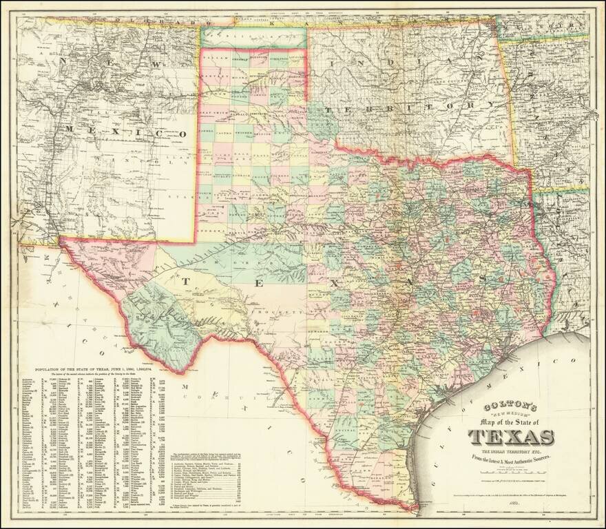
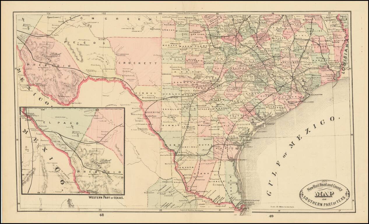
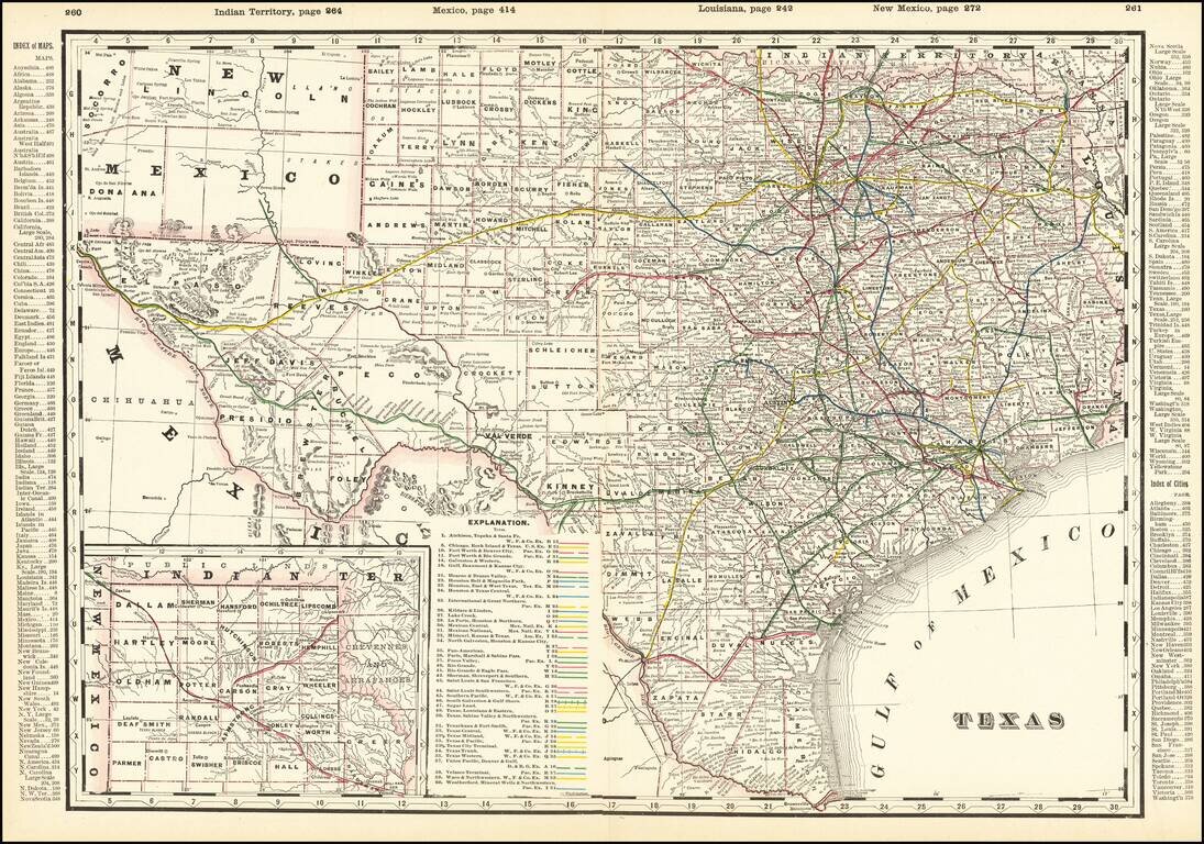
A Texas Rarity Fine large separately published map of Texas, published by GW & CB Colton in 1884. The map provides a detailed treatment of Texas, Indian Territory, and New Mexico, the latter two of which have now been extensively surveyed and...
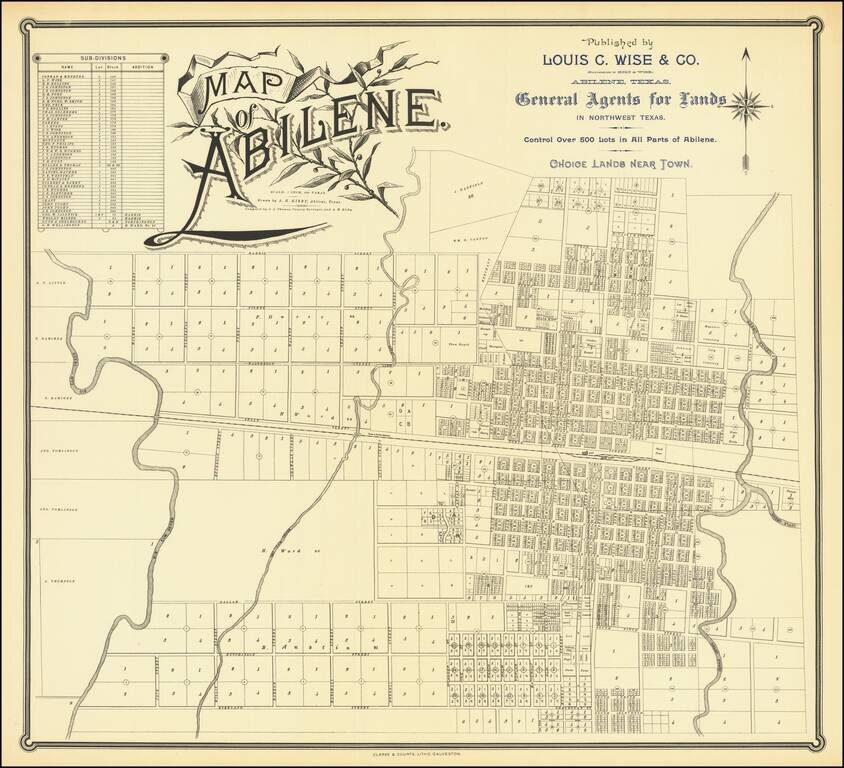
Rare Texas City Plan Flawless uncirculated example of this rare map of Abilene Texas, drawn by A.H. Kirby and compiled by J.A. Thomas, County Surveyor, quite likely the earliest printed map of the city. Printed by Clarke & Courts of Galveston,...
Some of the first Anglo groups to settle in the area were the families of John, Silas, and Ben Parker, all of whom helped build a fort near the site of present Groesbeck (Limestone County) in 1833. This fort was attacked on May 19, 1836, and all of the...
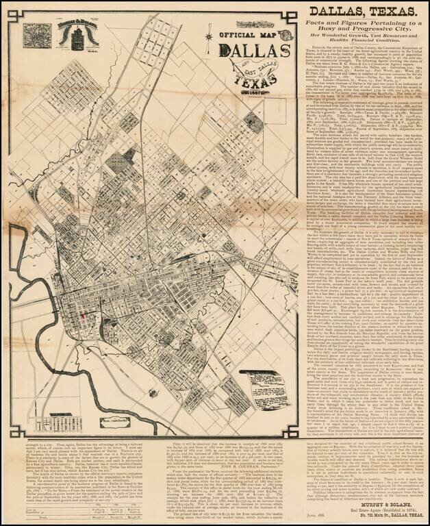
Extremely Rare - one of the earliest obtainable separately issued maps of Dallas, Texas, Murphy & Bolanz's highly detailed promotional broadside. This fascinating map is a promotional broadside, extolling the virtues of Dallas, Texas as "the...
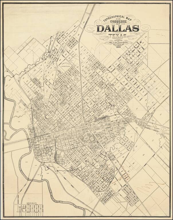
Important 19th-Century Map of Dallas. The Only Known Example. The only known example of this 1890 map of Dallas, Texas, by William Flamm & Co. of Baltimore, Maryland. Curiously, Flamm calls the map a "Topographical Map for Commerce" but there is...
Detailed and interesting railroad map of Texas, which appeared in Cram's Standard American Railway Atlas. Includes the routes of approximately 40 different railroads (with each identified by name and color key), towns, counties, post offices, rivers,...
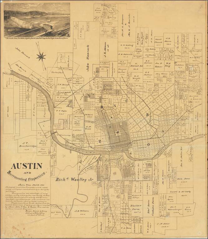
An Early Wall Map of Austin, Texas -- Includes Contemporary Developer's Annotations Rare promotional plat map of Austin, Texas, published by the Bergen, Daniel & Gracy Abstract Title Company. Fine cadastral map identifying dozens of land owners...
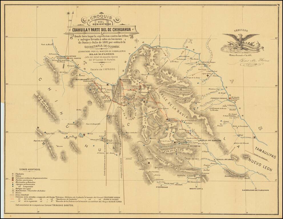
Extermination of the Lipan Indians in Northern Mexico Finely executed map of part of Coahuila and Chihuahua, illustrating the theater of war between the Mexican Cavalry and the Lipan Indians. At the direction of President Porfirio Diaz in 1881, the...
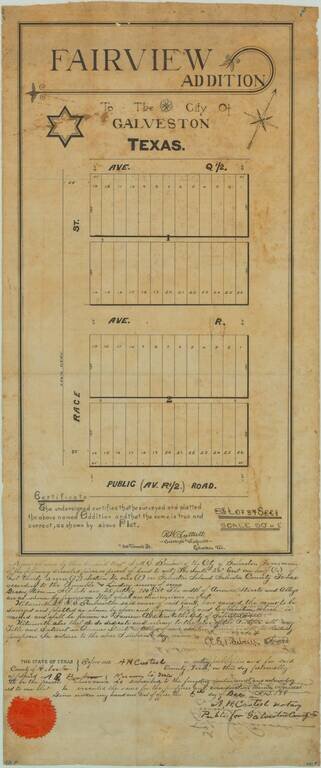
19th-century Manuscript Map of Part of Galveston Texas. Unique antique manuscript map of the "Fairview Addition" to Galveston, Texas, produced by one of Galveston's most important early surveyors, R.W. Luttrell. The map covers two blocks of plots,...
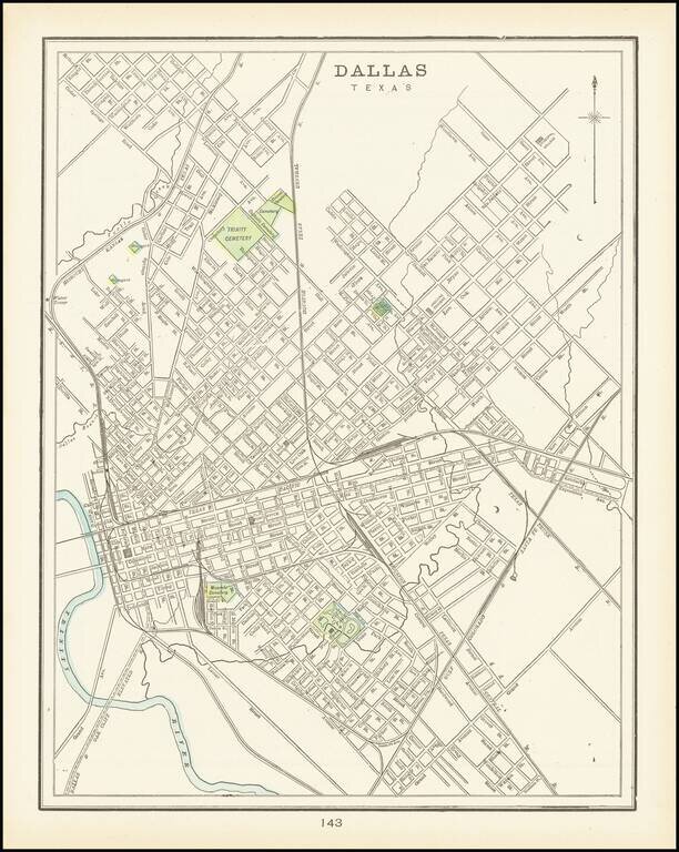
A detailed plan of the city of Dallas highlighting major parks and cemeteries and showing a portion of the Trinity river as well as local creeks. The first separate map of Dallas to appear in a Commercial Atlas and one of the few maps of Dallas...
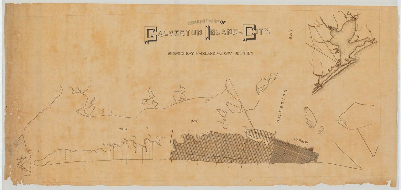
A Pre-Hurricane Manuscript Map of Galveston. Detailed manuscript map of Galveston Island and the city of Galveston, Texas. The map was prepared before the Galveston Hurricane of 1900, when the city was booming and plans for its expansion across the...