
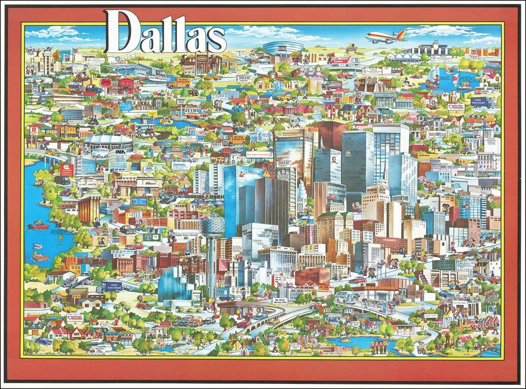
Richly embellished advertising oriented pictorial map / birdseye view of Dallas, Texas, published by Archar Inc. of Canada. Packed with advertising for local businesses, the images shows buildings, tourism and other landmarks, recreational...
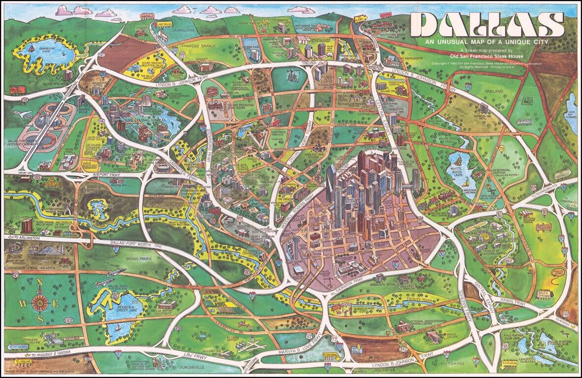
Elaborate pictorial map of Dallas, published by the Old San Francisco Steak House. The map extends to Grapevine Lake, Addison Airport, and famous Southfork Ranch. Love Field and Southwest Airlines Muse Air are shown at the center, with the Dallas...
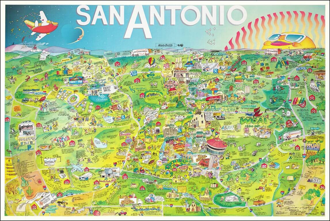
This is a bright whimsical pictorial map of San Antonio, published by Vaughan Company of Round Rock. The map presents a wide array of late 1980s advertisements and tourist attractions in and around San Antonio. Notes around the map paint an interesting...
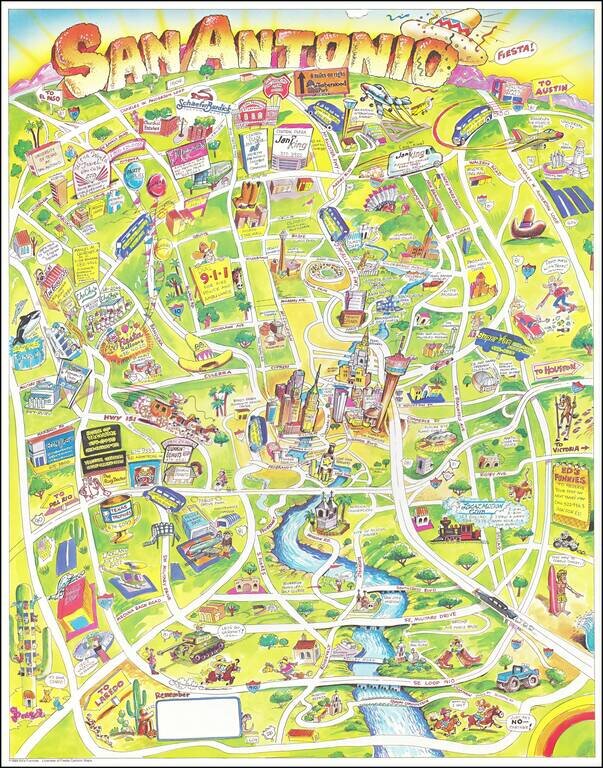
This is an amusing pictorial map of San Antonio from the late 20th century. Alongside the many landmarks of the city, advertisements are shown for companies including restaurants, shuttle services, and custom home producers. The ringed structure of...
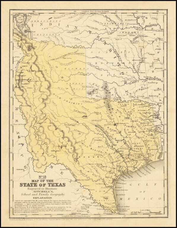
An interesting map of Texas published the year after the state's admission to the Union. In the North, several Indian Districts are shown, including the Comanches, Kiowas and Pawnee-Picts. A region named Wild Horses is shown, this nomenclature derives...
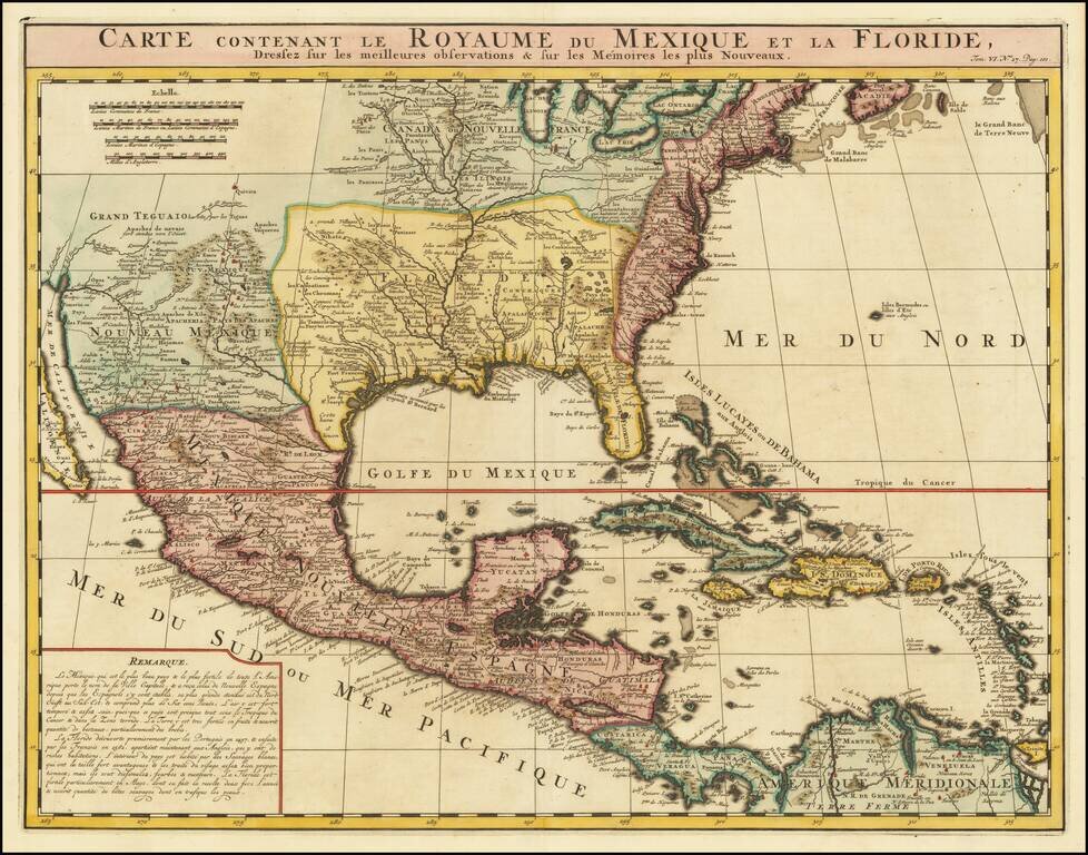
An Early Re-Issue of a Cartographic Landmark Map This is a finely executed map of the southern part of North America by the French mapmaker Henri Chatelain. The map draws its inspiration from the royal mapmaker Guillaume de L'Isle's landmark map of...