
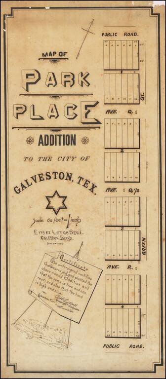
Manuscript 19th-century Galveston Survey Map. Unique manuscript map of an early addition to Galveston, Texas, produced by a Galveston-based surveyor circa 1895. The addition probably occurred (or was to occur) on the west side of the City of...
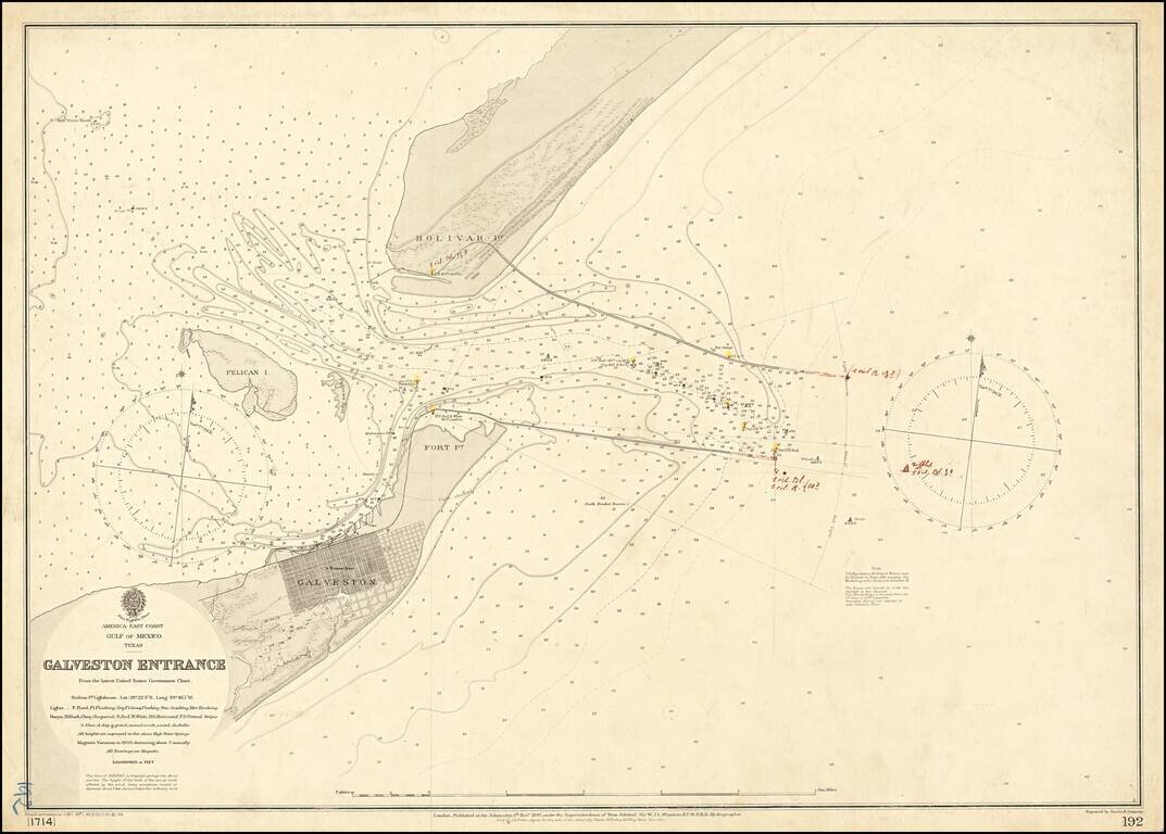
Galveston in the Year of The Great Hurricane (1900) Scarce separately published map of the area around Galveston, Texas, published by the British Admiralty. The coding at the bottom left of the map suggest this is the third revision in 1900, and...
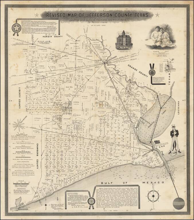
The Birth Certificate of the Texas Oil Industry. A rare promotional map published by the Father of Texas Oil, Pattillo Higgins, pre-dating the discovery of oil at Spindletop. Upon its discovery in 1901, the gusher at Spindletop became the most...
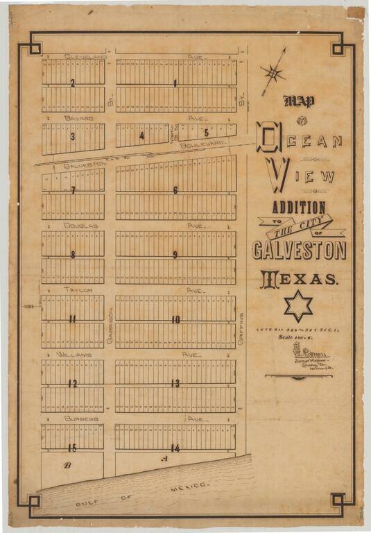
Attractive manuscript plan for an early subdivision in Galveston, Texas, drawn by Galveston-based surveyor R.W. Luttrell. The map shows a Gulf of Mexico-adjacent 15-block addition called the "Ocean View Addition". The addition is centered around the...
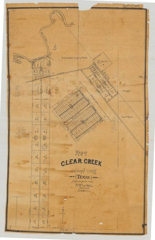
Original manuscript plat map of "Clear Creek", now League City, in Galveston County, Texas, drawn by Galveston-based surveyor R.W. Luttrell probably around 1900. The map shows a series of plots and roads just south of Clear Creek, which enters Clear...
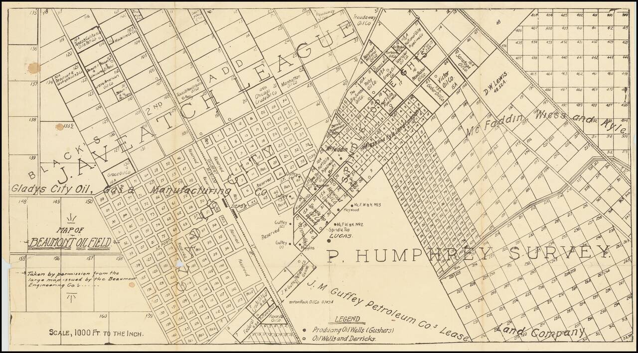
One of the first printed maps of the first major Texas oilfield centered on the Spindletop "Lucas" Gusher. The map is reflective of the frenzy of commercial and oil-drilling activity that took place around the Lucas Gusher in 1901, especially in the...
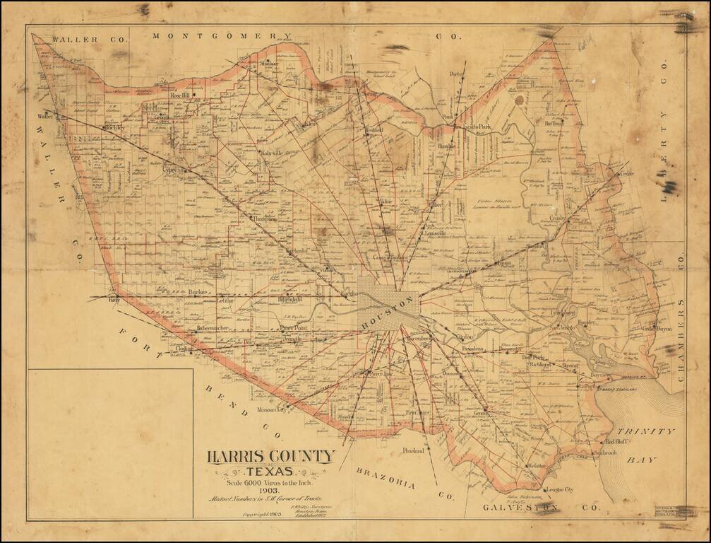
Rare Houston-published antique map of Harris County, Texas, covering the Houston metropolitan area, published by Patrick Whitty, Houston's main surveyor at the end of the 19th century and beginning of the 20th. The map extends from Katy in the west to...
![[Manuscript Map of Oil Development at High Island, Texas]](/map/small/66465.jpg)
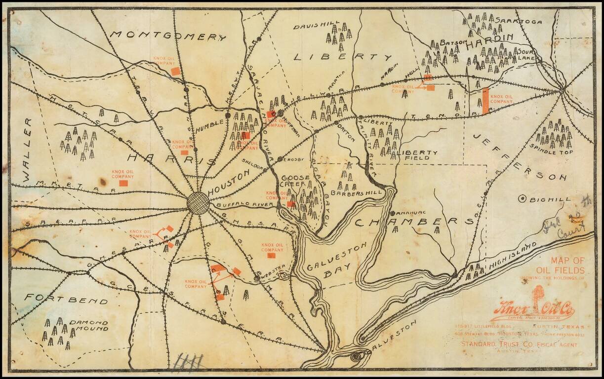
An interesting manuscript map of High Island, Texas, one of the first big oil strikes after Spindletop. Showing drilling blocks in the process of being developed. The map includes notes about a spring and "foot ridge" (?) The map offers an...
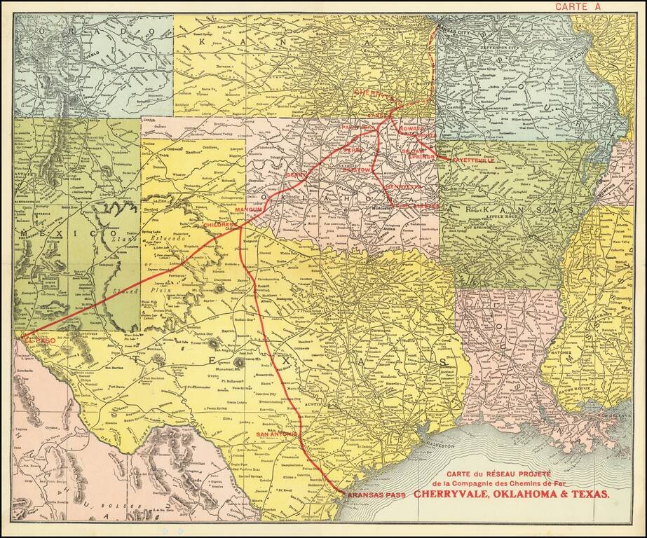
Promoting Railroads To French Investors Fine example of this rare promotional map centered on Texas, Oklahoma and Kansas, published to attract French investors in the issuance of bonds to construct the Cherryvale, Oklahoma & Texas Railway. This...
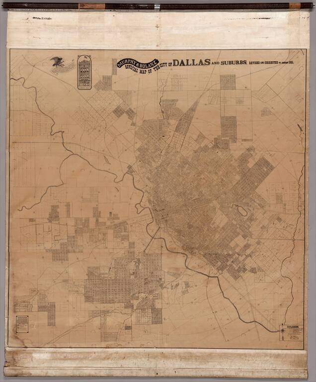
A Colossal, Virtually Unknown Wall Map of Dallas, Published After Publication of George Kessler's Plan For Modernizing Dallas The present map measuring approximately 7.5 feet x 7.5 feet, is the only other large format map of Dallas published before...
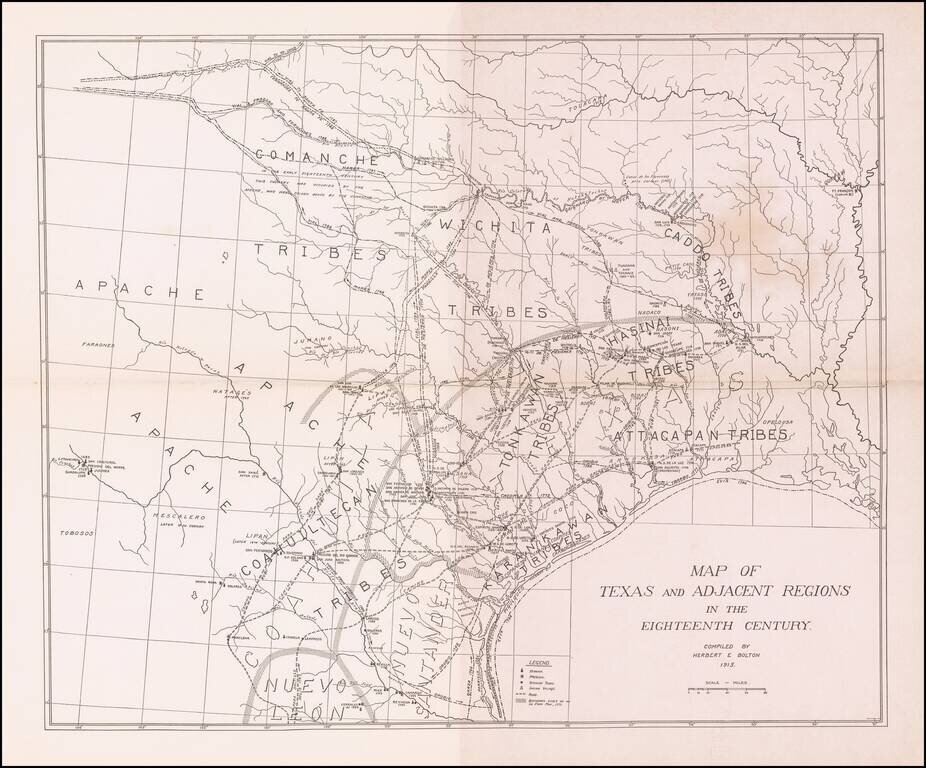
Scarce map showing Texas and adjacent regions as they would have been in the 18th Century. The map was prepared by Herbert Bolton, one of the most prolific and important writer/scholars of the 20th Century. The map shows the major Indian tribes and a...
Extremely Rare Early Texas Oil Promotional Map, Featuring the First Oil Fields of the Texas Oil Industry. Separately issued promotional map printed in black (showing geographical features including towns and railroads) and red (showing the oil leases...
![[Early Texas Aeronautical Navigation Map] Aeronautical Map For Cross Country . . Drawn by Cpl. V.G. Smylie Aero Squadron, Ellington Field](/map/small/59678.jpg)
Rare Early Aeronautical Map of Texas - 252nd Aero Squadron - Ellington Field Rare aviation map prepared by Vernon Guy Smylie of the 252nd Aero Squadron, Ellington Field, in Houston, Texas. The map covers an approximately 9500 square mile area of...
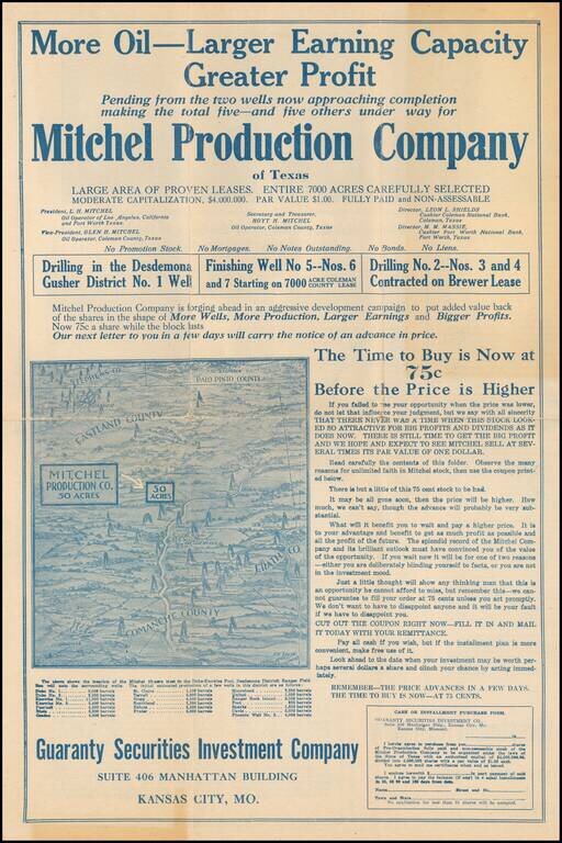
Richly Illustrated Oil Promotional Progress Bulletin --THERE NEVER WAS A TIME WHEN THIS STOCK LOOKED SO ATTRACTIVE! Promotional brochure for the Mitchel Production Company, promoting investments in its wells in Eastland, County, Texas. The map...
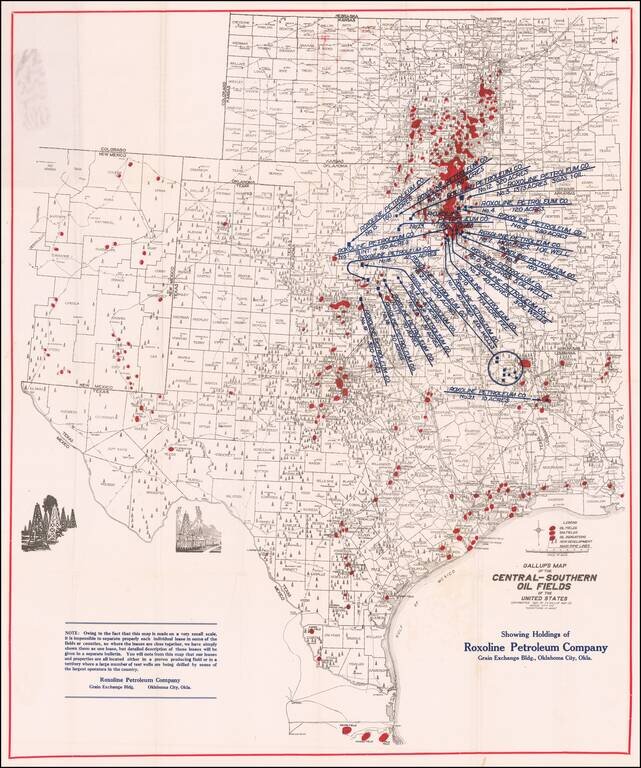
Early Texas Oil Map. Scarce oil map covering all of Texas, Oklahoma, and Kansas along with portions of New Mexico, Missouri, Arkansas, and Louisiana. It prominently shows oil fields, gas fields, and "oil indications" in red overprinting with large...
![[Texas Oil Promotional - North Texas] Ablon Predicts 20 for 1](/map/small/69496.jpg)
Early Texas oil promotional broadsheet, showing the location of the sites at which George Ablon was then seeking investors. The map illustrates a 400-acre leasehold, identified as "Collins #1", with an area above reserved for Ralph-Dudley. The...