
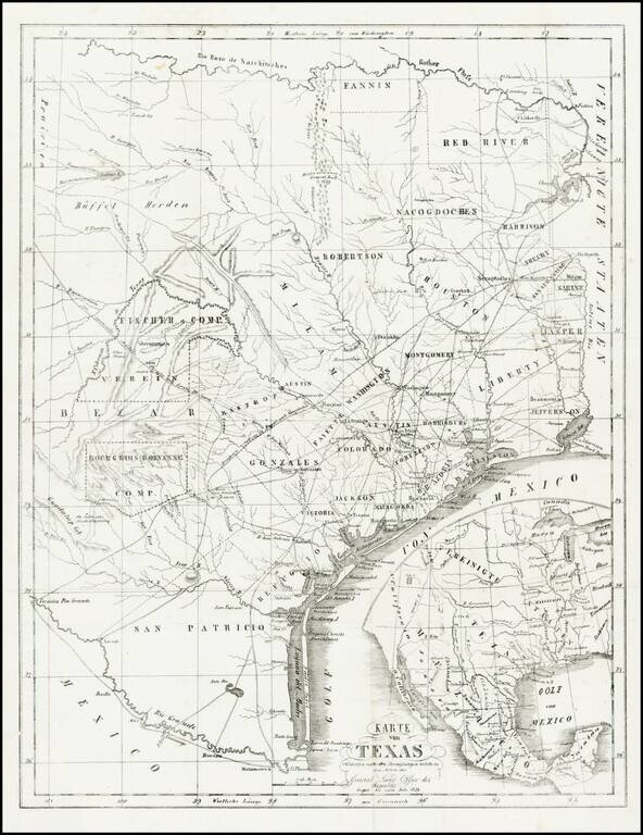
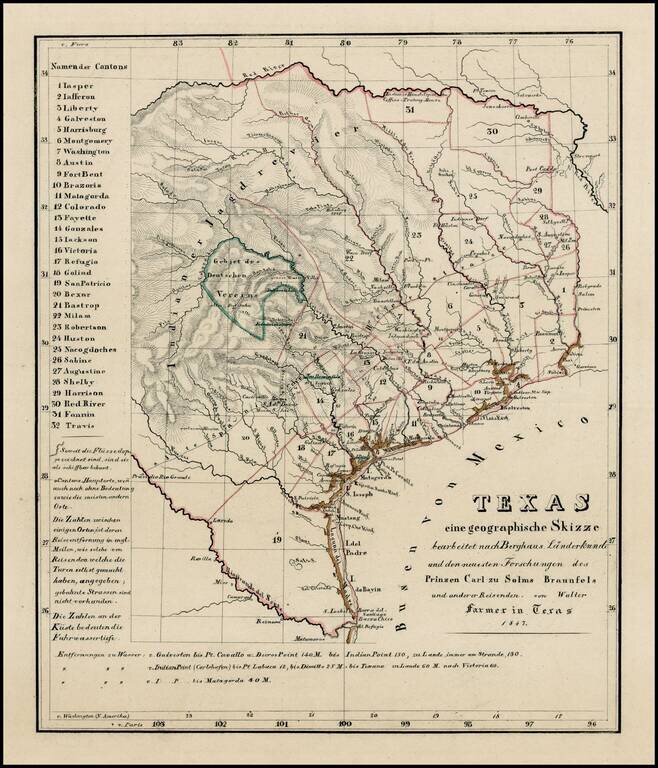
Rare and important early German immigration map of Texas prepared in connection with the Solms-Braunfels promotion of German colonies in Texas, based upon the larger Hunt & Randel map of 1839. The map provides a detailed look at Texas during its...
![[Republic of Texas] Map of Texas From the most recent authorities . . .](/map/small/32223.jpg)
Nice example of Henry Schenk Tanner's map of the Republic of Texas, issued in Tanner's Universal Atlas. The present example is the rare first state of Tanner's 1845 map of the Republic, pre-dating, the addition of a number of Texas Counties formed in...
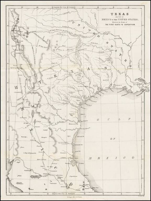
A Milestone Work, Which Re-Invigorated Interest In Settlement in the Republic of Texas Detailed map of Texas, eastern New Mexico and part of Mexico, illustrating the region covered by the Santa Fe Expedition. Based upon the maps of Zebulon Pike and...
![Mexico, Mittel-America, Texas [Republic of Texas]](/map/small/64181.jpg)
Nice example of Carl Flemming's detailed map of Texas and the Southwest, published shortly after Texas was annexed by the United States in 1845. The map was issued immediately after the annexation of Texas and prior to the creation of Utah and New...
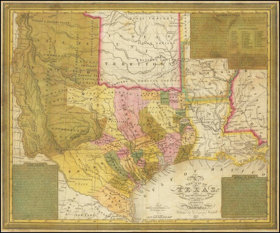
The Final Edition of the Mitchell-Young Map of Texas. One of Only Two or Three Known Examples. Hand-colored engraved antique map of Texas as a republic, by S. Augustus Mitchell and J.H. Young. This is the last edition of the map, from 1845, and this...
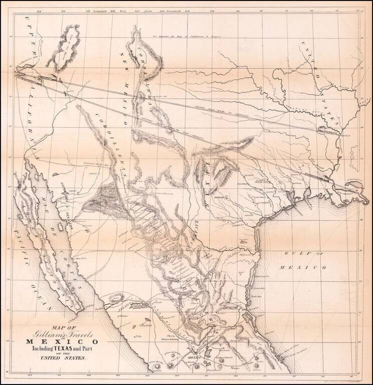
Transcontinental Railroad Routes To San Francisco in 1846! Scarce map of Texas, Upper California, Mexico and the Southwestern United States, prepared for Gilliam's Travels over the Table Lands and Cordilleras of Mexico during the Years 1843 and 44....

A German Map of the Republic of Texas Detailed map of the Republic of Texas at the start of the Mexican War. The massive stovepipe configuration is shown here, extending to Wyoming in the north, the Rio Grande in the west and the Red River and...

Including Manuscript Additions of the Overland Route To California and Other Important Points. Nice example of Mitchell's seminal map of Texas, Oregon, Upper California, Missouri Territory and a massive Indian Territory (covering most of Kansas and...
Extremely rare map of Texas, not listed in Day, Phillips, Streeter, Taliaferro, or any other Texas reference. While the map is unrecorded and its source is unknown, we are of the opinion that the map was printed, but ultimately never included in a...
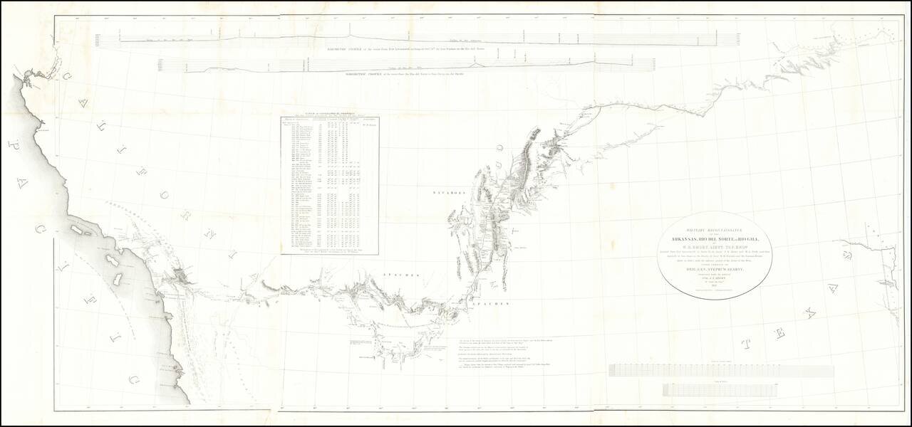
Fine example of the William Emory's milestone mapping of the Southwestern United State, from Ft. Leavenworth to the West Coast, from Emory's Notes of a Military Reconnaissance, from Fort Leavenworth, in Missouri, to San Diego, in California . . ., one...

Excellent map of California, Mexico, Texas and the Southwest, published by A&C Black. The map covers all of Upper California and shows the missions, early forts and information immediately prior to the discovery of gold. Several settlement and...
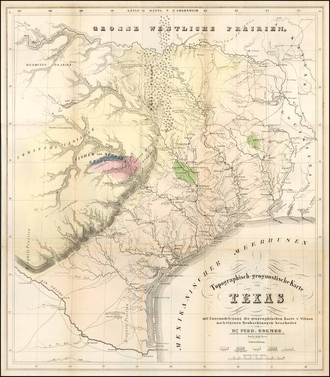
The First Geological Map of Texas An unusually fine example of this important early geological map of Texas by Ferdinand Roemer, published by Adolph Marcus and lithographed by Henry & Cohen, in Bonn. Roemer's map is the first geological map of...
![A New Map of Texas Oregon and California with the Regions adjoining Compiled from the most recent authorities... 1849 [Very Rare Variant Edition]](/map/small/60784.jpg)
Exceptionally Rare Gold Rush Variant of Mitchell's Famed Map of Texas, Oregon, and California. With Mitchell's Guide to California. Antique map of the American West by Samuel Augustus Mitchell. This is an example of the extremely rare 1849 edition,...
An Extremely Rare German Emigrant Guide to California, Oregon, Texas, Iowa and the Midwest -- Especially So With All Maps & Plans Second extended German edition, adding the view of St. Louis and with the often missing maps of Iowa and the United...
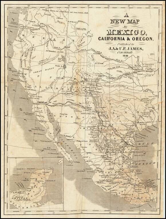
Scarce map of Texas and the West, published in Cincinnati. In Oregon Territory, a number of early American Forts are shown, along with Astoria and Oregon City. To the south, the Gold Region is shown in California, limited only to the area north of...
![Map Of Route pursued by U.S. Troops from Fort Smith, Arkansas, To Santa Fe, New Mexico, via south side of Canadian River In the Year 1849 Whilst serving as an Escort to a party of California Emigrants. . . . [bound with:] Map, No 2... [and:] Map, No. 3...](/map/small/70778.jpg)
Along the Canadian River, through the Texas Panhandle, to Santa Fe, New Mexico. Fine four-sheet map of the overland exploration and survey map, undertaken by the United States Troops at the start of the Gold Rush. In 1849, shortly after gold was...