
![[Oil in Culberson County] Location of Royalty owned by H.J. McMullen](/map/small/69430.jpg)
Interesting pictorial map of Culberson County, Texas, promoting investment in the area then being explored by H.J. Mullen. The map focuses on the areas north of the Texas & Pacific Railroads which the promoter illustrates as being under...
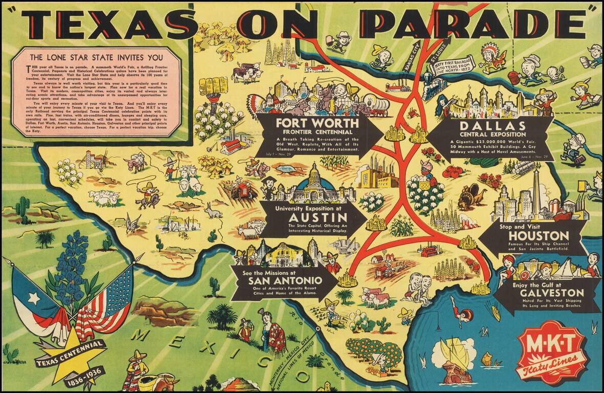
Rare Texas Centennial Pictorial Map, published by the MKT Katy Lines. The map highlights six destinations, Dallas, Houston, Austin, Galveston, San Antonio, and Fort Worth. The lively pictorial maps shows regional vignettes featuring the commerce and...
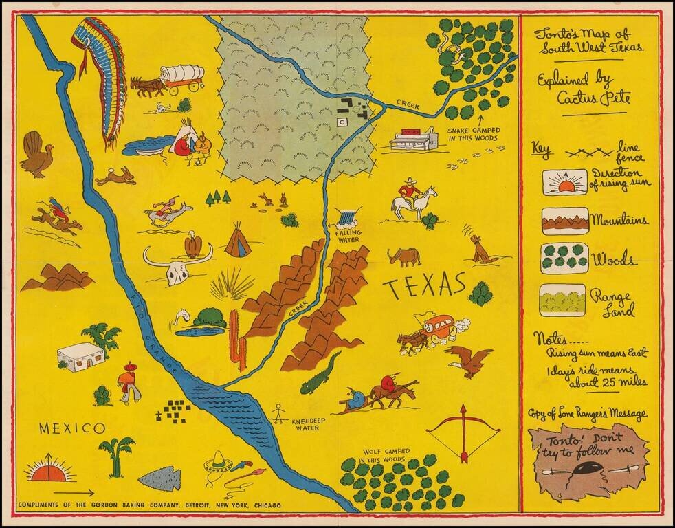
Decorative promotional map of Tonto's Southwest Texas, advertising for the Gordon Baking Company. Highlights the region along the Rio Grande which was the fictional home of the Lone Ranger and Tonto.
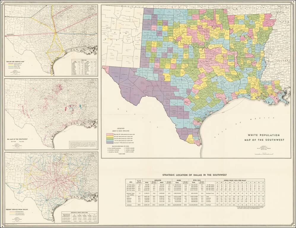
Racialized promotional pamphlet and map produced by the Industrial Department of the Dallas Chamber of Commerce. The material was published in or around 1940 in an attempt to entice businesses to bring their products to the Dallas market. The large...
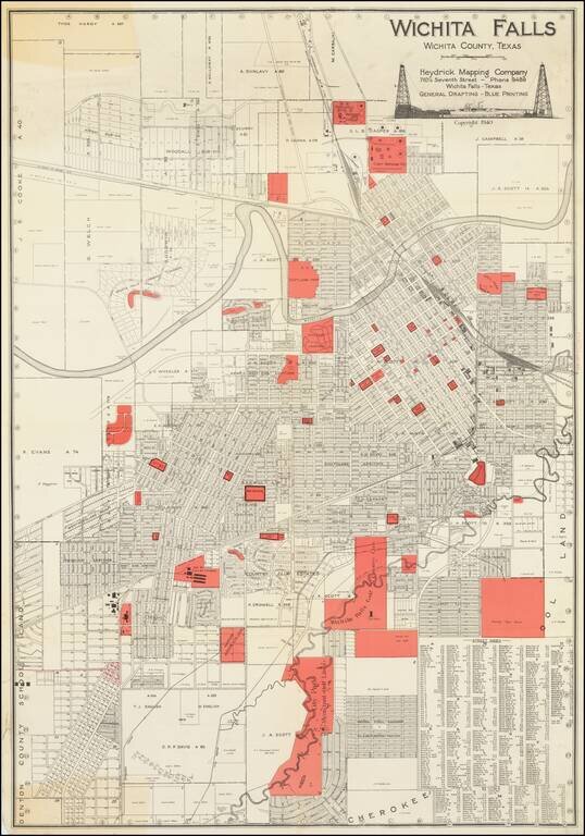
Large folding map of Wichita Falls, Texas, published in Wichita Falls in 1940 by the Heydrick Mapping Company. In the south the map extends below what is now Midwestern State University. In the north, the map extends about as far as the Highway 44-287...
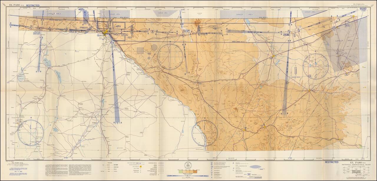
Restricted World War II Aviation Map Detailed aeronautical map of the El Paso Region, extending east to Odessa and Midland, and south to Marfa, Alpine and Sanderson, Texas. The chart is a font of information about civil and military aviation during...
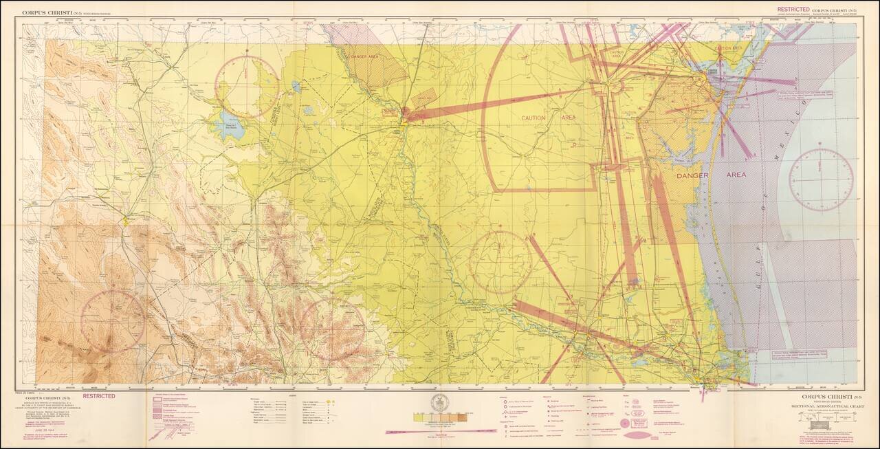
Restricted World War II Aviation Map Detailed aeronautical map of the Corpus Christi region. The chart is a font of information about civil and military aviation during WWII. It was intended for civil aviators flying by visual navigation and so...
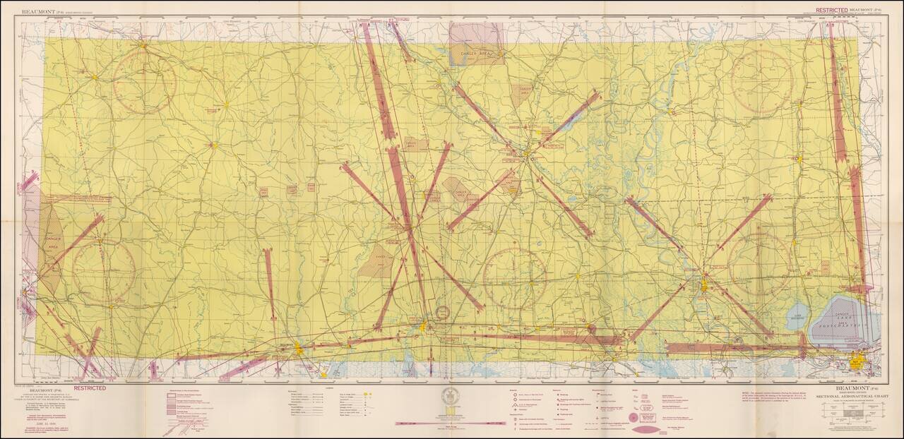
Restricted World War II Aviation Map Detailed aeronautical map of the Beaumont Region. The chart is a font of information about civil and military aviation during WWII. It was intended for civil aviators flying by visual navigation and so includes...
![[Original Texas Pictorial Map Artwork]](/map/small/65261.jpg)
Pictorial Artwork by Texas Artist Dick Spencer Lively hand drawn pictorial map of Texas, drawn by Dick Spencer. The map is drawn in an birdseye view style and is centered on Houston, Austin and San Antonio, with the Randolf (Army) Field at the...
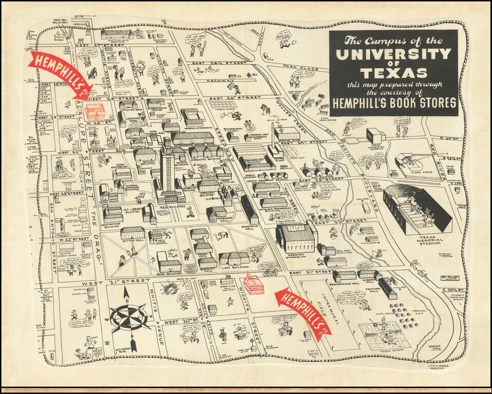
Whimsical map of the campus of the University of Texas at Austin, published in Austin by Hemphill's Bookstore. The map provides a fascinating look at the University of Texas circa 1945. This is one of two maps of the UT Austin done for Hemphill's....
![Official Texas Brags Map of North America . . . Scale One Inch = 6 Texas Grapefruit [With Original Envelope!]](/map/small/68359.jpg)
Texas Brags with Original Mailing Envelope! Whimsical Map of North America, from a Texan's perspective. Places and names throughout the states are often incorrect or fictitious, satirizing a parochial attitude towards other parts of the country. For...
![A Texan's Map of the United States [of Texas] [Everything Depicted Hereon Is Gospel Truth!...Attested To By A Group of Impartial Texans! All Skeptics May Appeal To His Emminence, The President of Texas. Scale of Miles 1 Texas Inch = 1,000 Miles.](/map/small/45966.jpg)
Fascsinating Pictorial Map of Texas, drawn by Dallas illustrator Frank Oliver for the Texoak Flooring Company of Crockett, Texas, "Honest-to-goodness Texans who manufacture." Of all the "Texan's Maps" we have seen, this one is perhaps the most...
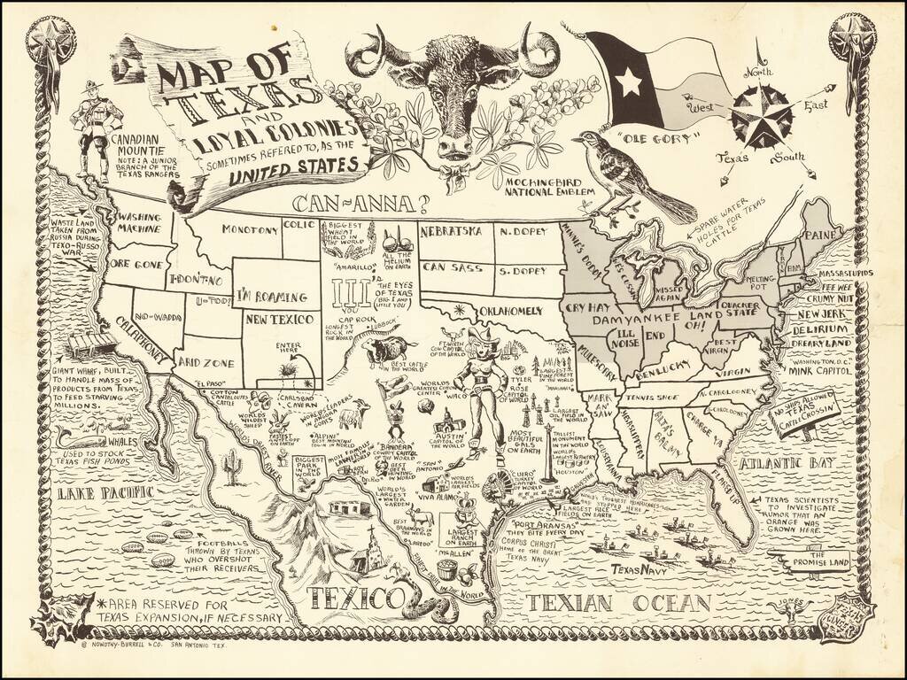
Lone Star Humor Previously unrecorded pictorial map of Texas, published in San Antonio by Nowotny-Burrell & Co. Entertaining pictorial map of Texas, with a fun variety of Texas humor and wit. The map is filled with clever notes and cute twists on...
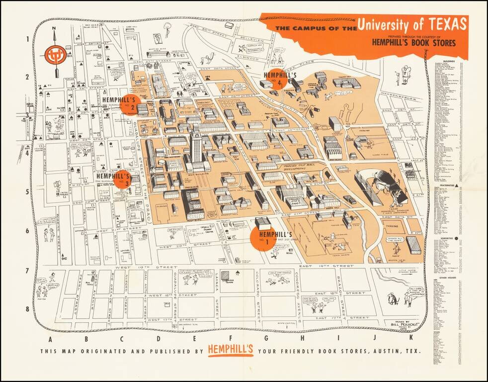
Whimsical map of the campus of the University of Texas at Austin, published in Austin by Hemphill's Bookstore. The map provides a fun-filled look at the University of Texas circa 1960. It shows the location of a new Hemphill’s book store and...

Decorative pictorial map of East Texas, published by the East Texas Chamber of Commerce.
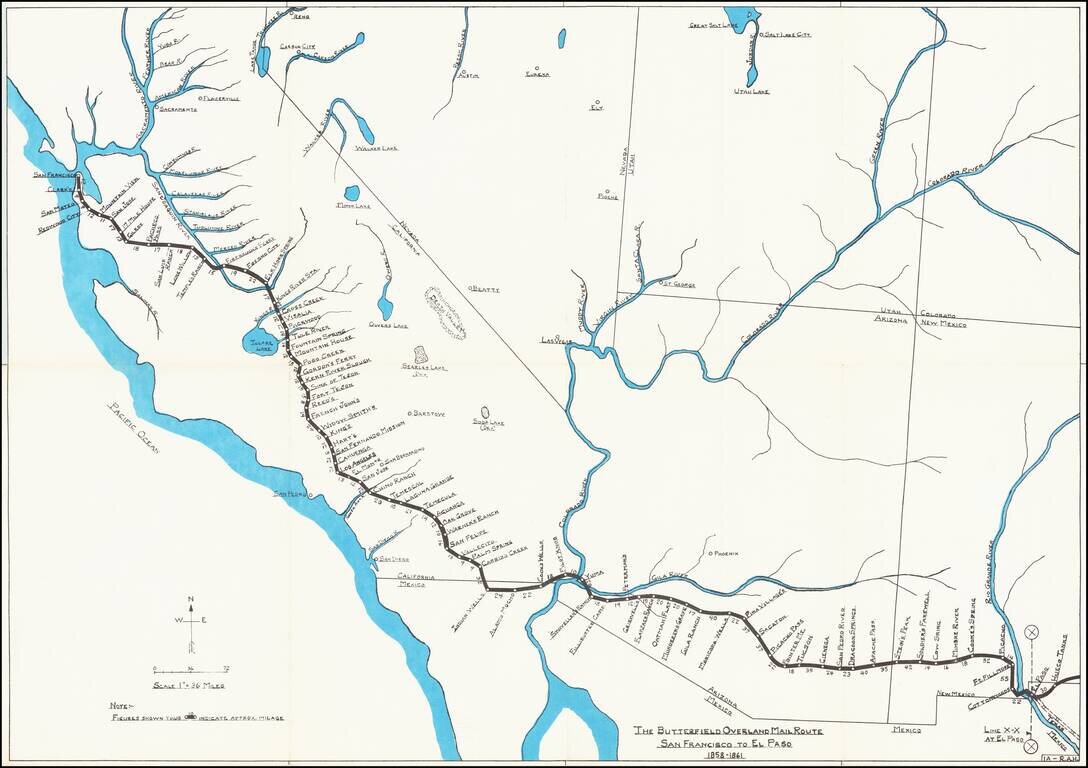
Rare historical / pictorial map of Western portion of the Butterfield Mail Route, drawn by Robert A. Hanson. The map was likely published by the Western Cover Society, a California based society which published the Western Express. Hanson's maps were...