Map size in jpg-format: 726214B
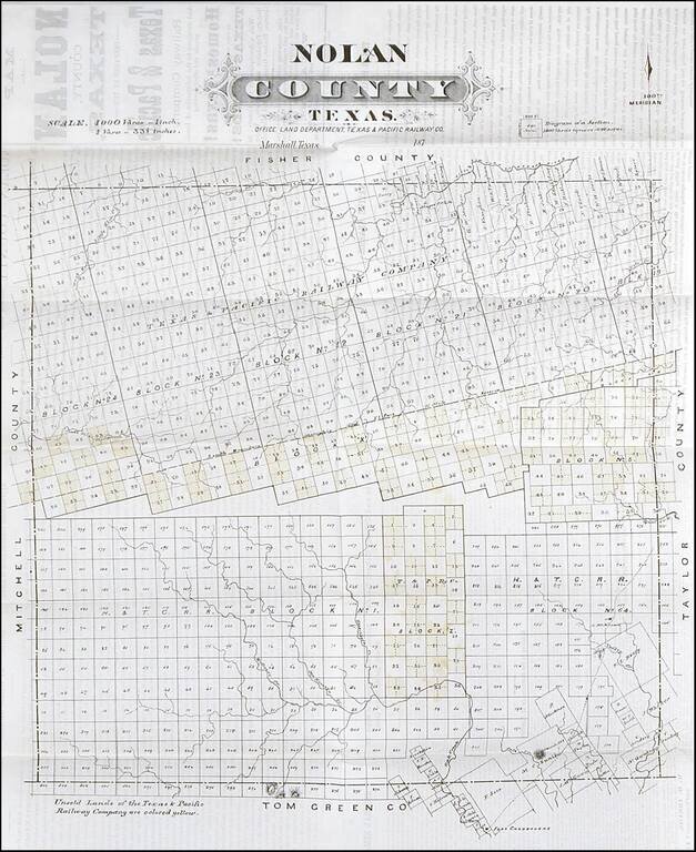
Rare early map of Nolan County, Texas, published by the Texas Pacific Railway Company.
The Texas & Pacific Railway was chartered March 3, 1871, with the right to build a trans-continental line from Marshall, TX., to San Diego, CA. Work on the line west of Fort Worth did not begin until 1880, and reached Sweetwater, the county seat of Nolan County (est. 1876) the following year.
As an incentive to construction, the Company was granted twenty sections of land per mile through Texas. This map is specifically designed to show the Company's sections in Nolan County, with the unsold lands colored in yellow. It was ultimately forced to relinquish much of its grant west of Fort Worth on the grounds that the track was not completed within the stipulated time.
If you are a student, write to us in telegram: @antiquemaps and indicate what material you need and for what work you need a map in high detail. We are ready to provide material on special terms. For students only!


