
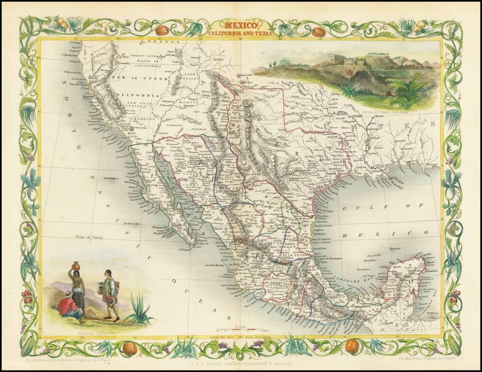
Rare variant edition of this decorative regional map of the Texas, California and the Southwest, featuring Texas in its Republic configuration, with Stovepipe reaching to Wyoming and Colorado. Upper California is shown with the Gold Regions...
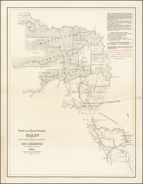
Final Hand-Corrected Proof State? Hand annotated example of this rare Adelsverein map of a part of central Texas, which was then being settled by Texas immigrants under the auspices of the Verein zum Schutze Deutscher Einwanderer Nach Texas (Society...
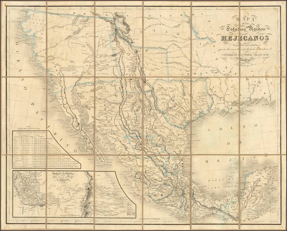
Rare second edition of the so-called Rosa map of Mexico, first published in Paris in 1837 and re-issued in 1851, at the request of the Congress of Mexico. Rosa's map is perhaps the rarest of the so-called Treaty Map sequence, which shaped the original...
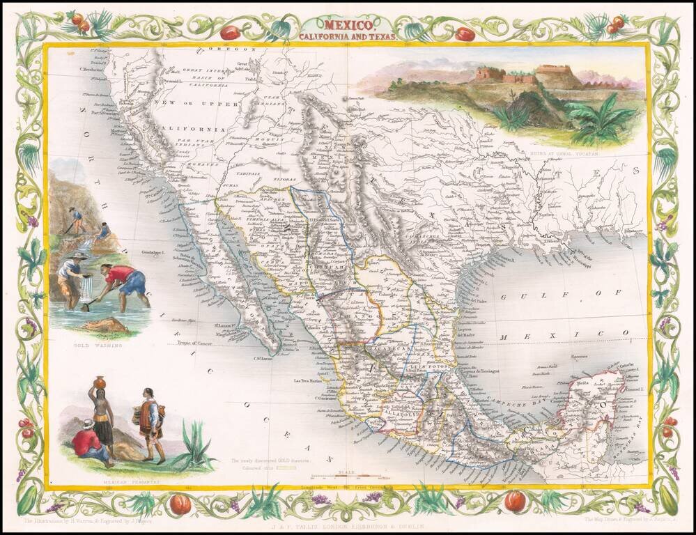
Decorative regional map of the Texas, California and the Southwest, featuring Texas in its Republic configuration, with Stovepipe reaching to Wyoming and Colorado. This is the second edition of the map, which includes the Gold Washing vignette not...
![Karte von Tejas und den angrenzenden Theilen Mejicos . . . [with California Gold Regions Inset]](/map/small/61669.jpg)
Rare Texas Emigrant Map Extremely rare map of Texas, Mexico and contiguous regions, which appeared in volume 6 of Freidrich Heinzelmann's Die Weltkunde in einer planmassig geordneten rundscahu der wichtiigsten neueren Land-und Seereifen für das...
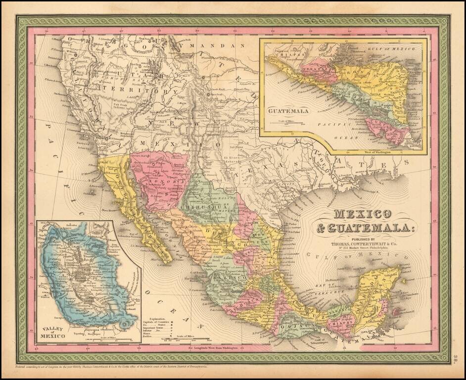
Detailed map of Mexico and the Southwest. Many of the early place names in Texas still appear. Pre-Gadsden Purchase border with Mexico. Large insets of the Valley of Mexico, Isthmus of Tehuantepec, Isthmus of Nicaragua and Guatemala.
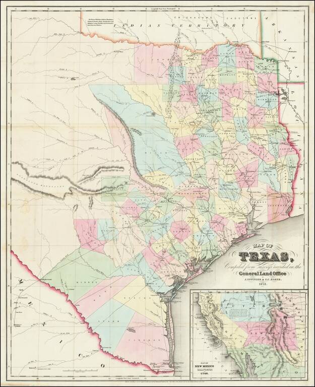
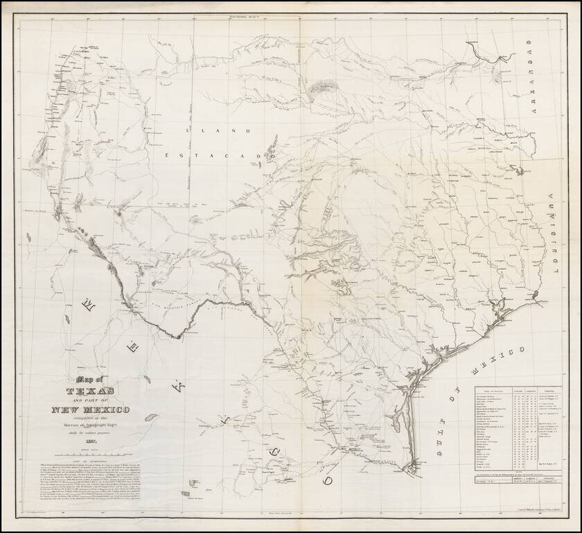
Very rare 1852 edition of this large, hand-colored engraved map of Texas. The map shows a plethora of development east and south of San Antonio, Austin, and the Cross Timbers. There is no meaningful development west of this line. This is one of the...
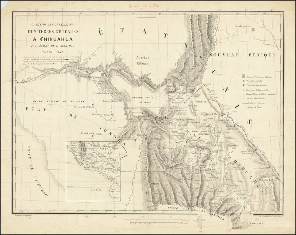
A French European Colony In Sonora and Chihuahua To Resist US Expansionism Scarce map of the borderlands between the United States and Mexico, illustrating the colonization scheme of Frenchman Hippolyte du Pasquier de Dommartin. The map provides a...
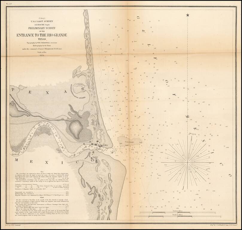
An early Sea Chart of the Mouth of the Rio Grande River One of the earliest obtainable charts of the region around the mouth of the Rio Grande River. Shows Bagdad, the observatory and a number of geographical details, soundings, etc. Includes tidal...
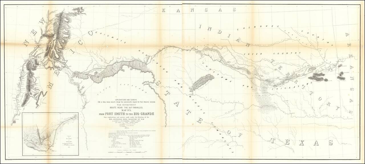
Important early map of the region between Fort Smith Arkansas and the Rio Grande River (Santa Fe, Taos, etc), prepared by the US Pacific Railroad Survey. The primary cartographic detail is in the Rio Grande Valley of New Mexico and along the Canadian...
Detailed map of Texas, published in McNally's School Geography. Dallas is shown on the map. Most of the western counties are still not formed.
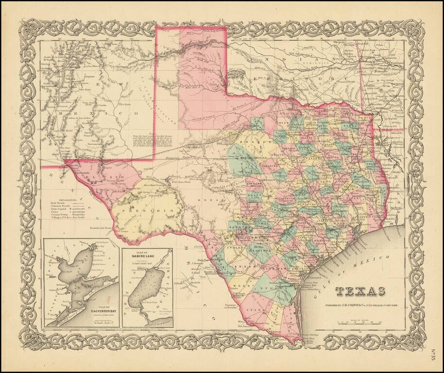
Early State of Colton's Atlas Map of Texas Fine early map of Texas, from Colton's General Atlas, the only edition to appear in a single page format. The map shows a very incomplete set of Western Texas Counties. The German Settlements in Gillespie...
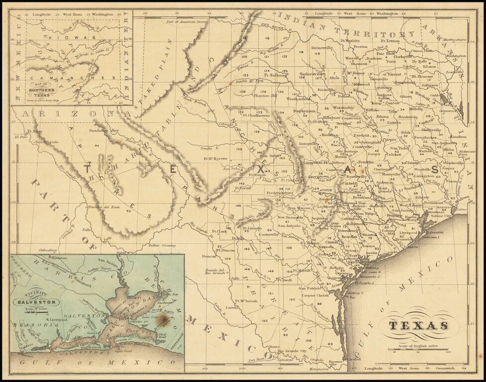
One of the Rarest Great Modern Maps of Texas First edition of this remarkable separately issued map of Texas and part of New Mexico, prepared by the United States Topographical Engineers in 1857 and issued in very small numbers, likely only for use...
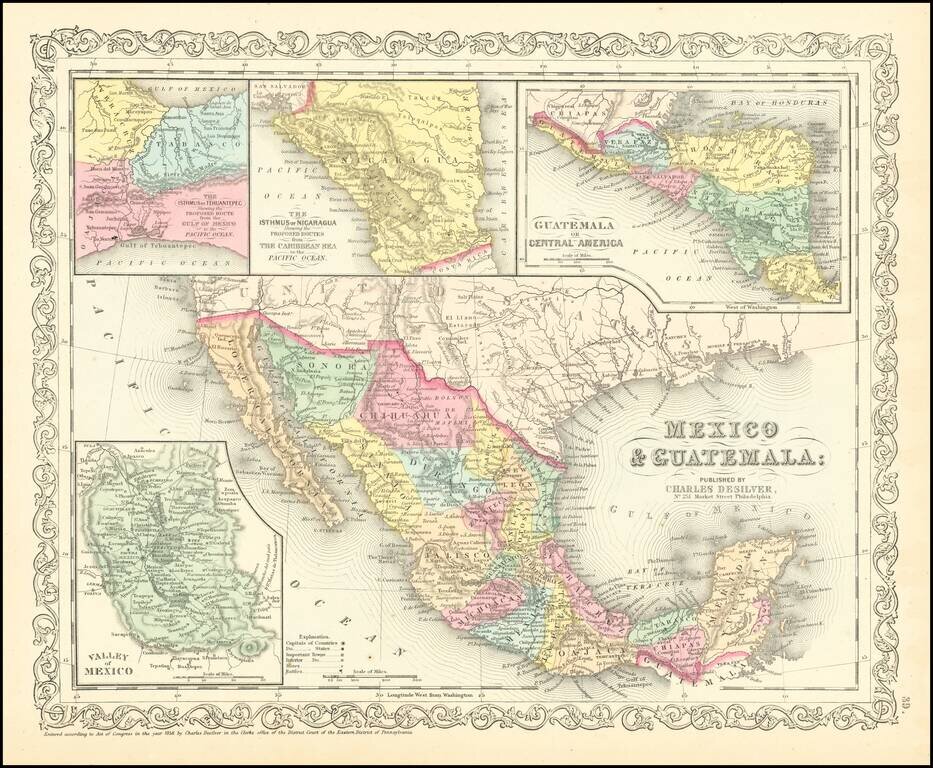
Scarce Charles Desilver map of Mexico and the Southwest. Many of the early place names in Texas still appear. Pre-Gadsden Purchase border with Mexico. Large insets of the Valley of Mexcio, Ithmus of Tehuantepeci, Isthmus of Nicaragua and Guatemala.
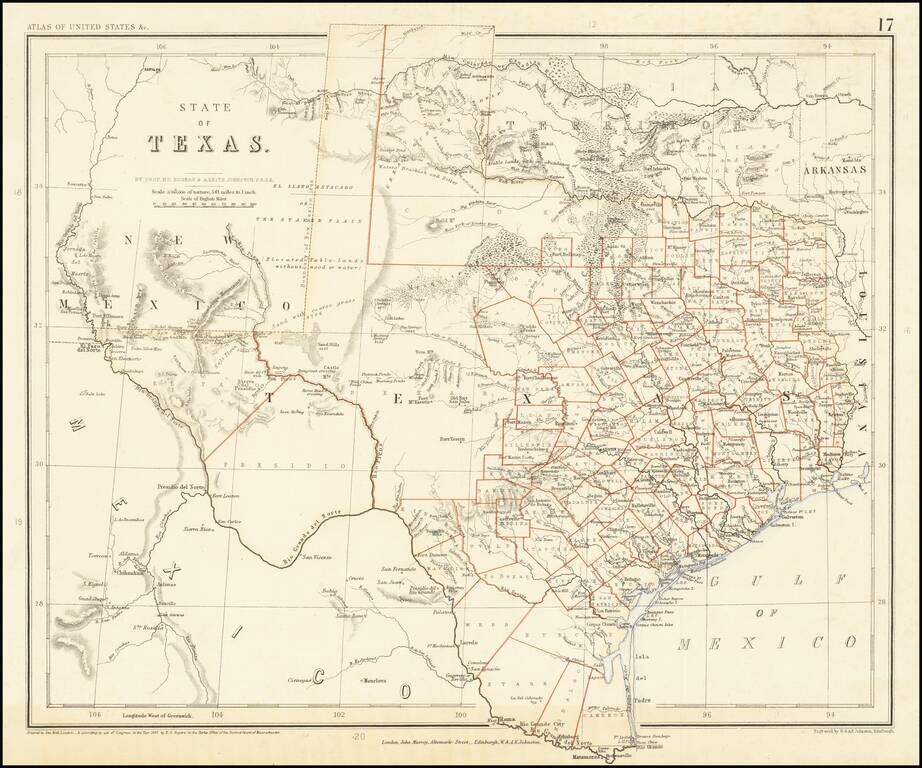
A Texas Rarity One of the rarest English Language maps of Texas to appear in a commercial Atlas. Rogers & Johnstons' map of Texas appeared in the extremely rare Atlas of the United States. The map was derived from the monumental and equally rare...
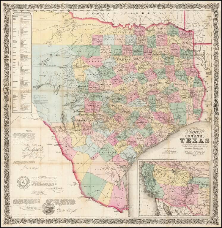
One of the rarest and most important of maps of Texas, and a foundation map for all future Texas cartography. Jacob de Cordova was a land developer in Texas following its annexation by the United States in 1845. De Cordova and Robert Creuzbaur,...