
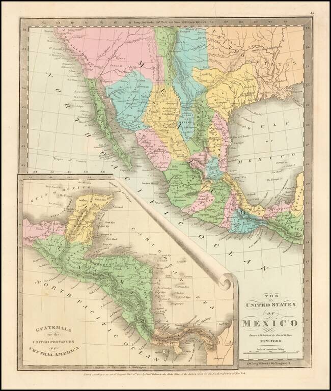
Scarce map of Texas, Upper California, Mexico, etc. from the first edition of David Burr's Universal Atlas. While the map bears the copyright date of 1832, this example is published in 1836. One of the earliest American maps to show Texas in its...
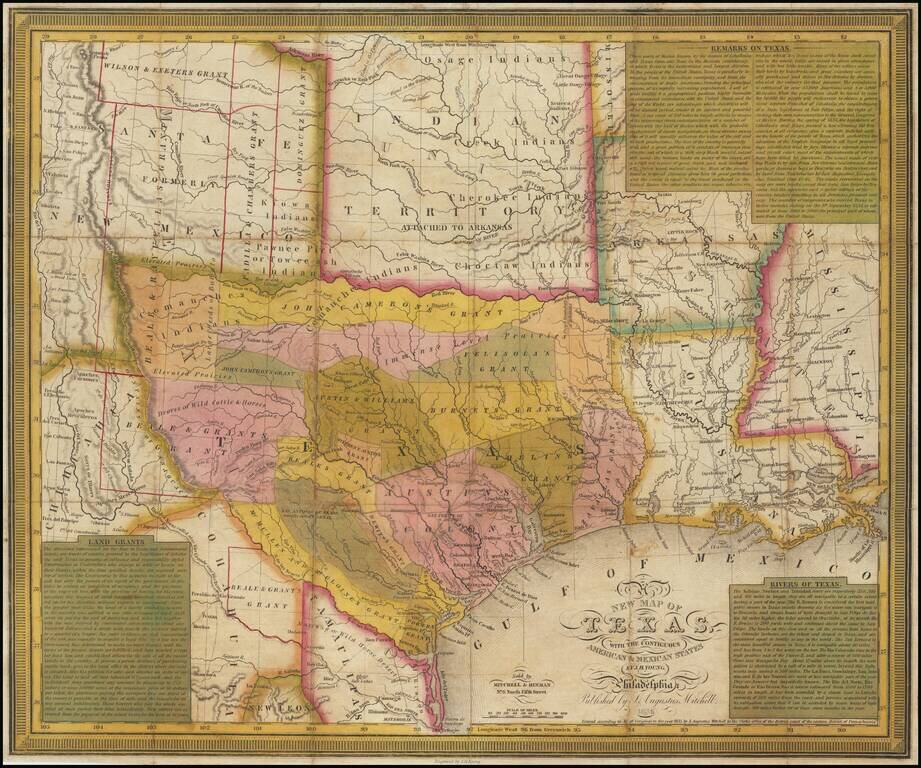
A fine example of Young & Mitchell's map, one of the truly great early maps of Texas, published in 1836, the year that Texas became the independent 'Lone Star Republic'. Young & Mitchell's A New Map of Texas, especially in the present first...
![Mexico & Guatemala [Showing pre-Republic of Texas (Coahuila and Texas)]](/map/small/71256.jpg)
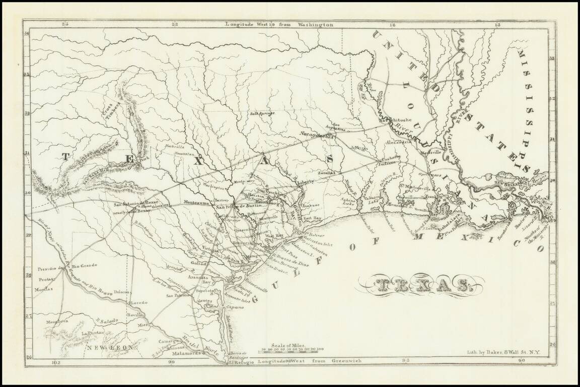
Detailed map of Mexico and the Southwest, featuring Texas and Coahuila, on the eve of Texas Independence. The Austins Colony appears prominently in Texas, along with Austin's Grant, Washington, Houston, Goliad and a number of other early settlements....
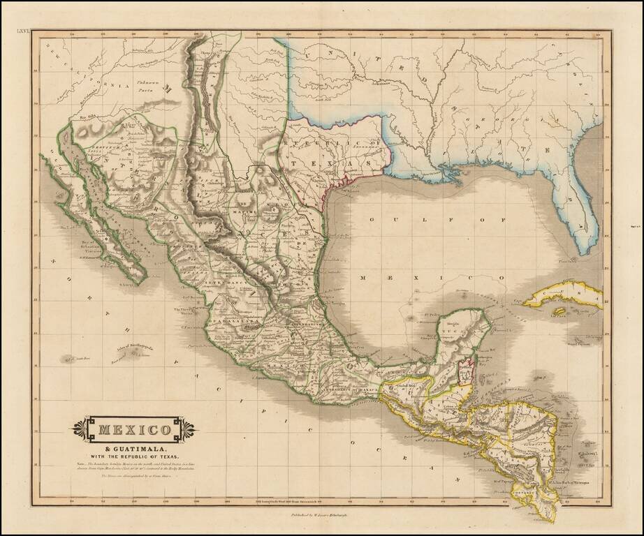
"Republic of Texas" in the Title of the Map Scarce map of Texas, Mexico, Upper California and contigous parts of the Southeastern US, naming the Republic of Texas. The present map is one of the only obtainable printed maps to name the "Republic of...
![Texas [Republic of Texas]](/map/small/64088.jpg)
Nice example of the first edition of Bradford's large map of the Republic of Texas, first published in 1838. In 1835, Bradford issued a small map of the Texas shortly before it became a Republic. In 1838, Bradford issued his Illustrated Atlas, a much...
Fine example of Chester Newell's early map of the Republic of Texas, published in 1838. The map shows all of Texas north to the Red River, providing an early look at the Republic, including a fine accounting of its early roads and settlements. The...
![Carte Des Etats-Unis Du Mexique…1838 [Republic of Texas]](/map/small/70909.jpg)
Fine example of Alexandre Emile Lapie's map of the Republic of Texas, New Mexico, Upper California and Mexico. One of the best large format maps of Mexico, Texas and Upper California to appear in a commercial atlas in the 1830s. Texas is clearly...
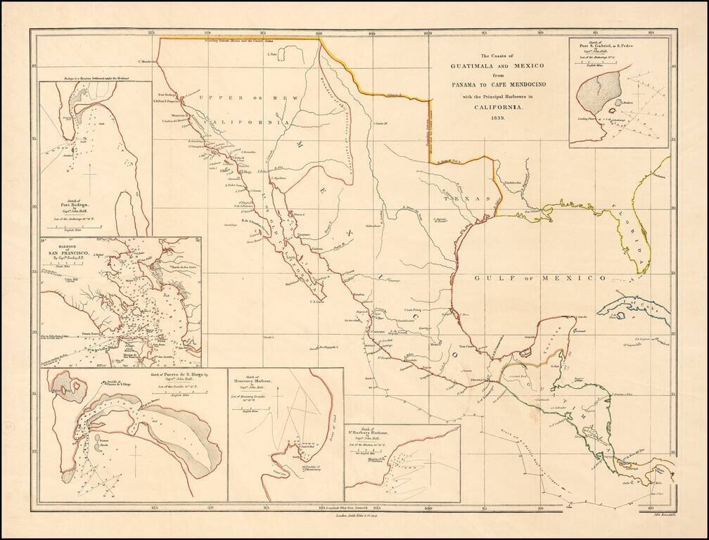
Rare early map of Mexico and Upper California, focusing on the harbors along the California Coast. Includes some of the earliest harbor plans for: Santa Barbara San Gabriel or San Pedro San Diego San Francisco Monterrey Bodega Bay Rumsey...
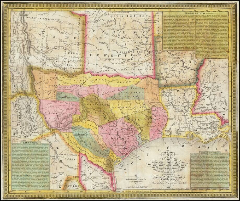
An Important Early Map of The Republic of Texas. Young & Mitchell's A New Map of Texas is one of the great monuments of Texan cartography. This is an essential piece for any serious collection of Texana. This is Streeter's 4th state (of 8, 1178D)...
![[Republic of Texas] Texas Compiled from the latest and best Authorities.](/map/small/61225.jpg)
The Republic of Texas in 1842 Early map of the Republic of Texas, published by Jeremiah Greenleaf. Greenleaf's map follows the cartographic details David Burr's map of 1833, distinguished as the first large-scale map of Texas to show all of what...
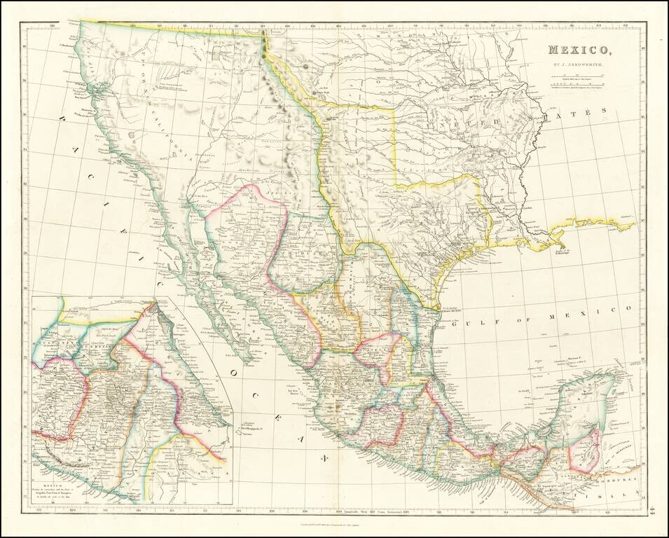
Mexico & The Republic of Texas Striking example of Arrowsmith's Map of Mexico, from the London Atlas, including the Republic of Texas in its largest configuration. The map provides a fantastic example of the Republic of Texas in earliest Republic...
![Mexique par Th. Duvotenay…1843 [Republic of Texas]](/map/small/67925.jpg)
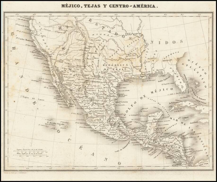
Detailed map of Texas, Upper California, the Plains and Mexico, published in Paris. The map prominently shows the Republic of Texas, a mythological Lake Teguayo and pre-Fremont Western United States. Western border of Texas includes an odd eastern...
A Separate Map of the Republic of Texas Scarce map of the Republic of Texas, extending west to the Presidio Rio Grande and the Rio Colorado and its tributaries. Shows early land grants and counties, towns, roads, forts, rivers and other details....
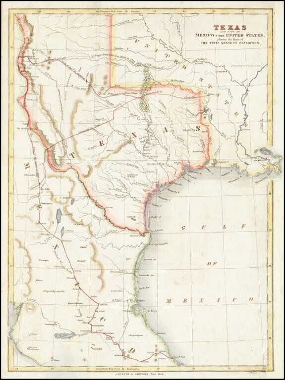
Map of the Republic of Texas, which appeared in Kendall's Narrative Of The Texan Santa Fe Expedition .... This map shows efforts of the Republic of Texas, under President Mirabeau Lamar, seeking to take control over Santa Fe and develop trade links...
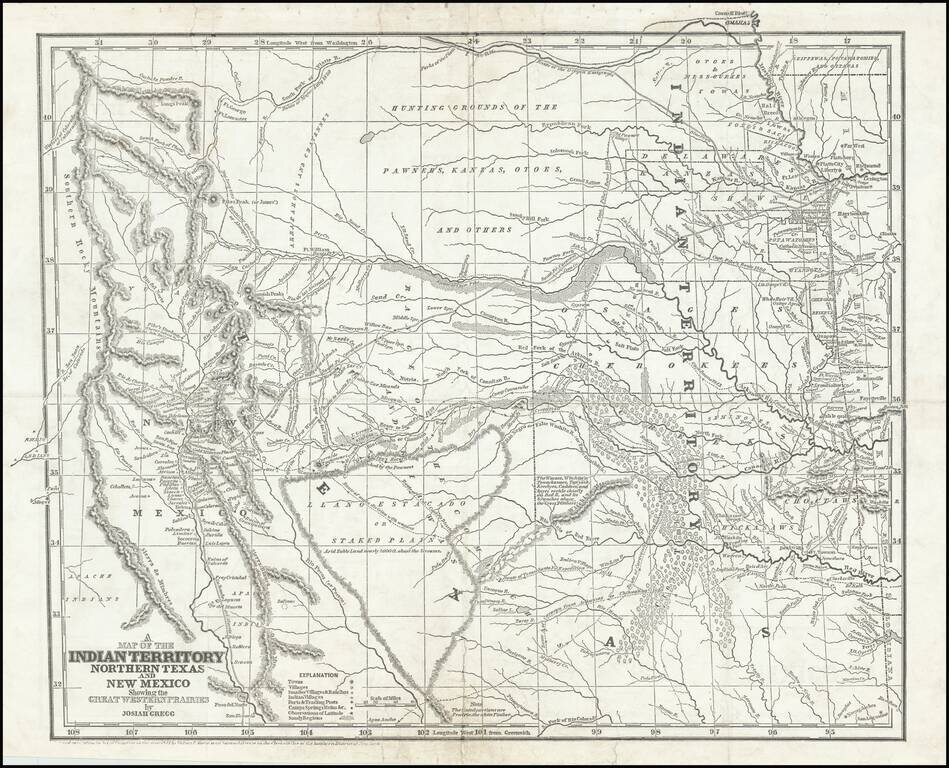
Josiah Gregg's Landmark Map of the Southwest & Northern Texas Fine example of Josiah Gregg's monumental map of Northern Texas & the Plains, from his monumental Commerce Of The Prairies, one of the classic accounts of the Transmississippi West...
Rare map showing the Republic of Texas (República de Tejas), one of only a few maps to specifically refer to Texas as "Republic of Texas," during the period between 1836 and 1845. The map was originally published in Sanchez de Bustamante's Nuevo...