
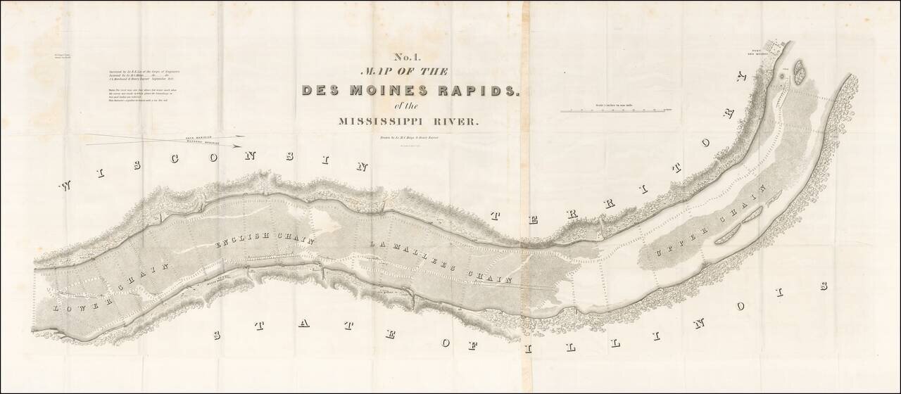
Finely detailed map of the section of the Mississippi River, showing the Des Moines Rapids in the area of Fort Des Moines, based upon the surveys of Lieutenant Robert E. Lee of the US Corps of Engineers. The Des Moines Rapids was one of two major...
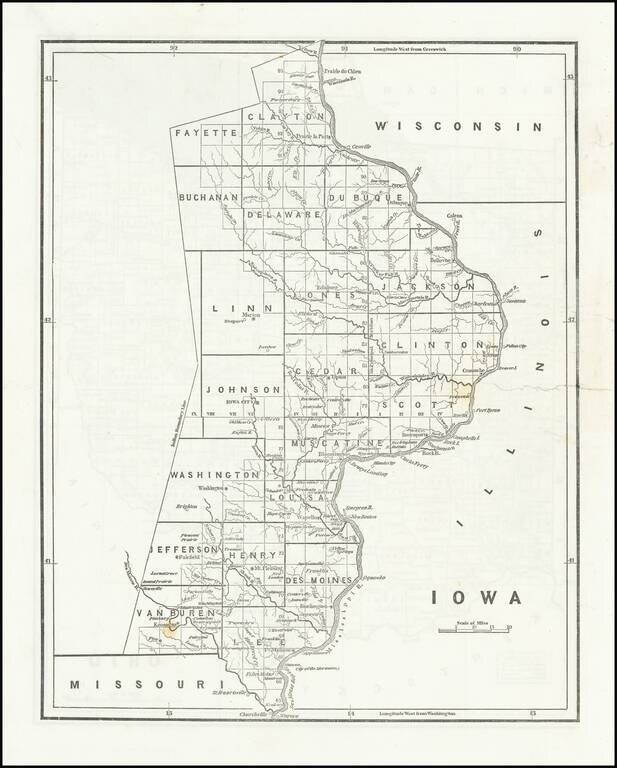
Rare early map of the surveyed portions of Iowa, from an early example of Morse's Cerographic Atlas of the United States. Includes a number of counties, towns, rivers, etc. The map shows the settled portions of Iowa Territory, four years after it...
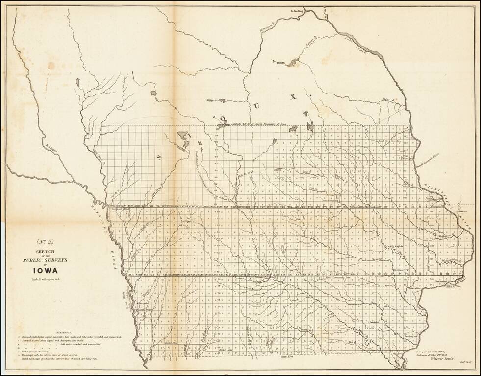
Nice example of the 1853 public survey map of Iowa prepared by Warner Lewis, Surveyor General of Iowa. The map shows the progress of township and baseline surveys in Iowa. The northern part of the state is still largely unsurveyed, as is a section...
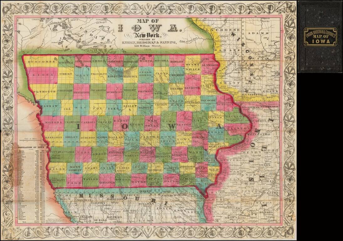
A Stunning Early Map of Iowa Fine early map of Iowa during its initial period of rapid settlement, showing the land office locations, a table of population by county in 1840 and 1850, and the settled areas of adjoining states. Rare first...
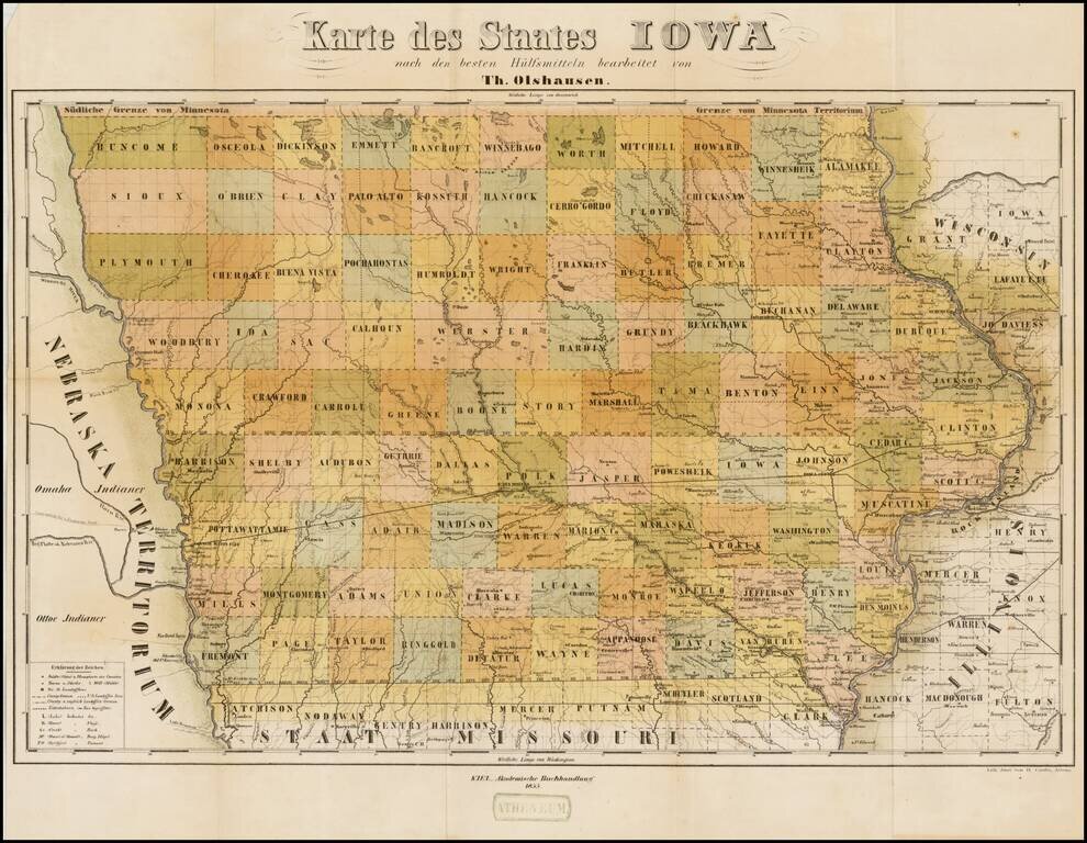
Rare separately issued map of Iowa, published in Kiel in a promotional tract, Der Staat Iowa geographisch und statistisch beschrieben von Theodor Olshausen in St. Louis in Staate Missouri . . ., published in 1855. Olshausen is also known to have...
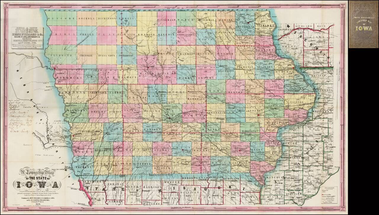
Nice example of the second state of Henn, Williams & Co.'s large format map of Iowa. The evolution of the Henn, Williams & Co. map of Iowa over the first 3 years of its publication provides a remarkable visual depiction of the rapid growth of...
Scarce early separately issued map of Iowa, pre-dating the first edition Colton's atlas map of Iowa. An attractive and detailed map of Iowa with an ornate border. It is colored by counties and shows cities, towns, railroads, rivers, and lakes.
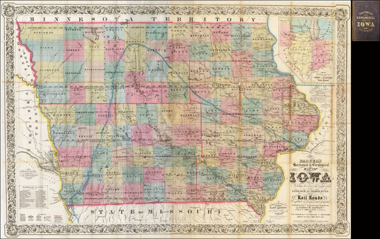
The First Commercially Published Geological Map of Iowa A fine large format map of Iowa, published by Nathan H. Parker in Clinton, Iowa and printed by J. H. Colton in New York and Keen & Lee in Chicago. This is one of the earliest appearances of...
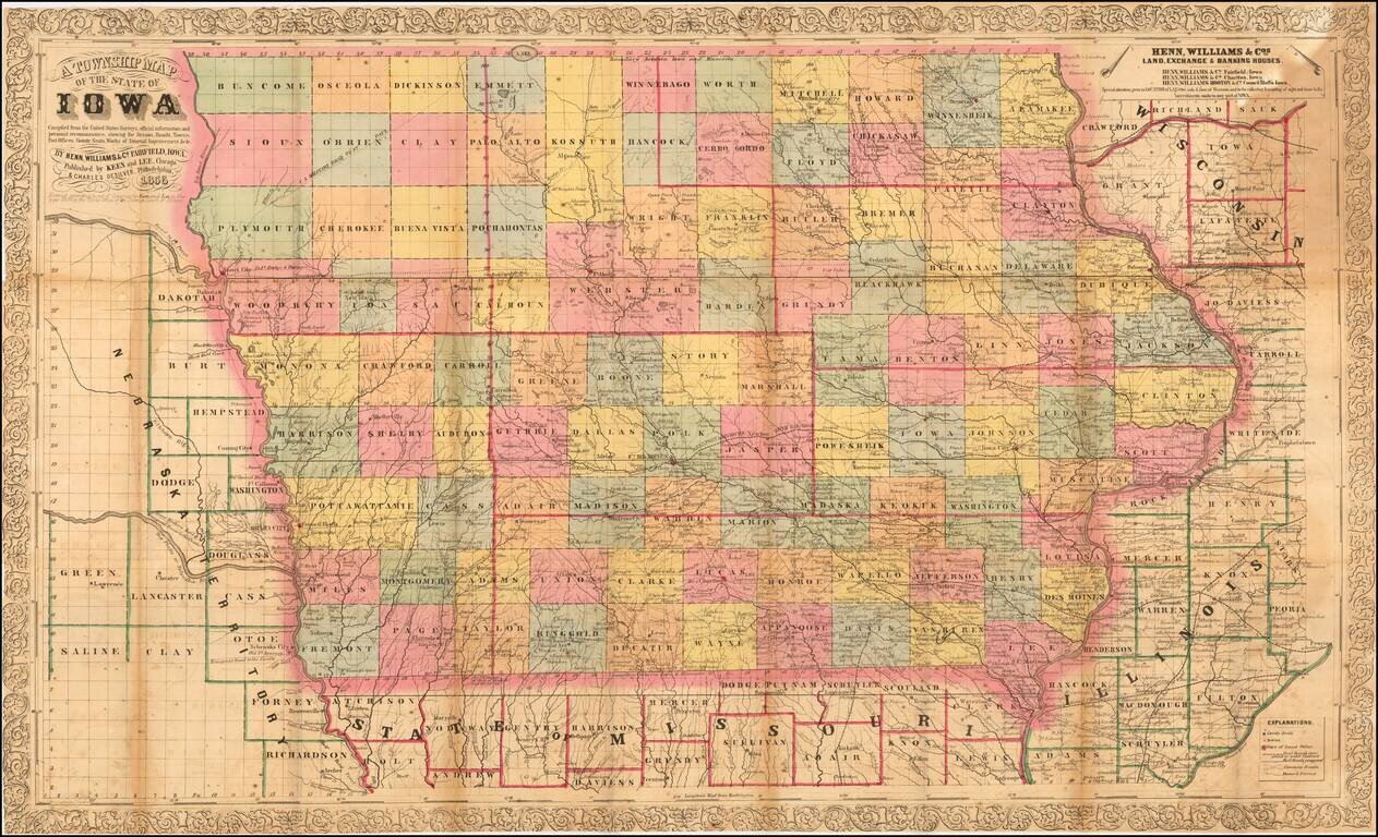
Nice example of the third edition of Henn, Williams & Co.'s large format map of Iowa. The map is hand colored by counties and shows township surveys, towns, railroasd,s roads, rivers, post offices and other details. The map has been entirely...
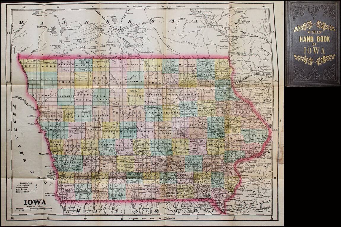
Scarce map and guide for Iowa, published by John G. Wells. Includes material on pre-emption of public lands, "Instructions to Settlers," mineral productions, "Various Avenues to Wealth" (including wool-growing and stock-raising), etc. The full title...
Scarce 1857 edition of this detailed map of Iowa. The map is hand colored by counties, showing railroads, stage lines, canals, roads, rivers, lakes, forts and other details.
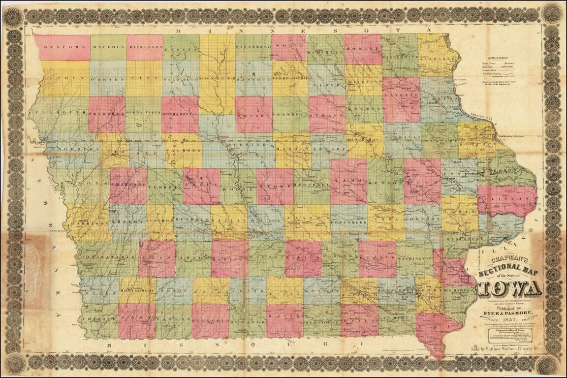
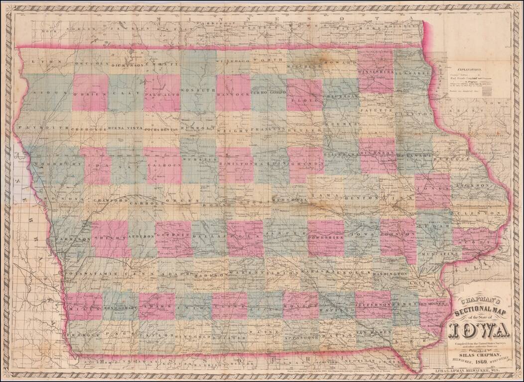
Iowa in 1857 Rare separately published antique map of Iowa, published in Milwaukee by Silas Chapman and drawn by James A. Reid of Dubuque. The map is colored by counties and shows township surveys, county towns, completed railroads, railroads in...
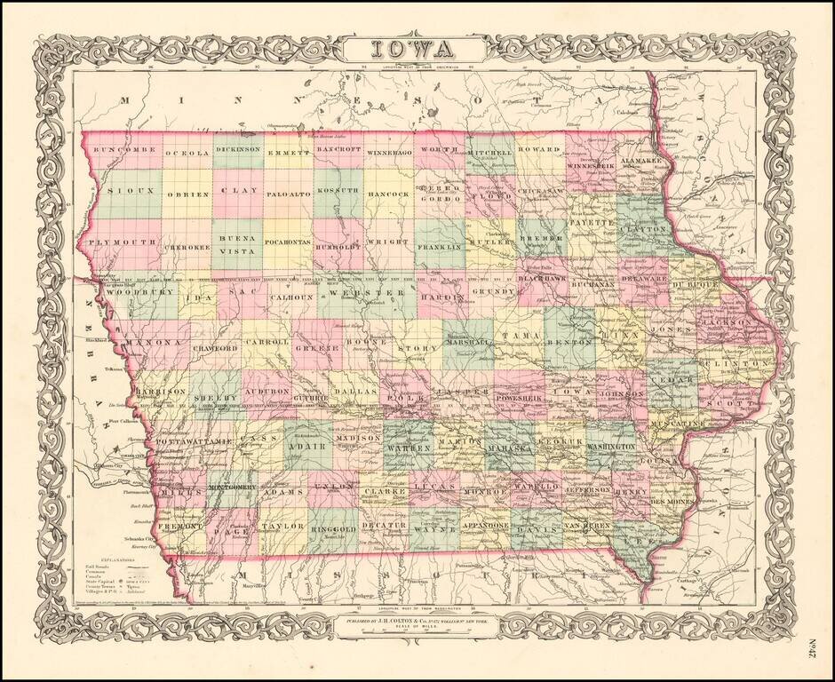
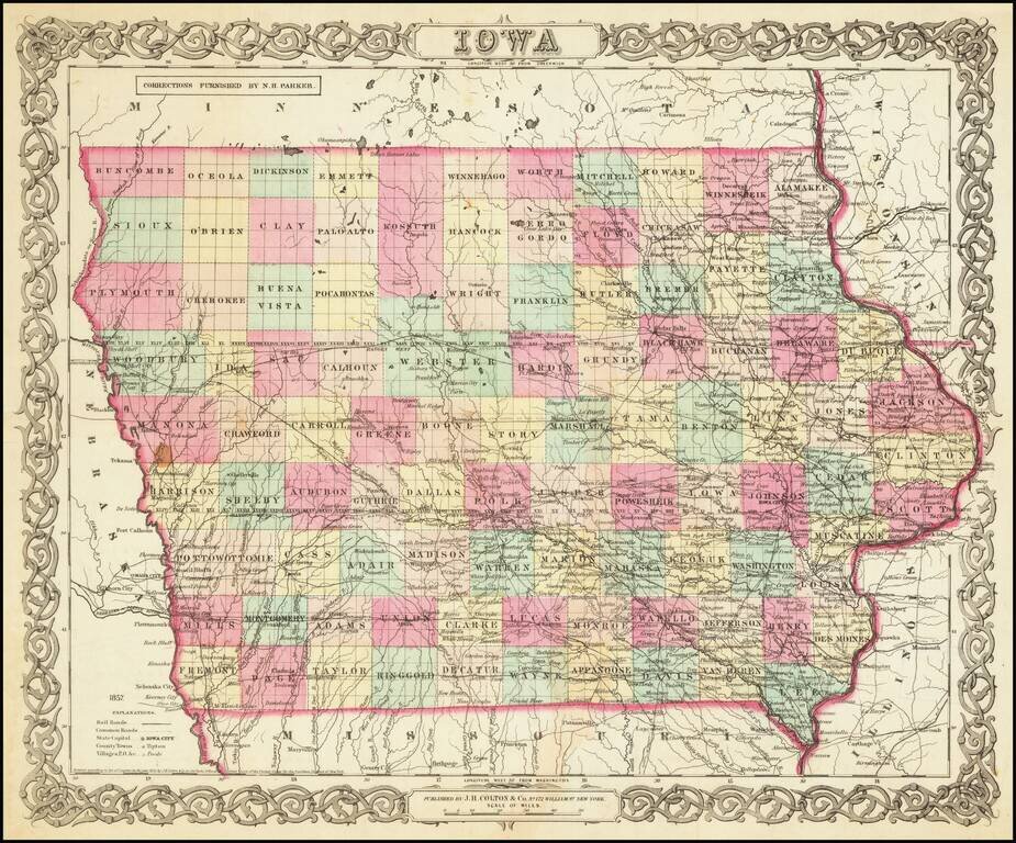
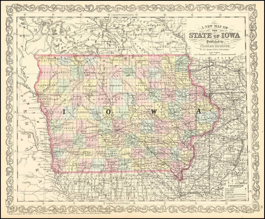
Attractive and detailed early map of Iowa with an ornate border. The map is hand colored by counties and shows cities, towns, railroads, rivers, and lakes. From an early edition of JH Colton's Atlas. Wide margins. JH Colton was one of the pre-eminent...
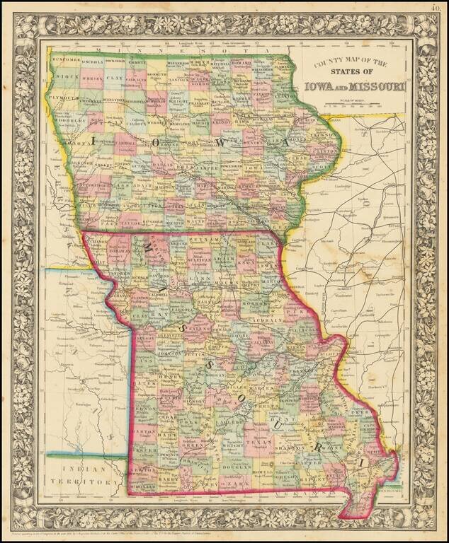
Attractive map of Iowa and Missouri, colored by counties. Shows towns, roads, railroads, rivers, etc.
Rare separately published antique map of Iowa, published in Milwaukee by Silas Chapman. The map is colored by counties and shows township surveys, county towns, completed railroads, railroads in progress and other details. Chapman began offering maps...
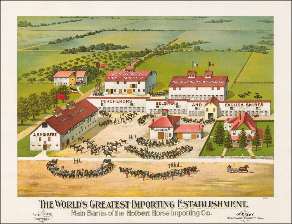
The most extensive importer, breeder and seller of registered horses in the United States Fine chromolithographic image of this outstanding horse farm in Greeley, Iowa. On the barns Holbert advertises that he carries the following breeds:...