
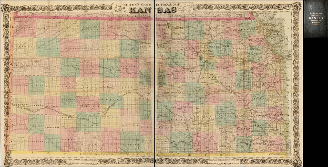
Nice example of Colton's 1878 edition of the New Sectional Map of Kansas. This is a later issue of a beautiful large scale map of Kansas, first issued in 1867. The map locates cities, towns, rivers, roads and railroad lines. While the rectangular...
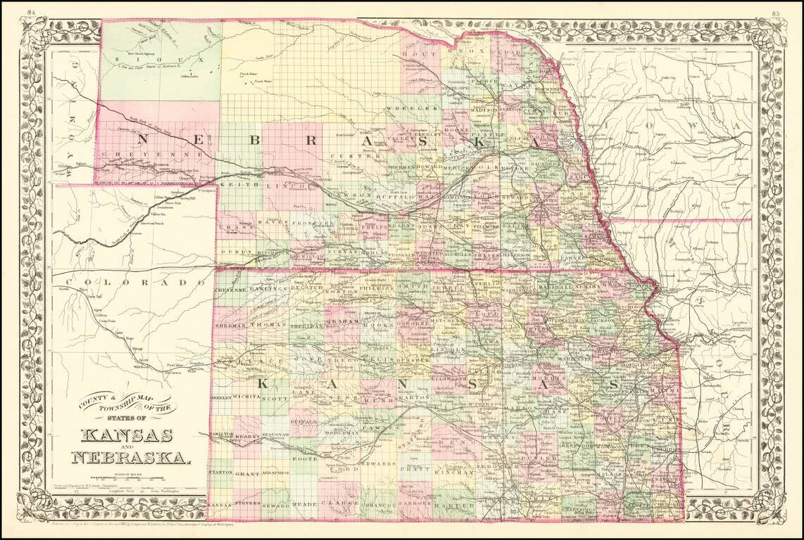
Detailed map of Kansas and Nebraska. Illustrates the disparity in western development in Nebraska and Kansas. Kansas shows almost modern county configuration, while northern Nebraska is still largely unexplored. Shows railways, towns, roads, forts, etc.
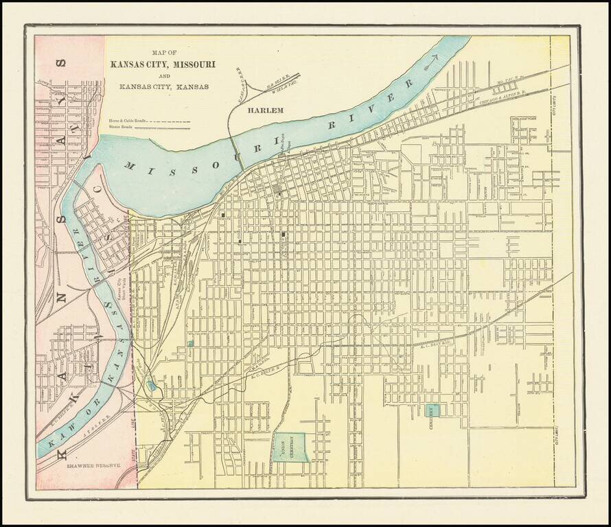
Detailed city plan of Kansas City, showing streets, buildings, train lines, public places, rivers etc. Cram was one of the pre-eminent American Mapmakers of the late 19th Century, relying upon a cerographic printing process first applied to maps by...
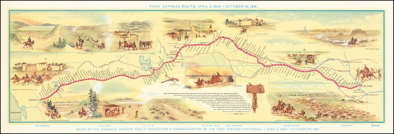
Fine pictorial map of the Pony Express Route, issued by the American Pioneer Trails Assocation in to commemorate the Centennial of the Pony Express. As noted by David Rumsey: Shows route of Pony Express with names and location of relay stations....
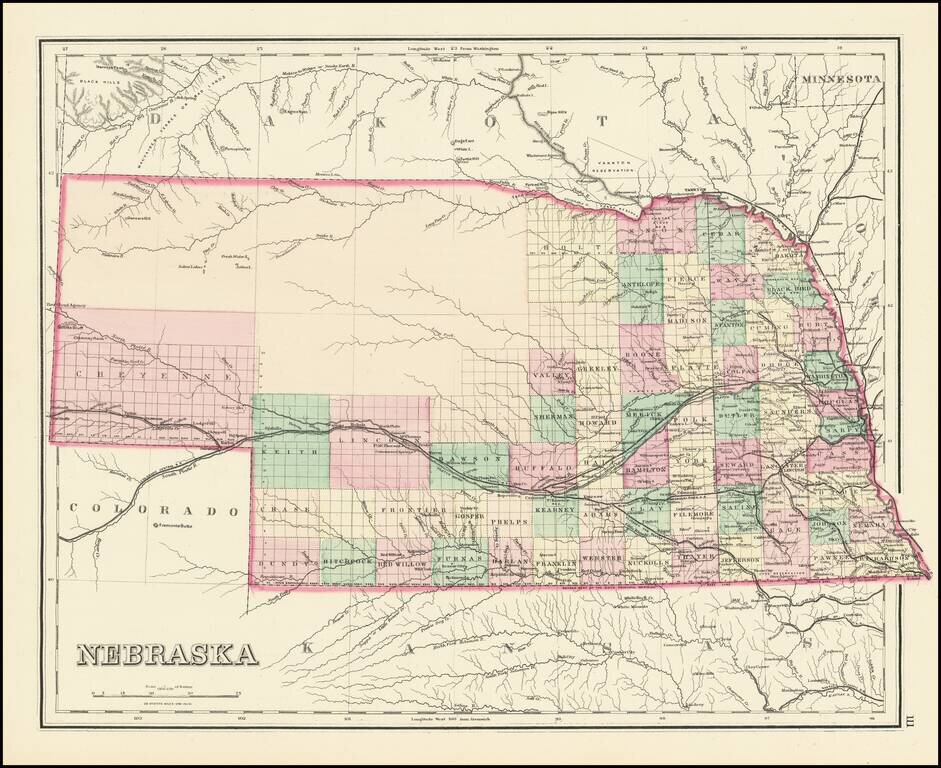
Detailed map of Nebraska, colored by counties and showing townships, roads, railroads, towns, etc. One of the earliest obtainable separate maps of Nebraska to appear in a commercial atlas.
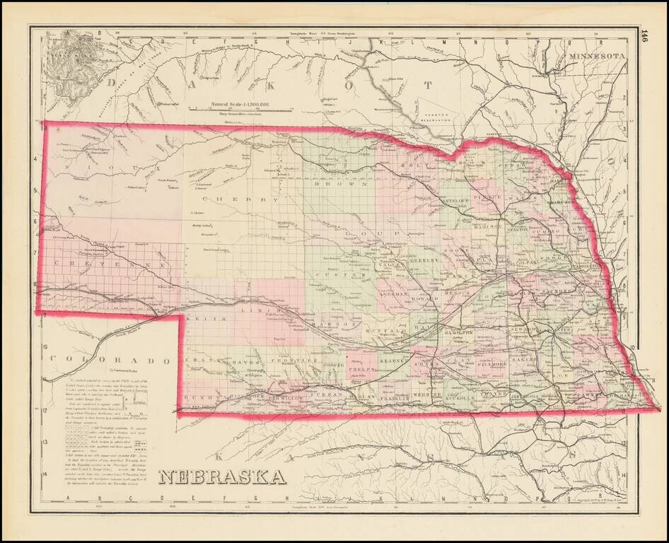
Scarce Late State Detailed map of Nebraska, colored by counties and showing townships, roads, railroads, towns, etc. The present example adds a number of western counties which did not appear in the earliest editions of this map.
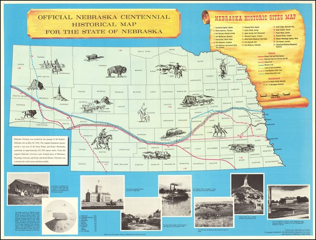
Interesting historical map of Nebraska, published to celebrate the 100 year anniversary of its Statehood in 1867. The map includes about 15 vignettes in the map and a key locating 21 points of interest, 7 important historical trails across Nebraska...
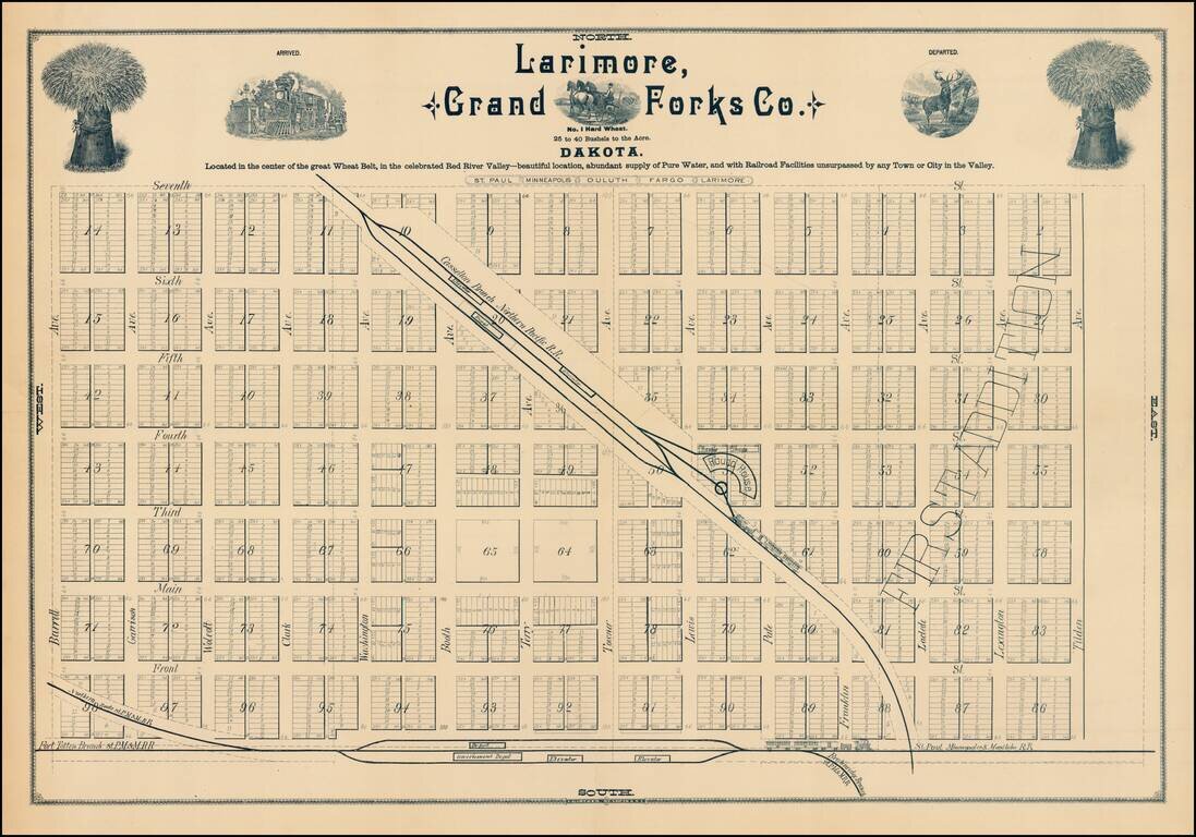
Fine early plan of Larimore, in Grand Forks County, North Dakota. The town of Larimore was formed in 1881 with the arrival of the Northern Pacific Railroad. The map notes that Larimore is: Located in the center of the great Wheat Belt, in the...
![[North Dakota - Fargo]](/map/small/46531fb.jpg)
Rare letter sheet with map on verso, printed for The Oriska Elevator. The map is centered on Fargo, North Dakota and extends north to Grand Forks and South to Big Stone Lake, focusing on the railroad lines, towns and other features. The map...
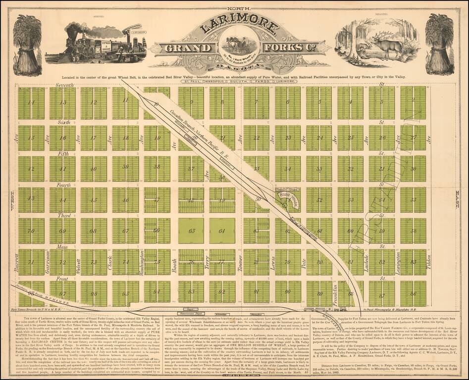
Located in the center of the great Wheat Belt Early promotional map of Larimore, North Dakota, printed in St. Louis by Augustus Gast & Co. in 1882. The map extolls the virtues of the newly created and fast growing town, which after just six...
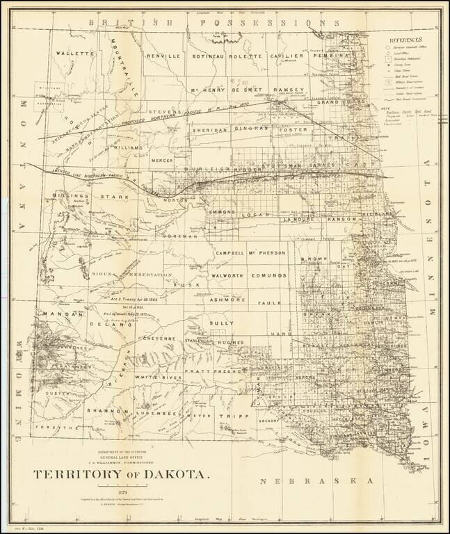
Detailed map of Dakota Territory, prepared by the General Land Office. The map shows early evidence of the township surveys in the west. The dates and details of the creation of a number of Indian Reservations are shown, including: Arikares,...
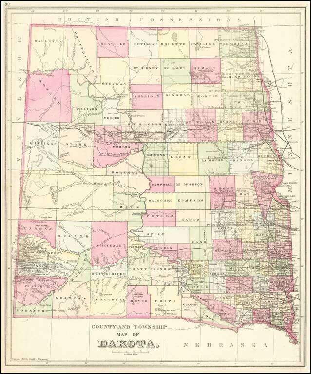
Detailed map of Dakota Territory, published by William Bradley Jr., in a late edition of SA Mitchell Jr's Atlas. The map is colored by county, and shows state surveys, forts, towns, railroads, etc. Extremely detailed in the southwest corner in the...
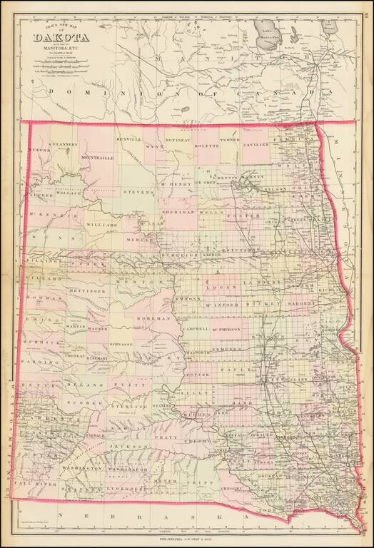
Highly detailed map of Dakota Territory, published by OW Gray & Son. The map is colored by counties and showing towns, roads, railroads, Post Offices, etc. Many counties not yet formed.
![[State of Lincoln!] British Columbia and the North West Territory](/map/small/60287.jpg)
Rare separately published map of Western Canada and part of the Northern United States, including the proposed State of Lincoln. The map provides a detailed treatment of the Western part of Canada, along with a very rare appearance of the proposed...
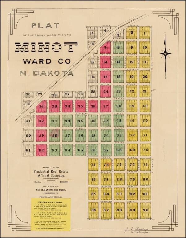
Fine early plat for a portion of downtown Minot, North Dakota, printed shortly after the creation of North Dakota in 1889, one of the earliest surviving maps of the town of Minot, North Dakota. The Brooklyn Addition is a part of Minot's central...
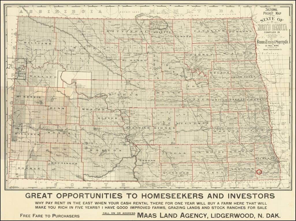
"Why Pay Rent in the East When Your Cash Rental There For One Year Will Buy A Farm Here That Will Make You Rich in Five Years?" Scarce early-20th century map of North Dakota, published for the Maas Land Agency, Lidgerwood, North Dakota, to promote...