
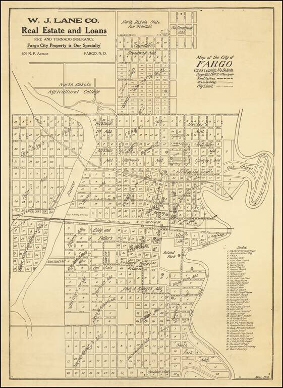
Antique map of Fargo, North Dakota, published by E.J. Henriques in the city in March of 1910. The map is quite detailed, featuring the names of the Additions, as well as the outlines of the original town. The Index in the lower-right corner has 42...
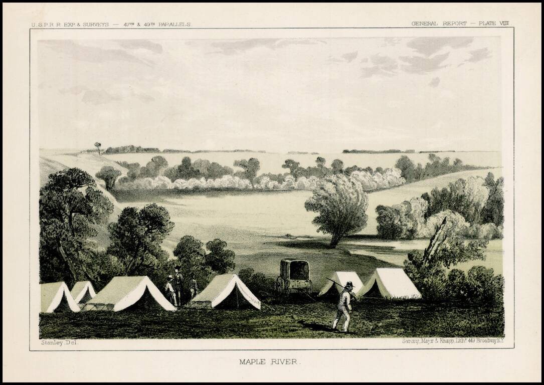
Fascinating view of an encampment on the Maple River in South Dakota, prepared as part of the United States survey for the most practicable route for a railroad line to the West Coast of America, conducted just prior to the Civil War. A scenic view as...
![[Wounded Knee] Scene of the Fight with Big Foots Band, Dec. 29th 1890. showing Positions of Troops when first shot was fired. From Sketches made by Lt. S.A. Cloman Act'g Eng'r Officer Division of the Missouri](/map/small/65742.jpg)
Interesting battle plan depicting the Battle of Wounded Knee / Wounded Knee Massacre Wounded Knee resulted in the killing of several hundred Lakota Indians, almost half of whom were women and children, by soldiers of the United States Army, on...
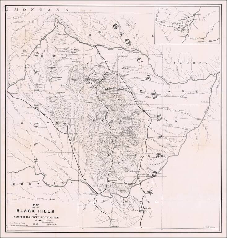
The First Book on Descriptive Mineralogy of the Black Hills with An Important Map Detailed map of the Black Hills region of western South Dakota and eastern Wyoming, between the North Fork and the South Fork of the Cheyenne River, published by Samuel...
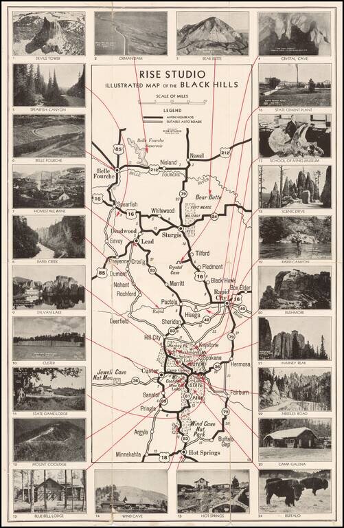
Unusual promotional map of the Black Hills, published to advertise the services of Rise Studio (photographers), of Rapid City, South Dakota. The map shows the roads in and around Custer's State Park, Rapid City and Sturgis, extending north to Belle...
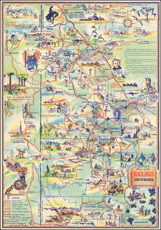
Why Not Have a Real Vacation this Year in The Mountainous Black Hills of South Dakota Decorative vintage pictorial map of the South Dakota Black Hills, published locally in the 1940s. Attractive tourist promotional pictorial map by K. Pyle. We have...
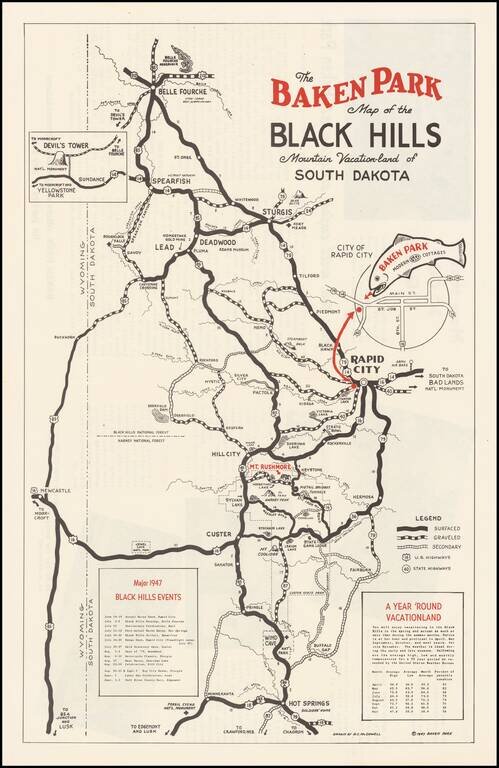
Promotional map for the Baken Park area of South Dakota, published in 1947. The map illustrates the recreational opportunties centered on Baken Park, a suburb of Rapid City, South Dakota. Advertising on the verso and a list of Major 1947 Black Hills...
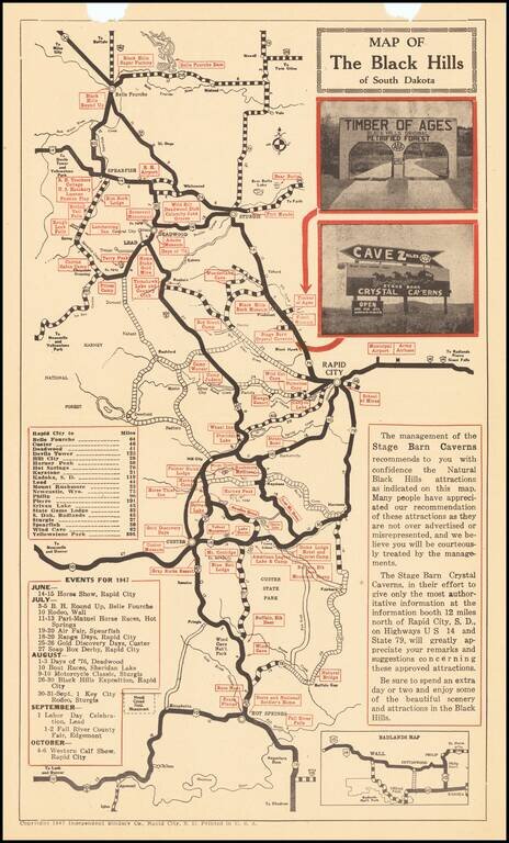
The Black Hills Leading Crystal Cave Tourist promotional map of the Black Hills Region, including advertising on the verso for Cyrstal Caverns, with photographs. Centered on Rapid City, the map highlights other tourist attractions in the region.
![[Indian Territory [with Colorado on verso]](/map/small/69383.jpg)
Highly detailed map of Colorado [and Indian Territory on the back side], hand colored by counties and showing townships, towns, roads, mountains, rivers, lakes, mines, plateaus, railroads, etc. One of the most detailed maps of the period for each of...
![Colorado [with Indian Territory on verso]](/map/small/71186.jpg)
Highly detailed map of Colorado [and Indian Territory on the back side], hand colored by counties and showing townships, towns, roads, mountains, rivers, lakes, mines, plateaus, railroads, etc. One of the most detailed maps of the period for each of...
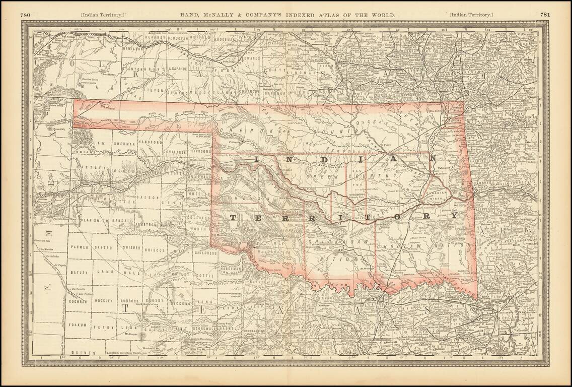
Large format detailed map of Indian Territory, showing towns, rivers, railroads, mountains, lakes, etc. Includes the various Nations, and a number of early details.
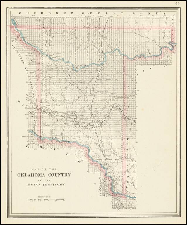
Unusual map of the "Oklahoma Country," published by George Cram in Chicago.
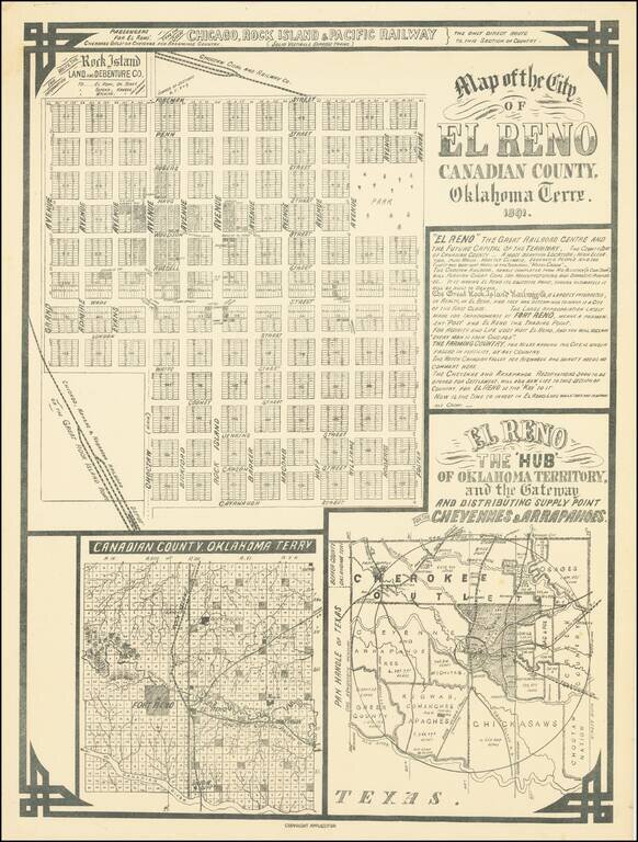
El Reno The 'Hub' of Oklahoma Territory and the Gateway and Distributing Supply Point for the Cheyennes & Arrapahoes Rare early map of the city of El Reno, Indian Territory, published in 1891, on the eve of the Third Oklahoma Land Rush (April 19,...
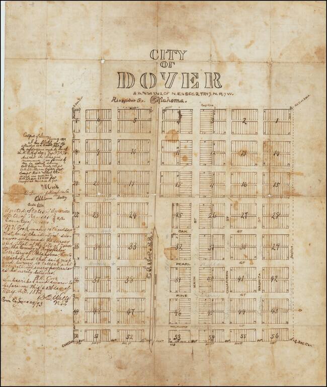
The First Map of Dover, Oklahoma Territory -- Primary Stopover on the Chisholm Trail -- Final Robbery By The Wild Bunch / Doolin Dalton Gang Drawn only 2 years after the establishment of the Dover Post Office, the present map is almost certainly the...
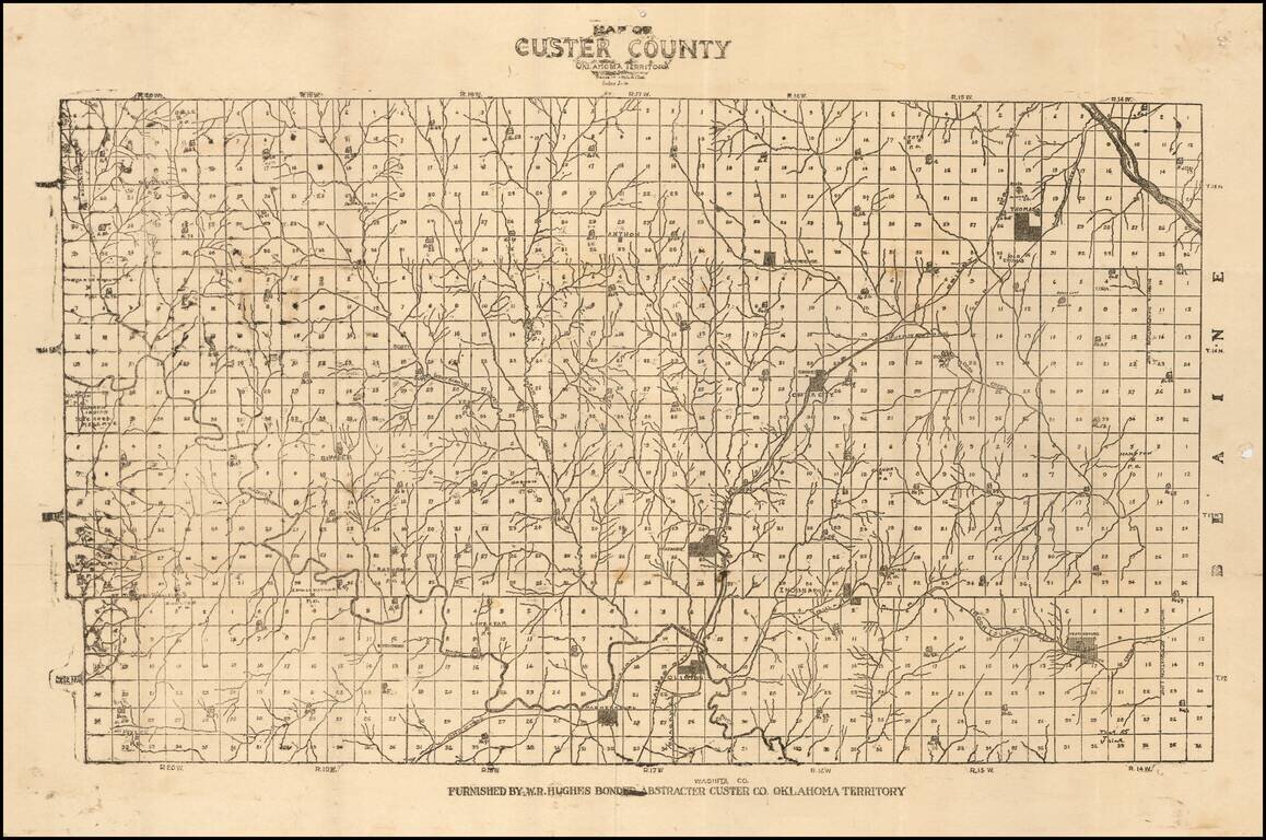
Unrecorded Early Map of Custer County, Oklahoma Territory One of the earliest surviving printed maps of Custer County, Oklahoma Territory. The map is subdivided into townships, with each lot subdivided into 36 numbered sections. Several towns are...
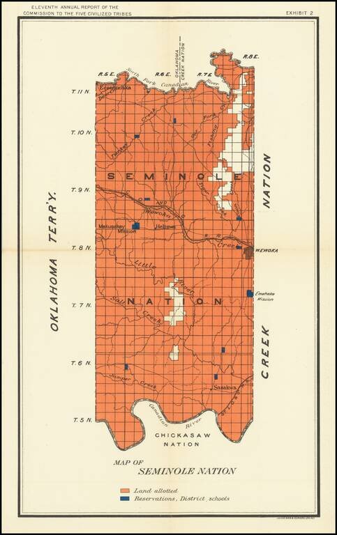
Nice map of the Seminole Map in Indian Territory, showing the coal regions for the Department of the Interior. The map shows Lands Allotted and the location of Reservation District Schools.