
![[Western Territory]](/map/small/68666.jpg)
Antique Map of the Plains and Indian Territory, Extending the Rocky Mountains Rare and important map from the 1835 Dodge-Kingsbury expedition (only 500 copies printed). The map identifies place names as far west as Santa Fe New Mexico, Pike's Peak...
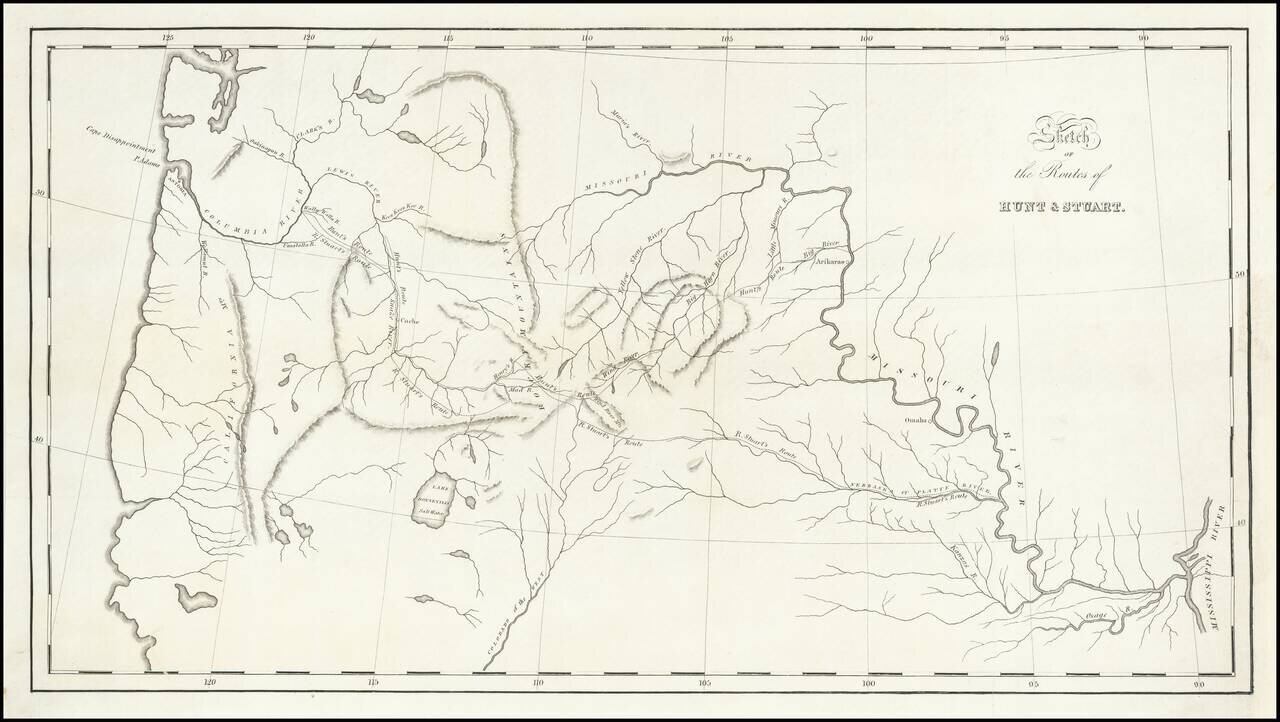
St. Louis to Astoria, Oregon in the 1810s—the Hunt and Stuart Expeditions Intriguing early map of the routes of Hunt and Stuart, two of the earliest American overland travelers, immediately following Lewis and Clark. The map illustrates Wilson...
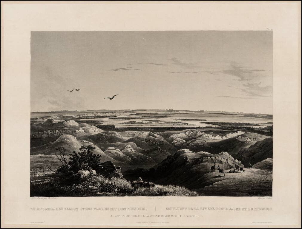
Finely executed view of the Junction of the Missouri and Yellowstone Rivers, from Maximilian, Prince of Wied's Travels in the Interior of North America, during the years 1832-1834, including blindstamp. The view provides a fine image of the confluence...
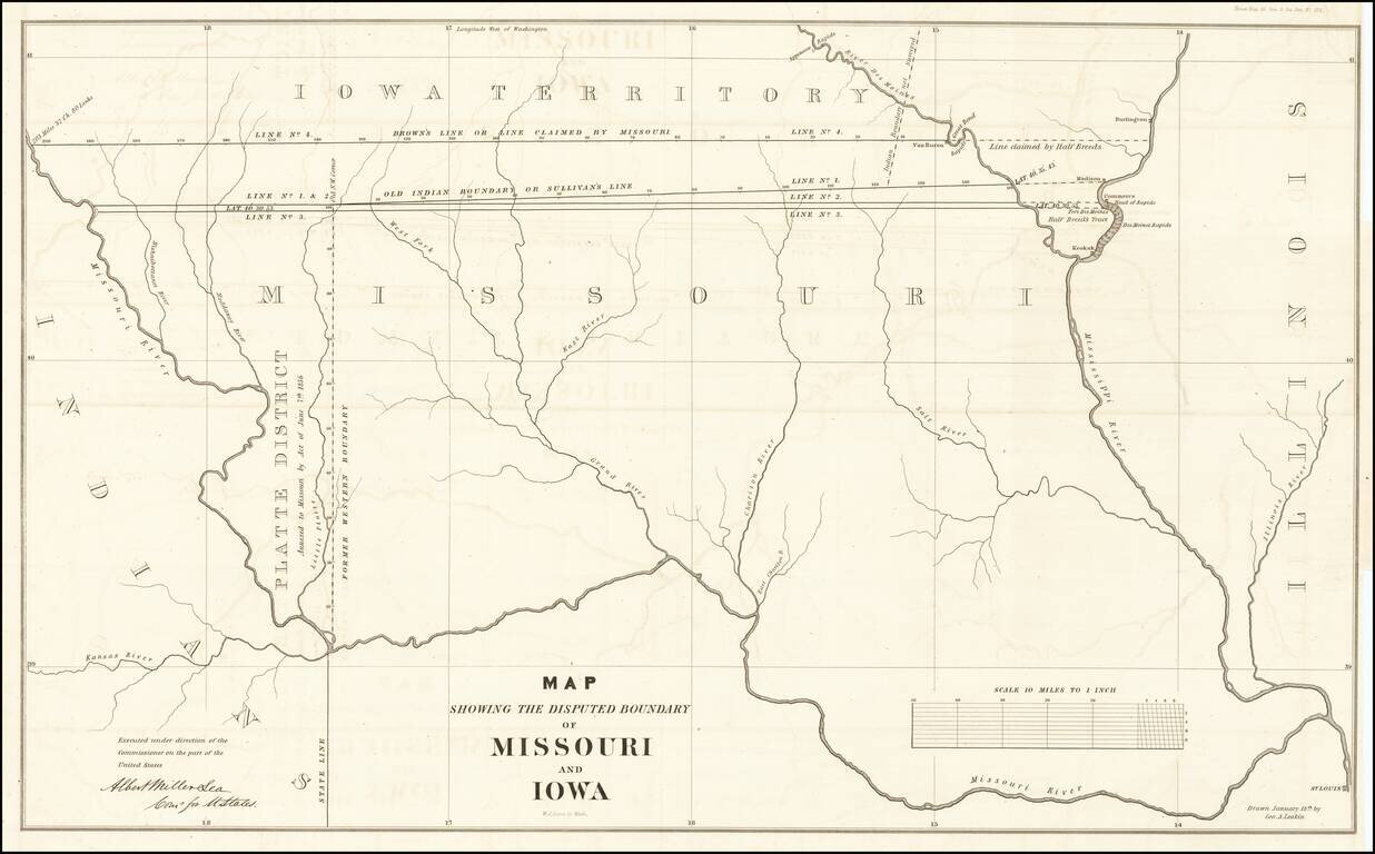
The Iowa-Missouri Boundary Dispute Detailed map illustrating the boundary dispute between Missouri and Iowa, drawn by George A. Leakin, accompanied by the report to the House of Representatives dated December 31, 1842, regarding the Northern Boundary...
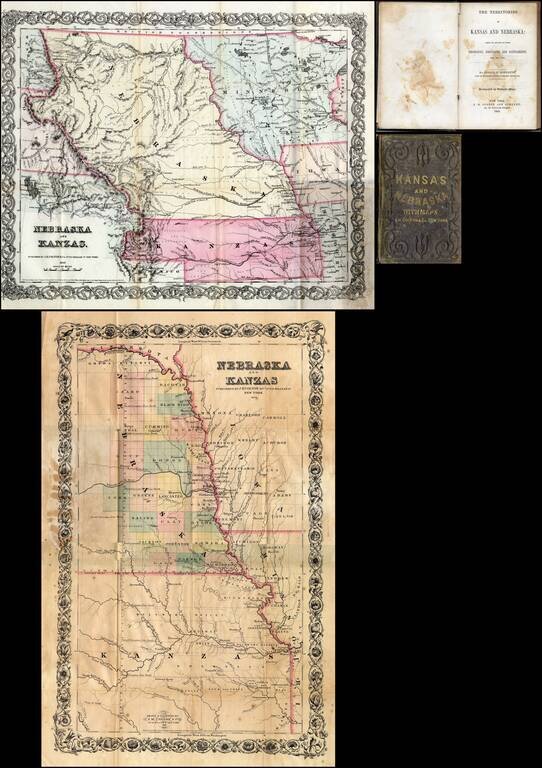
First edition of this fine early guide book to Kansas Territory and Nebraska Territory by Joseph F. Moffette, embellished with rare variant editions of two maps of Kansas and Nebraska, published by J.H. Colton & Company in New York. Pocket guide...
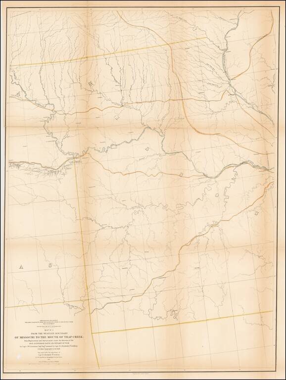
Detailed survey map of the region centered on the course of the Missouri River, published as part of the Surveys to find the most practicable routes from the Mississippi River to the Pacific Ocean. The present map is one of the first maps created by...
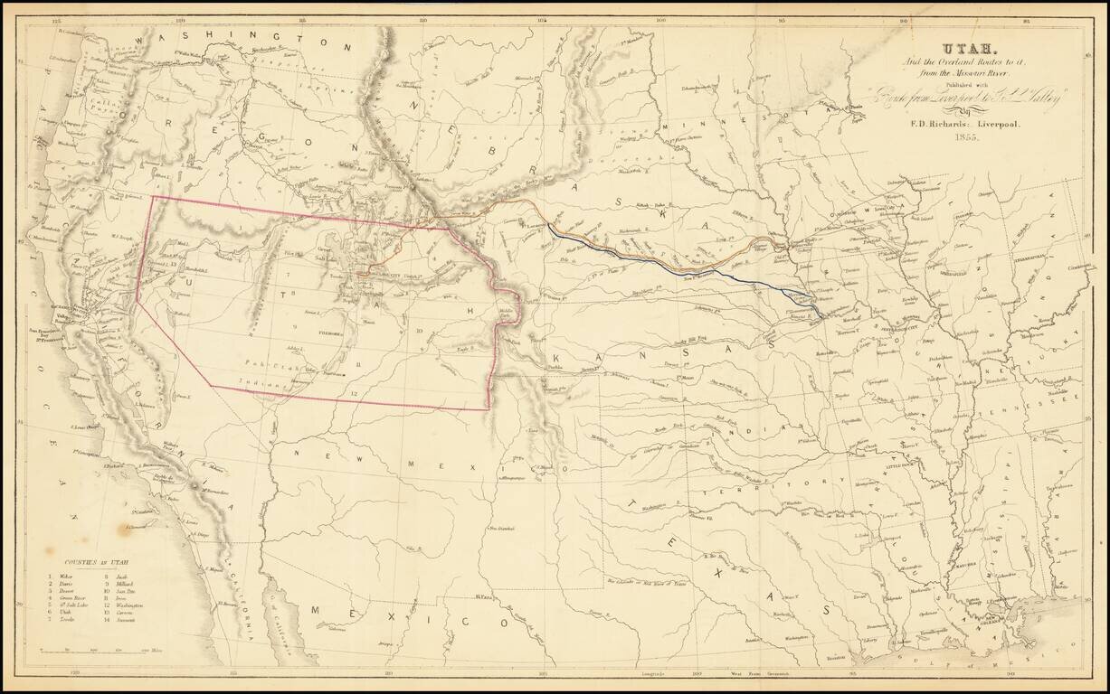
The Only Contemporary Map of the Mormon Trail. Rare hand-colored lithographed antique map of the American West focusing specifically on the routes by which Mormon's could reach Utah from points on the Missouri River. As such, it is the only...
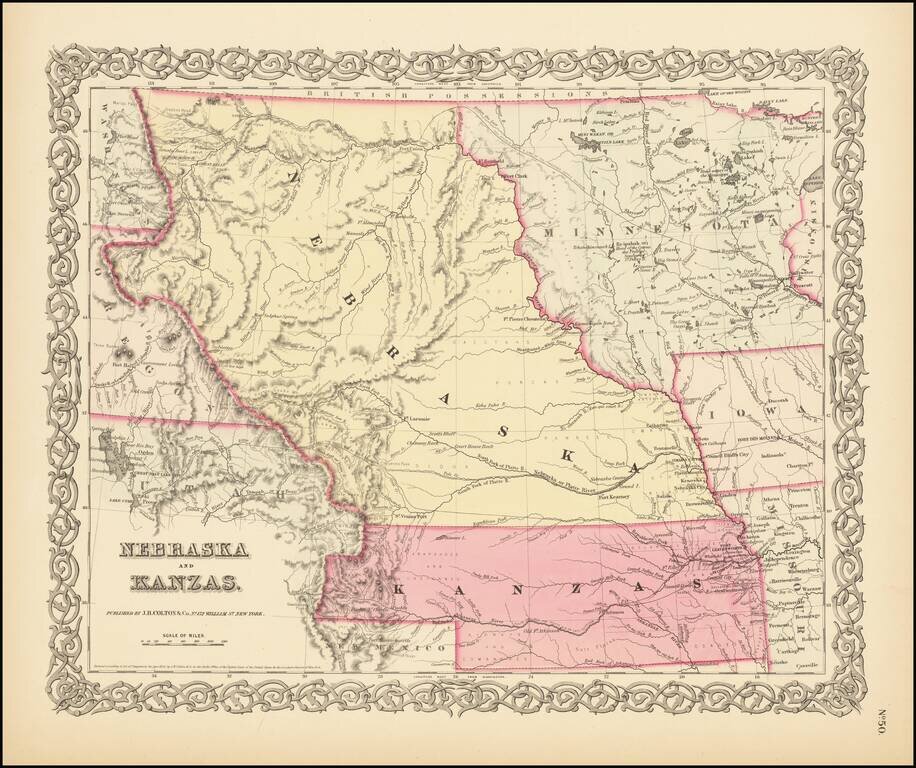
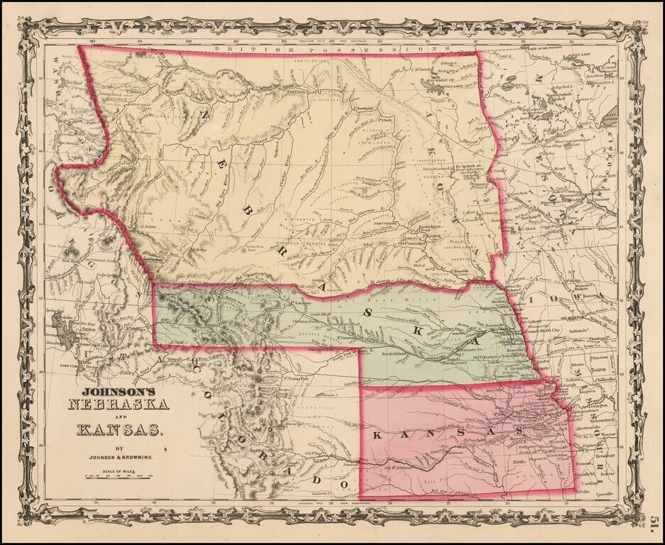
First State of Colton's Map of Kanzas and Nebraska Colton's highly sought after regional map of Nebraska and Kanzas, first published in 1855. Nebraska extends to Canada and the Rockies, taking up large portions of Montana, Wyoming and Utah. Kanzas...
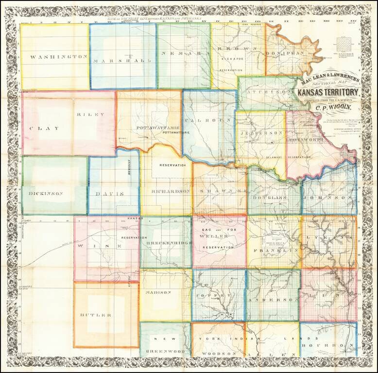
The First Great Map of Kansas Territory Fine large map of the soon to be "settled part" of Kansas Territory, drawn from the work of C.P. Wiggin. and lithographed by William Schuchman & Bro in Pittsburgh. The map illustrates the earliest...
![Territory of Nebraska [includes parts of Montana, Wyoming, Colorado and Dakota]](/map/small/66957.jpg)
Rare map of the Territory of Nebraska, from Rogers & Johnston's Atlas of the United States. Rogers & Johnston's map is the only commercial atlas map to show Nebraska Territory on a single map. The map was derived from the monumental and...
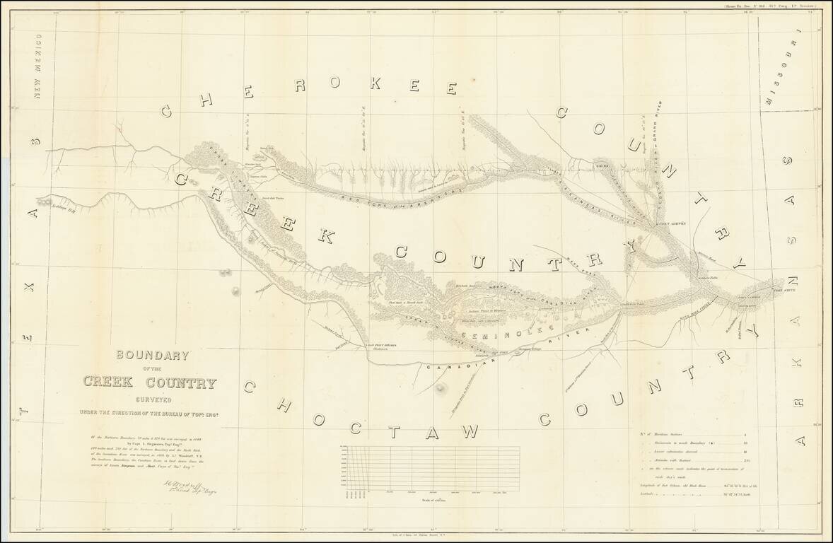
Detailed survey of the lands in Indian Territory occupied by the Creek Indians by agreement with the United States Government. The map shows the results of the earliest surveys of the watershed of the Canadian River and Red Fork of the Arkansas River...
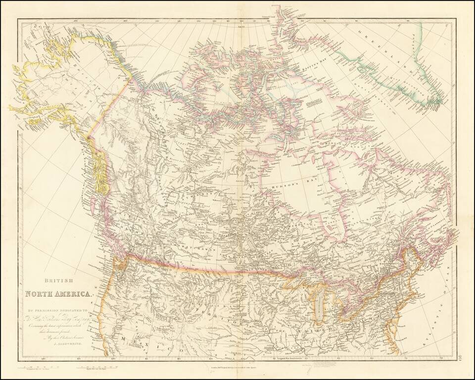
Detailed Map of British Possessions in North America—Rare Late Edition! Highly-detailed state of John Arrowsmith’s map of British possessions in North America, published in multiple editions between 1832 and 1859. This is a late edition, from the...
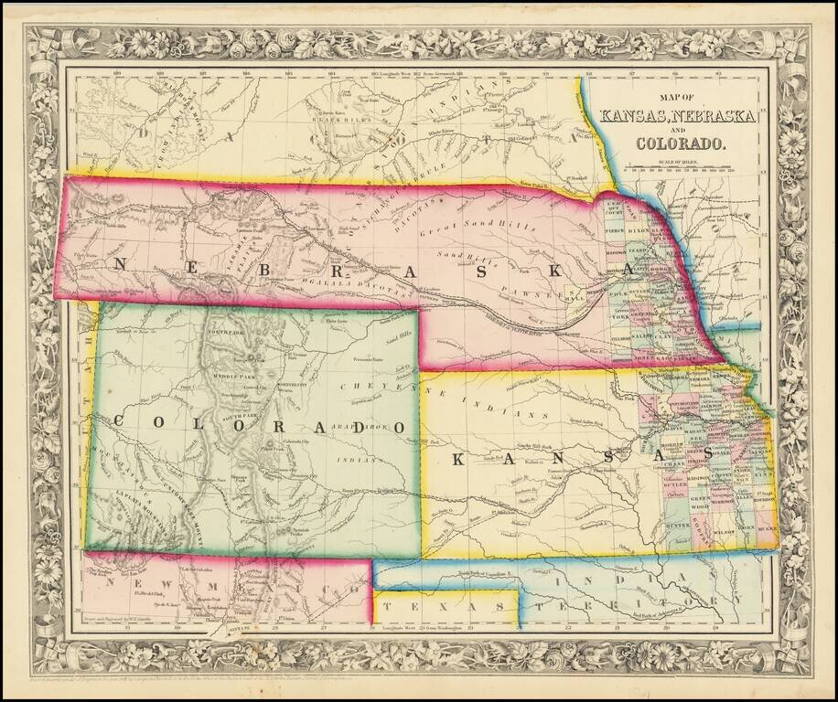
Early map in the series of Johnson's maps of this region, the first edition to include Colorado Territory. In this edition, Kansas extends to the Rocky Mountains and Nebraska extends to Oregon Territory and Canada. In the next edition, Kansas gives...
Excellent early map of the regional map of the Plains and Rocky Mountains, published by S.A. Mitchell Jr. Kansas counties cover only the eastern third of the state. Nebraska counties cover only a very small fraction of the state, which stretches all...
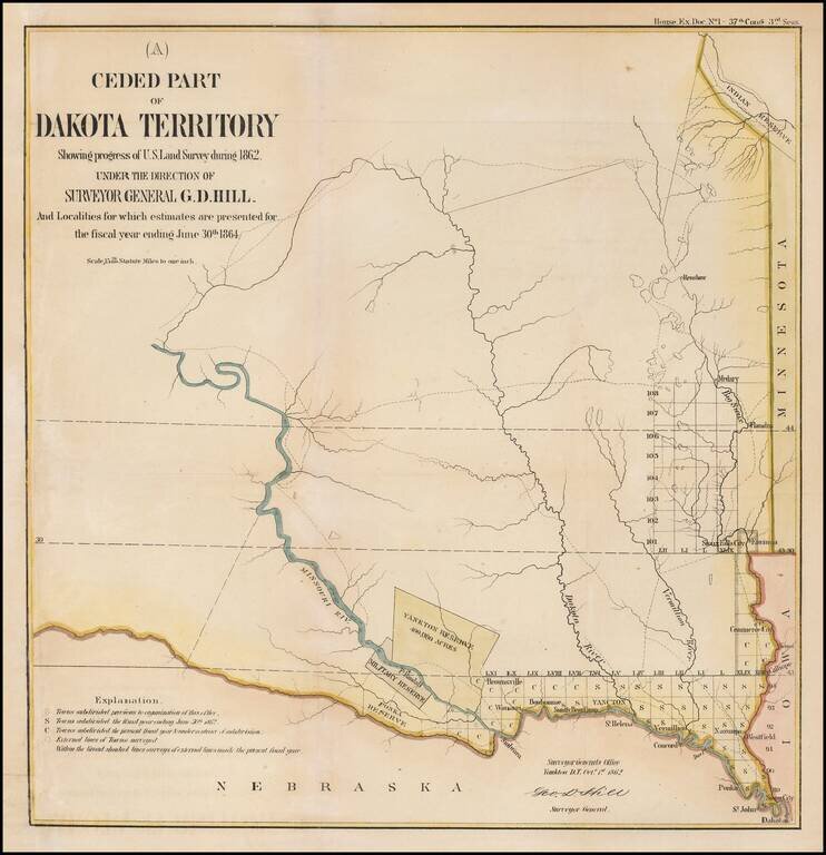
Interesting early map of part of Dakota Territory. The map is focused on the township surveys and the various Indian reserves along the Missouri River, including the Yankton Reserve, Ft. Randall Military Reserve and Ponka Reserve, along with an Indian...
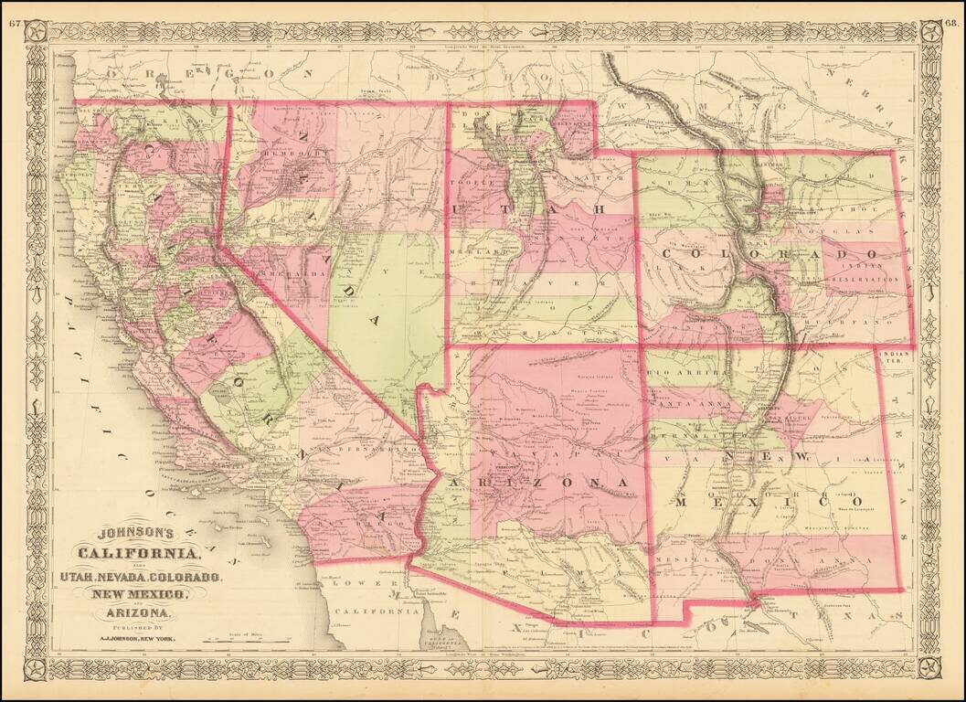
Interesting map of the southwest, hand colored by counties and showing a number of interesting territorial anomalies. Nevada has its lower corner truncated, leaving Las Vegas in Arizona. Nevada is truncated at the bottom. In each of the states and...