logo

1856. Parker's Sectional & Geological Map of Iowa Exhibiting her Iron Lead Copper Coal and other Geological Resources and all Rail Roads Completed in progress and projected . . . 1856

  • Parker's Sectional & Geological Map of Iowa  Exhibiting her Iron Lead Copper Coal and other Geological Resources and all Rail Roads Completed in progress and projected . . . 1856

Parker's Sectional & Geological Map of Iowa Exhibiting her Iron Lead Copper Coal and other Geological Resources and all Rail Roads Completed in progress and projected . . . 1856 information:

Year of creation: 
Resolution size (pixels): 
 3368x2116 px
Disk Size: 
 2.52785MiB
Number of pages: 
 1
Place: 
 Clinton, Iowa
Author: 

Print information. Print size (Width x height in inches):
Printing at 72 dpi 
  46.78 х 29.39
Printing at 150 dpi 
 22.45 х 14.11
Printing at 300 dpi 
 11.23 х 7.05

An example of detailing the file of this map of in a printable high-resolution:

Click to open in high resolution (open in new tab).
Attention! this is just the central piece (central area 960x960 px) of the map file!
This is an example, so that you can see and study the level of detail of a given map. The entire Map will be fully available after payment!

Parker's Sectional & Geological Map of Iowa  Exhibiting her Iron Lead Copper Coal and other Geological Resources and all Rail Roads Completed in progress and projected . . . 1856

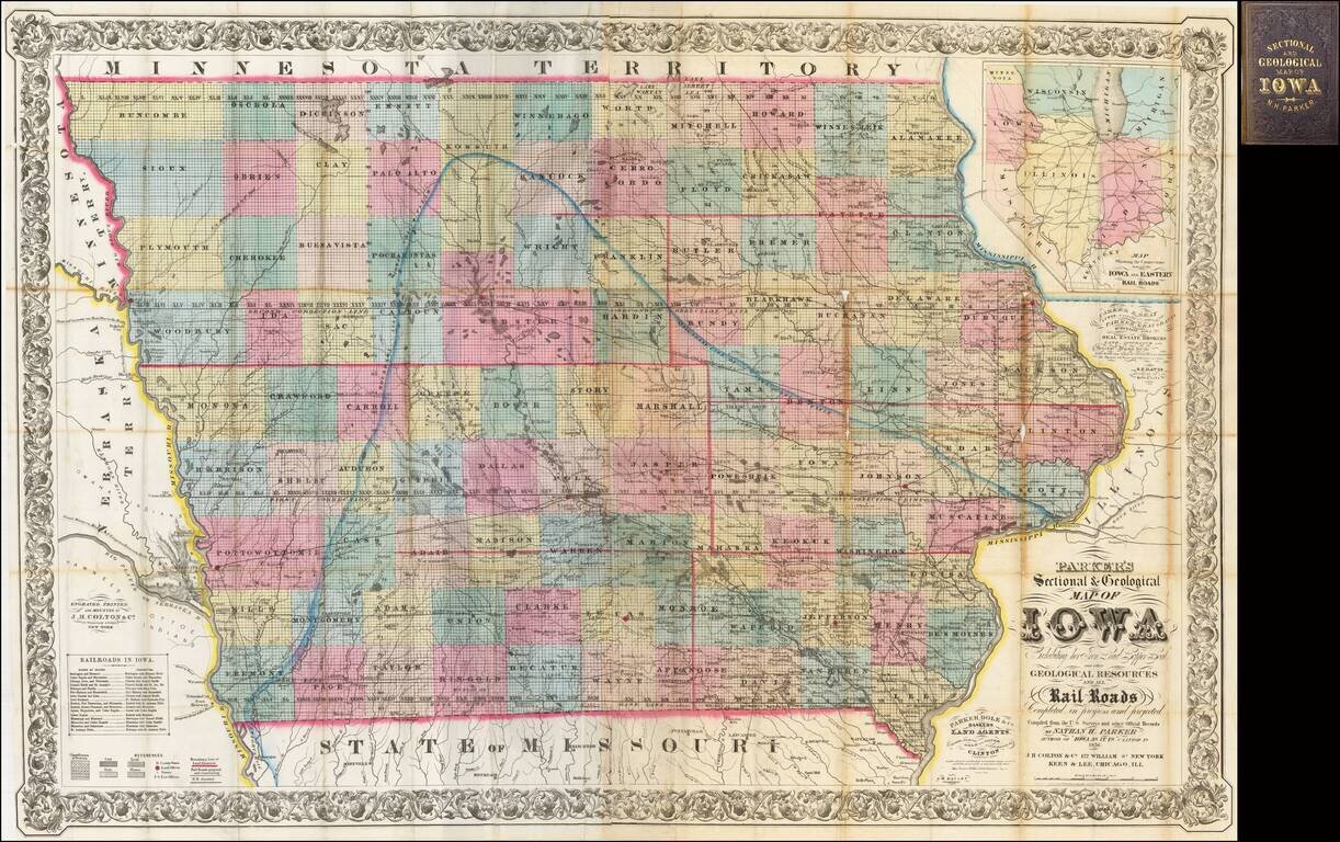
The First Commercially Published Geological Map of Iowa

A fine large format map of Iowa, published by Nathan H. Parker in Clinton, Iowa and printed by J. H. Colton in New York and Keen & Lee in Chicago. This is one of the earliest appearances of the Keen & Lee name.

Parker was a partner in the Clinton Iowa firm of Parker, Dole & Co. The firm included both bankers and land agents in Iowa during its initial period of settlement following its admission as a state. The map was issued as an inducement to settlement and investment in the region.

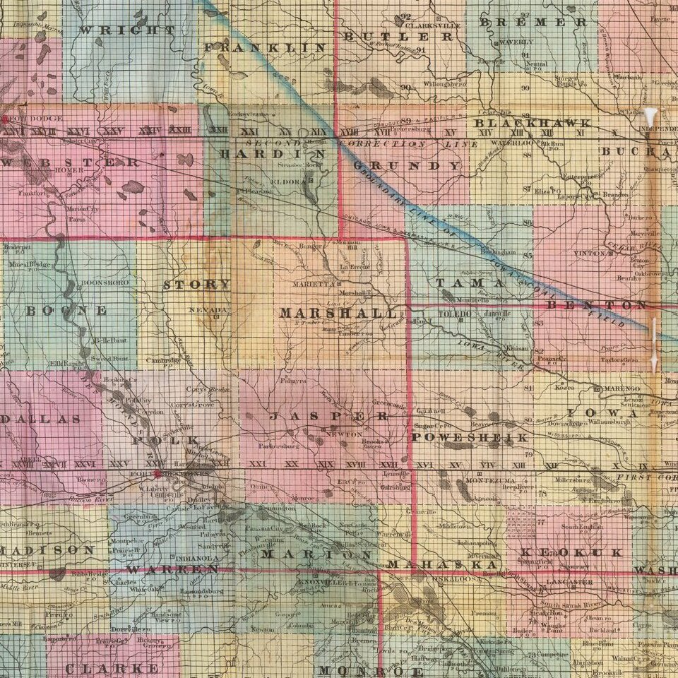
Iowa is hand colored by counties, with a list of approximately 16 railroads at the left, including the names of the railroads with which they connect.

The regions where coal, lead, iron and plaster are mined are identified.

Inset map titled "Map Showing the Connections between Iowa and Eastern Rail Roads."


Special conditions for students!

If you are a student, write to us in telegram: @antiquemaps and indicate what material you need and for what work you need a map in high detail. We are ready to provide material on special terms. For students only!

Item information:

Year of creation:
Size:
3368x2116 px
Disk:
2.52785MiB
Number of pages:
1
Place:
Clinton, Iowa
Author:
Nathan Parker.
$14.99

Related item