Map size in jpg-format: 57.6187MiB
Click to open in high resolution (open in new tab).
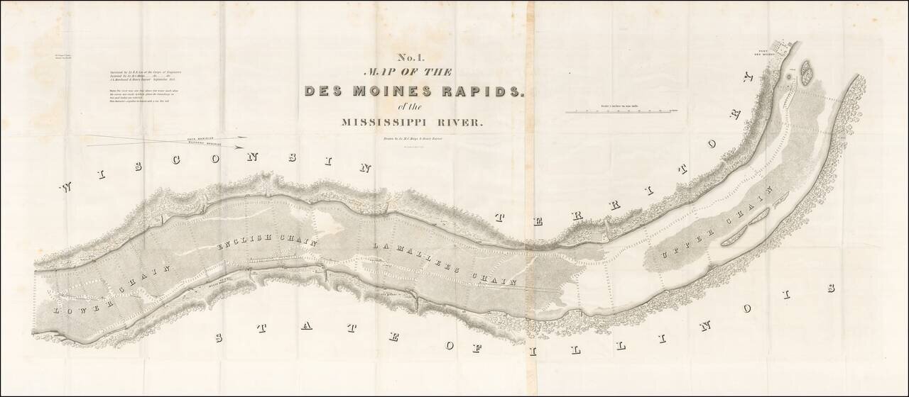
Finely detailed map of the section of the Mississippi River, showing the Des Moines Rapids in the area of Fort Des Moines, based upon the surveys of Lieutenant Robert E. Lee of the US Corps of Engineers.
The Des Moines Rapids was one of two major rapids on the Mississippi River that limited Steamboat traffic on the river through the early 19th century.
The survey of the River was commenced by Napoleon B. Buford of the US Army Corps of Topographical Engineers in 1829 and corrected by Henry Miller Shreve in 1836. This particular survey was completed in 1837 by Robert E. Lee.
The map was published as part of a concerted effort between 1825 and 1843 to survey and improve commercial navigation and flooding on major American Rivers, undertaken by the US Army Corps of Engineers.
Includes soundings and the route of the navigable channel.
If you are a student, write to us in telegram: @antiquemaps and indicate what material you need and for what work you need a map in high detail. We are ready to provide material on special terms. For students only!

![Amer. Sep. No. 49. Partie des États Unis [Missouri, Illinois, Indian Territory, Kansas, Nebraska, Iowa]](/map/small/22888.jpg)