Map size in jpg-format: 6.79136MiB
Click to open in high resolution (open in new tab).
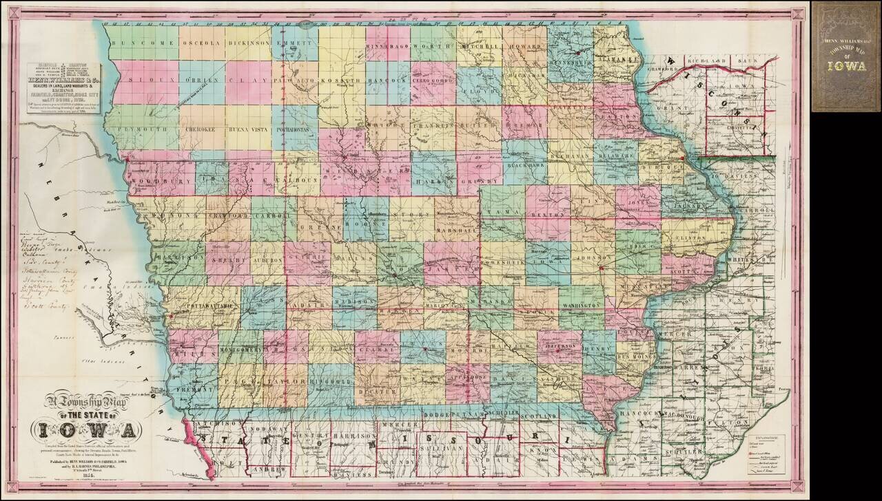
Nice example of the second state of Henn, Williams & Co.'s large format map of Iowa.
The evolution of the Henn, Williams & Co. map of Iowa over the first 3 years of its publication provides a remarkable visual depiction of the rapid growth of Iowa and the understanding of its lands, in the years immediately following the arrival of the railroads in the mid-1850s.
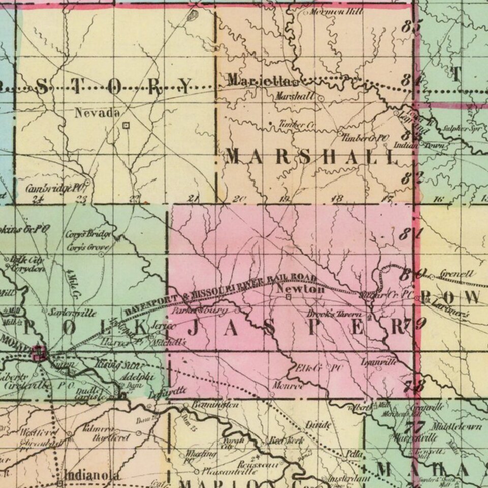
The map is hand colored by counties and shows township surveys, towns, railroads, roads, rivers, post offices and other details.
The present example is the second state of the map, following the 1854 first edition. It is the only edition of the map which includes Bancroft and Humboldt Counties, which were absorbed by Kossuth County in this 1855 edition of the map. This second state is also the first state of the map to show the upper reaches of the Des Moines River and its tributaries. The listing of an unnamed "County Seat" in Kossuth County is also of note, along with a group of lakes simply named as "lakes".
An example of the 1854 edition can be seen here: /gallery/detail/37432
At the top left, a note reflects that Henn and Williams were "Dealers in Land, Land Warrants & Exchange" in Fairfield, Chariton, Sioux City, and Ft. Dodge, Iowa. By contrast, the first state of the map notes only an office in Fairfield.
Over the first 3 years of the history of this map, there were many changes. The first state of the map includes very little information in the northwest part of the state. In the 1855 map (the second state), there are extensive additions of rivers and other topographical details, as well as the road to St. Paul. There was also apparently an 1851 map by Henn & Williams, but in a different configuration.
In 1856, the map is entirely re-engraved from 1855 edition, with numerous changes and new decorative border. The 1856 edition of the map was co-published by Keen & Lee of Chicago and Charles DeSilver of Philadelphia. Published in Chicago.
A fine example of this detailed early map of Iowa.
If you are a student, write to us in telegram: @antiquemaps and indicate what material you need and for what work you need a map in high detail. We are ready to provide material on special terms. For students only!

![Amer. Sep. No. 49. Partie des États Unis [Missouri, Illinois, Indian Territory, Kansas, Nebraska, Iowa]](/map/small/22888.jpg)