
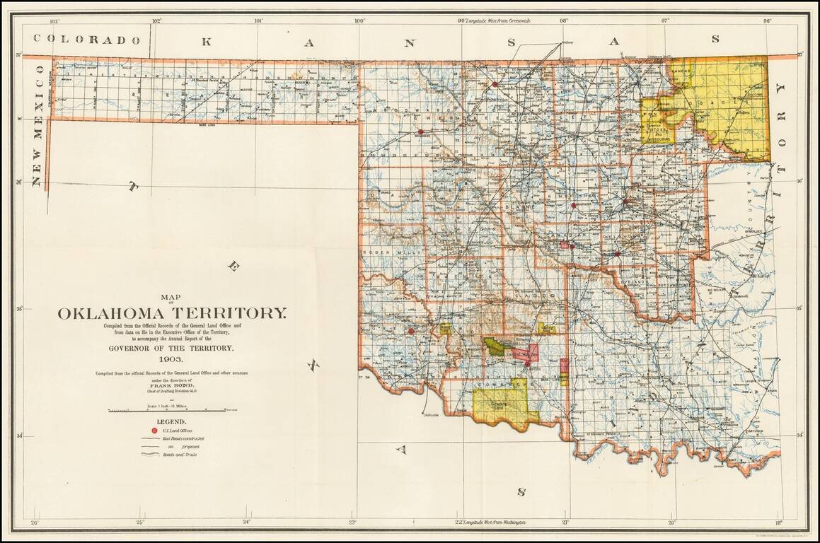
Rare Oklahoma Territory Map -- Pre-Dating Merger with Indian Territory. Rare map of Oklahoma Territory, issued by the Territorial Governor, during the brief period when Oklahoma and Indian Territory were separate Territories of the United States....
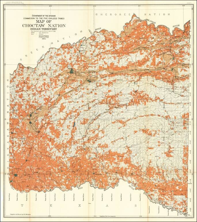
Detailed allotment map of the Choctaw Nation lands in Indian Territory, showing land allotted to July 1st, 1904, as well as coal and asphalt segregation. The map covers the Choctaw Reservation between Red, Canadian, and Arkansas Rivers.
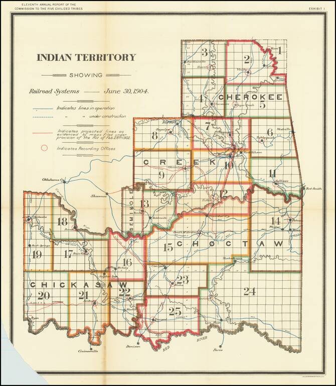
Striking map of Indian Territory, showing the Recording Districts in the Territory, for the Report of the Commission To The Five Civilized Tribes, published by the Department of the Interior. The map extends west to Oklahoma City in Oklahoma...
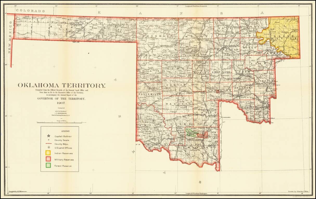
The Final Year of Oklahoma Territory Map -- Pre-Dating Merger with Indian Territory To Form The State of Oklahoma Rare map of Oklahoma Territory, issued by the Territorial Governor, during the brief period when Oklahoma and Indian Territory were...
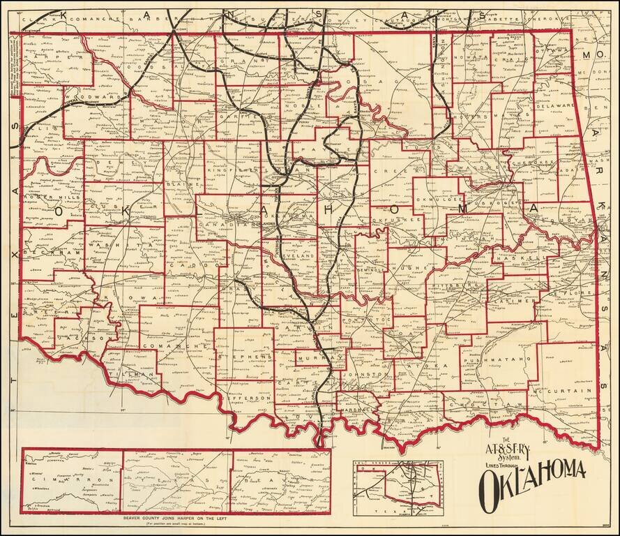
Fine map of Oklahoma, shortly after it obtained statehood on September 17, 1907, and published by the Atchison Topeka & Santa Fe Railroad. Fine map of the state, with the lines of the Santa Fe Railroad running up the center and a number of other...
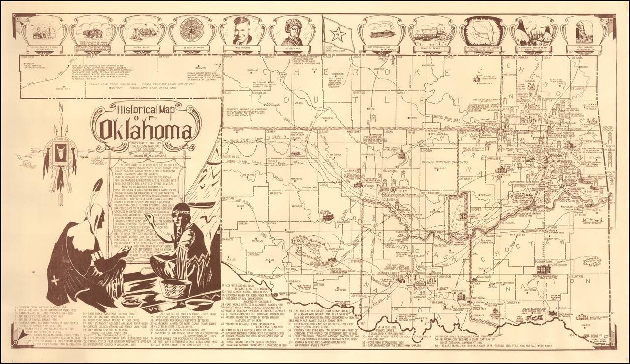
Fine pictorial map of Oklahoma, drawn by H.Z. Sanders for the Oklahoma Natural Gas Company. The map is decorated with small pictorial images showing some of the historical landmarks around the state and famous people. Also included is a legend with...
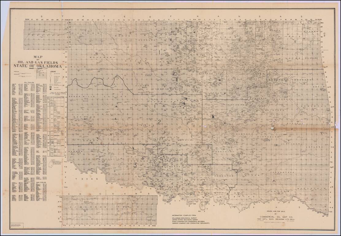
First published in January 1937, the map is revised to February 1938. A rare and detailed map of oil and gas development in Oklahoma, by the Commercial Oil Map Co. of Oklahoma City. The map was compiled from information collected by the Oklahoma...
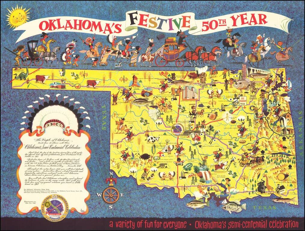
Rare Lowell Hess Pictorial Map Festive pictorial map of Oklahoma, celebrating the 50 year anniversary of Oklahoma Statehood, drawn by famed commercial illustrator Lowell Hess. The map is filled with colorful historical vignettes celebrating...
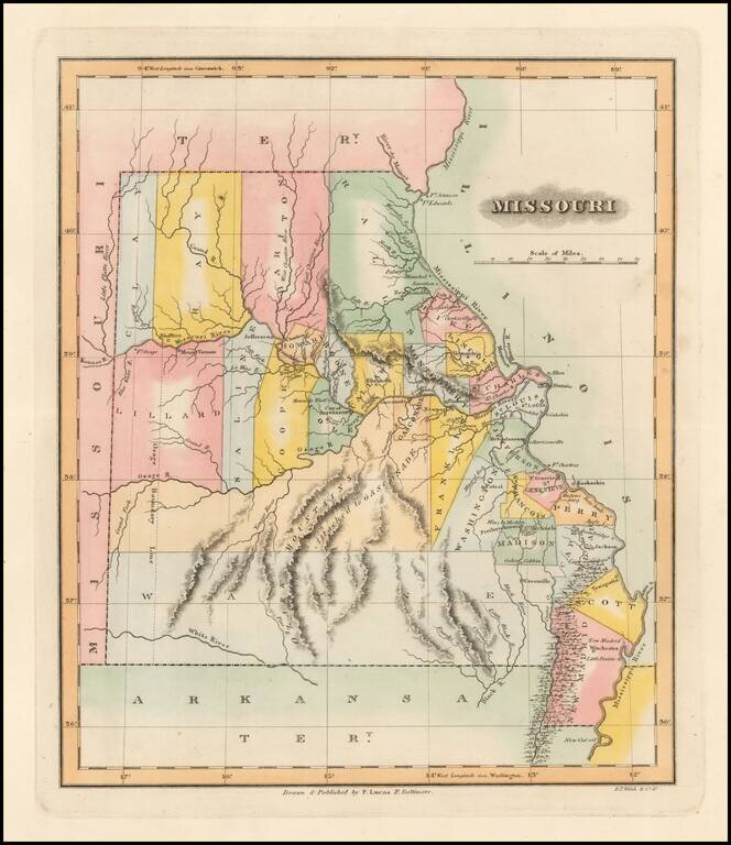
One of the Earliest Printed Maps of the State of Missouri Rare early map of Missouri just two years after statehood. Early state boundaries and most Western area are not yet partitioned into smaller counties. An Osage Boundary Line passes through...
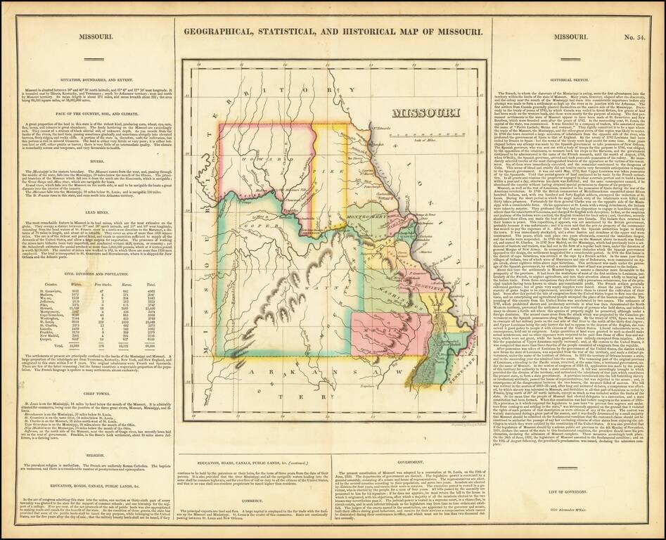
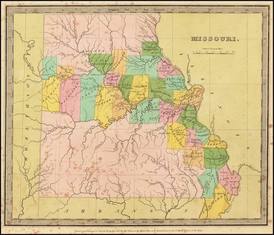
Nice example of the first printed map of Missouri as a state from the first edition of Carey & Lea's Atlas. Size includes text below map, which contains details concerning the topography, indigenous lands, rivers, chief towns, commerce,...
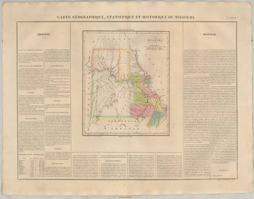
The First European Printed Map of Missouri . Fine example of Buchon's map of Missouri, the first map of Missouri published outside of America. Buchon's map appeared in his Atlas Geographique, Statistique, Historique et Chronologique ...., the first...
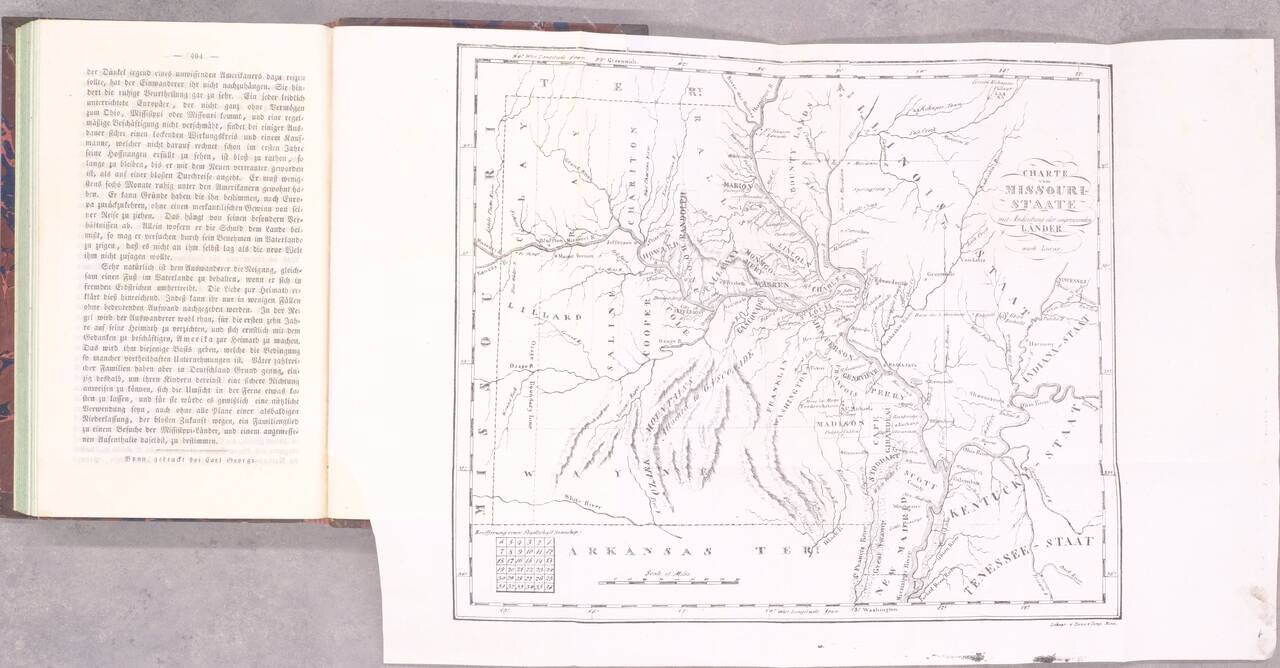
The Beginning of German Immigration to Missouri. Second and best edition. Gottfried Duden was among the first German immigrants to Missouri, having traveled there in 1824. He established a farm in the Missouri River valley between St. Louis and...
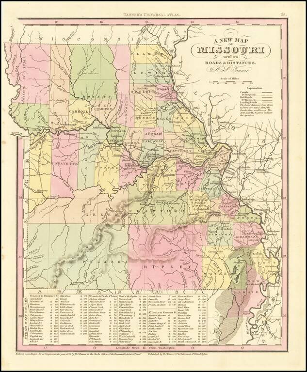
Detailed map of Missouri from Tanner's New Universal Atlas. Hand colored by county and showing towns, rivers, lakes, railroads, roads, etc. Table of Steam Boat routes and distances. Includes a number of ovesized counties, including Barry, Taney,...
Striking full color example of the first edition of David Burr's map of Missouri, which appeared in his Universal Atlas. Includes fascinating primitive counties, large unnamed counties in the north and south, Bounty Lands above Chariton, etc. The...
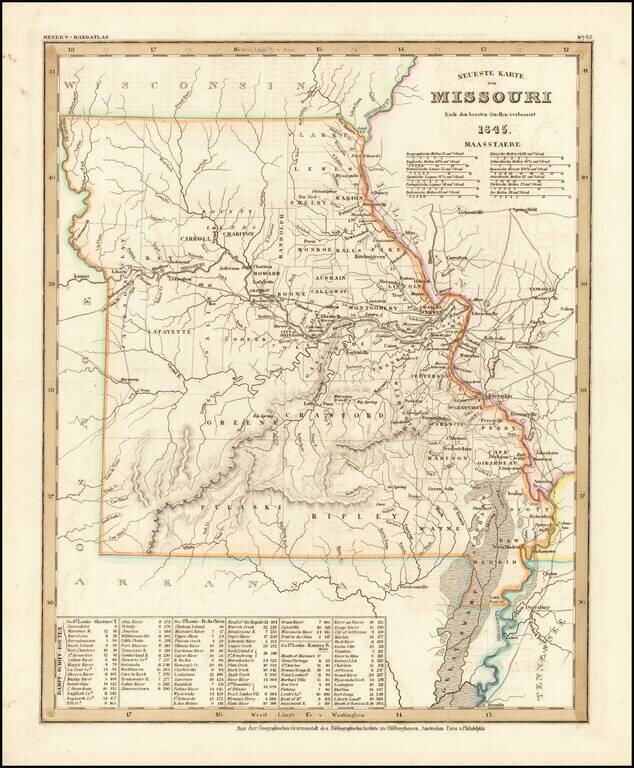
Elegantly engraved & detailed map, taken based upon Tanner's work in the early 1840s. Shows counties, towns, roads, mountain ranges, rivers etc. Includes a table of Distances and times for various steamship routes along several rivers.
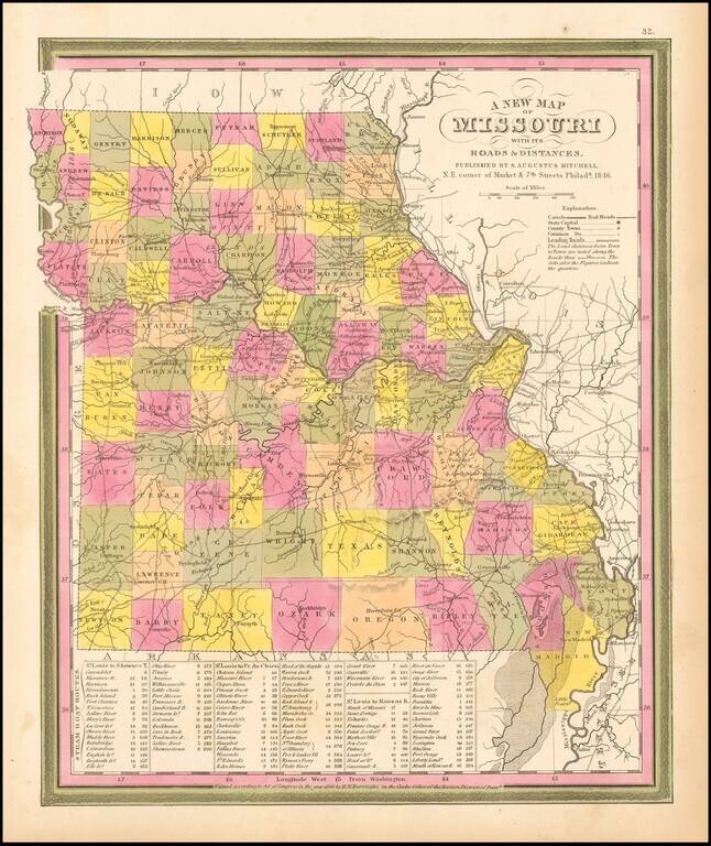
Detailed and interesting map from Mitchell's New Universal Atlas. Hand colored by county and showing towns, rivers, lakes, railroads, roads, etc. Table of Steam Boat routes and distances. Nice wide margins. Mitchell's pre-1850 maps are becoming...