
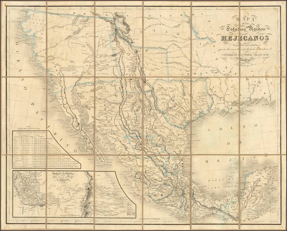
Rare second edition of the so-called Rosa map of Mexico, first published in Paris in 1837 and re-issued in 1851, at the request of the Congress of Mexico. Rosa's map is perhaps the rarest of the so-called Treaty Map sequence, which shaped the original...
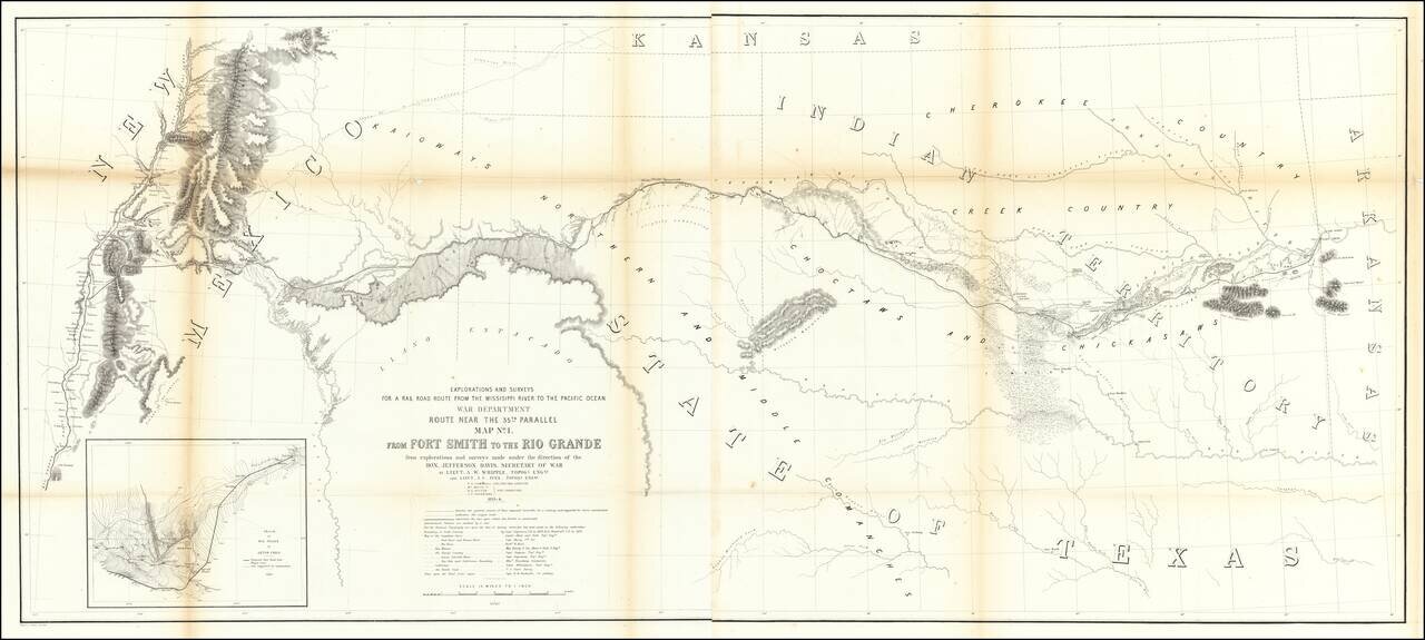
Important early map of the region between Fort Smith Arkansas and the Rio Grande River (Santa Fe, Taos, etc), prepared by the US Pacific Railroad Survey. The primary cartographic detail is in the Rio Grande Valley of New Mexico and along the Canadian...
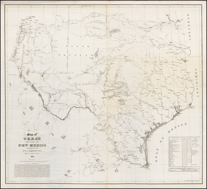
One of the Rarest Great Modern Maps of Texas First edition of this remarkable separately issued map of Texas and part of New Mexico, prepared by the United States Topographical Engineers in 1857 and issued in very small numbers, likely only for use...
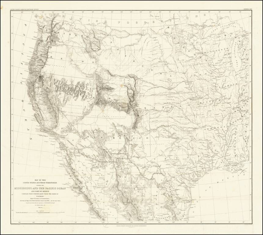
Emory's Map of the Transmississippi West. Marvelously detailed map of the Western Territorial US, published by W.H. Emory in his Report of the United States and Mexican Boundary Survey. The map is one of the fundamental post-Gadsden Purchase maps of...
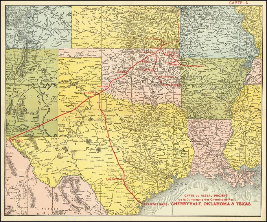
Promoting Railroads To French Investors Fine example of this rare promotional map centered on Texas, Oklahoma and Kansas, published to attract French investors in the issuance of bonds to construct the Cherryvale, Oklahoma & Texas Railway. This...
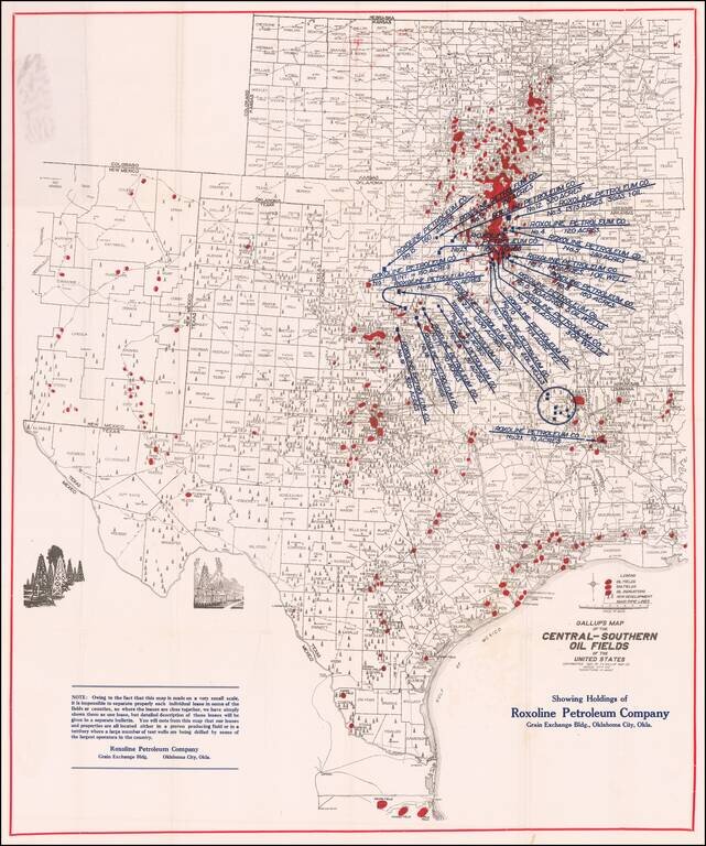
Early Texas Oil Map. Scarce oil map covering all of Texas, Oklahoma, and Kansas along with portions of New Mexico, Missouri, Arkansas, and Louisiana. It prominently shows oil fields, gas fields, and "oil indications" in red overprinting with large...
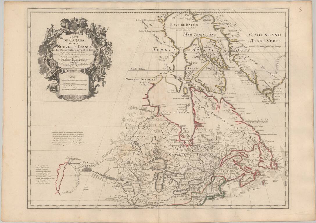
Seminal Early Map of Canada & The Great Lakes -- One of The First Maps To Reference The Rocky Mountains Nice example of Guillaume De L'Isle's map of Canada, the Great Lakes and Upper Midwest, one of the most important and influential maps of...
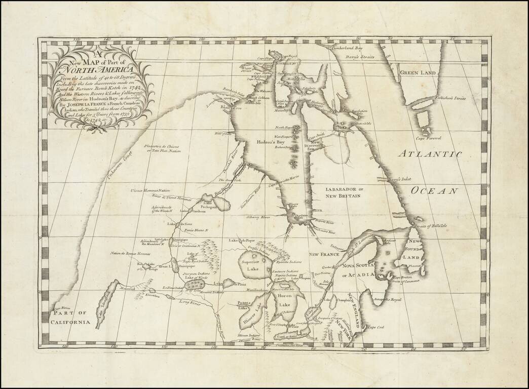
Important early map illustrating the controversy over the Northwest Passage. The map was part of the great Dobbs-Middleton debate concerning British exploration in search of a northwest passage. The present map extends from the Great Lakes, Upper...
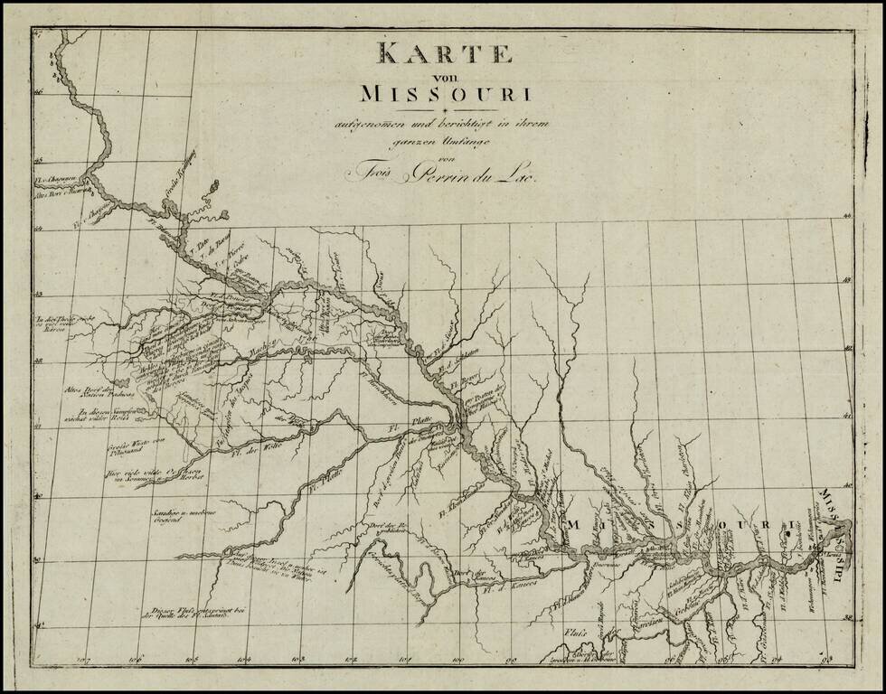
Fine example of the German edition of Perrin du Lac's seminal map of the course of the Missouri River. As noted by Wagner-Camp, Wagner states that the map . . "is the earliest published map of the trans-Missisisppi region which can be said to display...
An Early American Map of the Old Northwest Nice example of the rare 1814 edition of Mathew Carey's map of the old Northwest. The map reflects a very early appearance of Michigan Territory (organized 1805), which had not yet appeared separately on any...
![Amer. Sep. No. 49. Partie des États Unis [Missouri, Illinois, Indian Territory, Kansas, Nebraska, Iowa]](/map/small/22888.jpg)
Important Early Mapping of the Missouri River, Upper Mississippi and Indian Regions Remarkable map of the central part of the Mississippi Valley and Lower MIssouri River Valley, only a few years after Missouri gained its statehood. The detail along...
![Amer. Sep. No. 33. Partie De La Nouvelle Bretagne (Upper Missouri River, Lake Winnepeg, Lake of the Woods and Saskatehawan River]](/map/small/41687.jpg)
Large format map of the region, centered on Lake Winnepeg and showing Riviere Skatehawan ou Fleuve Bourbon in the Northwest, the Missouri River and Assinniboines in the Southwest, Nenawecouhen and Lake Pike in the Northeast and the Lake of the Woods...
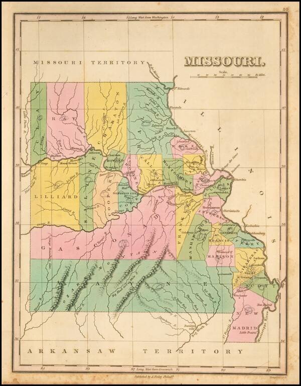
Nice example of the first state of Finley's map of Missouri, first published in 1824. The map is hand colored by counties and shows towns, rivers, mountains and other geographical features. One of the earliest obtainable maps of Missouri, with...
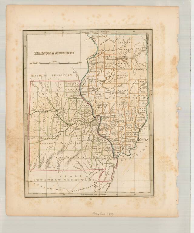
Scarce early map of Missouri & Illinois, also showing Arkansaw Territory to the South and Missouri Territory to the North. A number of early primitive counties still appear, especially in Missouri. Missouri has 38 counties, but lacks the Platte...
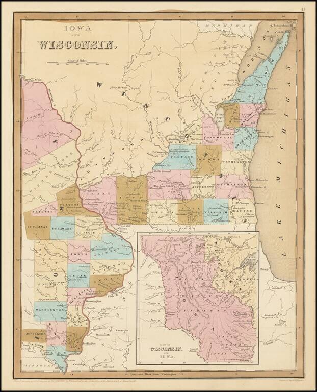
Early Antique Map of Iowa Territory and Wisconsin Territory Important early map of part of Iowa and Wisconsin, with large inset showing all of Iowa Territory and Wisconsin Territory extending to the Canadian Border. Iowa Territory was organized in...
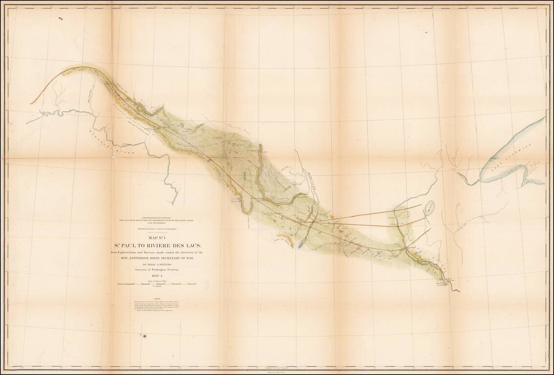
Detrailed map of the area from St. Paul and the Mississippi River to Fort Union and the confluence of the Yellowstone River and the Missouri River, published as part of the Pacific Railroad Surveys. The map shows one of the routes surveyed from St....