
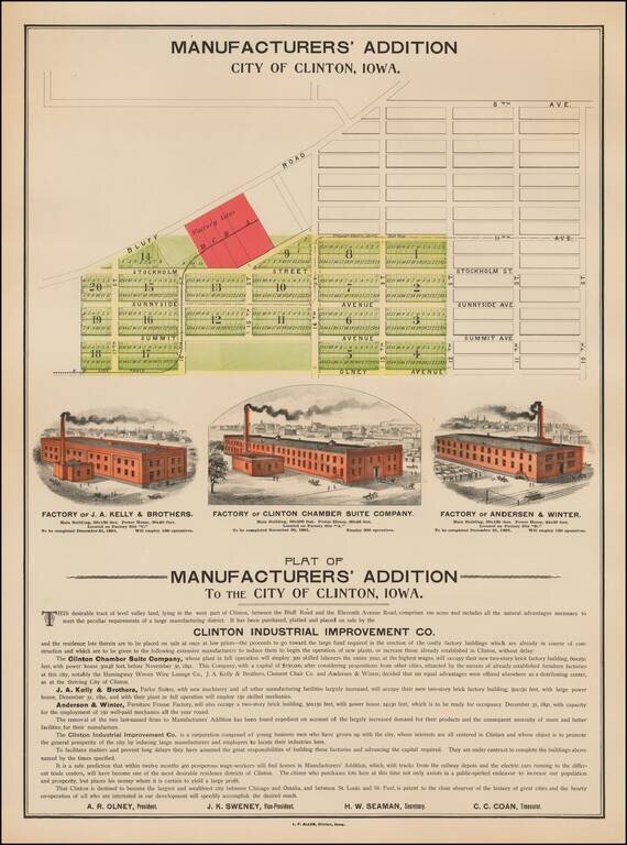
Rare illustrated promotional map broadside, promoting the Plat of Manufacturers' Addition To The City of Clinton, Iowa. In addition to the Plat of the Manufacturers Addition, the map illustrates 3 factories, each of which was scheduled for completion...
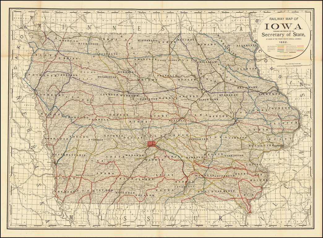
Finely detailed railroad map of Iowa, published for the Iowa State Legislature by Rand McNally & Co. The map illustrates 9 color coded railroads, including: Burlington, Cedar Rapids and Northern Central Iowa Railway Illinois Central RR...
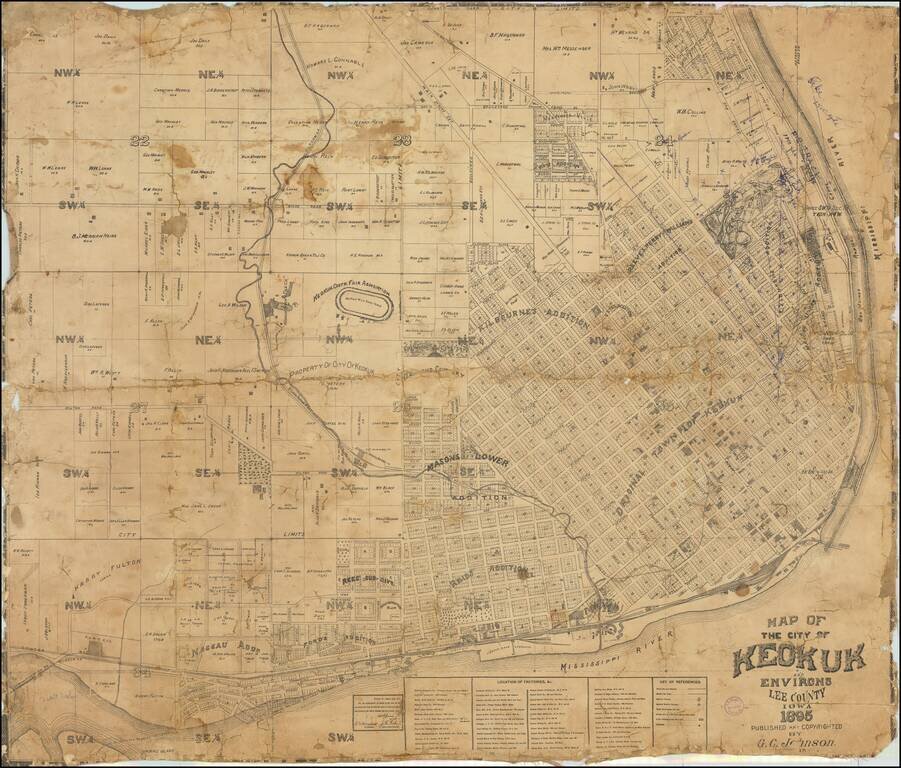
Finely executed cadastral map of Keokuk, published in 1895. The map provides an excellent overview of the city, which at the time had a population of about 14,000. The original townsite is shown, along with a number of later additions. The Keokuk...
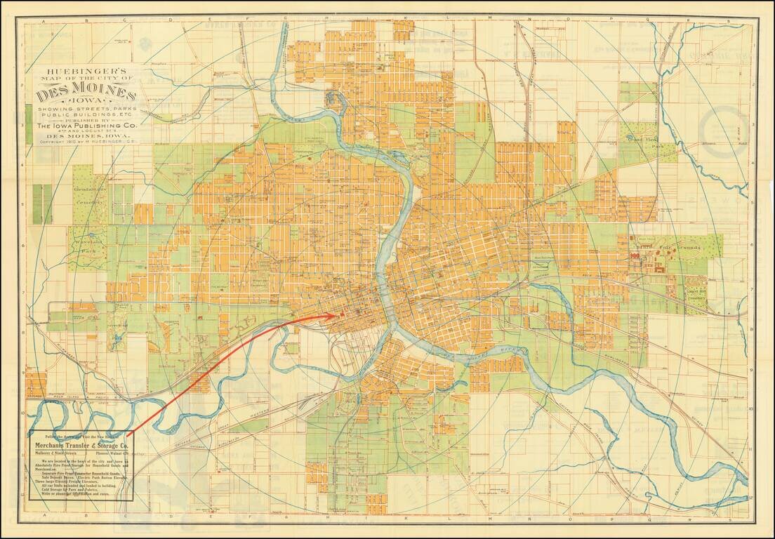
Fine large map of Des Moines, Iowa, published by Melchior Huebinger, Civil Engineer, of Des Moines Iowa and the Iowa Publishing Company. Published as a promotional map for the Merchant Transfer & Storage Company, the map elegantly differentiates...
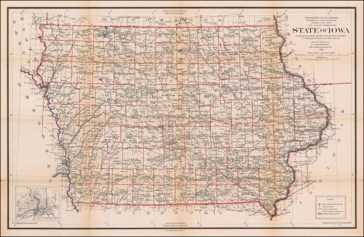
Highly detailed map of Iowa, published by the General Land Office. Shows county boundaries and railroad land-grant limits are shown in color. Also shows Private Claims, county names, public land surveys, towns, principal railroad stations, post...
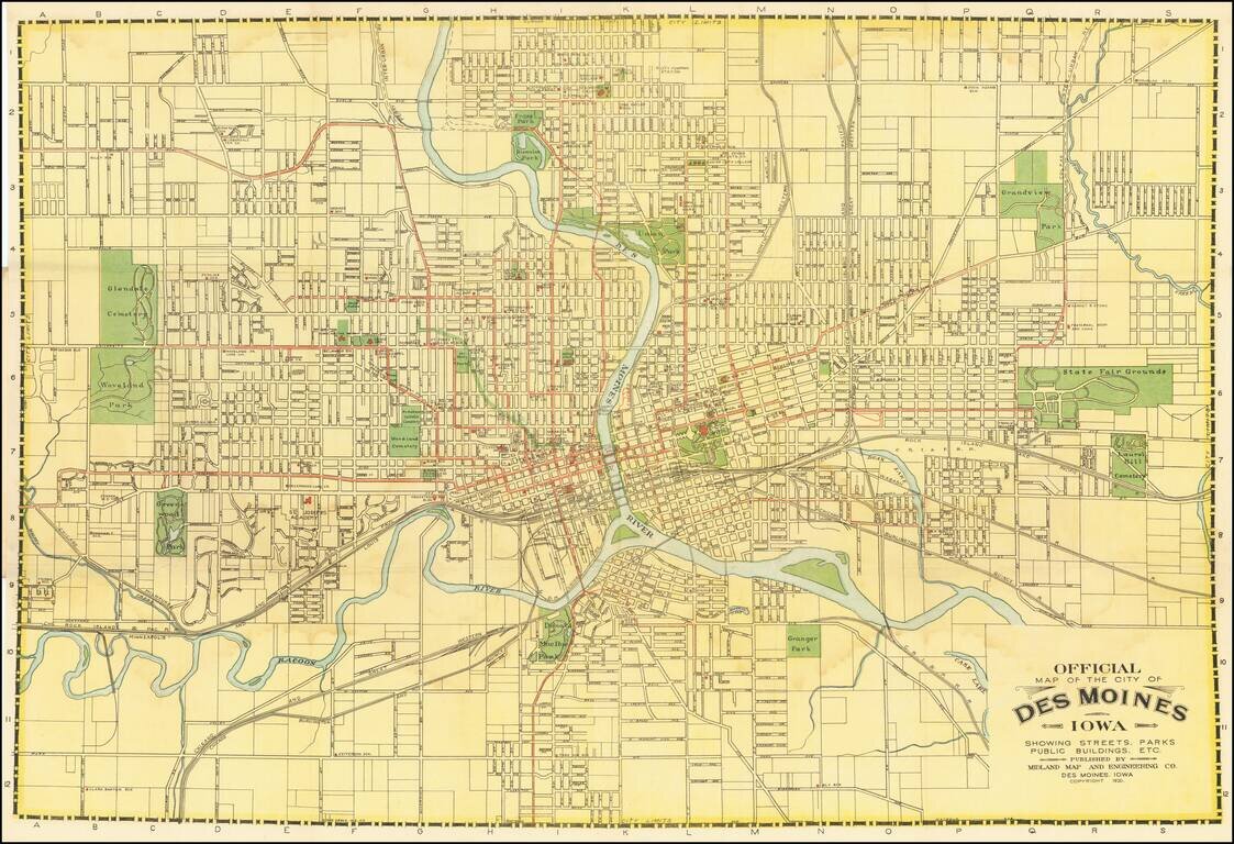
Des Moines City Beautiful Project Detailed map of Des Moines, Iowa, published in Des Moines in 1920. The map is filled with important local information, including early street car lines, parks, pubic buildings, etc. The map was issued following Des...
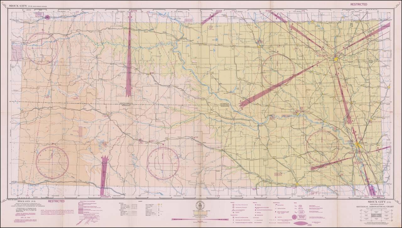
Restricted World War II Aviation Map Detailed aeronautical map of the Boise area. The chart is a font of information about civil and military aviation during WWII. It was intended for civil aviators flying by visual navigation and so includes data...
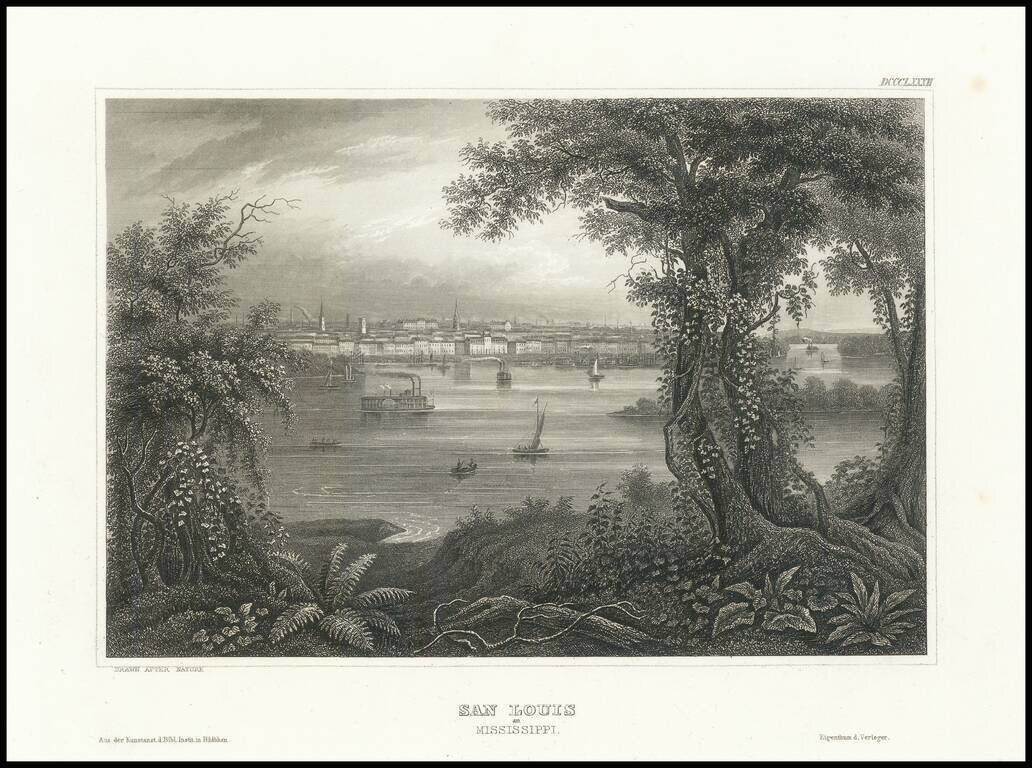
Fine steel engraved view of St. Louis from across the Mississippi River.
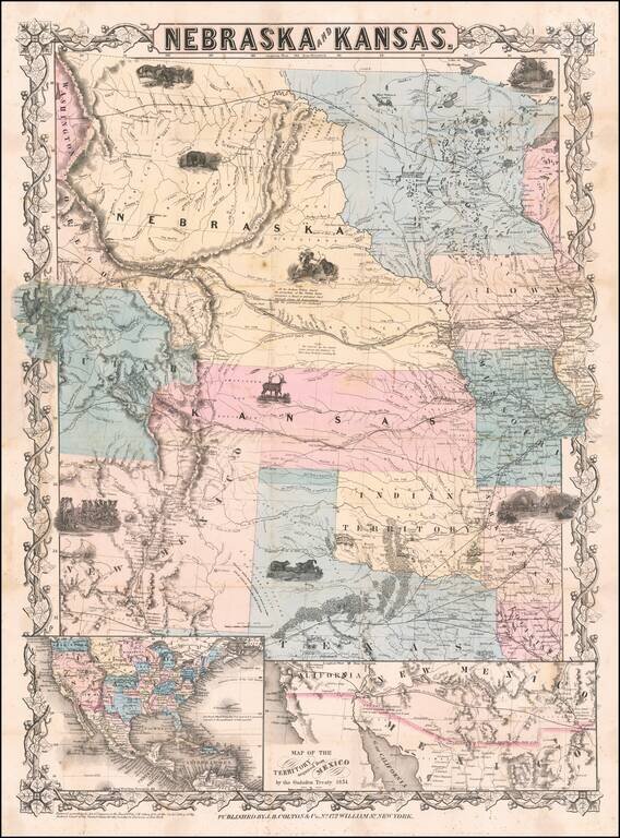
First edition, second state of this rare and important separately issued map of Kansas and Nebraska, published by J.H. Colton in New York. Colton's map is the first printed map to show the configurations of Nebraska and Kansas after the creation of...
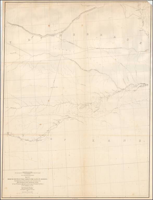
Detailed map of large portions of Kansas and Nebraska, prepared in connection with the Surveys to determine the most practicable routes for Transcontinental Railroads in the the 1850s. The map provides a detailed treatment of the region between the...
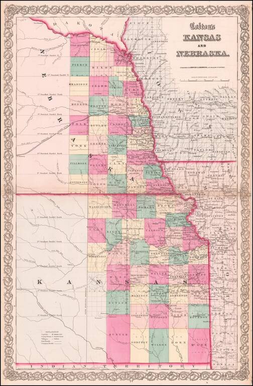
Vibrant example of this early map of Kansas and Nebraska, which was only issued in the vertical format for a few years. Primitive County configurations in the west and south. Multiple proposed railroad routes throughout the map.
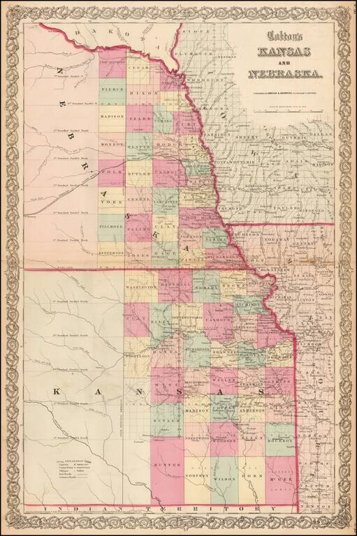
Vibrant example of this early map of Kansas and Nebraska, which was only issued in the vertical format for a few years. Primitive County configurations in the west and south. Multiple proposed railroad routes throughout the map.
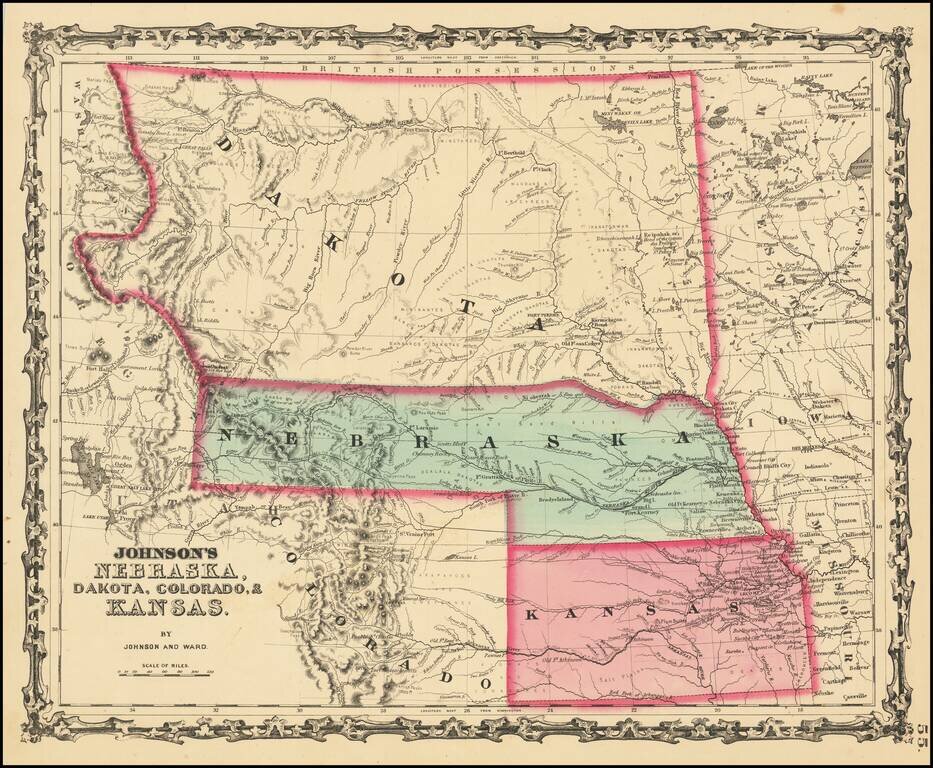
Massive Dakota Territory -- Pre-dating Wyoming and Montana. This is the third map in the series of Johnson's maps of this region and the first to include Colorado. Kansas gives way to Colorado, Nebraska is truncated by Dakota, but still extends to...
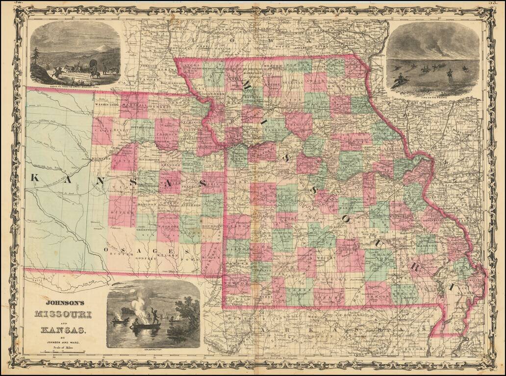
Decorative map of Missouri and Kansas, colored by counties, published by Johnson & Ward. Includes large decorative vignettes of a fire on the prairie with horse mounted Indians, the Santa Fe Trail and spear fishing Indians. Shows towns, counties,...
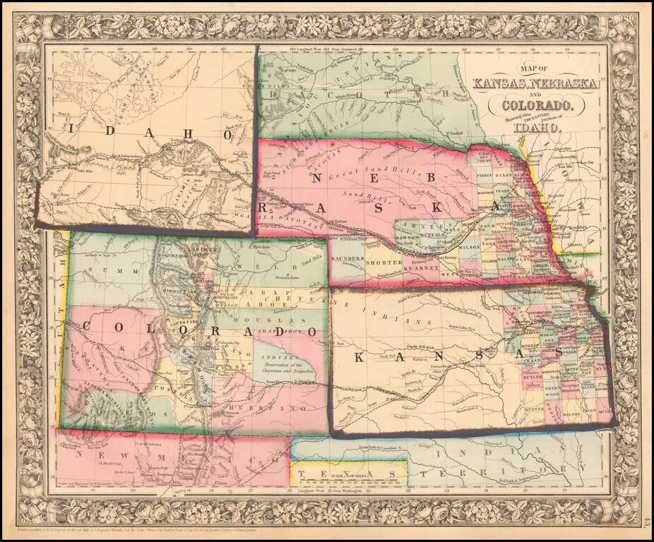
Excellent early map of the region, including an early appearance of Idaho Territory, one of the earliest appearances of this Territory (formed March 1863), on a printed map. Kansas counties cover only the eastern third of the state. Nebraska counties...
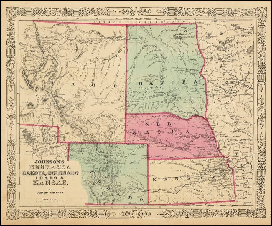
The Earliest Appearance of Idaho Territory--Including The Future Montana & Wyoming Territories Third in series of Johnson maps showing evolution of the mapping of these western territories. The most notable feature of the map is the massive...