
![Map showing the scene of General Hancock's operations in the Indian Country, the Forts, Military Stations, Pacific Railroads, etc. [Harper's Weekly. June 15,1867]](/map/small/70224.jpg)
Fine map of the Western United States, published in Harper's Weekly The map focuses on General Hancock's military operations against the Native Americans in Indian Territory. The map highlights the the forts, military stations, and railroads in the...
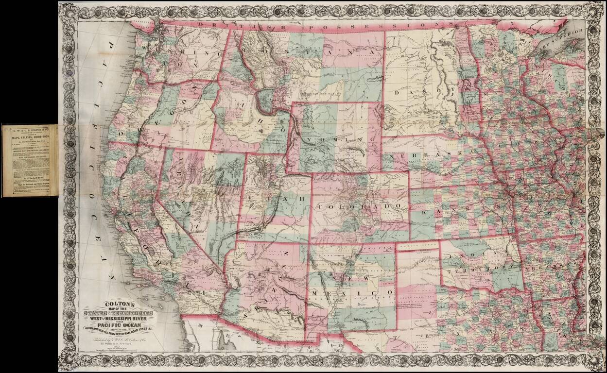
Large scale pocket map of the Transmississippi West. Fine example of Colton's large format map of the West, colored by Counties and focusing on the projected railroad lines west of the Mississippi River, shortly before the first appearance of...
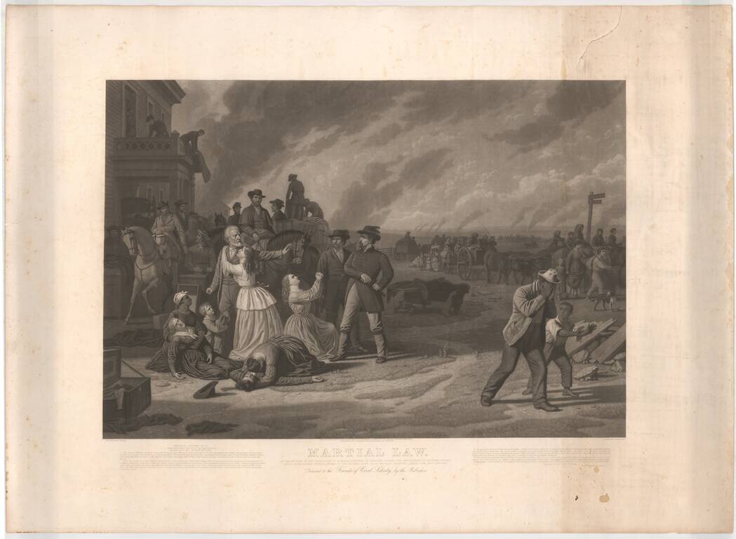
Proof state of this large mezzotint of George Caleb Bingham's painting "Martial Law," an artistic protest against the Federal Goverment's declaration of martial law on the Kansas-Missouri border. This iconic image shows the evacuation of civilians...
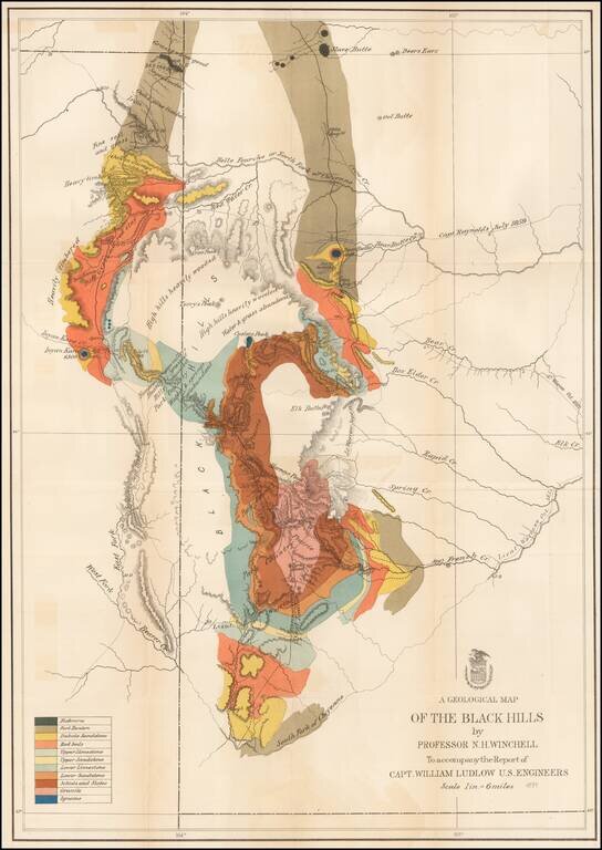
Important early geological survey map of the Black Hills region, undertaken by William Ludlow, while under the command of George Custer. In 1874, a large group of cavalrymen under the command of Lt. Col. George Armstrong Custer moved into the Black...
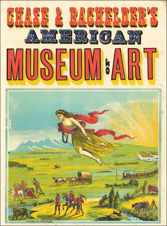
Fulfilling America's Manifest Destiny One of the earliest travel or travel-related posters ever created and also the wellspring of all future American travel images. An allegorical figure leads trains, covered wagons, coaches and prospectors across...
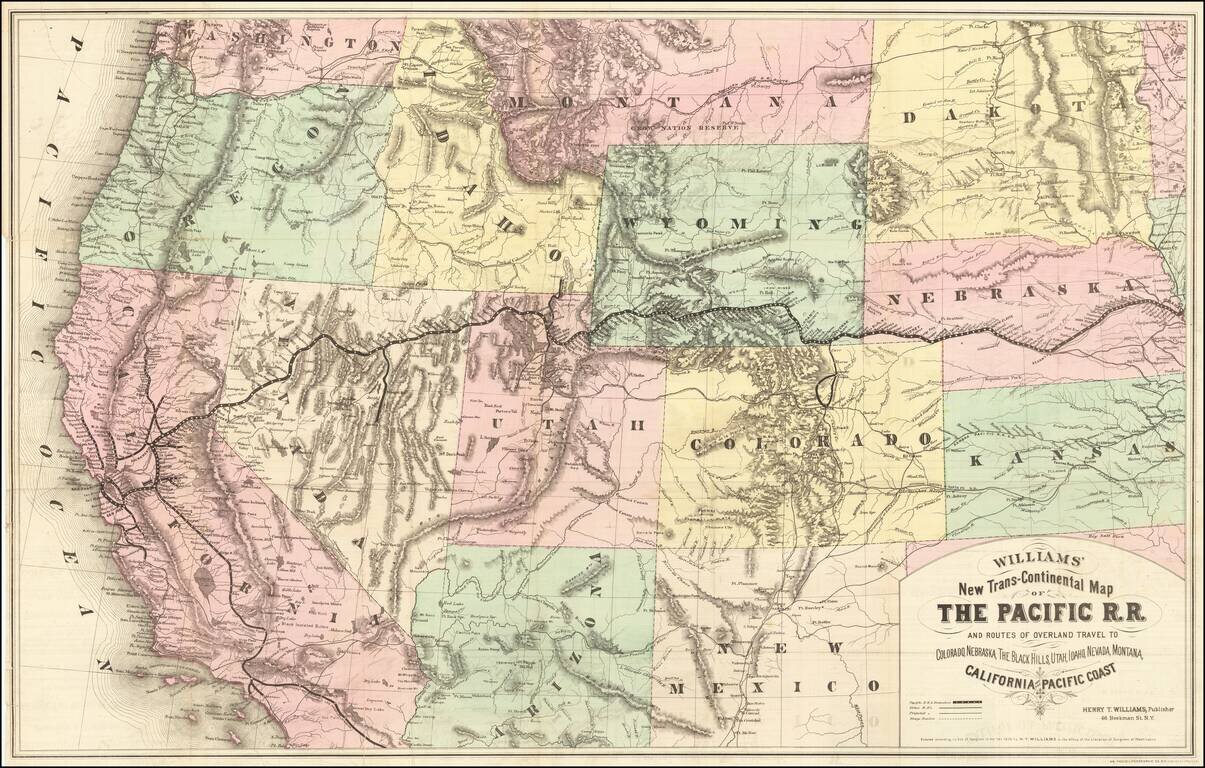
Rare first edition of this striking large format map of the West, published by Henry T. Williams, with handwritten notes, including a note relating to the notorious stagecoach robber, Black Bart, who operated in northern California and southern Oregon...
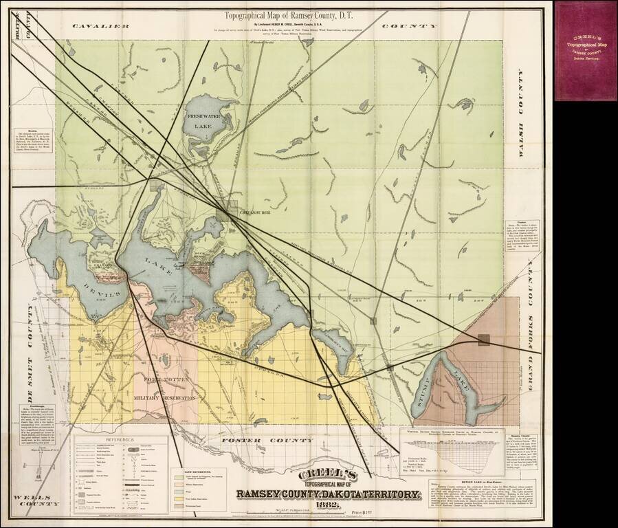
Fine large format map promoting settlement in Ramsey County, Dakota Territory, published by Heber M. Cree, formerly of the 7th Cavalry, whom the map notes as having been "in charge of survey north shore of Devil's Lake, D.T.; also survey of Fort Totten...
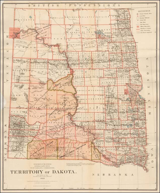
Detailed map of Dakota Territory, prepared by the General Land Office. The present example would appear to be a special issue, with the Standing Rock Indian Reservation, Pine Ridge Indian Reservation and the Lower Brule Indian Reservation highlighted...
![[Union Pacific Railway Map]](/map/small/55008.jpg)
Fine large format map of the routes of the Union Pacific Railroad, published in May 1885 by Rand McNally & Company. The map is colored by counties and locates rail lines, stations and other details. The wide black lines locate the lines of the...
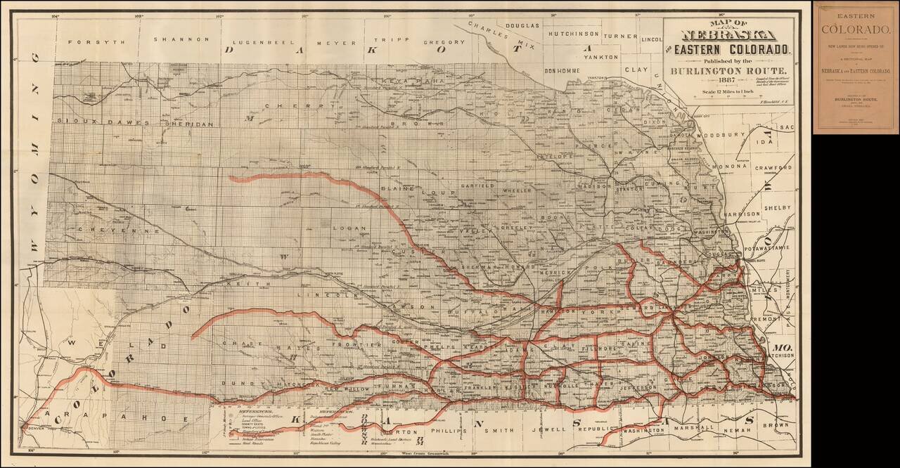
Fine railroad promotional map, stretching from Denver, Ft. Collins and Cheyene in the west to the Missouri River. Scarce promotional booklet for lands being opened up by the Burlington Route of the Chicago, Burlington & Quincy Railroad Company....
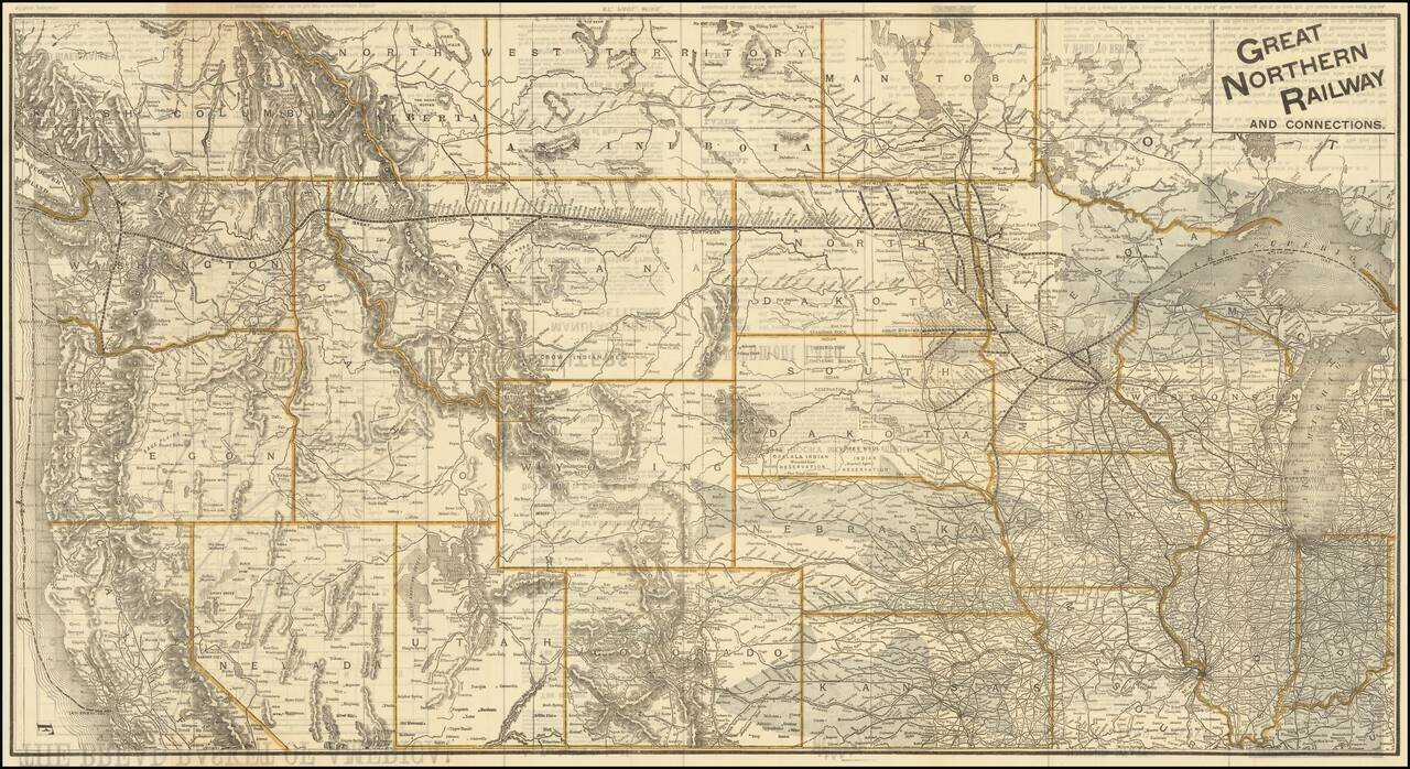
The Bread Basket of America! -- You Are Not Going To the Frontier! Fine large promotional map for the Great Northern Railway, promoting the Government lands available in the Red River Valley. The map shows the railroad lines of the Great Northern,...
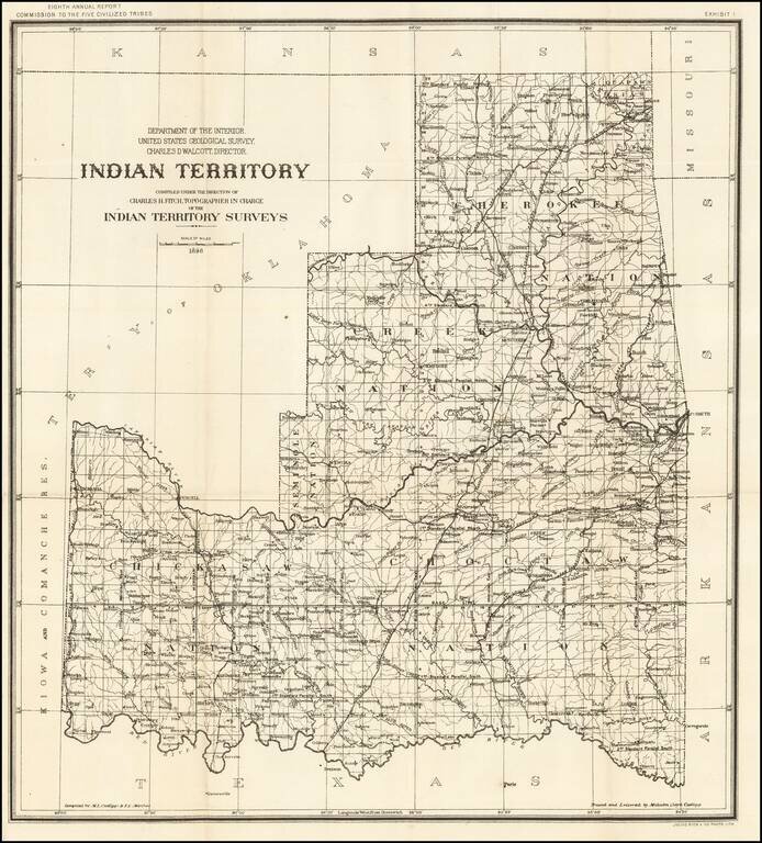
Detailed map of Indian Territory, during the short-lived period where Oklahoma was divided into two Territories, Oklahoma Territory and Indian Territory. The map shows the progress of the Indian Territory survey in the first year of the survey. The...
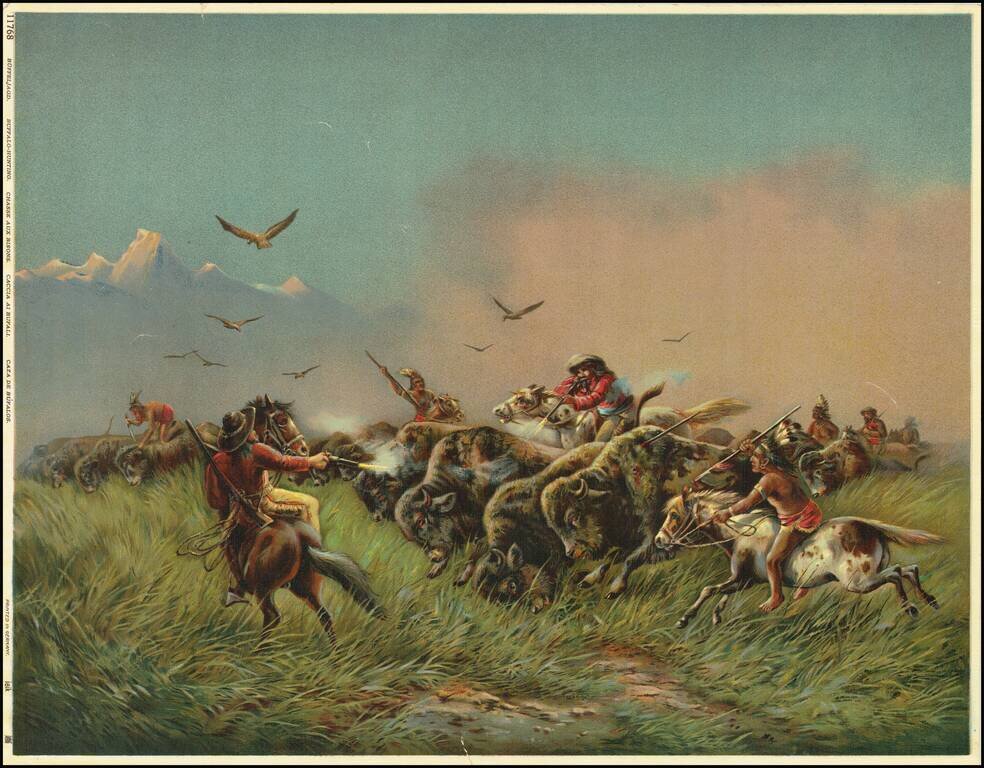
This is a great color-lithograph of a buffalo-hunting scene. The image is heavily romanticized, painting a rosy picture of the American West. Hardened cowboys on bucking horses use guns while Indians spear or stab the buffalo. Raptors fly above the...
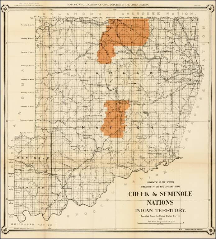
Striking map of the Creek & Seminole Nation lands in Indian Territory, showing the coal regions for the Department of the Interior. The map depicts the various land classifications in the Creek & Seminole Nations, including Agricultural,...
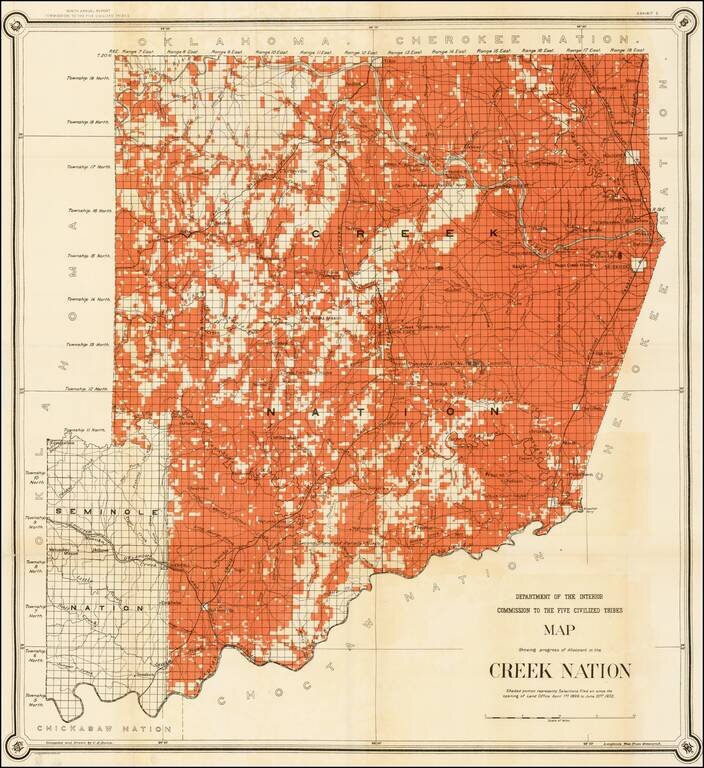
Nice example of C.H. Dana's map of the Creek Nation, showing the lands alotted between April 1, 1899 and June 30, 1902. Prepared to accompany the Department of the Interior's report on the Commission To The Five Civilized Tribes.
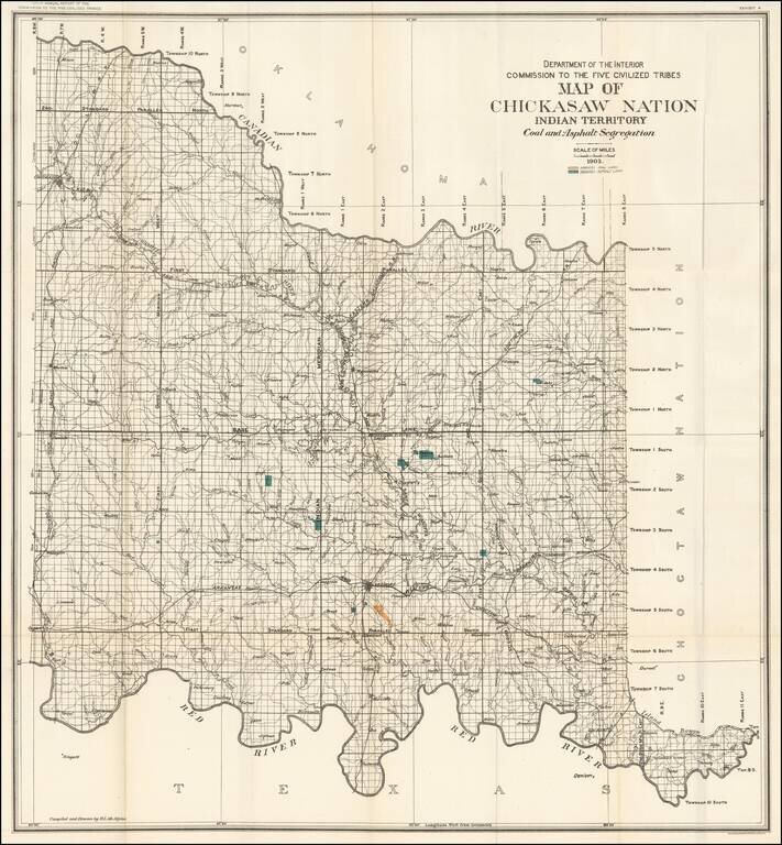
Large format map of the lands allocated to the Chickasaw Nation. The map shows the coal and asphalt deposits in the Chickasaw nation. Also featured are towns, hydrography, and rail road lines.