
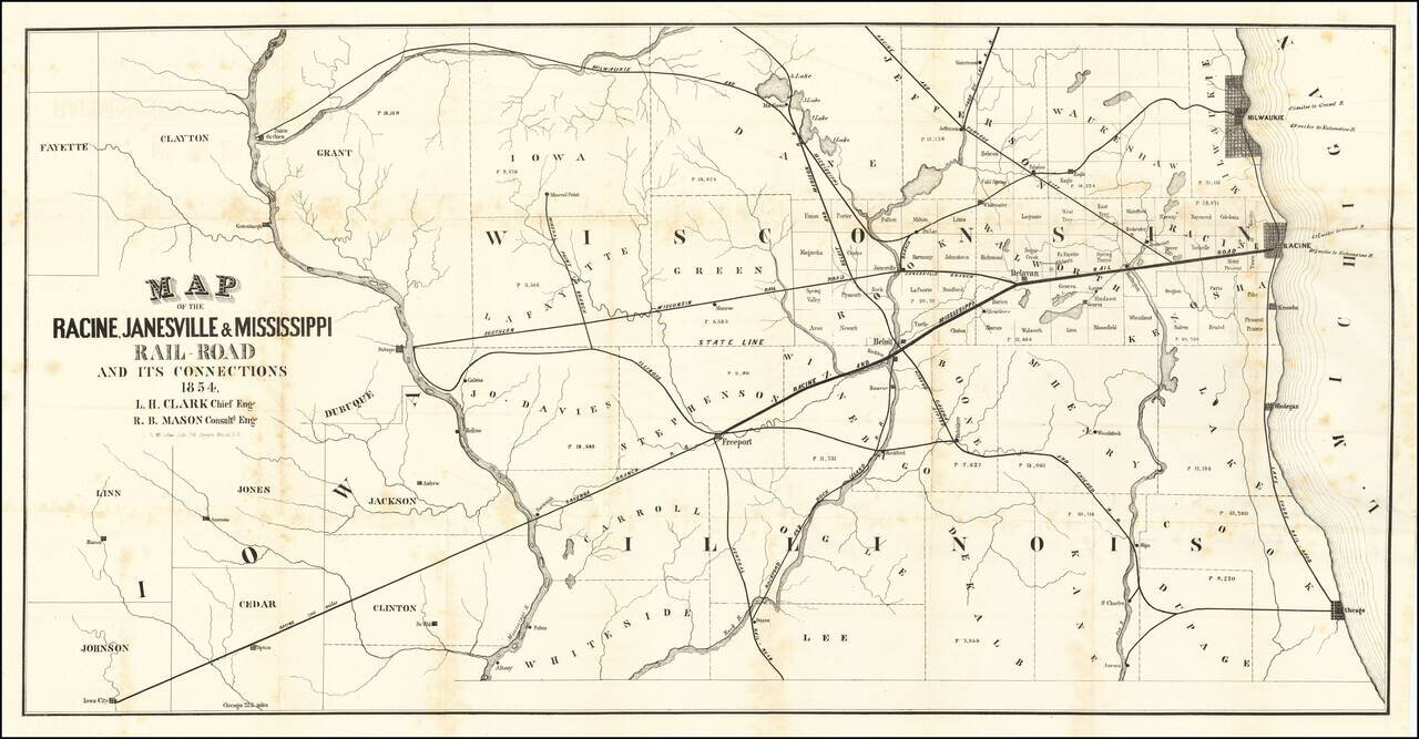
A Wisconsin Railroad That Never Was Rare map of the railroad lines of the Racine, Janesville & Mississippi Railroad, published in Racine with the first annual report of the Racine, Janesville & Mississippi Railroad. The map shows the area...
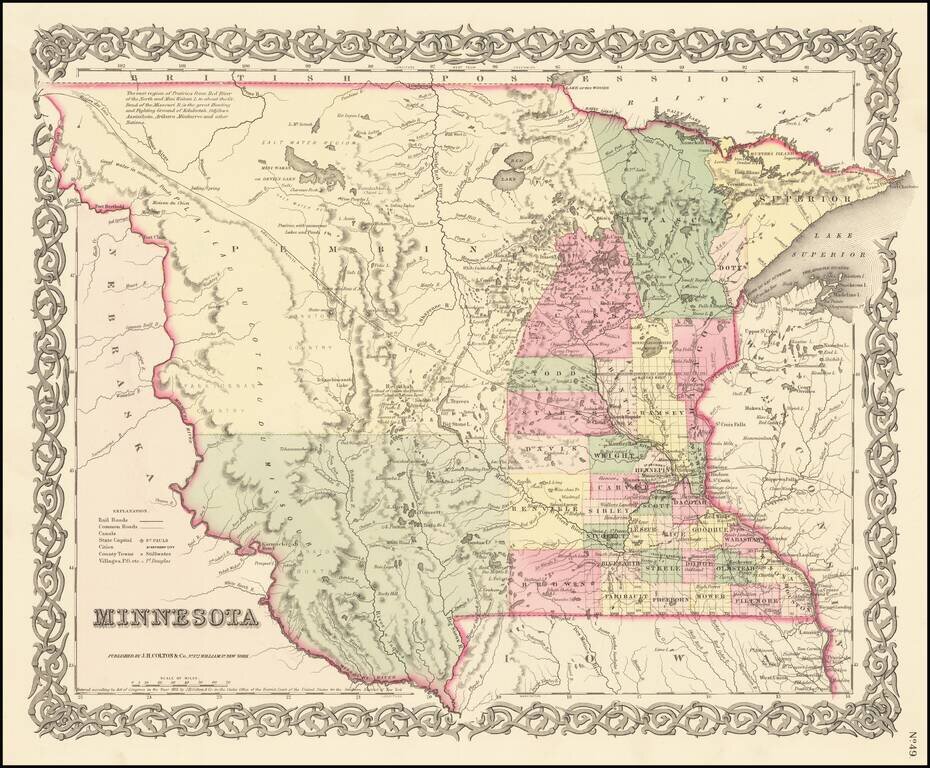
First Atlas State of Colton's Map of Minnesota Territory First atlas state of Colton's Map of Minnesota Territory, which extends to the Missouri River. Massive Pembina County and Yankton County dominate the western 2/3rds of the map. Only a hand...
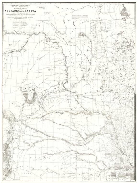
1875 Edition of Warren's Pivotal Map of the American Plains -- Early Reference To the Colorado / Kansas Gold Regions 1875 edition of Gouverneur Kemble Warren's large format map of Kansas, Nebraska, Dakota and part Colorado and Wyoming, based upon...
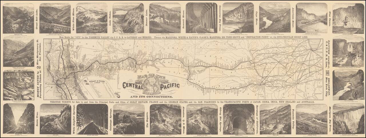
Decorative map of the route of the Central Pacific from the midwest to San Francisco, illustrated with 24 images of the west, primarily of California and Nevada. Decorative and highly detailed map, with vignettes of major points of interest in the...

Rare pictorial map of the Mormon Trail, published by American Pioneer Trail Association. The map includes lively historical vignettes focusing on the early history of the West, Mormon Battalion and Mormon Settlers. "Issued by American Pioneer Trails...
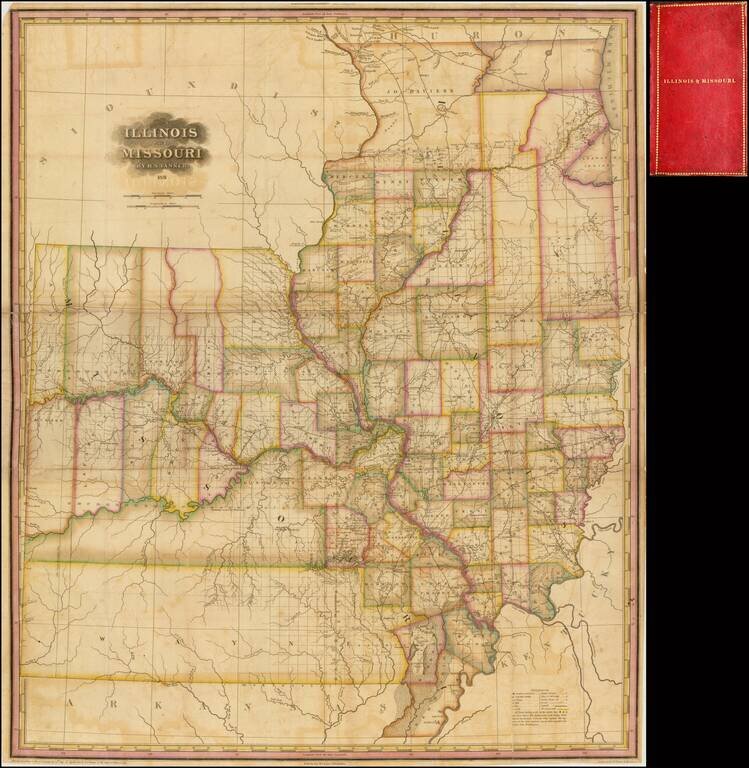
Significantly revised and updated version of HS Tanner's large format map of Missouri and Illinois Territories, first issued in 1821. The map includes remarkable detail where there had been relatively little detailed cartographic work to date. The...
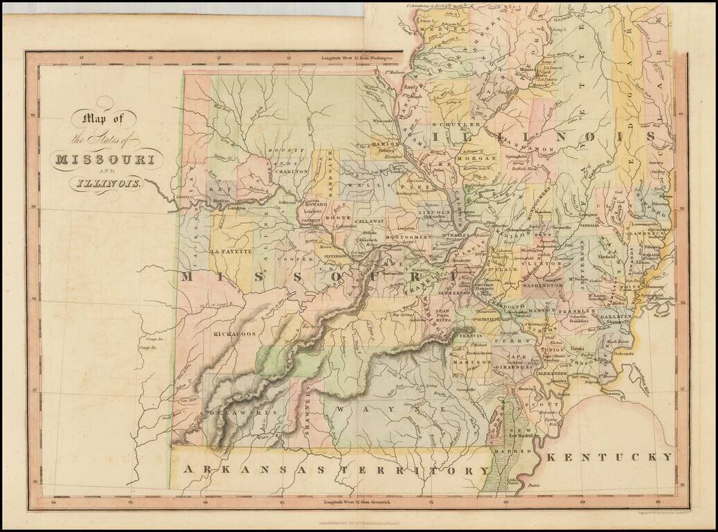
Scarce early map of Missouri and Illinois, hand colored by counties. Many of the western counties are Indian Lands, such as Kickapoo, Delawares, Shawnees, etc. The Boundy Lands are shown in the North. A massive Wayne County dominates the south. A...
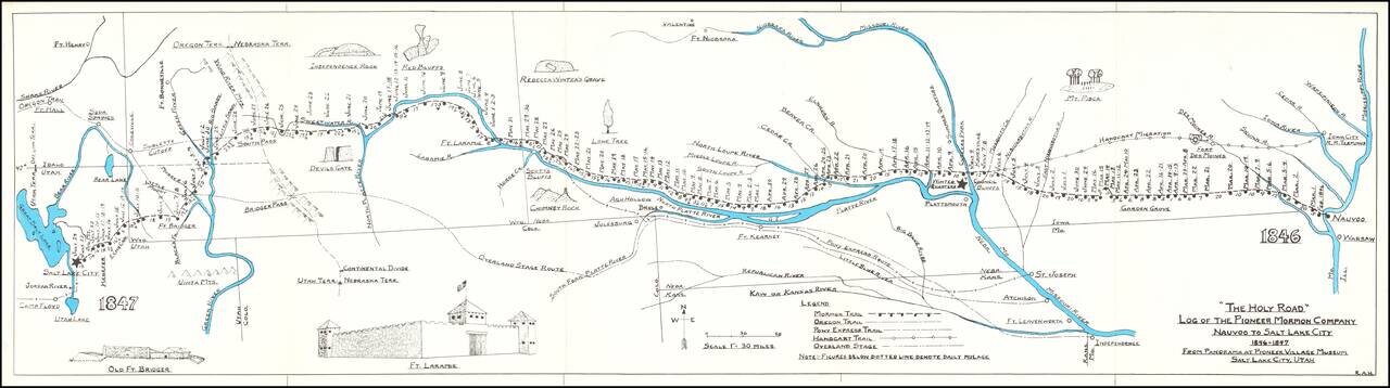
Rare historical / pictorial map of the Mormon Route from Navoo to Salt Lake, drawn by Robert A. Hanson. The map was likely published by the Western Cover Society, a California based society which published the Western Express. Hanson's maps were...
![The City of St. Louis [with] The City of Chicago](/map/small/70257.jpg)
Two detailed maps of the cities of Chicago and St. Louis, published by JH Colton in New York. The maps are each colored by ward, and showing streets, rail lines, parks, buildings and other details.
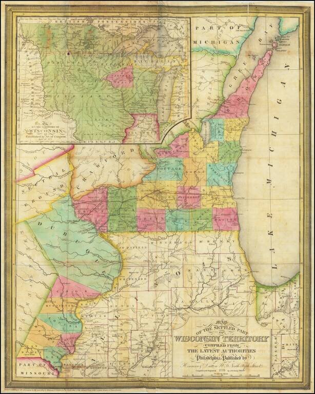
A Foundational Wisconsin Map. This is an important early map of Wisconsin, published only two years after the territory was incorporated. The map centers on the areas now part of southwestern Wisconsin and eastern Iowa. In this area, the most...
![The Minnesota Handbook, for 1856-7 [with] Minnesota Published by J.H. Colton & Co... 1857.](/map/small/68854.jpg)
1857 Edition of Parker's Handbook to Minnesota, along with the Special Edition of Colton's Map, with "Corrections Furnished by N.H. Parker." This Example from the James J. Hill Library. First and only edition of Parker's important early treatment of...
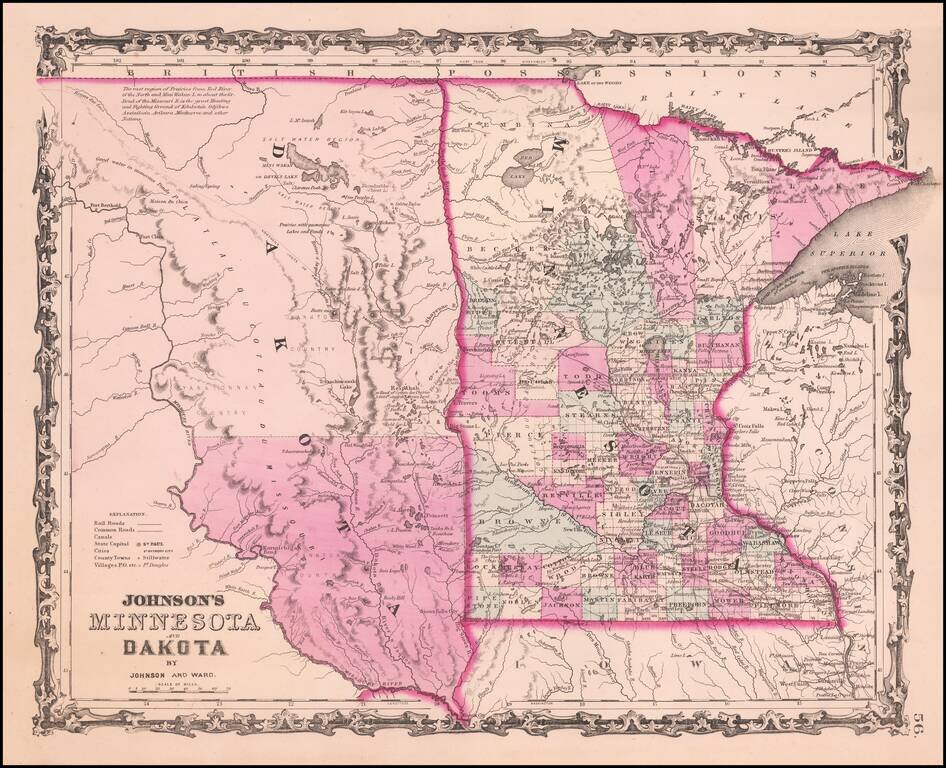
Detailed map of Minnesota and Dakota Territory, colored by county, with only two counties in Dakota and 4 large counties in northern Minnesota. Many Indian Tribal names and notes. Minneapolis is named.
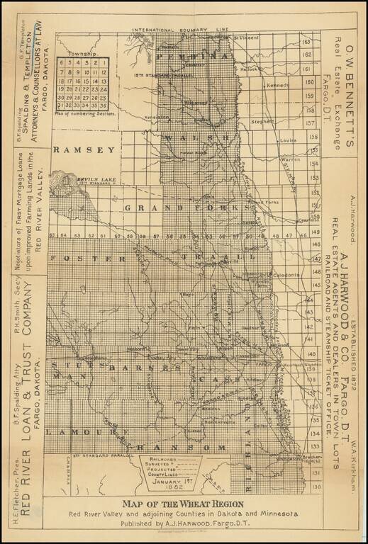
Scarce promotional map of the "Wheat Region" of the Red River Valley, published by A.J. Harwood in Fargo, Dakota Territory. The map illustrates the so-called Wheat Region, along with promotional information for three other Fargo based professionals,...

Fine map of the northern part of North America, intended to illustrate the probability of a water course from Hudson's Bay to the Northwest Coast, across the interior of North America. The map was prepared to illustrate the report of Meares expedition...
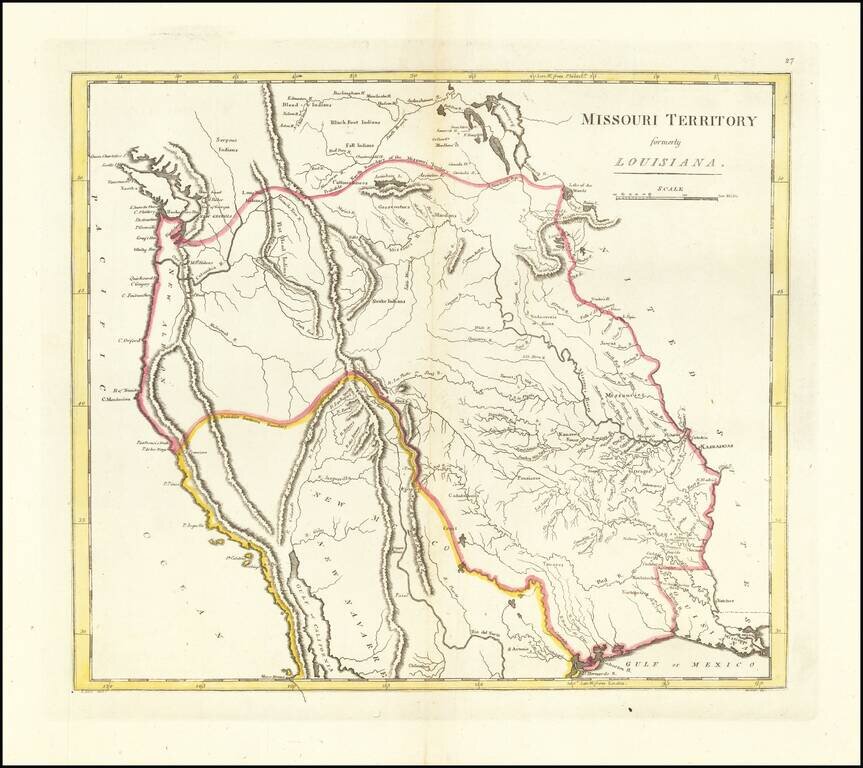
The First American Atlas Map of the Transmississippi West -- Based Upon Lewis & Clark's Reports Nice example of Mathew Carey's highly important map of Missouri Territory. Published shortly after the return of Lewis & Clark, Mathew Carey's...
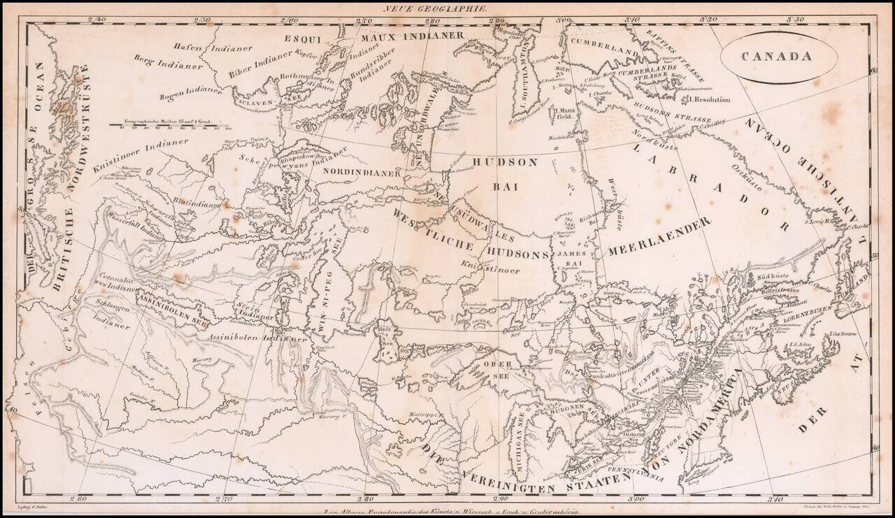
Rare early 19th Century map of Canada, from coast to coast, published in Germany. The map focuses on the drainages of the various rivers and lakes, centered on the Win-ni-peg See. Includes excellent treatment of the Lakes and Rivers. The map extends...