
Rare old maps of the United States.
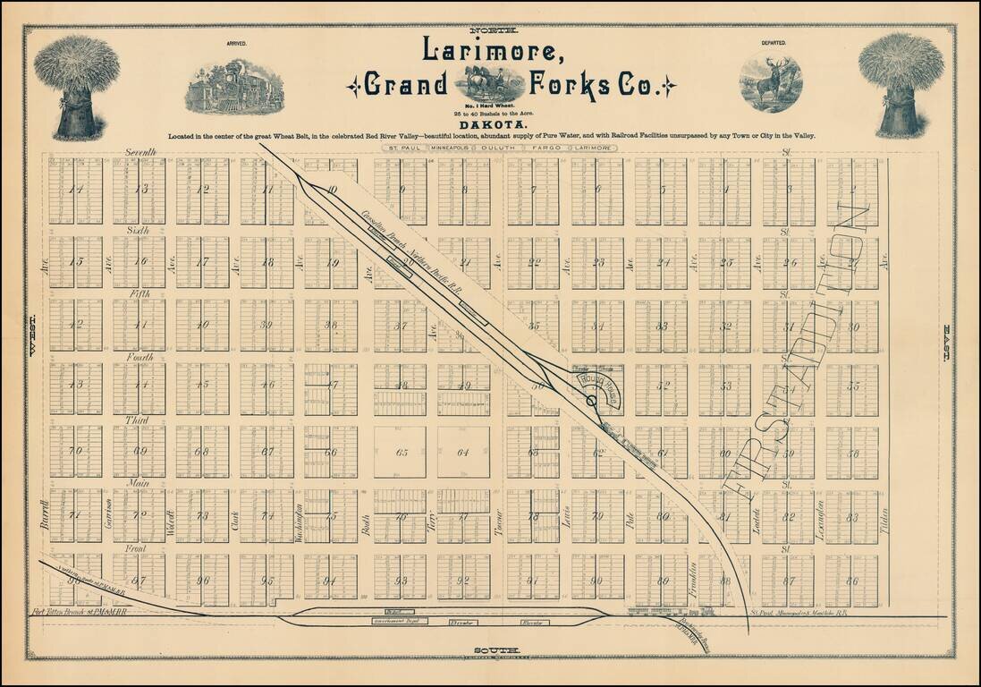
Fine early plan of Larimore, in Grand Forks County, North Dakota. The town of Larimore was formed in 1881 with the arrival of the Northern Pacific Railroad. The map notes that Larimore is: Located in the center of the great Wheat Belt, in the...
![[North Dakota - Fargo]](/map/small/46531fb.jpg)
Rare letter sheet with map on verso, printed for The Oriska Elevator. The map is centered on Fargo, North Dakota and extends north to Grand Forks and South to Big Stone Lake, focusing on the railroad lines, towns and other features. The map...
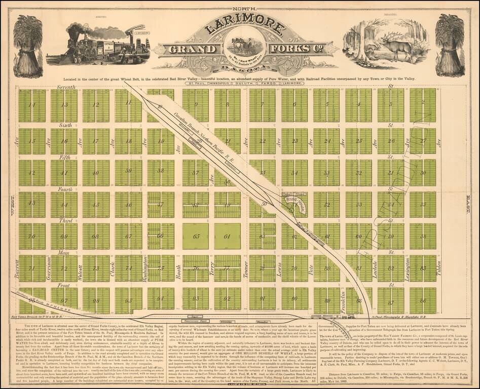
Located in the center of the great Wheat Belt Early promotional map of Larimore, North Dakota, printed in St. Louis by Augustus Gast & Co. in 1882. The map extolls the virtues of the newly created and fast growing town, which after just six...
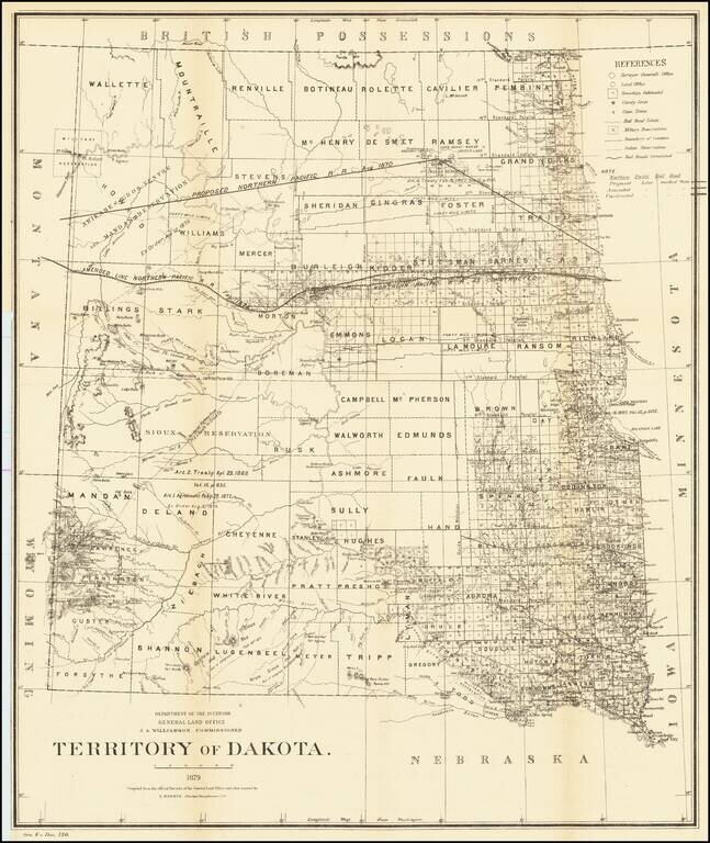
Detailed map of Dakota Territory, prepared by the General Land Office. The map shows early evidence of the township surveys in the west. The dates and details of the creation of a number of Indian Reservations are shown, including: Arikares,...
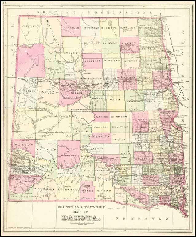
Detailed map of Dakota Territory, published by William Bradley Jr., in a late edition of SA Mitchell Jr's Atlas. The map is colored by county, and shows state surveys, forts, towns, railroads, etc. Extremely detailed in the southwest corner in the...
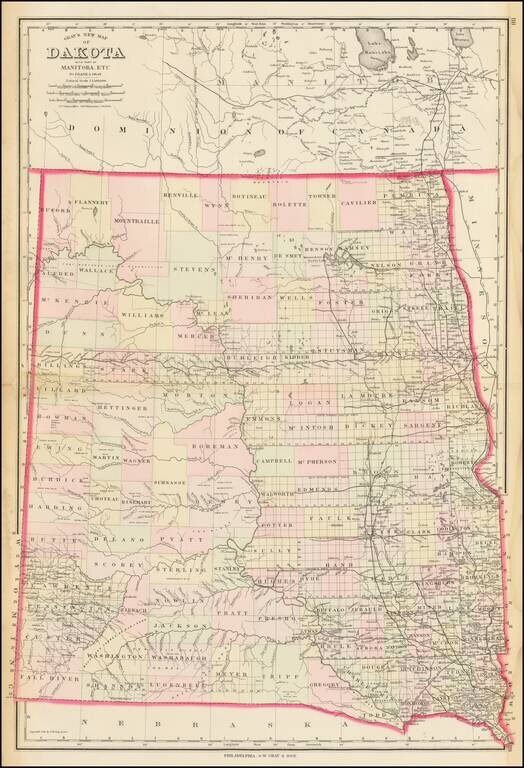
Highly detailed map of Dakota Territory, published by OW Gray & Son. The map is colored by counties and showing towns, roads, railroads, Post Offices, etc. Many counties not yet formed.
![[State of Lincoln!] British Columbia and the North West Territory](/map/small/60287.jpg)
Rare separately published map of Western Canada and part of the Northern United States, including the proposed State of Lincoln. The map provides a detailed treatment of the Western part of Canada, along with a very rare appearance of the proposed...
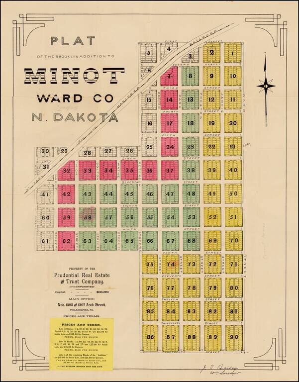
Fine early plat for a portion of downtown Minot, North Dakota, printed shortly after the creation of North Dakota in 1889, one of the earliest surviving maps of the town of Minot, North Dakota. The Brooklyn Addition is a part of Minot's central...
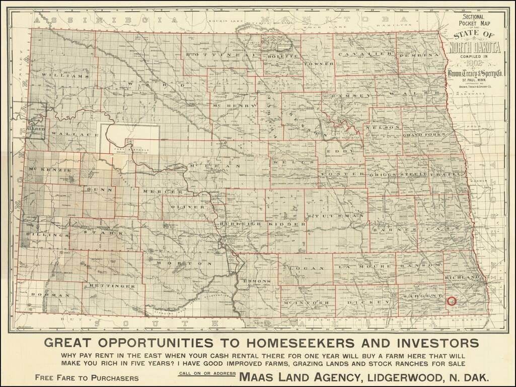
"Why Pay Rent in the East When Your Cash Rental There For One Year Will Buy A Farm Here That Will Make You Rich in Five Years?" Scarce early-20th century map of North Dakota, published for the Maas Land Agency, Lidgerwood, North Dakota, to promote...
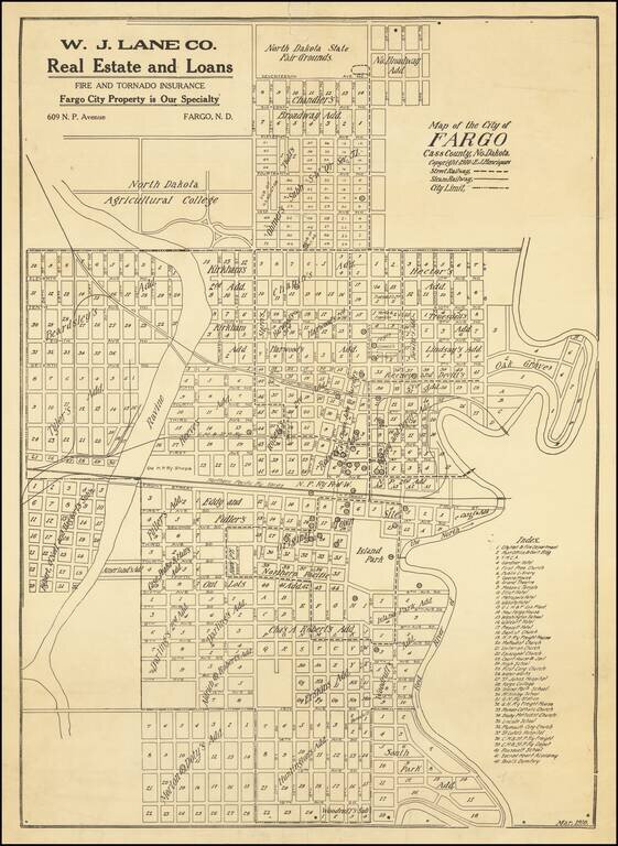
Antique map of Fargo, North Dakota, published by E.J. Henriques in the city in March of 1910. The map is quite detailed, featuring the names of the Additions, as well as the outlines of the original town. The Index in the lower-right corner has 42...
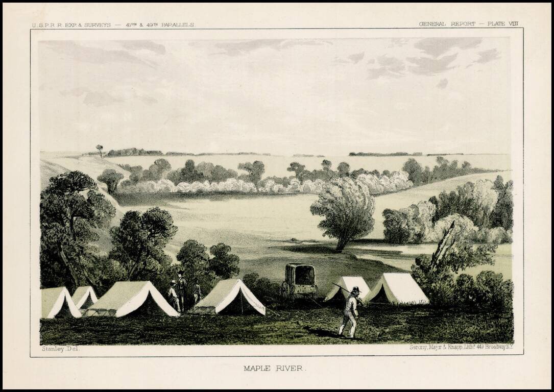
Fascinating view of an encampment on the Maple River in South Dakota, prepared as part of the United States survey for the most practicable route for a railroad line to the West Coast of America, conducted just prior to the Civil War. A scenic view as...
![[Wounded Knee] Scene of the Fight with Big Foots Band, Dec. 29th 1890. showing Positions of Troops when first shot was fired. From Sketches made by Lt. S.A. Cloman Act'g Eng'r Officer Division of the Missouri](/map/small/65742.jpg)
Interesting battle plan depicting the Battle of Wounded Knee / Wounded Knee Massacre Wounded Knee resulted in the killing of several hundred Lakota Indians, almost half of whom were women and children, by soldiers of the United States Army, on...
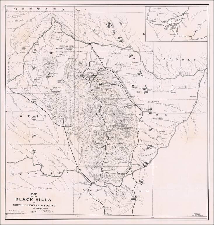
The First Book on Descriptive Mineralogy of the Black Hills with An Important Map Detailed map of the Black Hills region of western South Dakota and eastern Wyoming, between the North Fork and the South Fork of the Cheyenne River, published by Samuel...
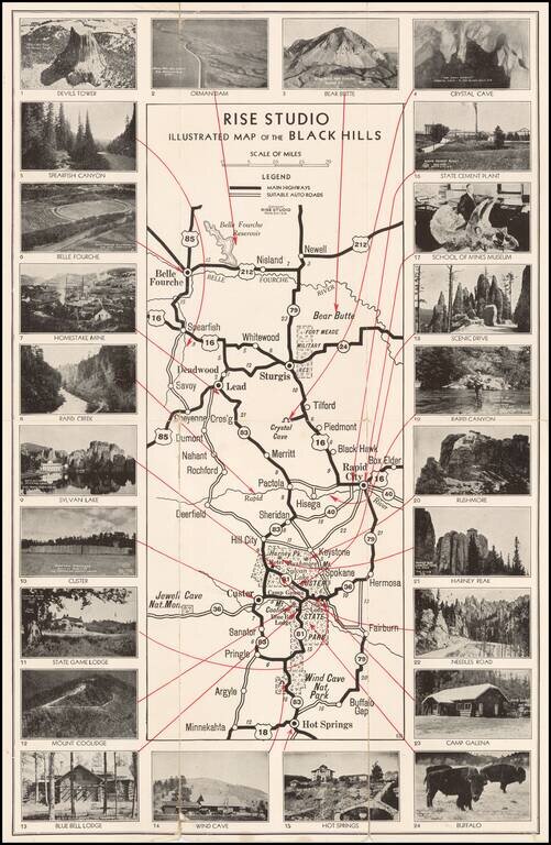
Unusual promotional map of the Black Hills, published to advertise the services of Rise Studio (photographers), of Rapid City, South Dakota. The map shows the roads in and around Custer's State Park, Rapid City and Sturgis, extending north to Belle...
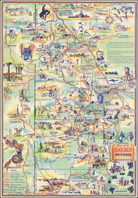
Why Not Have a Real Vacation this Year in The Mountainous Black Hills of South Dakota Decorative vintage pictorial map of the South Dakota Black Hills, published locally in the 1940s. Attractive tourist promotional pictorial map by K. Pyle. We have...
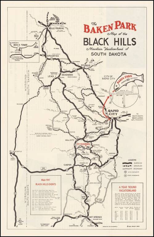
Promotional map for the Baken Park area of South Dakota, published in 1947. The map illustrates the recreational opportunties centered on Baken Park, a suburb of Rapid City, South Dakota. Advertising on the verso and a list of Major 1947 Black Hills...