Map size in jpg-format: 3089590B
Click to open in high resolution (open in new tab).
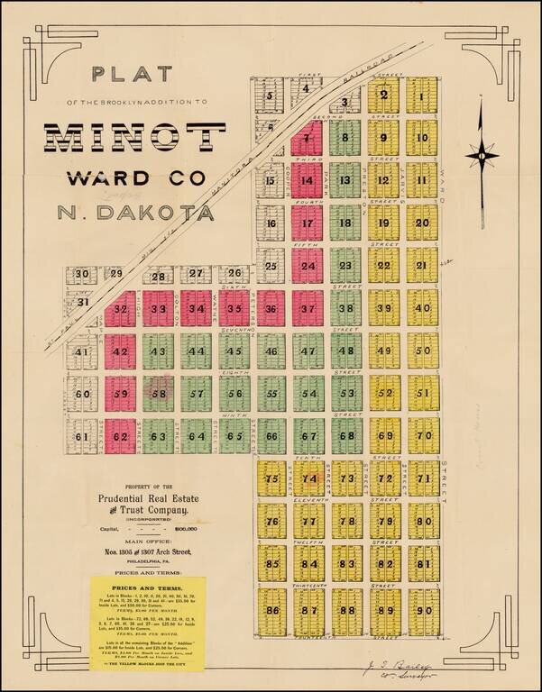
Fine early plat for a portion of downtown Minot, North Dakota, printed shortly after the creation of North Dakota in 1889, one of the earliest surviving maps of the town of Minot, North Dakota.
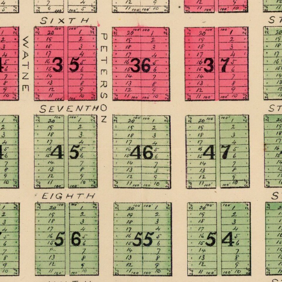
The Brooklyn Addition is a part of Minot's central business district and among the oldest parts of the town and includes the name of J.T. Bailey, the County Surveyor for Ward County, North Dakota. The present plan identifies the names of the original streets, a number of which are no longer in use.
The map was printed as a promotional item by the Prudential Real Estate & Trust Company of Philadelphia and includes a printed paste down with prices and terms for lots in what would become downtown Minot. The map shows a detailed plan for the town just to the south of the Minnesota and Manitoba Railroad, a line owned by James Jerome Hill. Lot prices range from $15.00 for inside lots nearest the city to $50.00 for the corner lots further away and near the railroad. Each colored block is a different price
Minot was first settled in 1886, when the Great Northern Railway was extended to that location. Originally, a tent city sprung up where the trestle was being constructed across the Gassman Coulee. When it became known that the railroad had picked a townsite to the east, the tent city was relocated to what is now downtown Minot. At this time, the area was part of the Dakota Territory, whose capital had been transferred from Yankton in what is now South Dakota, to nearby Bismarck in 1883.
The town was named after Henry D. Minot, a railroad investor, an ornithologist and friend of Hill.
This map is one of the earliest surviving maps of Minot, North Dakota. A search of OCLC locates no maps printed prior to 1900.
If you are a student, write to us in telegram: @antiquemaps and indicate what material you need and for what work you need a map in high detail. We are ready to provide material on special terms. For students only!