logo

1947. The Baken Park Map of the Black Hills Mountain Vaction-Land of South Dakota

  • The Baken Park Map of the Black Hills Mountain Vaction-Land of South Dakota
  • The Baken Park Map of the Black Hills Mountain Vaction-Land of South Dakota

The Baken Park Map of the Black Hills Mountain Vaction-Land of South Dakota information:

Year of creation: 
Resolution size (pixels): 
 6676x10278 px
Disk Size: 
 14.4225MiB
Number of pages: 
 2
Place: 
 Baken Park, South Dakota
Author: 

Print information. Print size (Width x height in inches):
Printing at 72 dpi 
  92.72 х 142.75
Printing at 150 dpi 
 44.51 х 68.52
Printing at 300 dpi 
 22.25 х 34.26

An example of detailing the file of this map of in a printable high-resolution:

Click to open in high resolution (open in new tab).
Attention! this is just the central piece (central area 960x960 px) of the map file!
This is an example, so that you can see and study the level of detail of a given map. The entire Map will be fully available after payment!

The Baken Park Map of the Black Hills Mountain Vaction-Land of South Dakota

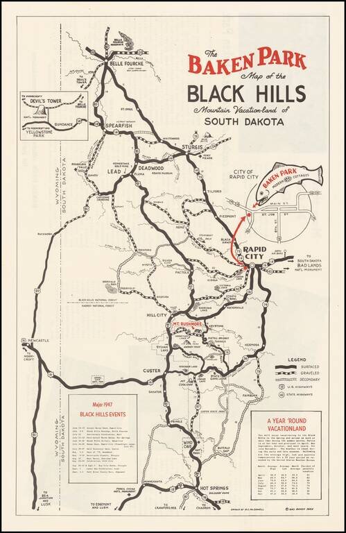
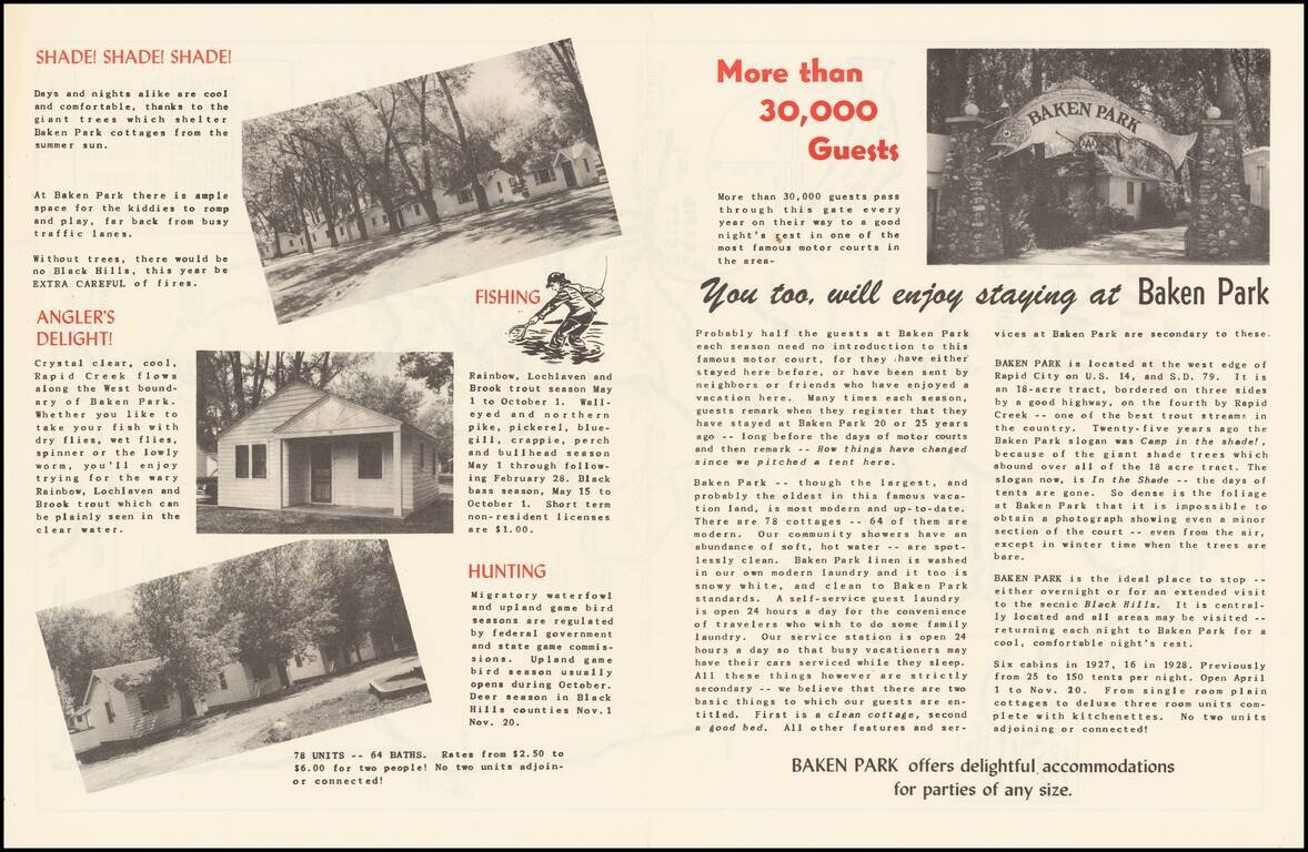
Promotional map for the Baken Park area of South Dakota, published in 1947.

The map illustrates the recreational opportunties centered on Baken Park, a suburb of Rapid City, South Dakota.

Advertising on the verso and a list of Major 1947 Black Hills Events on the front.


Special conditions for students!

If you are a student, write to us in telegram: @antiquemaps and indicate what material you need and for what work you need a map in high detail. We are ready to provide material on special terms. For students only!

Item information:

Year of creation:
Size:
6676x10278 px
Disk:
14.4225MiB
Number of pages:
2
Place:
Baken Park, South Dakota
Author:
D. C. McDowell.
$14.99

Related item