
Rare old maps of the United States.
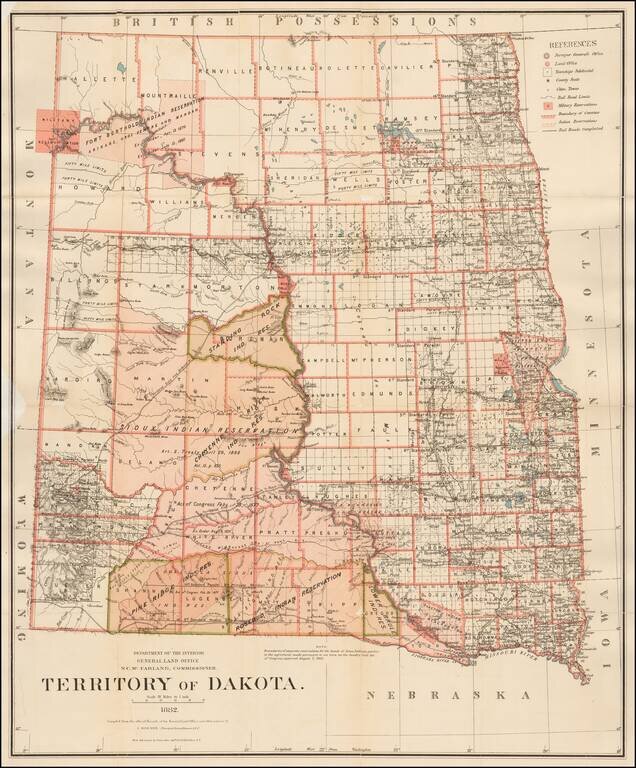
Detailed map of Dakota Territory, prepared by the General Land Office. The present example would appear to be a special issue, with the Standing Rock Indian Reservation, Pine Ridge Indian Reservation and the Lower Brule Indian Reservation highlighted...
![[Union Pacific Railway Map]](/map/small/55008.jpg)
Fine large format map of the routes of the Union Pacific Railroad, published in May 1885 by Rand McNally & Company. The map is colored by counties and locates rail lines, stations and other details. The wide black lines locate the lines of the...
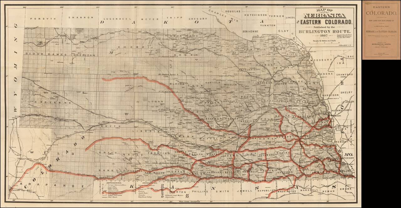
Fine railroad promotional map, stretching from Denver, Ft. Collins and Cheyene in the west to the Missouri River. Scarce promotional booklet for lands being opened up by the Burlington Route of the Chicago, Burlington & Quincy Railroad Company....
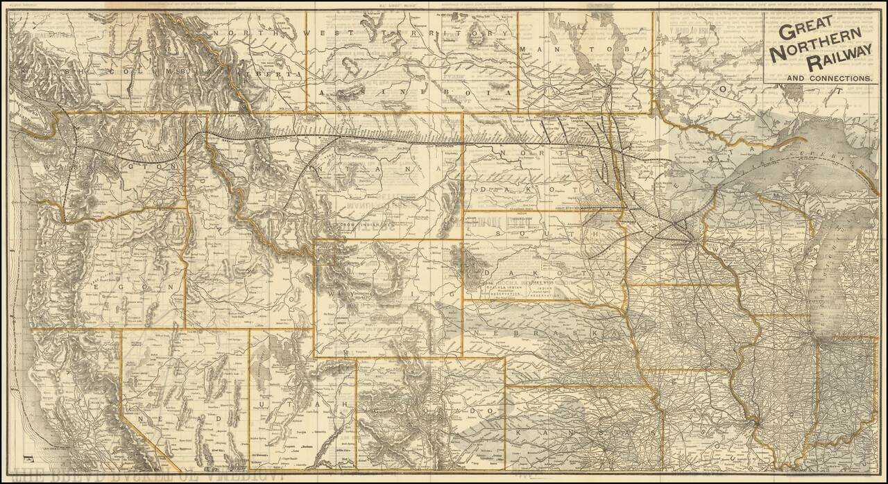
The Bread Basket of America! -- You Are Not Going To the Frontier! Fine large promotional map for the Great Northern Railway, promoting the Government lands available in the Red River Valley. The map shows the railroad lines of the Great Northern,...
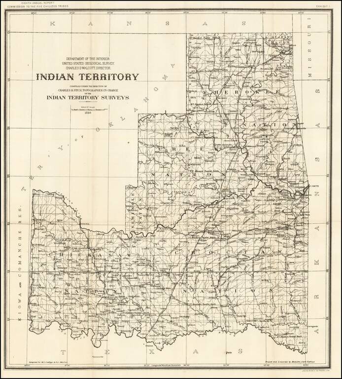
Detailed map of Indian Territory, during the short-lived period where Oklahoma was divided into two Territories, Oklahoma Territory and Indian Territory. The map shows the progress of the Indian Territory survey in the first year of the survey. The...
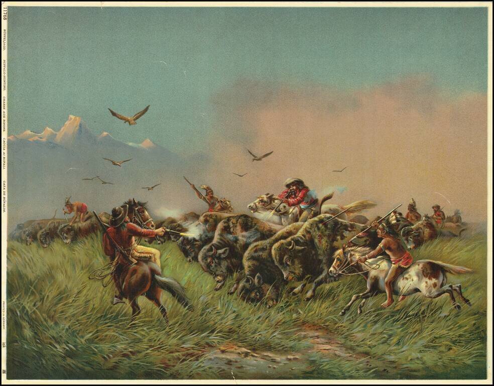
This is a great color-lithograph of a buffalo-hunting scene. The image is heavily romanticized, painting a rosy picture of the American West. Hardened cowboys on bucking horses use guns while Indians spear or stab the buffalo. Raptors fly above the...
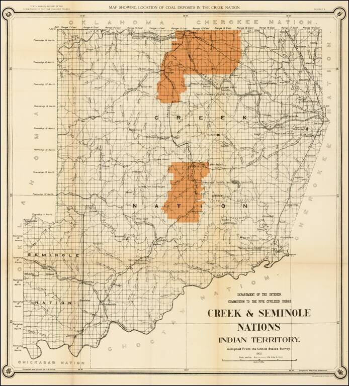
Striking map of the Creek & Seminole Nation lands in Indian Territory, showing the coal regions for the Department of the Interior. The map depicts the various land classifications in the Creek & Seminole Nations, including Agricultural,...
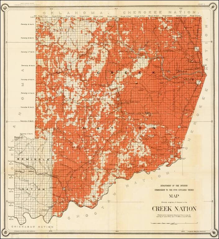
Nice example of C.H. Dana's map of the Creek Nation, showing the lands alotted between April 1, 1899 and June 30, 1902. Prepared to accompany the Department of the Interior's report on the Commission To The Five Civilized Tribes.
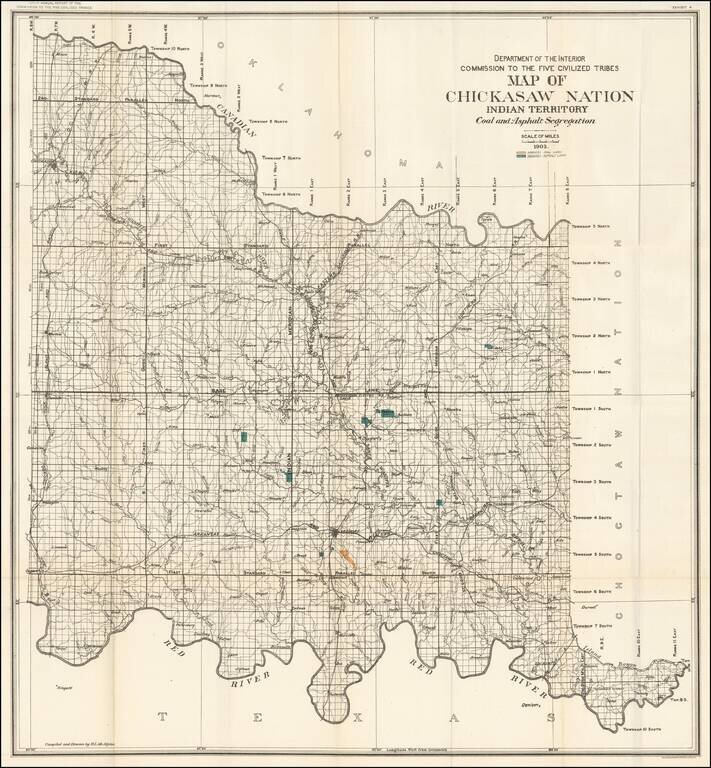
Large format map of the lands allocated to the Chickasaw Nation. The map shows the coal and asphalt deposits in the Chickasaw nation. Also featured are towns, hydrography, and rail road lines.
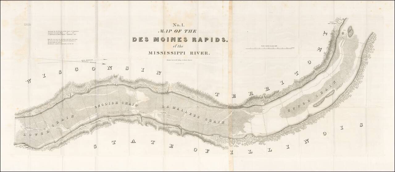
Finely detailed map of the section of the Mississippi River, showing the Des Moines Rapids in the area of Fort Des Moines, based upon the surveys of Lieutenant Robert E. Lee of the US Corps of Engineers. The Des Moines Rapids was one of two major...
Rare early map of the surveyed portions of Iowa, from an early example of Morse's Cerographic Atlas of the United States. Includes a number of counties, towns, rivers, etc. The map shows the settled portions of Iowa Territory, four years after it...
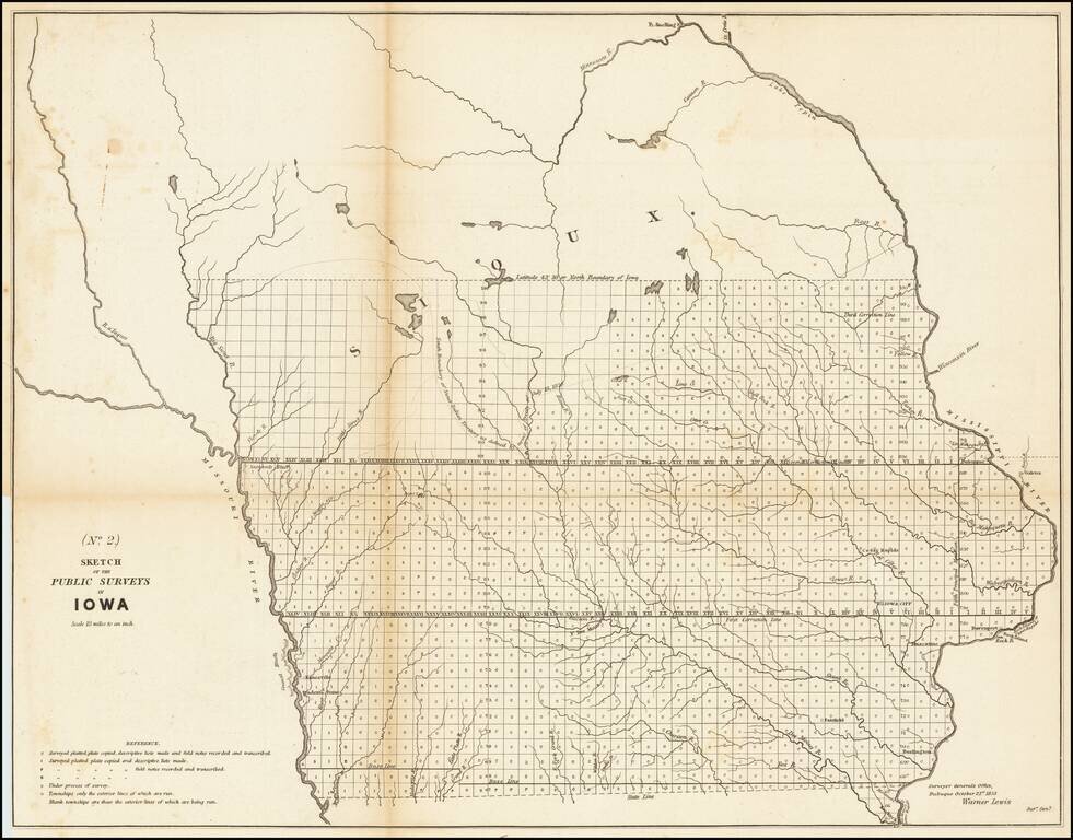
Nice example of the 1853 public survey map of Iowa prepared by Warner Lewis, Surveyor General of Iowa. The map shows the progress of township and baseline surveys in Iowa. The northern part of the state is still largely unsurveyed, as is a section...
A Stunning Early Map of Iowa Fine early map of Iowa during its initial period of rapid settlement, showing the land office locations, a table of population by county in 1840 and 1850, and the settled areas of adjoining states. Rare first...
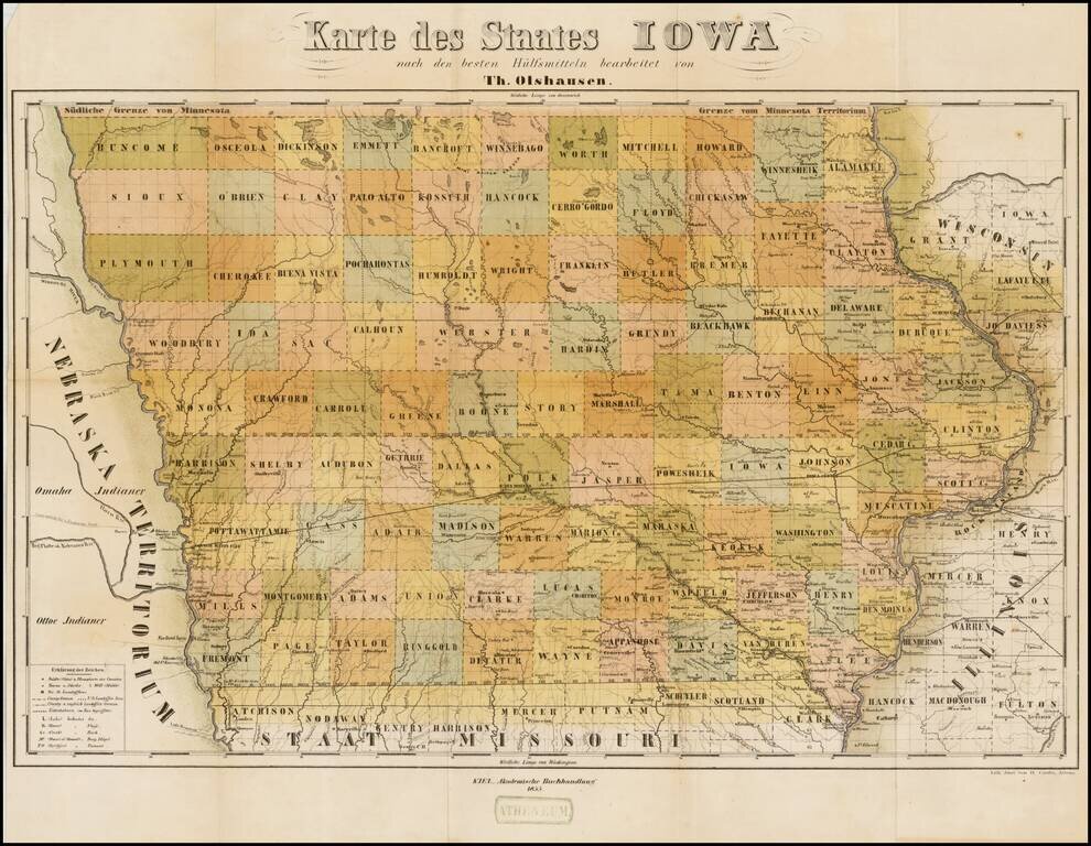
Rare separately issued map of Iowa, published in Kiel in a promotional tract, Der Staat Iowa geographisch und statistisch beschrieben von Theodor Olshausen in St. Louis in Staate Missouri . . ., published in 1855. Olshausen is also known to have...
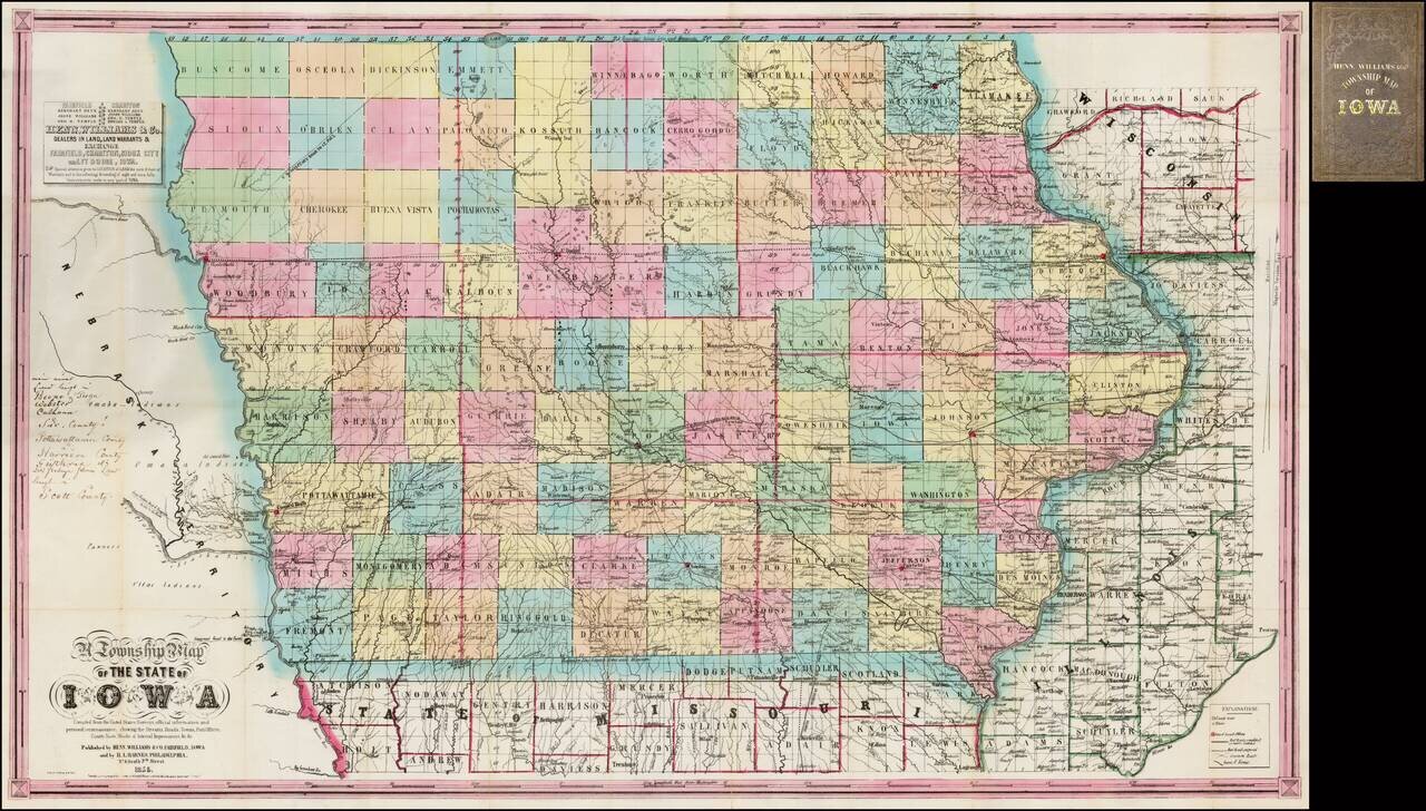
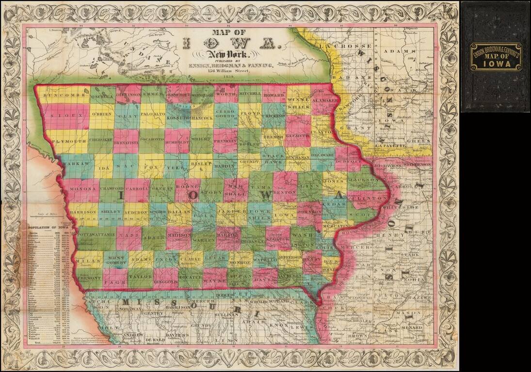
Nice example of the second state of Henn, Williams & Co.'s large format map of Iowa. The evolution of the Henn, Williams & Co. map of Iowa over the first 3 years of its publication provides a remarkable visual depiction of the rapid growth of...
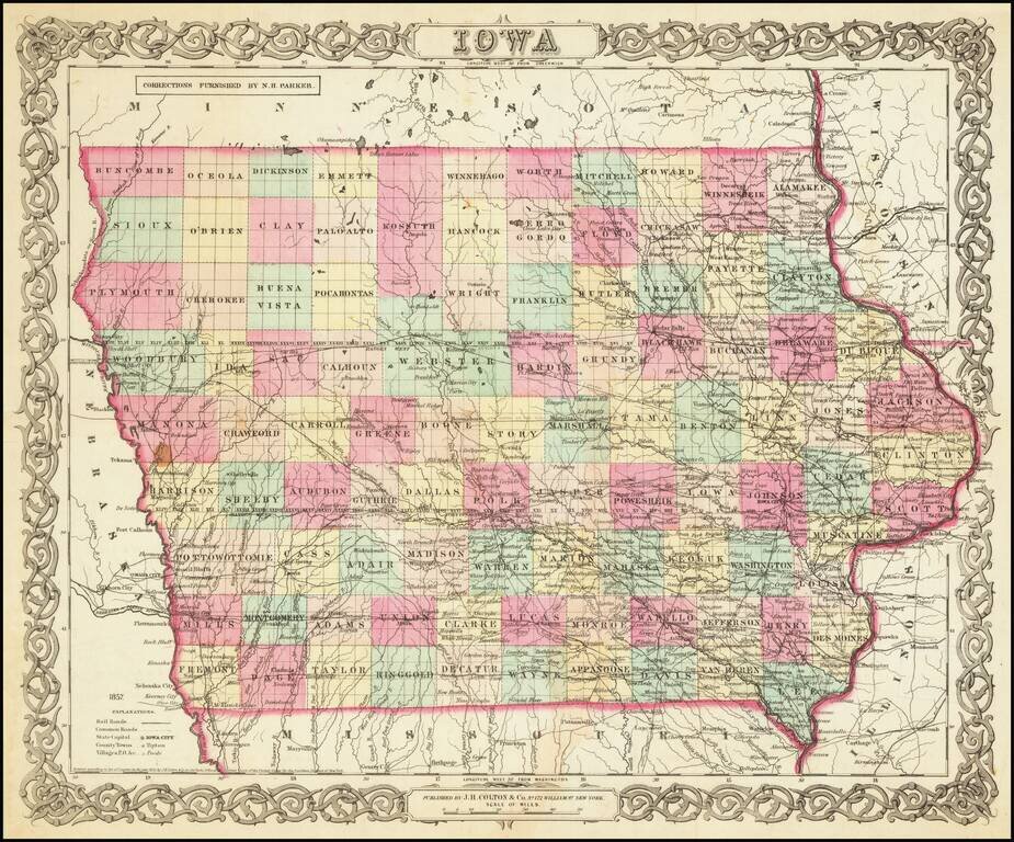
Scarce early separately issued map of Iowa, pre-dating the first edition Colton's atlas map of Iowa. An attractive and detailed map of Iowa with an ornate border. It is colored by counties and shows cities, towns, railroads, rivers, and lakes.