
Rare old maps of the United States.
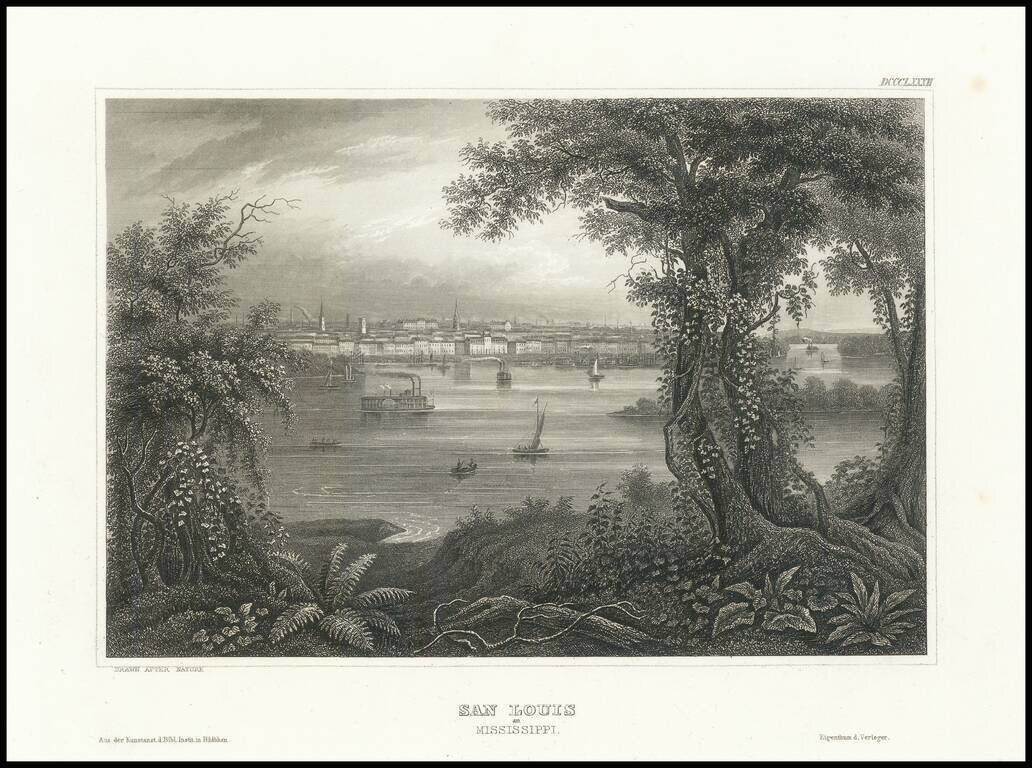
Fine steel engraved view of St. Louis from across the Mississippi River.
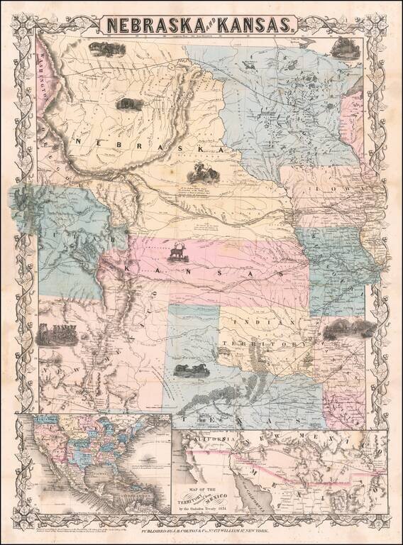
First edition, second state of this rare and important separately issued map of Kansas and Nebraska, published by J.H. Colton in New York. Colton's map is the first printed map to show the configurations of Nebraska and Kansas after the creation of...
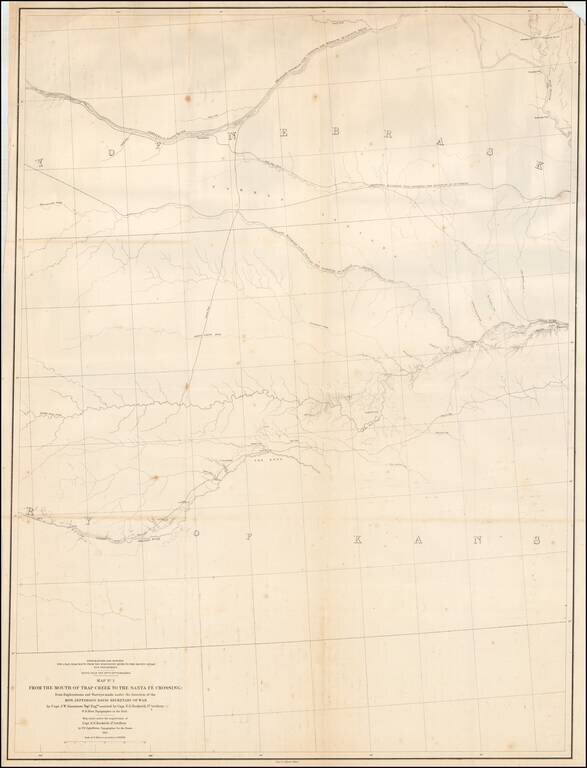
Detailed map of large portions of Kansas and Nebraska, prepared in connection with the Surveys to determine the most practicable routes for Transcontinental Railroads in the the 1850s. The map provides a detailed treatment of the region between the...
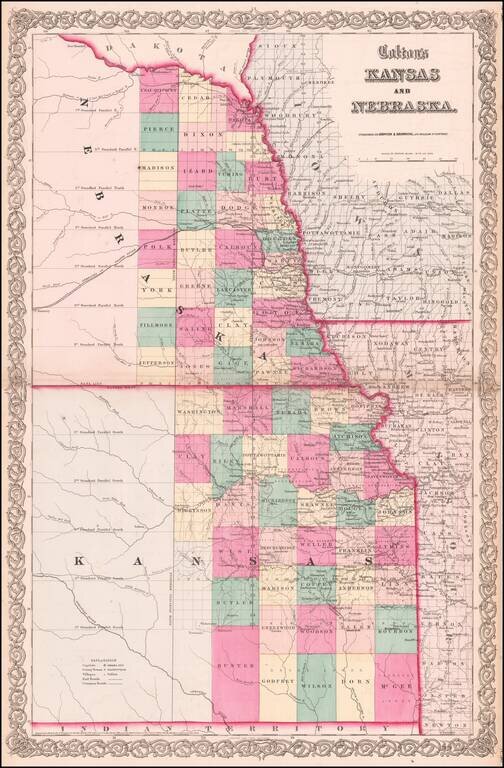
Vibrant example of this early map of Kansas and Nebraska, which was only issued in the vertical format for a few years. Primitive County configurations in the west and south. Multiple proposed railroad routes throughout the map.
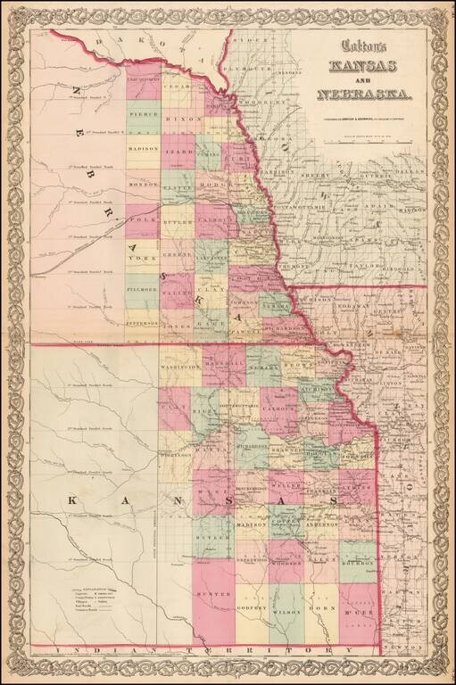
Vibrant example of this early map of Kansas and Nebraska, which was only issued in the vertical format for a few years. Primitive County configurations in the west and south. Multiple proposed railroad routes throughout the map.
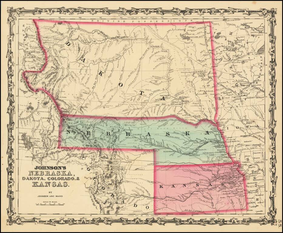
Massive Dakota Territory -- Pre-dating Wyoming and Montana. This is the third map in the series of Johnson's maps of this region and the first to include Colorado. Kansas gives way to Colorado, Nebraska is truncated by Dakota, but still extends to...
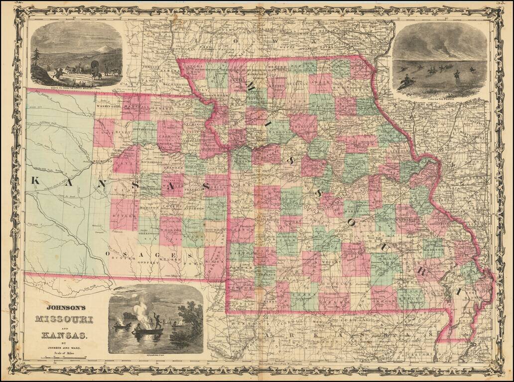
Decorative map of Missouri and Kansas, colored by counties, published by Johnson & Ward. Includes large decorative vignettes of a fire on the prairie with horse mounted Indians, the Santa Fe Trail and spear fishing Indians. Shows towns, counties,...
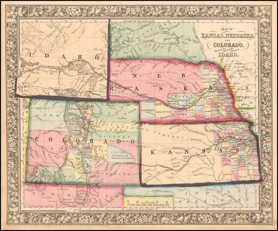
Excellent early map of the region, including an early appearance of Idaho Territory, one of the earliest appearances of this Territory (formed March 1863), on a printed map. Kansas counties cover only the eastern third of the state. Nebraska counties...
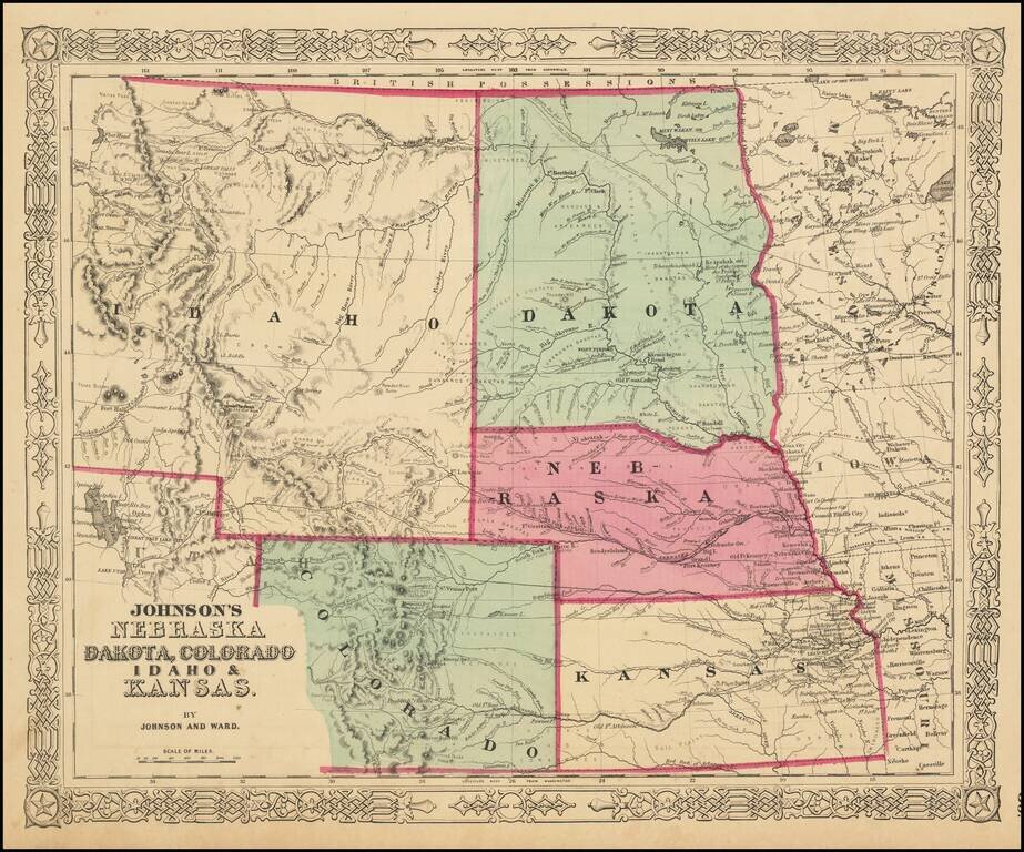
The Earliest Appearance of Idaho Territory--Including The Future Montana & Wyoming Territories Third in series of Johnson maps showing evolution of the mapping of these western territories. The most notable feature of the map is the massive...
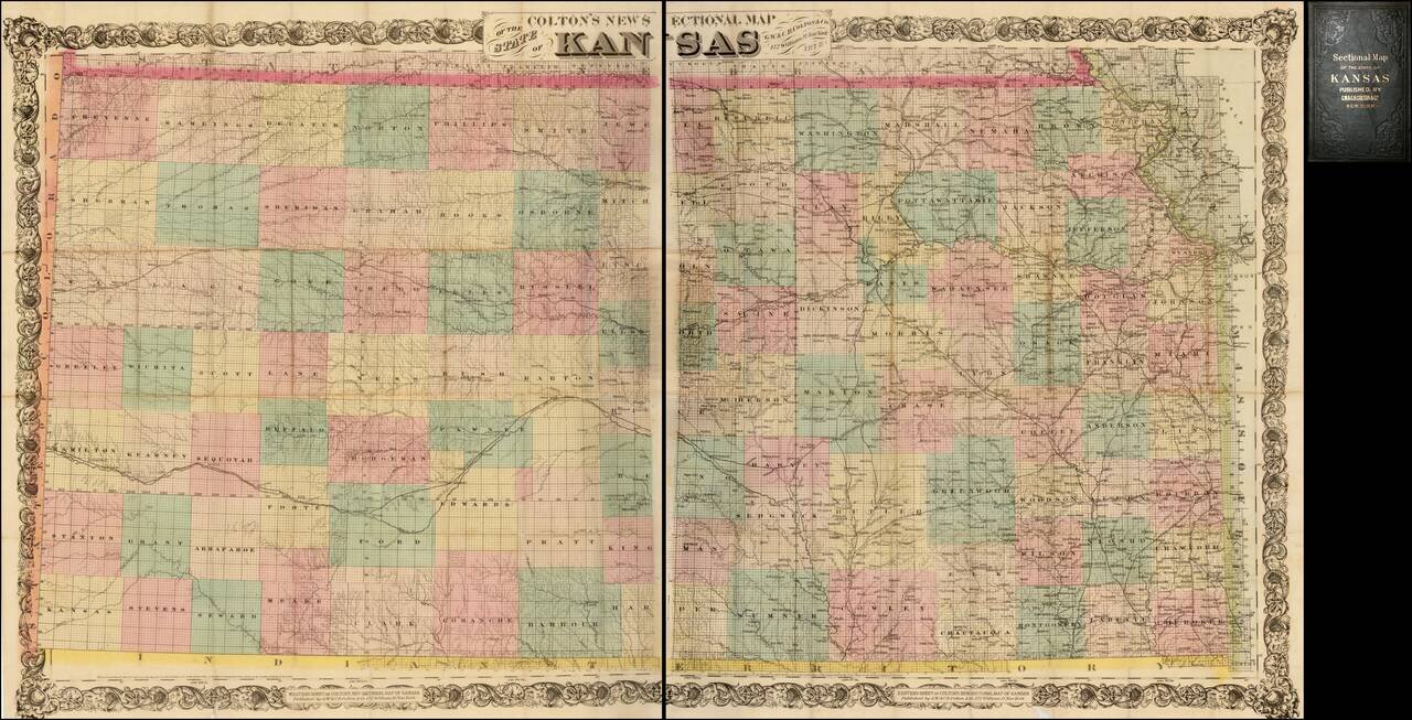
Nice example of Colton's 1878 edition of the New Sectional Map of Kansas. This is a later issue of a beautiful large scale map of Kansas, first issued in 1867. The map locates cities, towns, rivers, roads and railroad lines. While the rectangular...
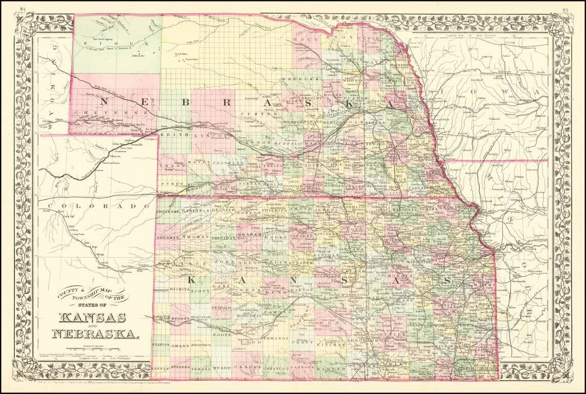
Detailed map of Kansas and Nebraska. Illustrates the disparity in western development in Nebraska and Kansas. Kansas shows almost modern county configuration, while northern Nebraska is still largely unexplored. Shows railways, towns, roads, forts, etc.
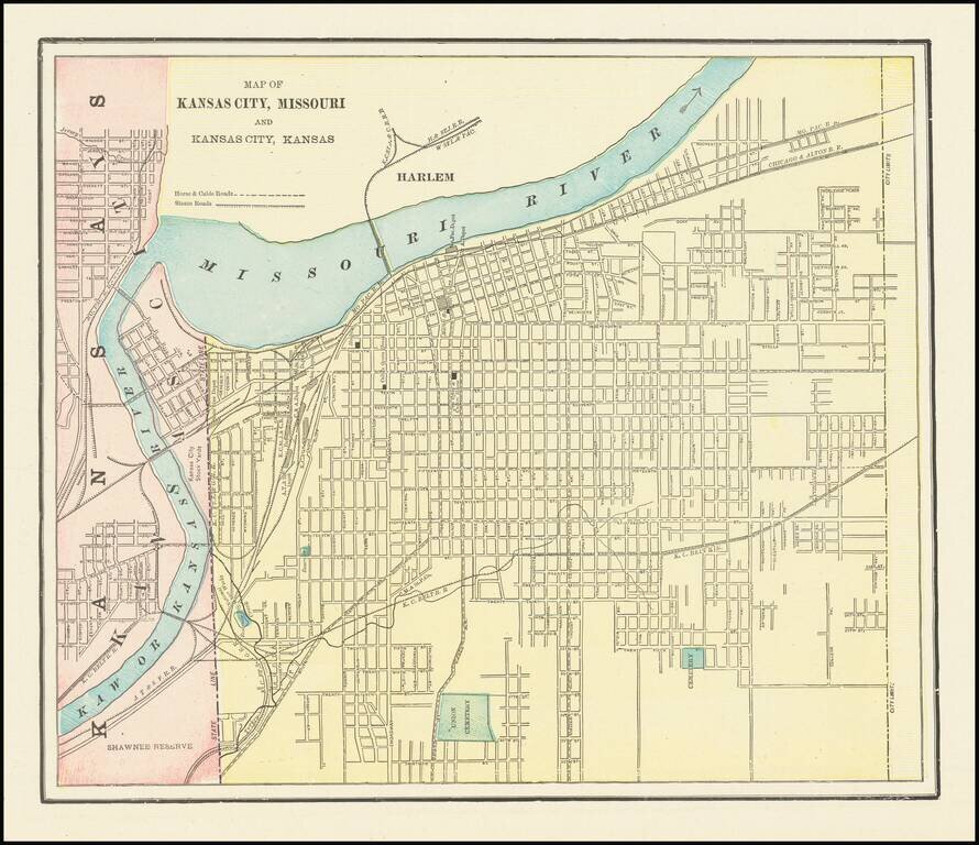
Detailed city plan of Kansas City, showing streets, buildings, train lines, public places, rivers etc. Cram was one of the pre-eminent American Mapmakers of the late 19th Century, relying upon a cerographic printing process first applied to maps by...
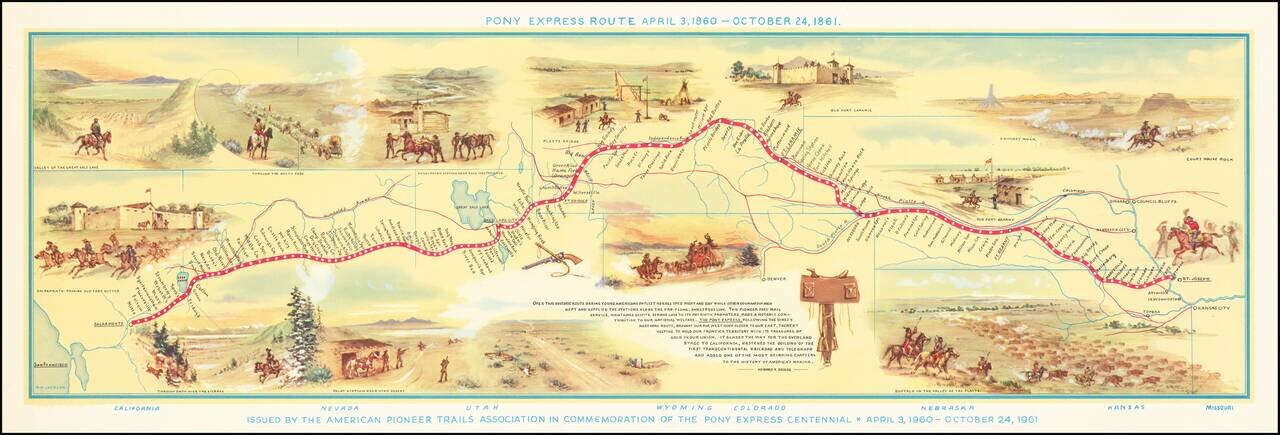
Fine pictorial map of the Pony Express Route, issued by the American Pioneer Trails Assocation in to commemorate the Centennial of the Pony Express. As noted by David Rumsey: Shows route of Pony Express with names and location of relay stations....
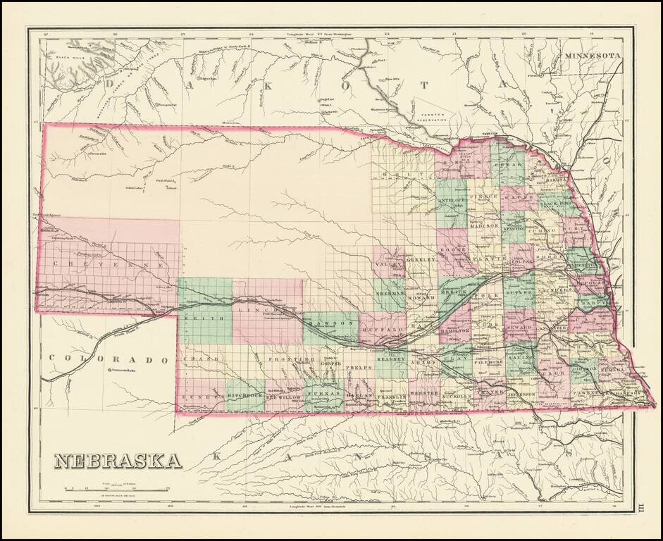
Detailed map of Nebraska, colored by counties and showing townships, roads, railroads, towns, etc. One of the earliest obtainable separate maps of Nebraska to appear in a commercial atlas.
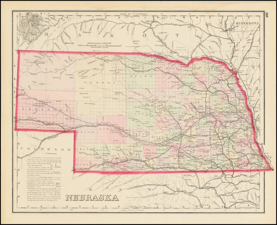
Scarce Late State Detailed map of Nebraska, colored by counties and showing townships, roads, railroads, towns, etc. The present example adds a number of western counties which did not appear in the earliest editions of this map.
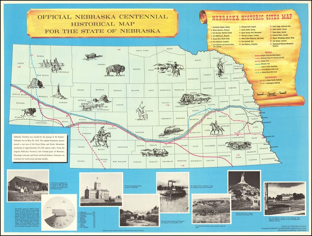
Interesting historical map of Nebraska, published to celebrate the 100 year anniversary of its Statehood in 1867. The map includes about 15 vignettes in the map and a key locating 21 points of interest, 7 important historical trails across Nebraska...