
Rare old maps of the United States.
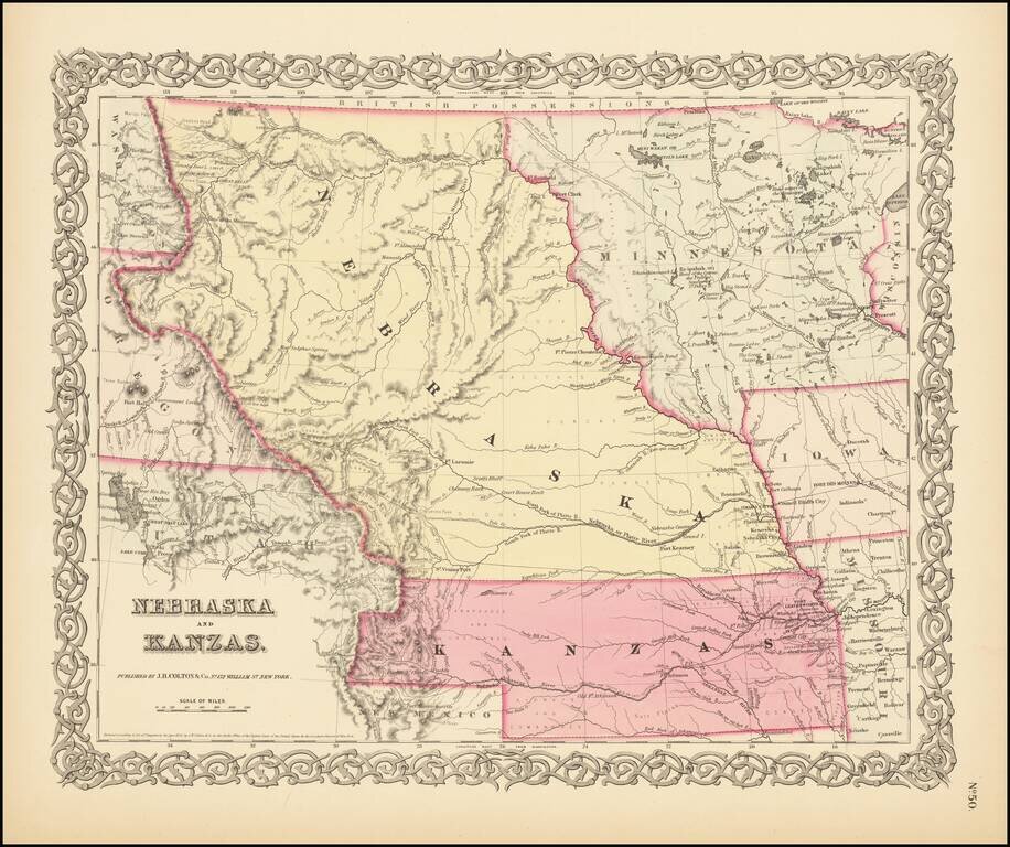
First State of Colton's Map of Kanzas and Nebraska Colton's highly sought after regional map of Nebraska and Kanzas, first published in 1855. Nebraska extends to Canada and the Rockies, taking up large portions of Montana, Wyoming and Utah. Kanzas...
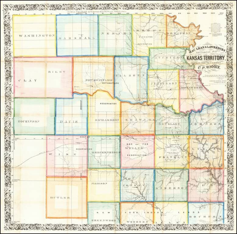
The First Great Map of Kansas Territory Fine large map of the soon to be "settled part" of Kansas Territory, drawn from the work of C.P. Wiggin. and lithographed by William Schuchman & Bro in Pittsburgh. The map illustrates the earliest...
![Territory of Nebraska [includes parts of Montana, Wyoming, Colorado and Dakota]](/map/small/66957.jpg)
Rare map of the Territory of Nebraska, from Rogers & Johnston's Atlas of the United States. Rogers & Johnston's map is the only commercial atlas map to show Nebraska Territory on a single map. The map was derived from the monumental and...
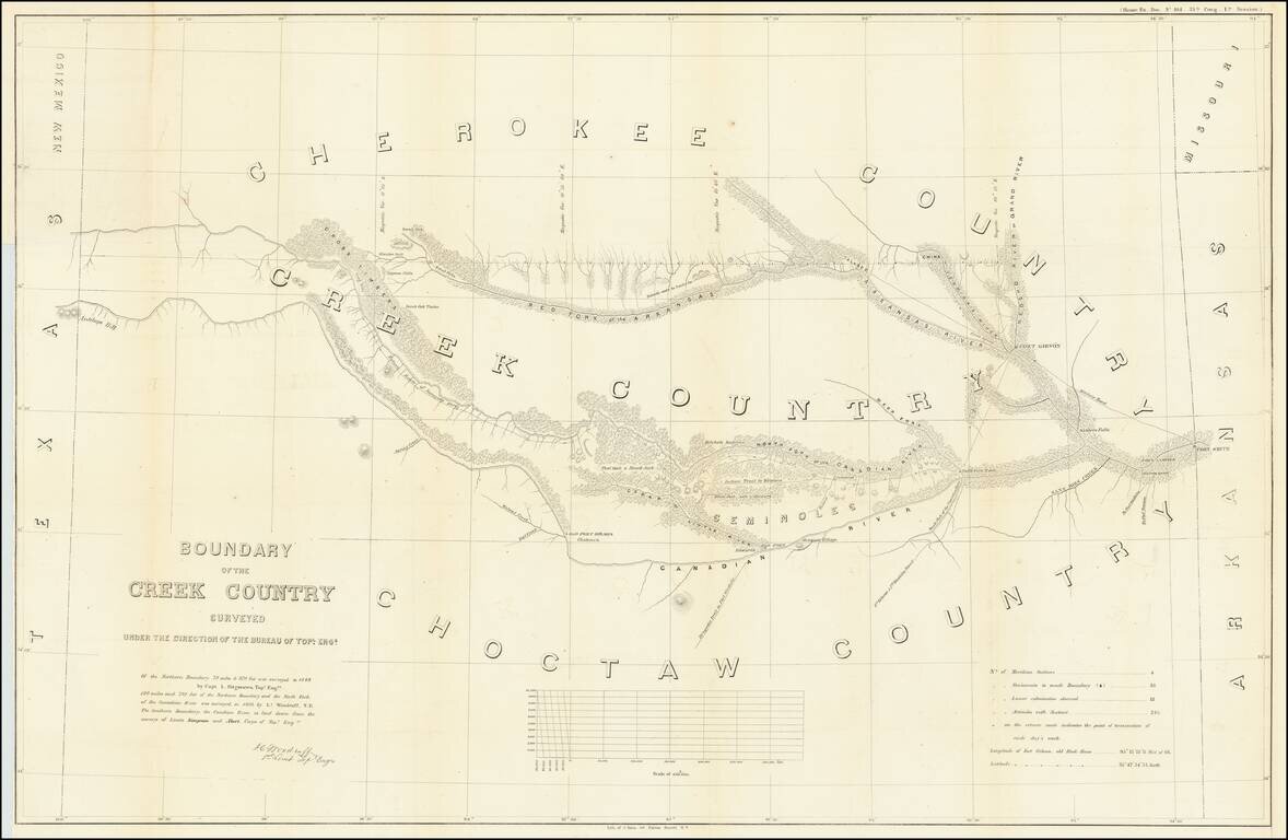
Detailed survey of the lands in Indian Territory occupied by the Creek Indians by agreement with the United States Government. The map shows the results of the earliest surveys of the watershed of the Canadian River and Red Fork of the Arkansas River...
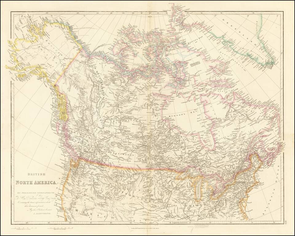
Detailed Map of British Possessions in North America—Rare Late Edition! Highly-detailed state of John Arrowsmith’s map of British possessions in North America, published in multiple editions between 1832 and 1859. This is a late edition, from the...
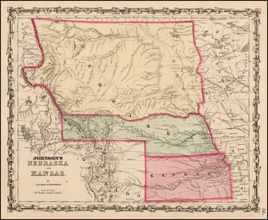
Early map in the series of Johnson's maps of this region, the first edition to include Colorado Territory. In this edition, Kansas extends to the Rocky Mountains and Nebraska extends to Oregon Territory and Canada. In the next edition, Kansas gives...
Excellent early map of the regional map of the Plains and Rocky Mountains, published by S.A. Mitchell Jr. Kansas counties cover only the eastern third of the state. Nebraska counties cover only a very small fraction of the state, which stretches all...
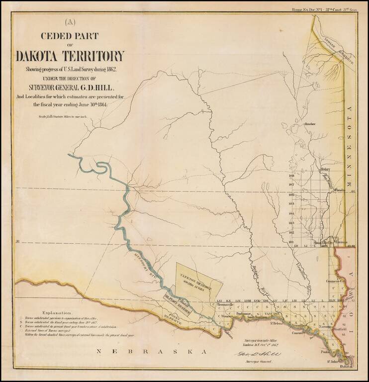
Interesting early map of part of Dakota Territory. The map is focused on the township surveys and the various Indian reserves along the Missouri River, including the Yankton Reserve, Ft. Randall Military Reserve and Ponka Reserve, along with an Indian...
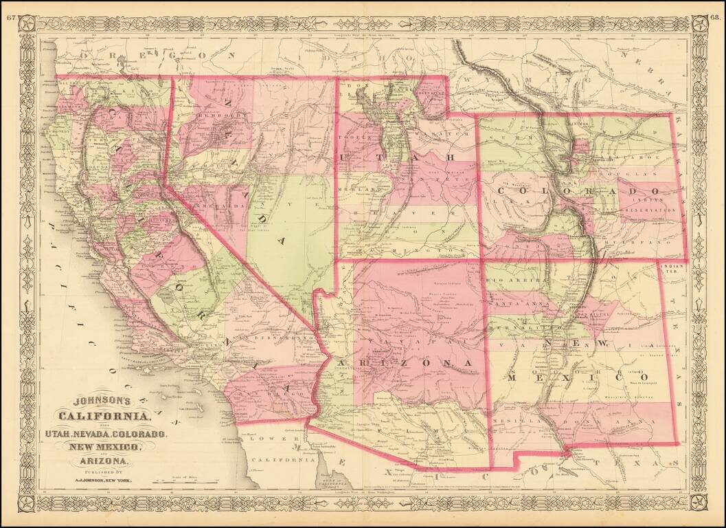
Interesting map of the southwest, hand colored by counties and showing a number of interesting territorial anomalies. Nevada has its lower corner truncated, leaving Las Vegas in Arizona. Nevada is truncated at the bottom. In each of the states and...
![Map showing the scene of General Hancock's operations in the Indian Country, the Forts, Military Stations, Pacific Railroads, etc. [Harper's Weekly. June 15,1867]](/map/small/70224.jpg)
Fine map of the Western United States, published in Harper's Weekly The map focuses on General Hancock's military operations against the Native Americans in Indian Territory. The map highlights the the forts, military stations, and railroads in the...
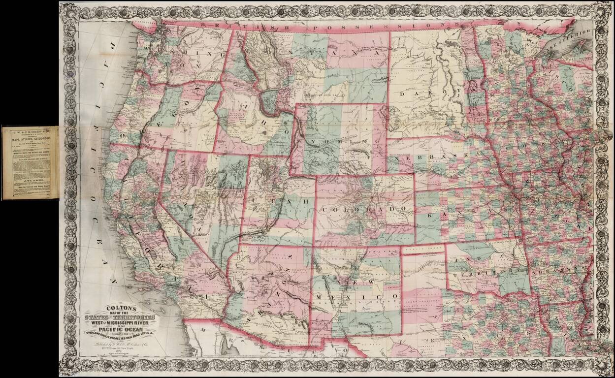
Large scale pocket map of the Transmississippi West. Fine example of Colton's large format map of the West, colored by Counties and focusing on the projected railroad lines west of the Mississippi River, shortly before the first appearance of...
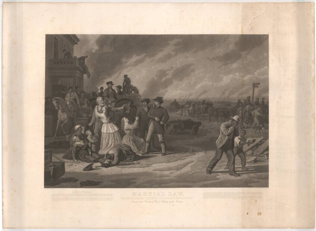
Proof state of this large mezzotint of George Caleb Bingham's painting "Martial Law," an artistic protest against the Federal Goverment's declaration of martial law on the Kansas-Missouri border. This iconic image shows the evacuation of civilians...
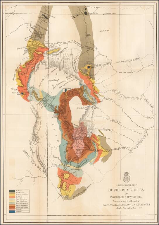
Important early geological survey map of the Black Hills region, undertaken by William Ludlow, while under the command of George Custer. In 1874, a large group of cavalrymen under the command of Lt. Col. George Armstrong Custer moved into the Black...
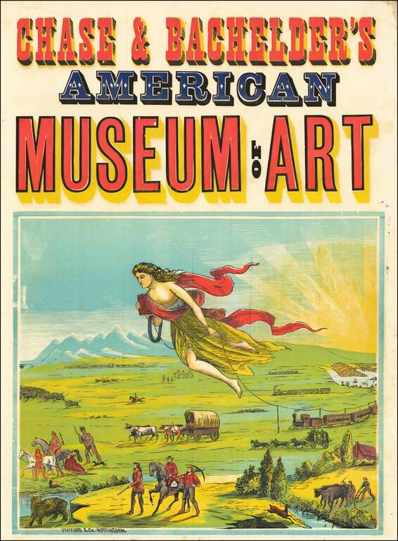
Fulfilling America's Manifest Destiny One of the earliest travel or travel-related posters ever created and also the wellspring of all future American travel images. An allegorical figure leads trains, covered wagons, coaches and prospectors across...
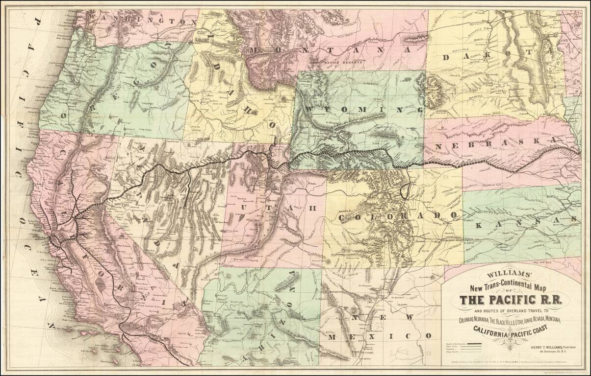
Rare first edition of this striking large format map of the West, published by Henry T. Williams, with handwritten notes, including a note relating to the notorious stagecoach robber, Black Bart, who operated in northern California and southern Oregon...
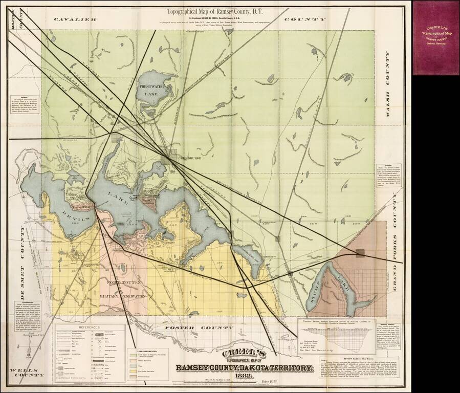
Fine large format map promoting settlement in Ramsey County, Dakota Territory, published by Heber M. Cree, formerly of the 7th Cavalry, whom the map notes as having been "in charge of survey north shore of Devil's Lake, D.T.; also survey of Fort Totten...