
Rare old maps of the United States.
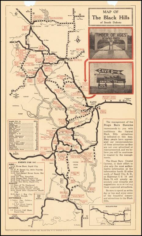
The Black Hills Leading Crystal Cave Tourist promotional map of the Black Hills Region, including advertising on the verso for Cyrstal Caverns, with photographs. Centered on Rapid City, the map highlights other tourist attractions in the region.
![[Indian Territory [with Colorado on verso]](/map/small/69383.jpg)
Highly detailed map of Colorado [and Indian Territory on the back side], hand colored by counties and showing townships, towns, roads, mountains, rivers, lakes, mines, plateaus, railroads, etc. One of the most detailed maps of the period for each of...
![Colorado [with Indian Territory on verso]](/map/small/71186.jpg)
Highly detailed map of Colorado [and Indian Territory on the back side], hand colored by counties and showing townships, towns, roads, mountains, rivers, lakes, mines, plateaus, railroads, etc. One of the most detailed maps of the period for each of...
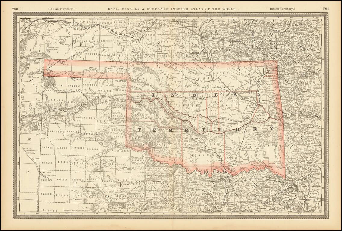
Large format detailed map of Indian Territory, showing towns, rivers, railroads, mountains, lakes, etc. Includes the various Nations, and a number of early details.
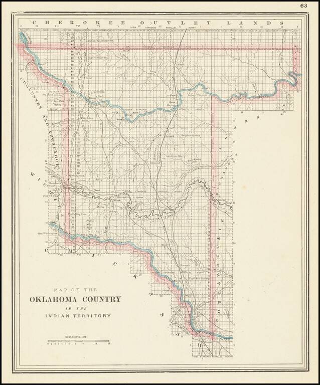
Unusual map of the "Oklahoma Country," published by George Cram in Chicago.
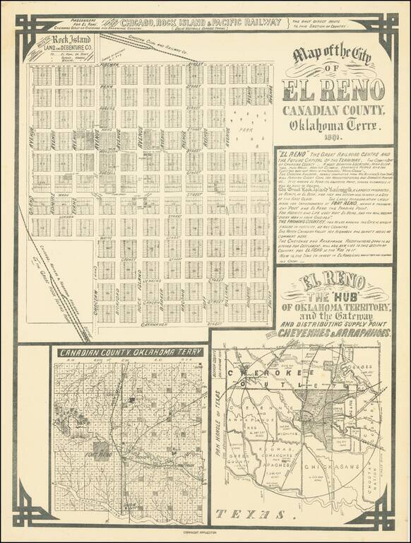
El Reno The 'Hub' of Oklahoma Territory and the Gateway and Distributing Supply Point for the Cheyennes & Arrapahoes Rare early map of the city of El Reno, Indian Territory, published in 1891, on the eve of the Third Oklahoma Land Rush (April 19,...
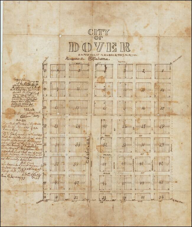
The First Map of Dover, Oklahoma Territory -- Primary Stopover on the Chisholm Trail -- Final Robbery By The Wild Bunch / Doolin Dalton Gang Drawn only 2 years after the establishment of the Dover Post Office, the present map is almost certainly the...
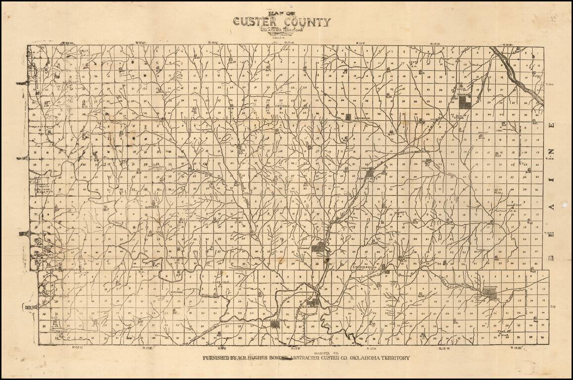
Unrecorded Early Map of Custer County, Oklahoma Territory One of the earliest surviving printed maps of Custer County, Oklahoma Territory. The map is subdivided into townships, with each lot subdivided into 36 numbered sections. Several towns are...
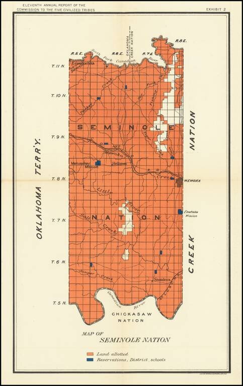
Nice map of the Seminole Map in Indian Territory, showing the coal regions for the Department of the Interior. The map shows Lands Allotted and the location of Reservation District Schools.
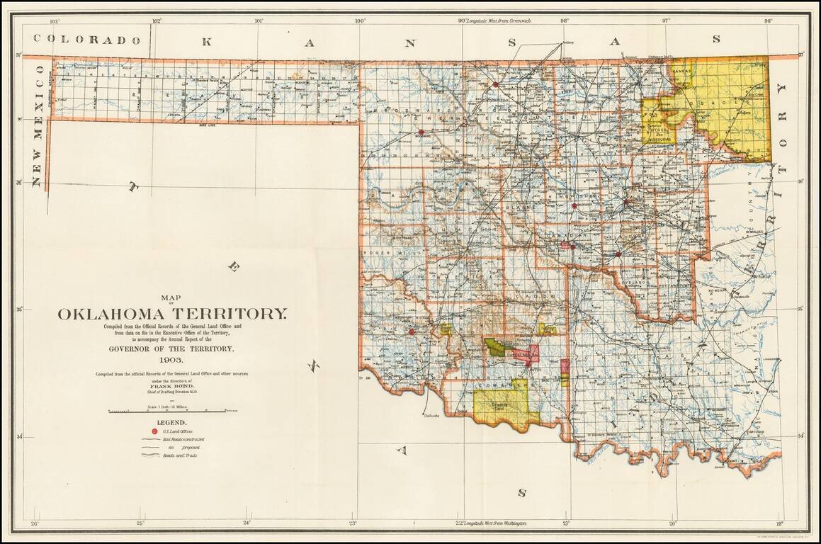
Rare Oklahoma Territory Map -- Pre-Dating Merger with Indian Territory. Rare map of Oklahoma Territory, issued by the Territorial Governor, during the brief period when Oklahoma and Indian Territory were separate Territories of the United States....
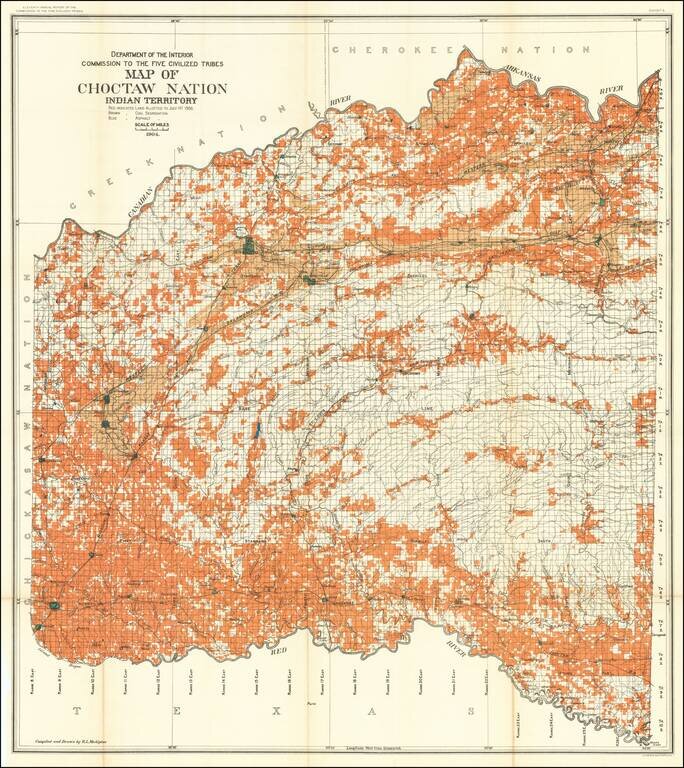
Detailed allotment map of the Choctaw Nation lands in Indian Territory, showing land allotted to July 1st, 1904, as well as coal and asphalt segregation. The map covers the Choctaw Reservation between Red, Canadian, and Arkansas Rivers.
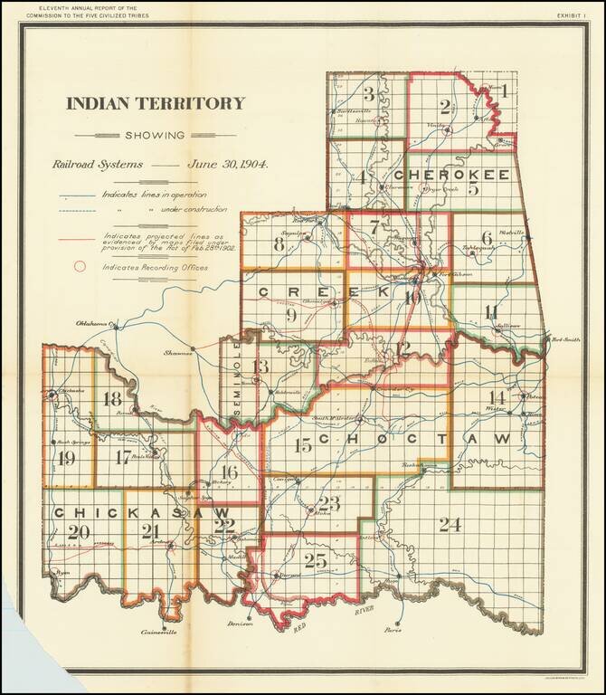
Striking map of Indian Territory, showing the Recording Districts in the Territory, for the Report of the Commission To The Five Civilized Tribes, published by the Department of the Interior. The map extends west to Oklahoma City in Oklahoma...
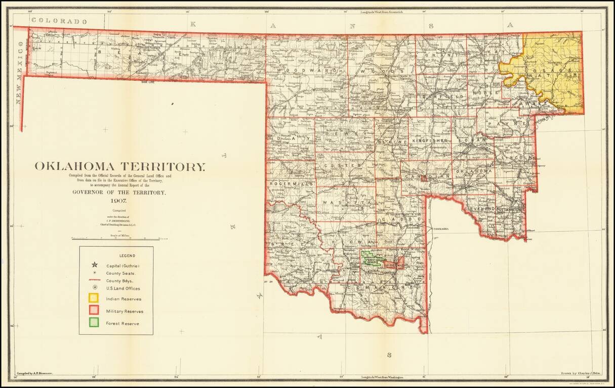
The Final Year of Oklahoma Territory Map -- Pre-Dating Merger with Indian Territory To Form The State of Oklahoma Rare map of Oklahoma Territory, issued by the Territorial Governor, during the brief period when Oklahoma and Indian Territory were...
Fine map of Oklahoma, shortly after it obtained statehood on September 17, 1907, and published by the Atchison Topeka & Santa Fe Railroad. Fine map of the state, with the lines of the Santa Fe Railroad running up the center and a number of other...
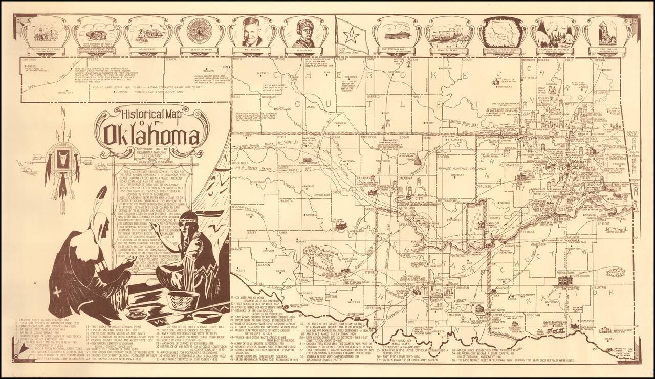
Fine pictorial map of Oklahoma, drawn by H.Z. Sanders for the Oklahoma Natural Gas Company. The map is decorated with small pictorial images showing some of the historical landmarks around the state and famous people. Also included is a legend with...
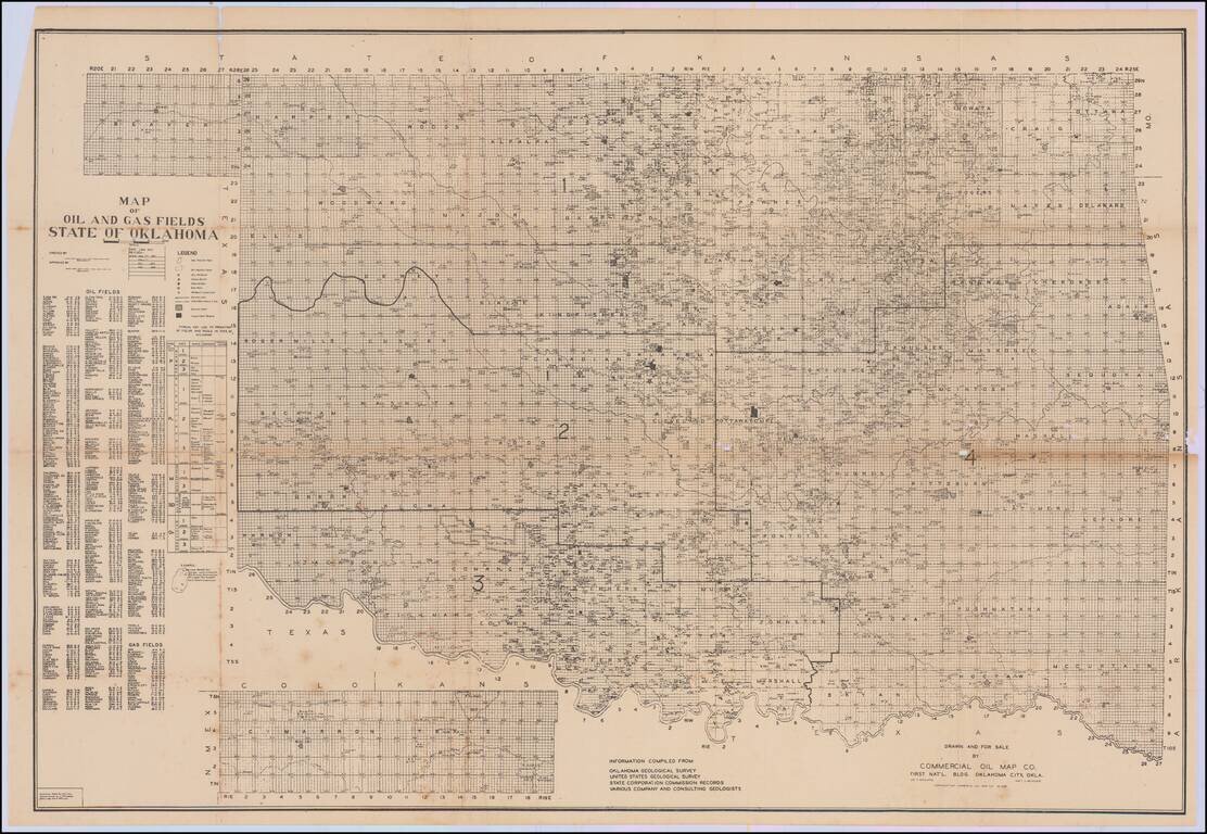
First published in January 1937, the map is revised to February 1938. A rare and detailed map of oil and gas development in Oklahoma, by the Commercial Oil Map Co. of Oklahoma City. The map was compiled from information collected by the Oklahoma...