
Rare old maps of the United States.
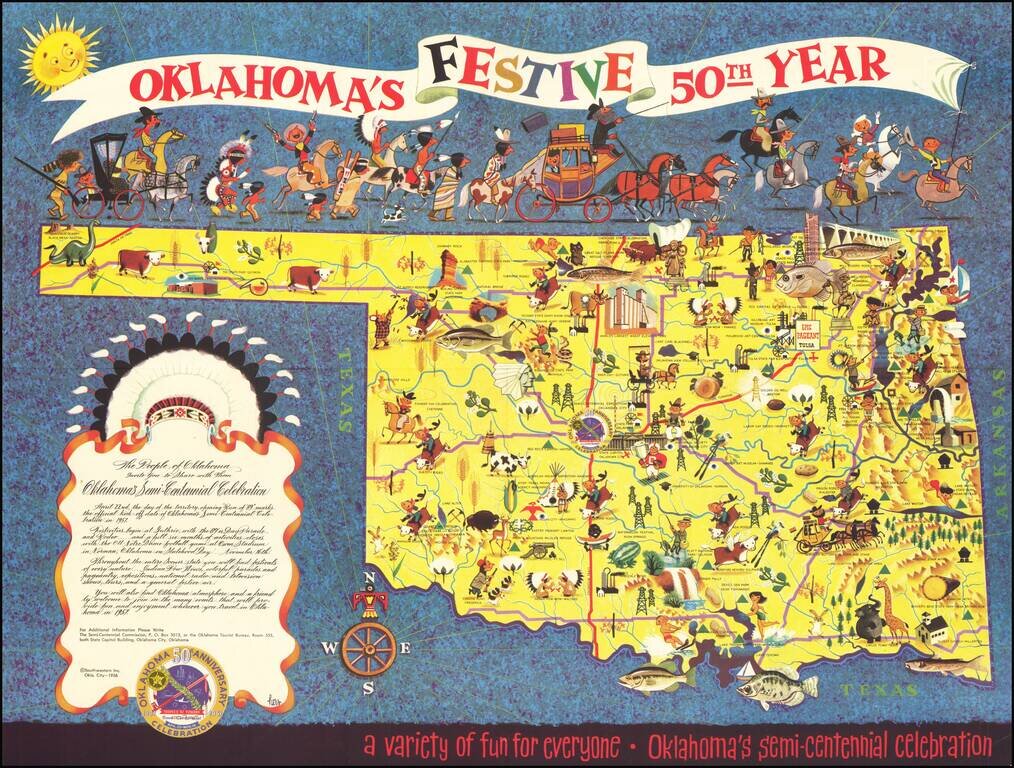
Rare Lowell Hess Pictorial Map Festive pictorial map of Oklahoma, celebrating the 50 year anniversary of Oklahoma Statehood, drawn by famed commercial illustrator Lowell Hess. The map is filled with colorful historical vignettes celebrating...
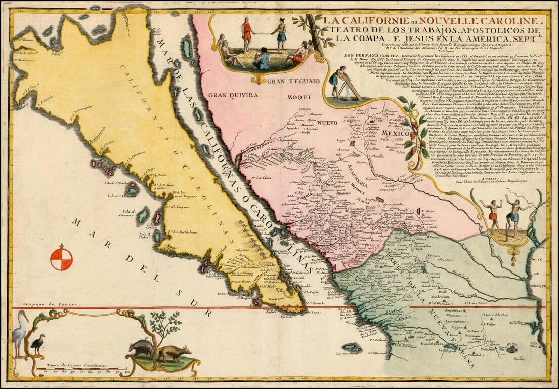
Largest Separate Representation of the Island of California Striking large-format map of the island of California—the largest separate representation of the island of California on a printed map. It is a later representation of the island (1720),...
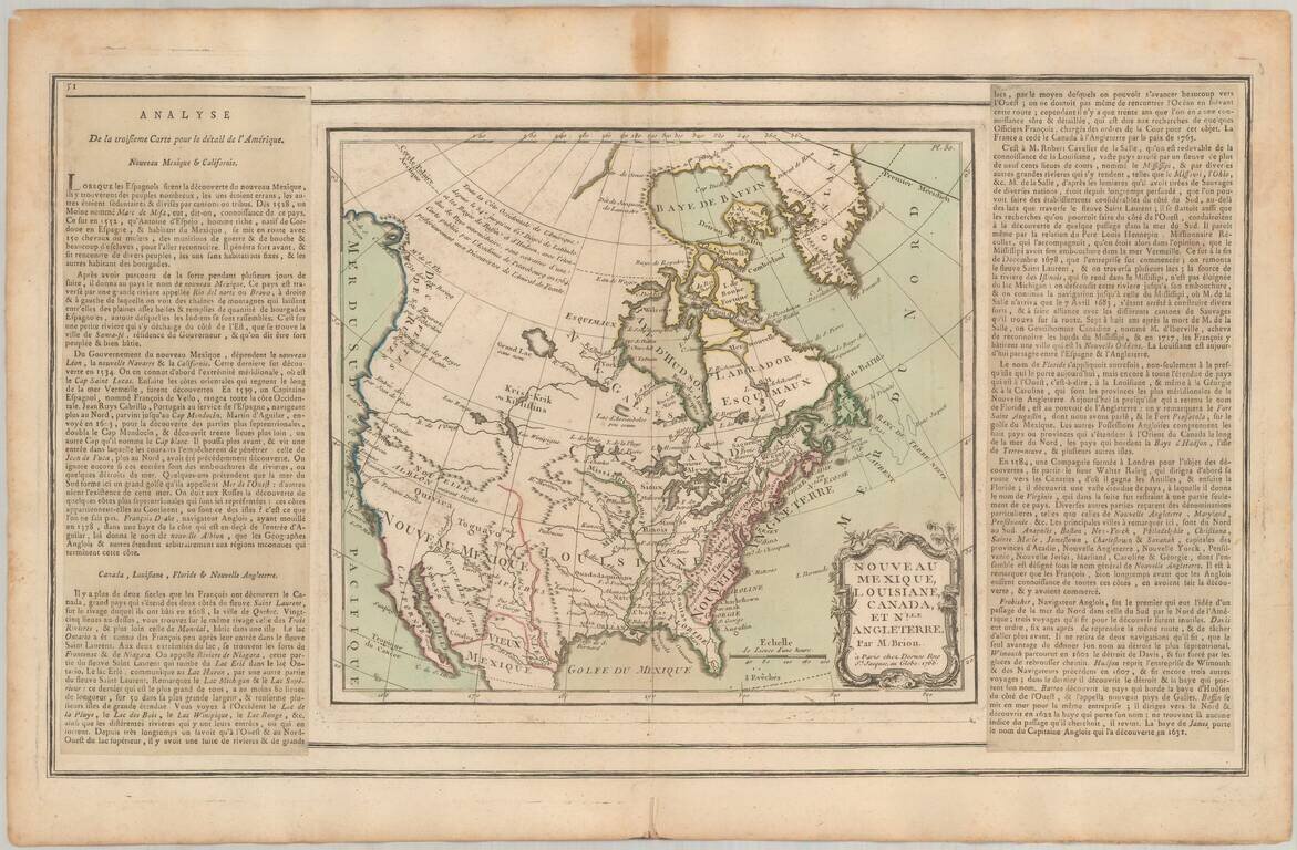
Fine example of the 1766 edition of Brion De La Tour's map of most of North America. A fascinating map of most of North America, exhibiting the extent of discoveries in the Southwest, Alaska and the Arctic Regions. Two long rivers run from California...
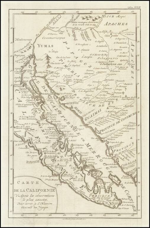
A scarce map of Baja California, northwestern Mexico, and southern Arizona. The map is detailed, showing many settlements, mountain ranges, islands, missions, and much more. California is shown as a peninsula. The California as an Island in its most...
![[Utah] Amer. Sep. No. 47. Partie Du Mexique](/map/small/69341.jpg)
The Earliest Printed Map of the Utah Region Wonderfully detailed map of the region from Lake Timpanogos, Lake Teguayo and Rio de los Piramides Sulfareas in the West and extending into modern day Colorado and Wyoming, showing more detail than any other...
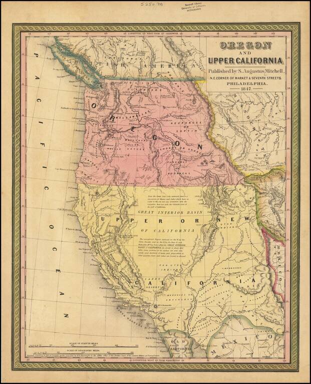
Rare 1847 edition of the best atlas map of the Western United States issued prior to the Civil War, reflecting Americans' contemporary knowledge of the West. The map shows the Spanish Trail, Lewis & Clark's Canoe Route, Oregon Trail, early roads,...
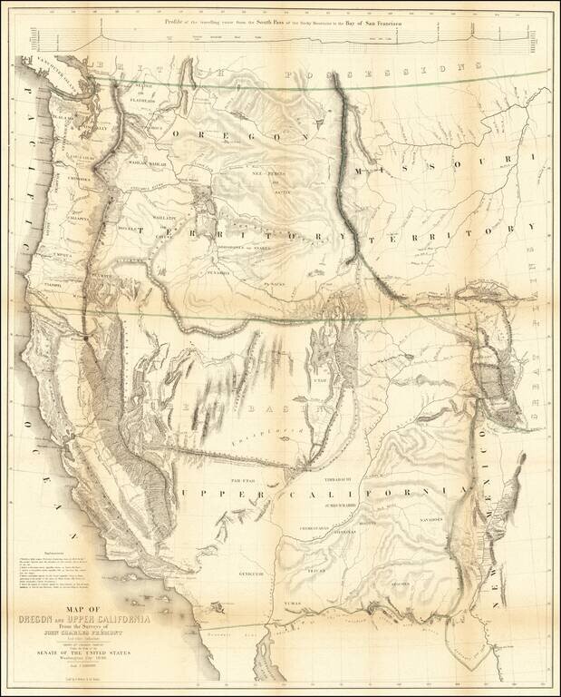
Nice example of Fremont's map of the region west of the Rocky Mountains, widely regarded as the most important and influential map the American West published in the middle of the 19th Century. This example includes the text of the Geographical Memoir...
![[New Mexico Territory] Map of the Route pursued by US Troops under the command of Bvt. Lieut. Col. Jno. M. Washington, Governor of New Mexico, in an expedition against the Navajos Indians. . . .1849](/map/small/49761.jpg)
Important early map of parts of New Mexico and Arizona, prepared during the survey explorations and military campaigns in New Mexico and West Texas in 1849. Prepared by Topographical Engineer James H. Simpson and the artist Edward Kern, the map...
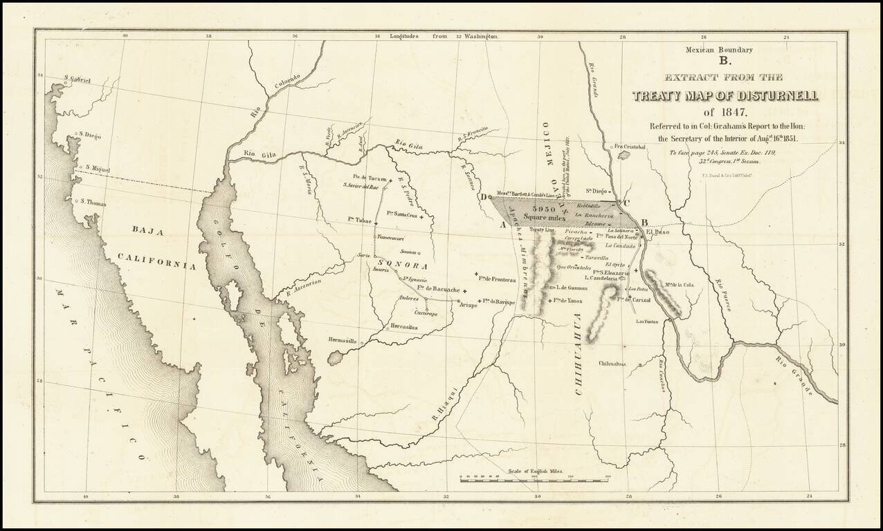
Important map illustrating the region between the Rio Grande and the Colorado River, with forts and towns marked, mainly intended to illustrate the error made by Bartlett in setting the line from the Rio Grande to the Continental Divide too far north,...
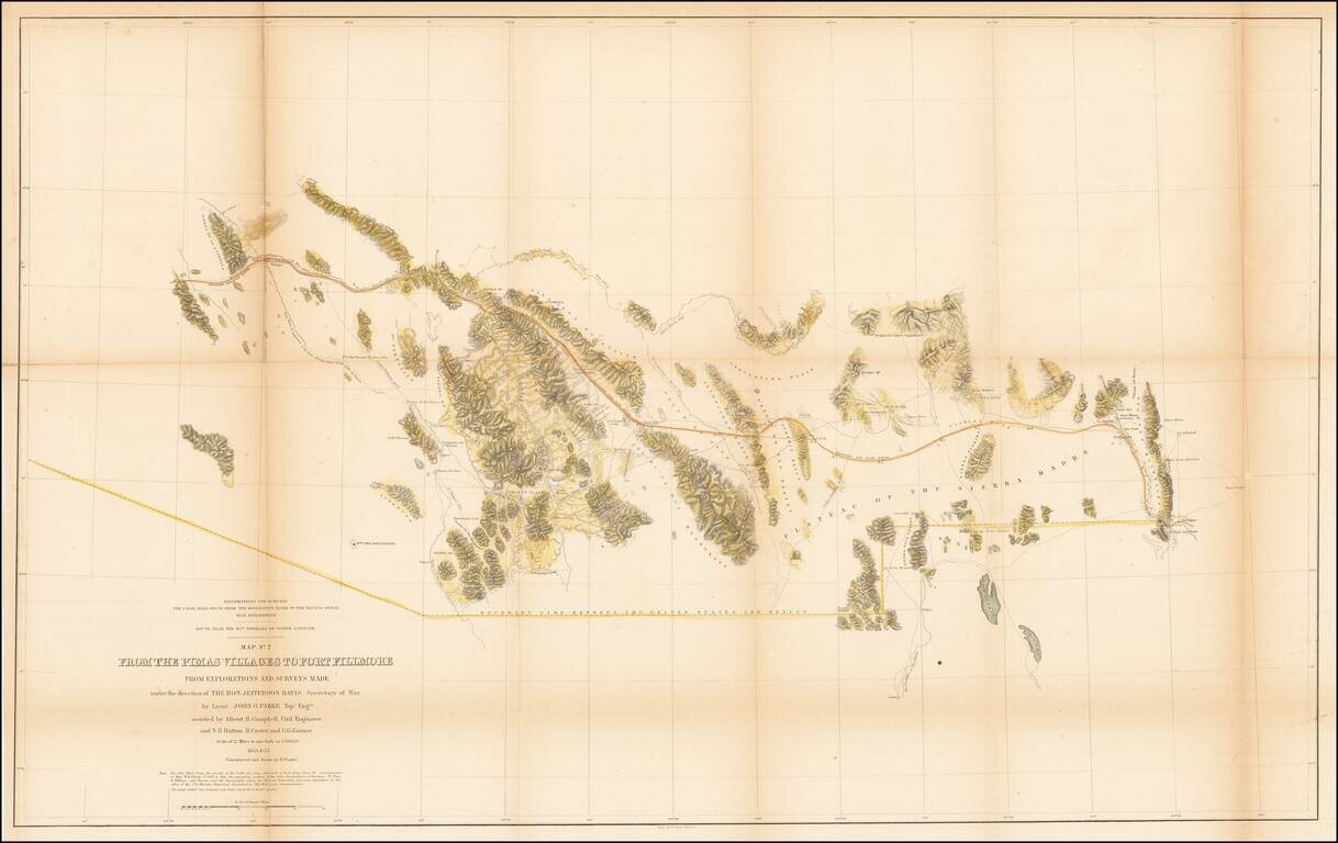
U.S. Mexican Boundary Commission map of Arizona and New Mexico's border with Mexico. Hand-colored lithographed folding map of the southern part of modern-day Arizona and New Mexico, by one of the great cartographers of the Southwest, John G. Parke....
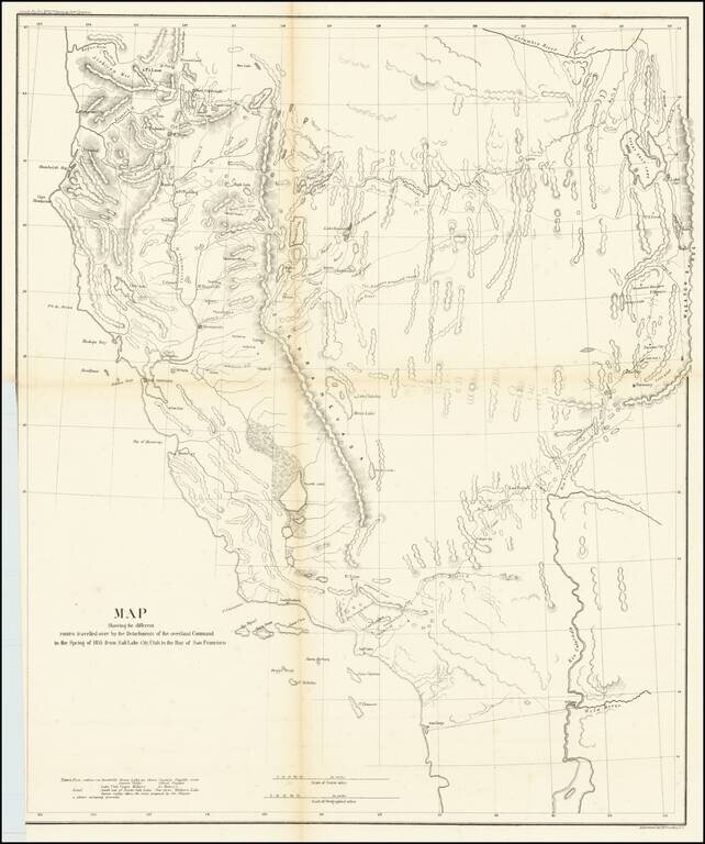
A Search For The Best Routes To The West. "[O]ne of the most interesting maps of the West" - Wheat 868 This is a scarce map which accompanied the Report of Capt. R. Ingalls on the March of L. Col. Steptoe from Ft. Leavenworth to California, in 1854...
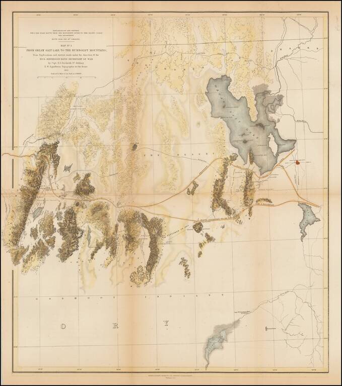
A detailed map showing the Great Salt Lake, Utah Lake and Sevier Lake, with the Humboldt Mountains at left edge. Includes the region from the Great Salt Lake and across the flats to the Humboldt range. Several proposed railroad routes noted, including...
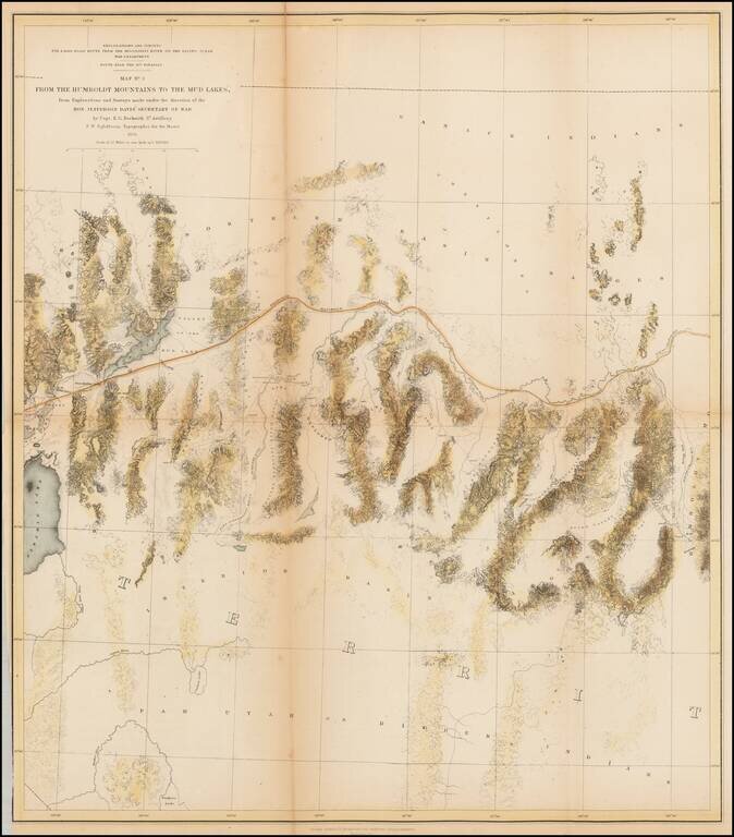
A detailed map of Northwestern Nevada, showing Pyramid Lake, the Carson River, Walker River and northern part of Walker Lake and extended East to the Elko area and the south fork of the Humboldt River. Wheat considers this an excellent map "due in...
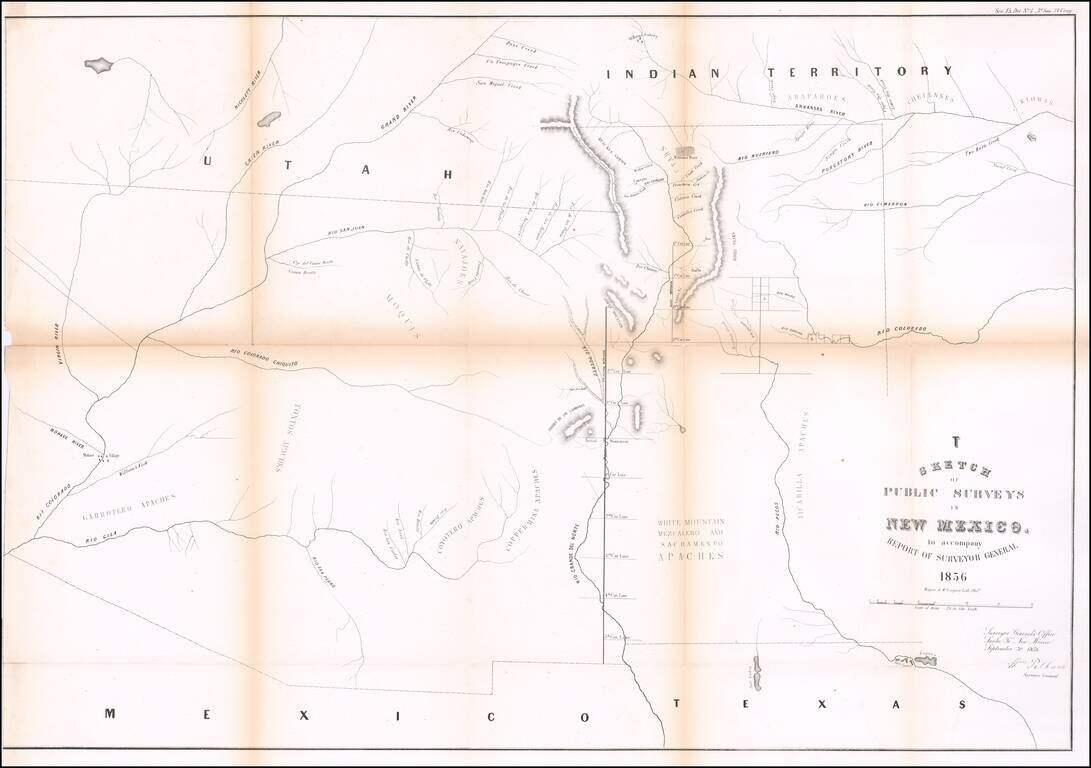
Interesting early map of New Mexico and Arizona, published by the General Land Office. The map extends from the confluence of the Colorado and Gila Rivers to Nicollet River in the northwest, the Rio Pecos in the southwest and Bent's Fort, the...
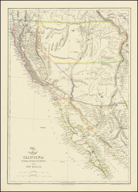
Nice example of the Ettling / Weekly Dispatch map of California and the Southwest, one of first atlas maps published in Europe to focus on the Territories of Utah and New Mexico. The map includes an excellent post Gadsden Purchase treatment of...
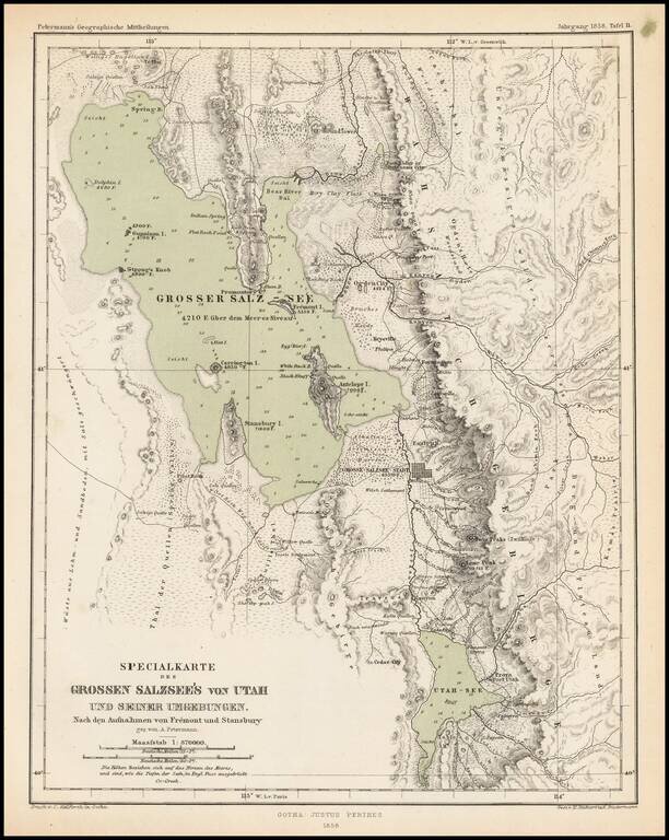
Scarce and highly detailed map of part of Utah in the Salt Lake and Wasatch region, published by Augustus Petermann. The map names numerous early Utah towns, including: Provo Salt Lake City (with a town grid) Springville Brigham City Palmyra Payson...