Map size in jpg-format: 33.8858MiB
Click to open in high resolution (open in new tab).
Vintage pictorial map of Southern California, issued by The All-Year Club of Southern California to promote tourism to the region in the middle of the 20th century.
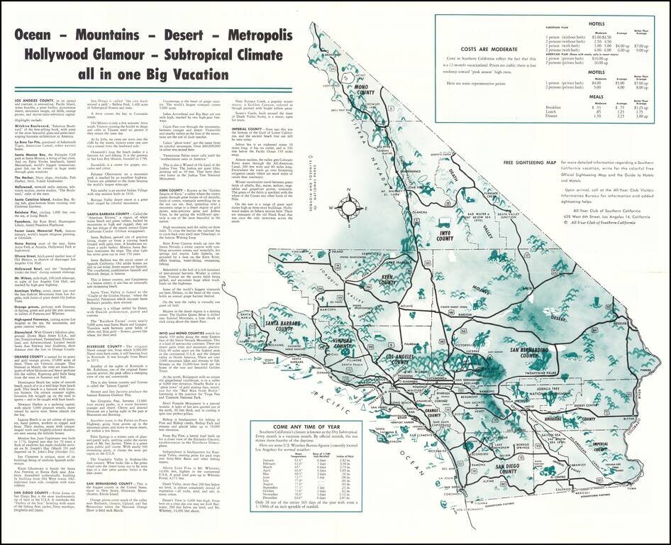
The main map includes an overview of Southern California (stretching up to Mono County), with tables of data proving that tourists should "Come Any Time of Year" and "Costs Are Moderate" (a "better than average" dinner costs $3.00 per person; and "American Plan" hotel with meals would cost $26 a night for 2 people.)
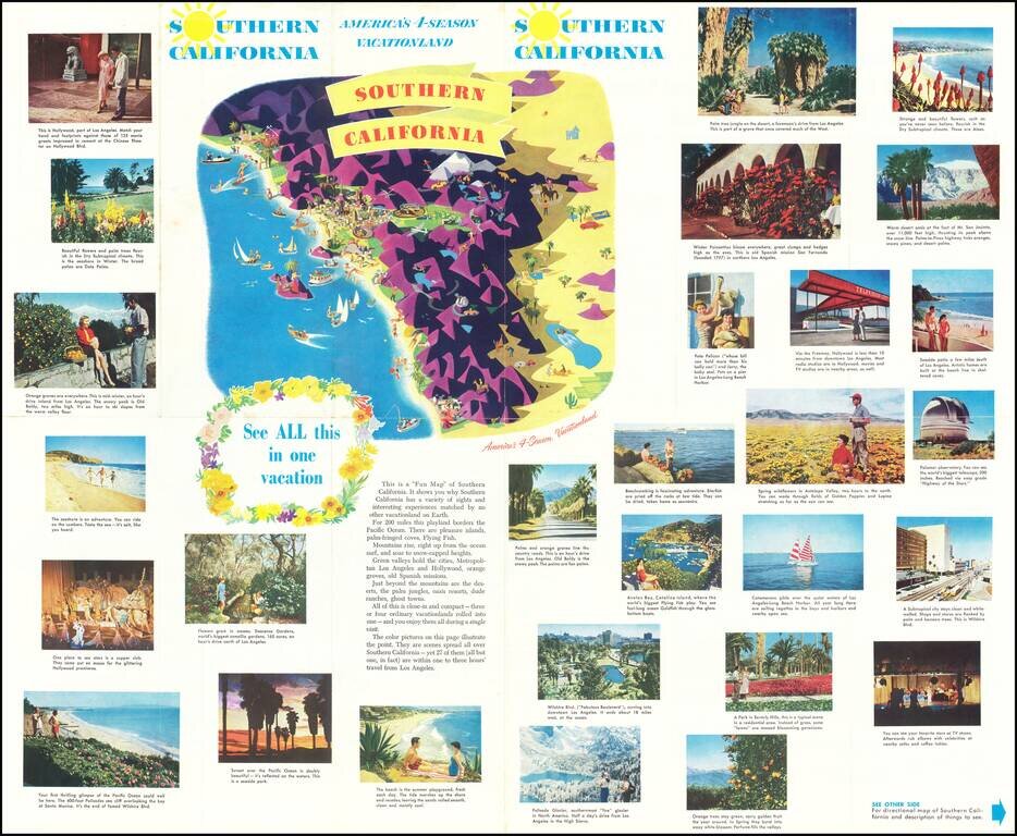
On the verso is a collage of color photographs and a brightly illustrated stylized graphic map of the region.
If you are a student, write to us in telegram: @antiquemaps and indicate what material you need and for what work you need a map in high detail. We are ready to provide material on special terms. For students only!
![[Signed Political Satire Artwork] Vietnam ... Vietnam ... Vietnam ...](/map/small/68726.jpg)

