Map size in jpg-format: 18.2243MiB
Click to open in high resolution (open in new tab).

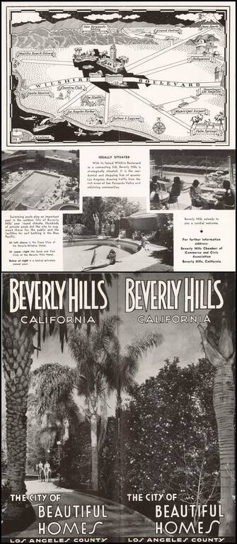
Pictorial map of the Los Angeles Basin, centered on Wilshire Boulevard and Downtown Los Angeles, drawn by C.A. Stanley.
Places illustrated include the Malibu Beach Colony, Flim Studios, Municipal Airport, etc.
If you are a student, write to us in telegram: @antiquemaps and indicate what material you need and for what work you need a map in high detail. We are ready to provide material on special terms. For students only!
![[Signed Political Satire Artwork] Vietnam ... Vietnam ... Vietnam ...](/map/small/68726.jpg)

