Map size in jpg-format: 98.7099MiB
Click to open in high resolution (open in new tab).
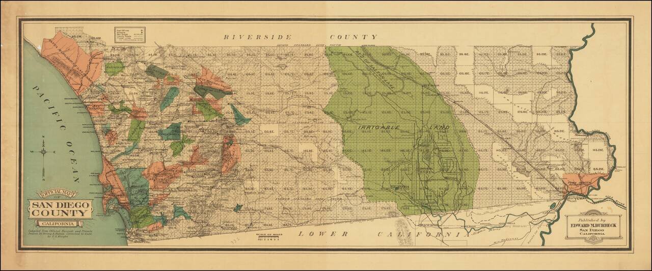
Colored By Ranchos!
Fine early map of San Diego County, published by Edward M. Burbeck.
the map shows the progress of township subdivisions, but is most noteworthy for its illustration of ranchos in color, an unusual feature for printed maps.
Dozens of small early towns are shown, as are Post Offices, Schools, Railroads, County Roads and Flume Lines (existing and proposed).
A large section of the eastern part of the County, which would become Imperial County, is highlighted in Green and called Irrigable Land.
The name Irving A. Hubon appears on San Diego related maps from about 1895 to 1908.
Rarity
OCLC locates a single copy (Yale).
If you are a student, write to us in telegram: @antiquemaps and indicate what material you need and for what work you need a map in high detail. We are ready to provide material on special terms. For students only!


