logo

1910. Map of Newport Bay Tract . . . Surveyed by Tarver Montgomery in June, 1905

  • Map of Newport Bay Tract . . . Surveyed by Tarver Montgomery in June, 1905

Map of Newport Bay Tract . . . Surveyed by Tarver Montgomery in June, 1905 information:

Year of creation: 
Resolution size (pixels): 
 4293x3057 px
Disk Size: 
 1735390B
Number of pages: 
 1
Place: 
 Los Angeles ?

Print information. Print size (Width x height in inches):
Printing at 72 dpi 
  59.63 х 42.46
Printing at 150 dpi 
 28.62 х 20.38
Printing at 300 dpi 
 14.31 х 10.19

An example of detailing the file of this map of in a printable high-resolution:

Click to open in high resolution (open in new tab).
Attention! this is just the central piece (central area 960x960 px) of the map file!
This is an example, so that you can see and study the level of detail of a given map. The entire Map will be fully available after payment!

Map of Newport Bay Tract . . . Surveyed by Tarver Montgomery in June, 1905

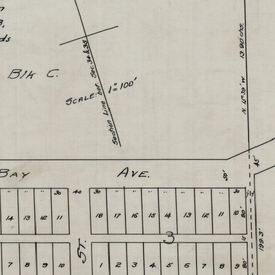
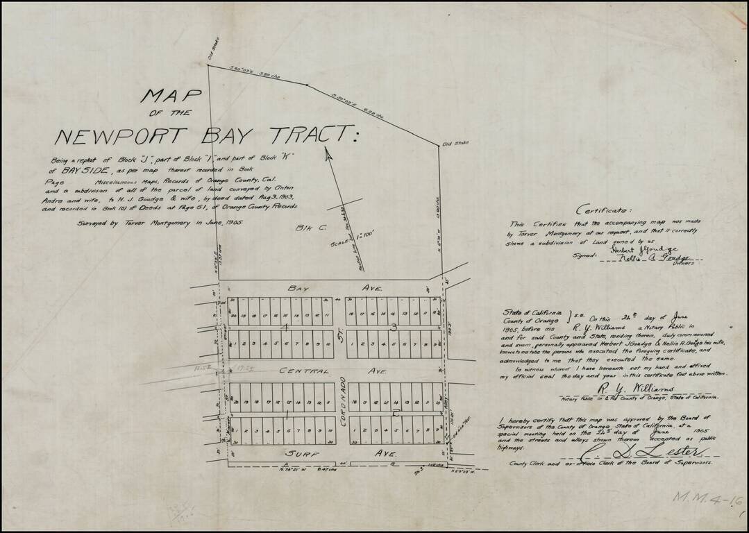
Detailed map of the "Newport Bay Tract," between Surf Avenue and Bay Avenue, centered on Coronado Street.

Surf Avenue is now East Ocean Front. Central Avenue is now Balboa Boulevard. Bay Avenue is unchanged. Alvarado Street also appears.

The land illustrated had been conveyed by Anton Andre to J.J. Goudge on August 3, 1903.


Special conditions for students!

If you are a student, write to us in telegram: @antiquemaps and indicate what material you need and for what work you need a map in high detail. We are ready to provide material on special terms. For students only!

Item information:

Year of creation:
Size:
4293x3057 px
Disk:
1735390B
Number of pages:
1
Place:
Los Angeles ?
Author:
Southern Pacific Railroad Company.
$14.99

Related item