
Rare old maps of the United States.
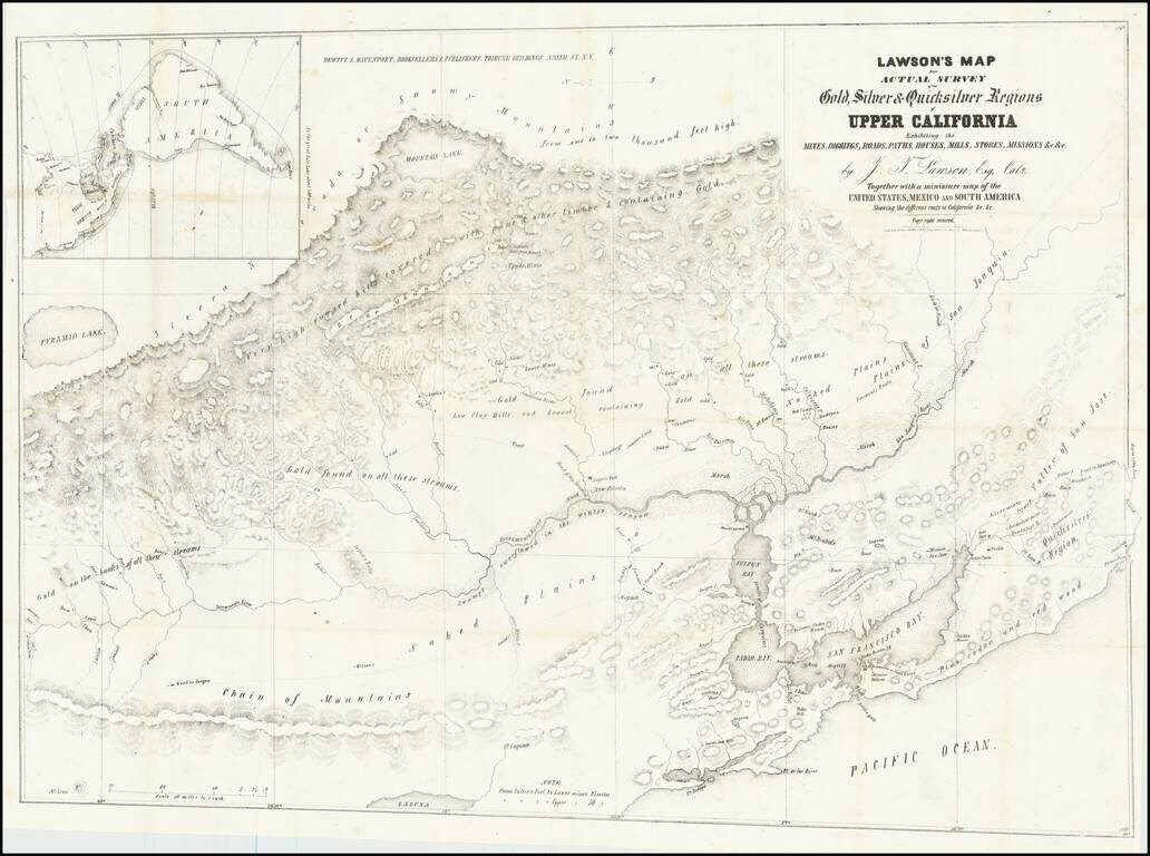
The First True Guide Map To The California Gold Regions and The First To Name Sutter's Mill. Important early map of the California Gold Regions, being the first true guide map to the newly discovered Gold Diggings and the first to name Sutter's...
![[Lower California]](/map/small/25667.jpg)
Early map of Baja California, printed in connection with an early Government exploration of the region.
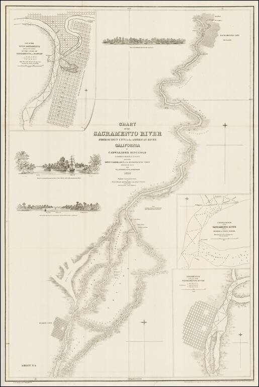
The Earliest Map of the Lower Sacramento River and San Joaquin River (Sacramento Delta) One of the earliest obtainable privately issued California charts, tracking the lower Sacramento and San Joaquin Rivers as they leave the Gold Regions of...
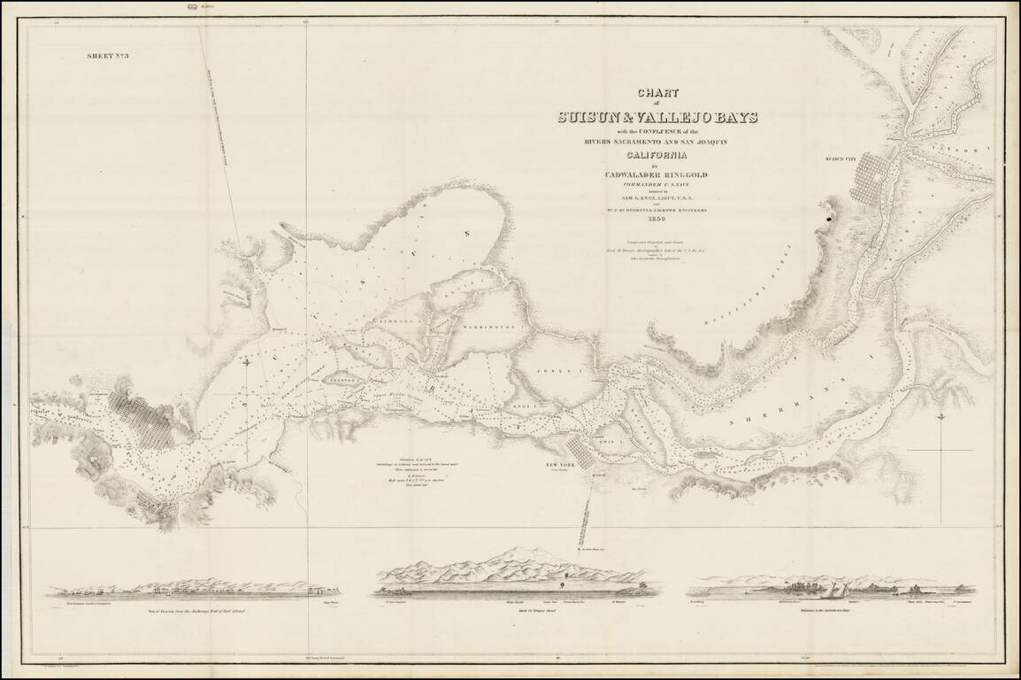
Fine example of Ringgold's map of the Sacramento River, from Suisun City and Brannan Island in the South, to Sacramento City, Boston and the American River. The map includes 3 profile views from the Sacramento River, each showing large sailing vessels...
Rare Annotated California Gold Regions Map, with a Vignette of Portsmouth Square in San Francisco, Annotated to Show The Earliest Gold Discoveries in Plumas County. Fine early map of the gold regions of California, lithographed by George F. Nesbitt,...
![Map of the Mining District of California by Wm. A. Jackson. [Proof State]](/map/small/44905.jpg)
Proof State of the First Edition of William Jackson's Map of the Gold Regions of California. The second recorded surviving example of William A. Jackson's seminal 1850 map of the California Gold Region, noted by Gary Kurutz as "as one of the best to...
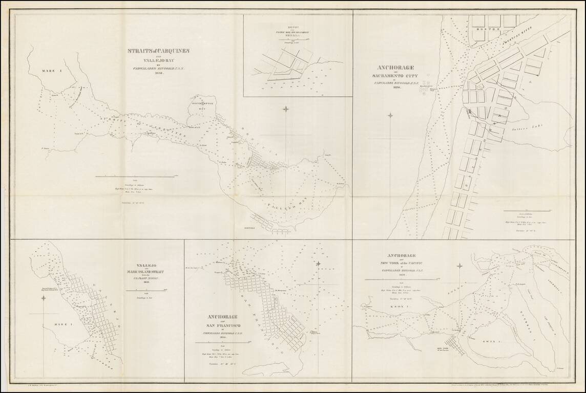
Nice example of Ringgold's chart of harbors and anchorages from San Francisco to Sacramento. The chart shows the primary anchorages in San Francisco Bay and environs at the outset of the 1849 California Gold Rush. Cadwalader Ringgold was a US Navy...
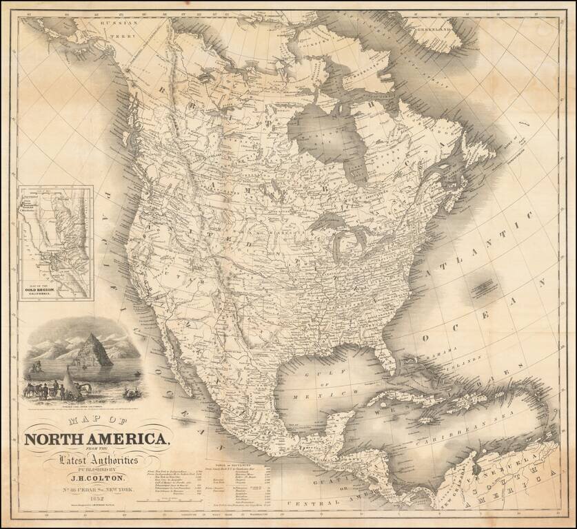
Striking Gold Rush era map of North America, published by J.H. Colton. The map includes an inset of the Gold Regions of California and a large vignette of Pyramid Lake, in Upper California. The routes to the west and the Oregon Trail are highlighted,...
![(California-Mexico Border Survey) Datos de los trabajos astronómicos y topográficos. [bound with:] Variedades de la civilizacion, nueva epoca (Tomo I)](/map/small/70777.jpg)
The First Survey of the New Border of California and Mexico. "The first detailed printed account of the regions traversed by Salazar, the surveyor for the Mexican border commission . . . Salazar's duties only took him to San Diego and to the...
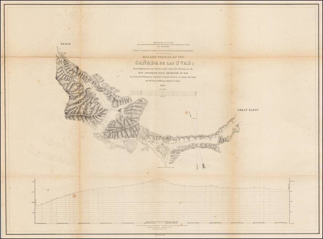
Detailed map of the region near Fort Tejon and the Tejon Pass, in Northern Los Angeles County.
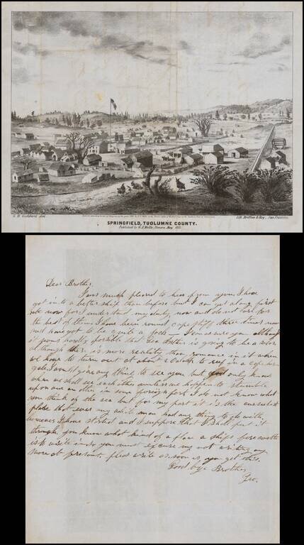
Early lettersheet birds eye view of the town of Springfield, Tuolumne County, California published in Sonora, California and engraved in stone by George H. Goddard, who would go on to become one of California's most important early surveyors. The view...
![Reconnaissance of the Western Coast of the United States From San Francisco to San Diego . . . 1852 [Rare Separately Issued & Revised Electrotype Copy]](/map/small/64536.jpg)
Early US Coast Survey Chart of the Coast of California, of one of the earliest coastal charts of the California Coastline produced in America. The chart includes 17 views of various parts of the California Coastline, including San Francisco Bay, Pt....
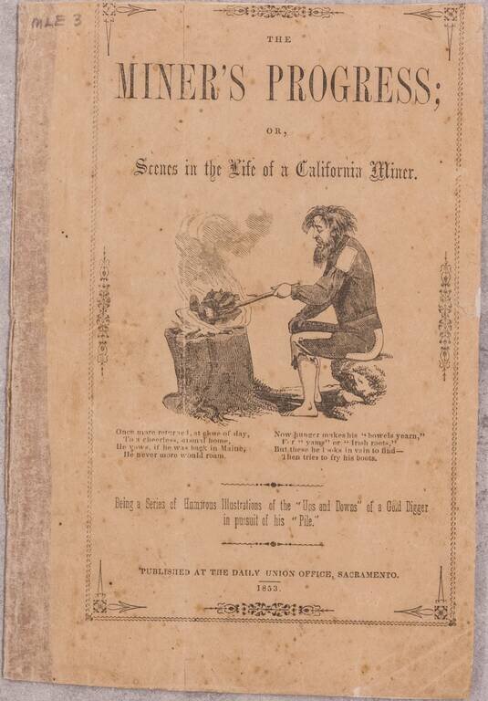
One of the Great Gold Rush Satires. The joint effort of Alonzo Delano and Charles Nahl, the present work reflects both the cynicism and the optimism among Californians after the initial excitement of the Gold Rush. Each page of the work is...
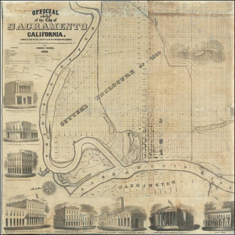
A Remarkable Survival Very rare wall map of Sacramento, oriented with east at the top of the map, showing the city at the height of the Gold Rush boom, drawn b y J.H. Peirce and lithographed by B.F. Butler. Originally printed on 8 sheets, the map...
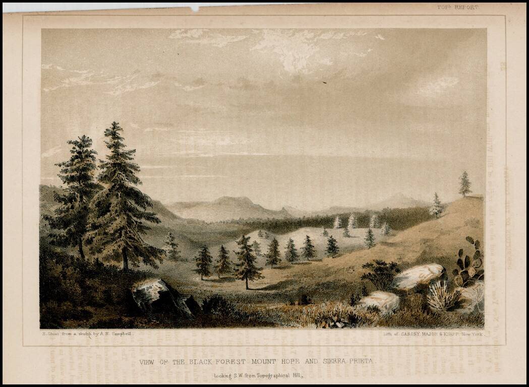
Detailed view from the Report of the United States Pacific Railroad Expedition and Surveys
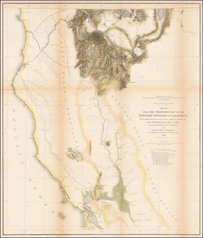
Important early survey map, covering the region between Crescent City and San Francisco Bay, showing the results of R.S. Williamson and H.L. Abbot's surveys in Oregon and California, in anticipation of the location of the first transcontinental...