logo

1875. Map of Slate Creek Basin Sierra Co. California Northern Part (and) Map of Slate Creek Basin Sierra Co. California Southern Part

  • Map of Slate Creek Basin Sierra Co. California Northern Part (and) Map of Slate Creek Basin Sierra Co. California Southern Part

Map of Slate Creek Basin Sierra Co. California Northern Part (and) Map of Slate Creek Basin Sierra Co. California Southern Part information:

Year of creation: 
Resolution size (pixels): 
 2071x1814 px
Disk Size: 
 842329B
Number of pages: 
 1
Place: 
 n.p.
Author: 

Print information. Print size (Width x height in inches):
Printing at 72 dpi 
  28.76 х 25.19
Printing at 150 dpi 
 13.81 х 12.09
Printing at 300 dpi 
 6.9 х 6.05

An example of detailing the file of this map of in a printable high-resolution:

Click to open in high resolution (open in new tab).
Attention! this is just the central piece (central area 960x960 px) of the map file!
This is an example, so that you can see and study the level of detail of a given map. The entire Map will be fully available after payment!

Map of Slate Creek Basin Sierra Co. California Northern Part (and) Map of Slate Creek Basin Sierra Co. California Southern Part

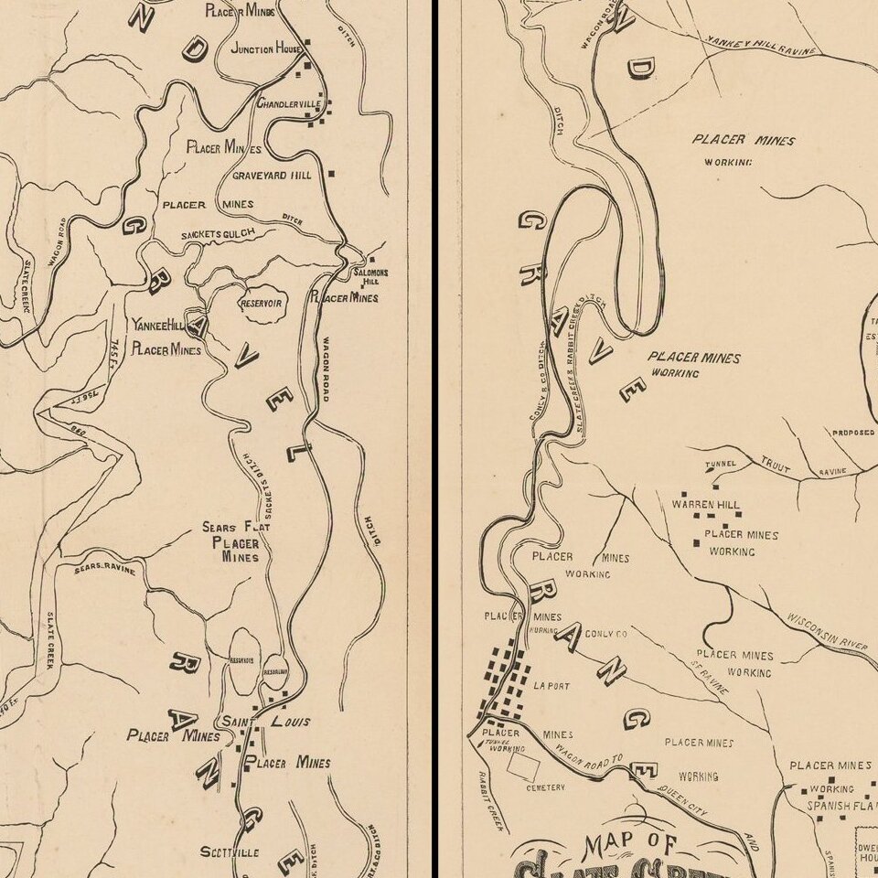
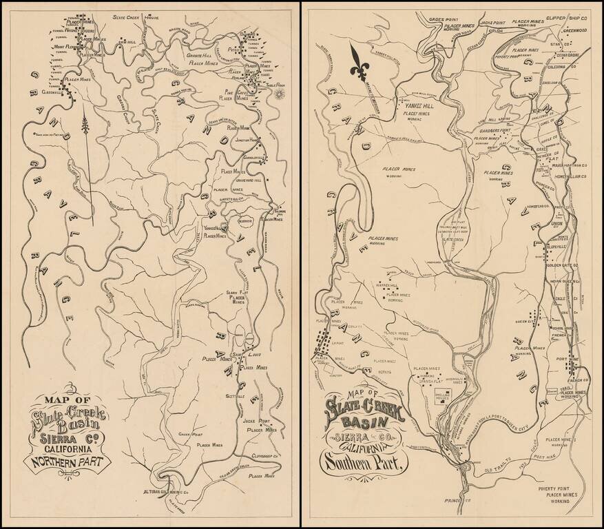
Fine Pair of California Gold Country Maps.

Scarce pair of maps showing a portion of Sierra County, in California's Gold Region, with valuable information on individual mines and tunnels.


Special conditions for students!

If you are a student, write to us in telegram: @antiquemaps and indicate what material you need and for what work you need a map in high detail. We are ready to provide material on special terms. For students only!

Item information:

Year of creation:
Size:
2071x1814 px
Disk:
842329B
Number of pages:
1
Place:
n.p.
Author:
Anonymous.
$9.99

Related item