Map size in jpg-format: 2.37734MiB
Click to open in high resolution (open in new tab).

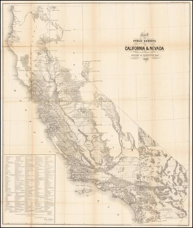
Remarkable large format map of California (along with some information in the Lake Tahoe area of Nevada), reporting the extent of the Land Office Surveys through 1863.
The most notable feature is the list of 433 private land grants for which final surveys have been completed. These land grants were essentially the certification of the Spanish-Mexican land grants throughout California, including the lands granted to the Church around the various missions and the private land grants.
The map is highly detailed, naming towns, rivers, lakes, mountains, the details in the gold mining regions, etc. An essential map for early California collectors.
The General Land Office (GLO) refers to the independent agency in the United States that was in charge of public domain lands. Created in 1812, it assumed the responsibilities for public domain lands from the United States Department of the Treasury. The Treasury had overseen the survey of the Northwest Territory, but as more area was added to the United States, a new agency was necessary to survey the new lands.
Eventually, the GLO would be responsible for the surveying, platting, and sale of the majority of the land west of the Mississippi, with the exception of Texas. When the Secretary of the Interior was created in 1849, the GLO was placed under its authority. Until the creation of the Forest Service in 1905, the GLO also managed forest lands that had been removed from public domain. In additional to managing the fees and sales of land, the GLO produced maps and plans of the areas and plots they surveyed. In 1946, the GLO merged with the United States Grazing Service to become the Bureau of Land Management.
If you are a student, write to us in telegram: @antiquemaps and indicate what material you need and for what work you need a map in high detail. We are ready to provide material on special terms. For students only!


