
Rare old maps of the United States.
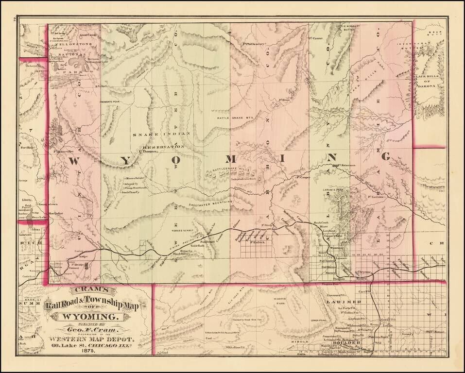
First edition of Cram's first map of Wyoming Territory. One of the few obtainable maps of Wyoming showing only 5 counties, illustrating the earliest township surveys within the Territory. The map shows Wyoming shortly before Custer's expedition...
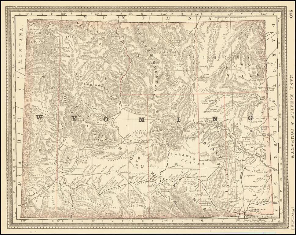
Highly detailed map of Wyoming Territory, showing towns, rivers, railroads, mountains, lakes, etc. One of the earliest seperately issued maps of Wyoming to appear in a commercial atlas.
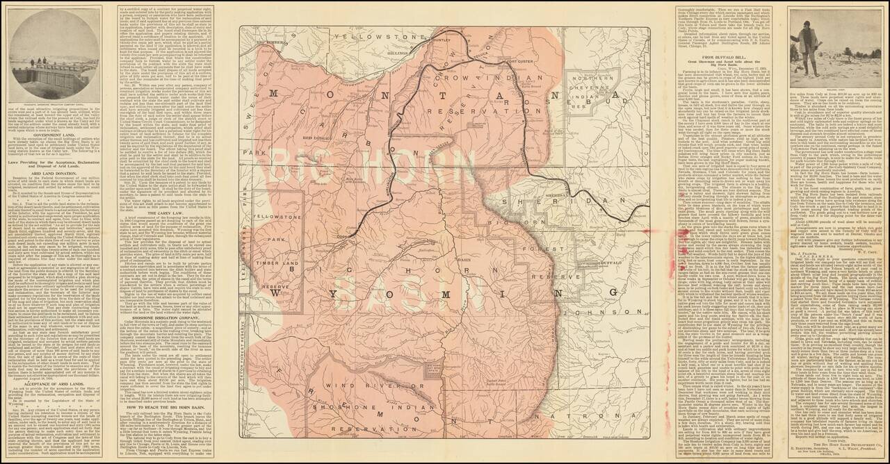
Promotional brochure and map promoting the Burlington Route. Includes a number of photographs and a smaller map on the verso.
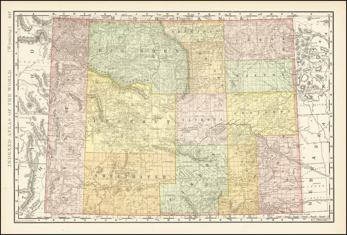
Highly detailed map of Wyoming Territory showing towns, rivers, railroads, mountains, lakes, etc. A fine early map of Wyoming Territory.
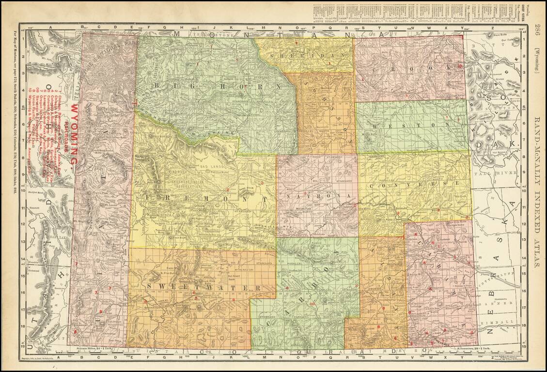
Highly detailed map of Wyoming Territory showing towns, rivers, railroads, mountains, lakes, etc. Includes a list of 9 Railroads at the top left.
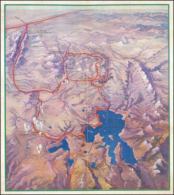
Attractive vintage pictorial bird's-eye view map of the Yellowstone National Park, produced by the Poole Brothers firm for the Chicago Milwaukee and St. Paul Railway in 1927. The map shows all of Lake Yellowstone and the surrounding region, with...
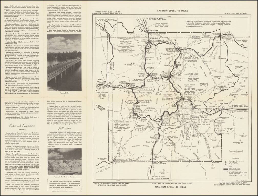
Don't Feed The Bears! Detailed 1941 map of old Yellowstone in Wyoming, published by the US Department of the Interior. Provides a fine overview of the roads, trails, campgrounds, hotels, geysers, and major points of interest in the park.
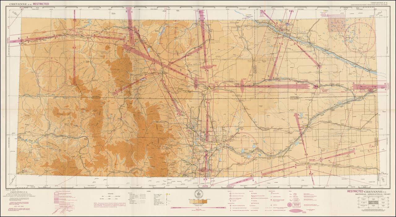
Restricted World War II Aviation Map Detailed aeronautical map of the Cheyenne, Wyoming region. The chart is a font of information about civil and military aviation during WWII. It was intended for civil aviators flying by visual navigation and so...
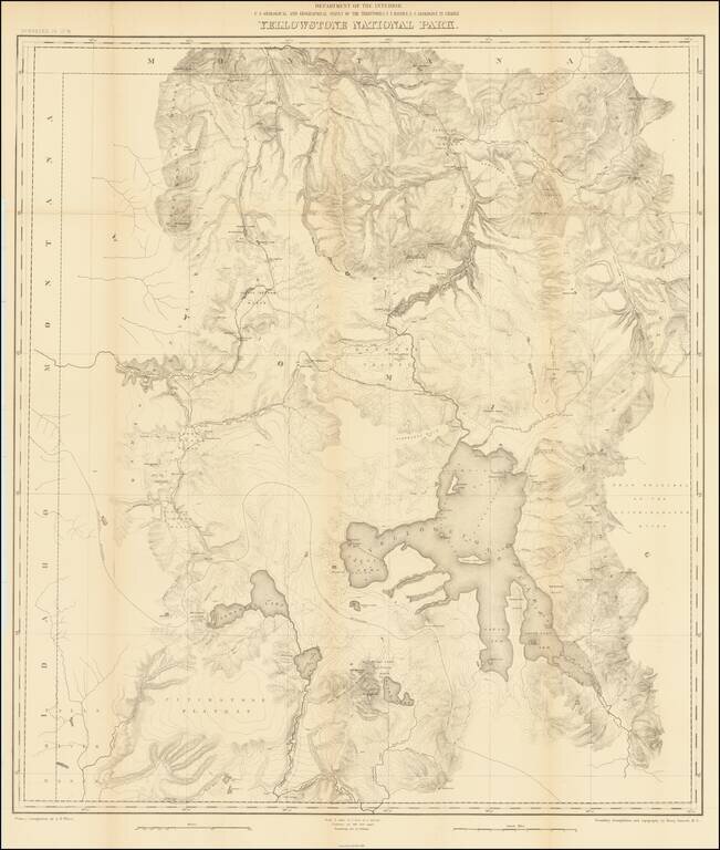
Second Hayden Survey Map of Yellowstone National Park A nice example of this fine large map of Yellowstone, prepared by the Department of the Interior. The map was prepared in connection with the second survey of the park by Ferdinand V. Hayden, the...
The Benevento Copy. The Earliest Printed Map of the Northwest Coast of North America Fine old color example of this rare, important map depicting the west coast of North America, derived from Plancius's world map of 1592. De Jode's map is one of the...
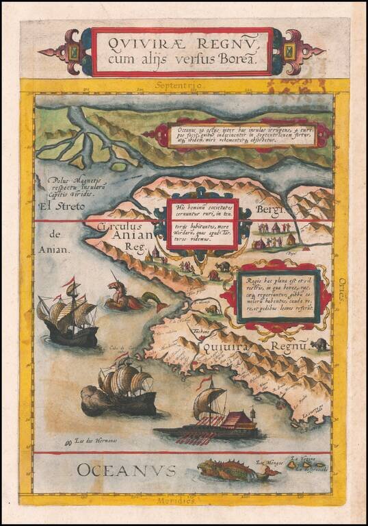
![Limes Occidentis Quivira et Anian. 1597 [Pacific Northwest & Northwest Passage]](/map/small/71207.jpg)
The Second Printed Map of the Northwest of North America, including the Northwest Passage. This is a fine example of Wytfliet's map of the Northwest Coast of North America, the second printed map to focus on the region which would become Alaska and...
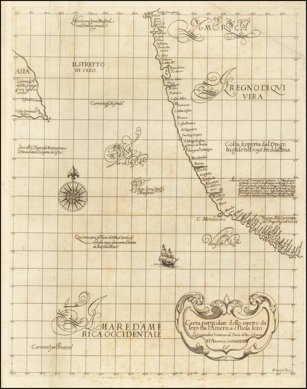
![[California Coastline] Carta particolare della America e parte maestrale dal C: di Cedros… D'America carta XXXII](/map/small/58075.jpg)
The Earliest Obtainable Sea Chart of the Coastline of California Fine example of the first edition of Robert Dudley's chart of the California Coastline, the earliest obtainable chart of the region and the first printed map to note the prevailing...
"The First Printed Sea Chart of the Northwest Coast of North America" (San Francisco to Vancouver Island) Rare early sea chart of the Pacific Northwest, from Sir Robert Dudley's Dell'Arcano del Mare. The chart shows all of the American Pacific coast...
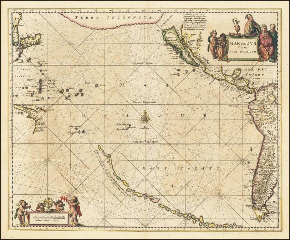
A fine example of Jansson's sea chart of the Pacific, the first chart of the Pacific to show California as an island and the earliest sea chart of the Pacific to appear in a Dutch Atlas. A long chain of islands appears in the South Pacific, which are...
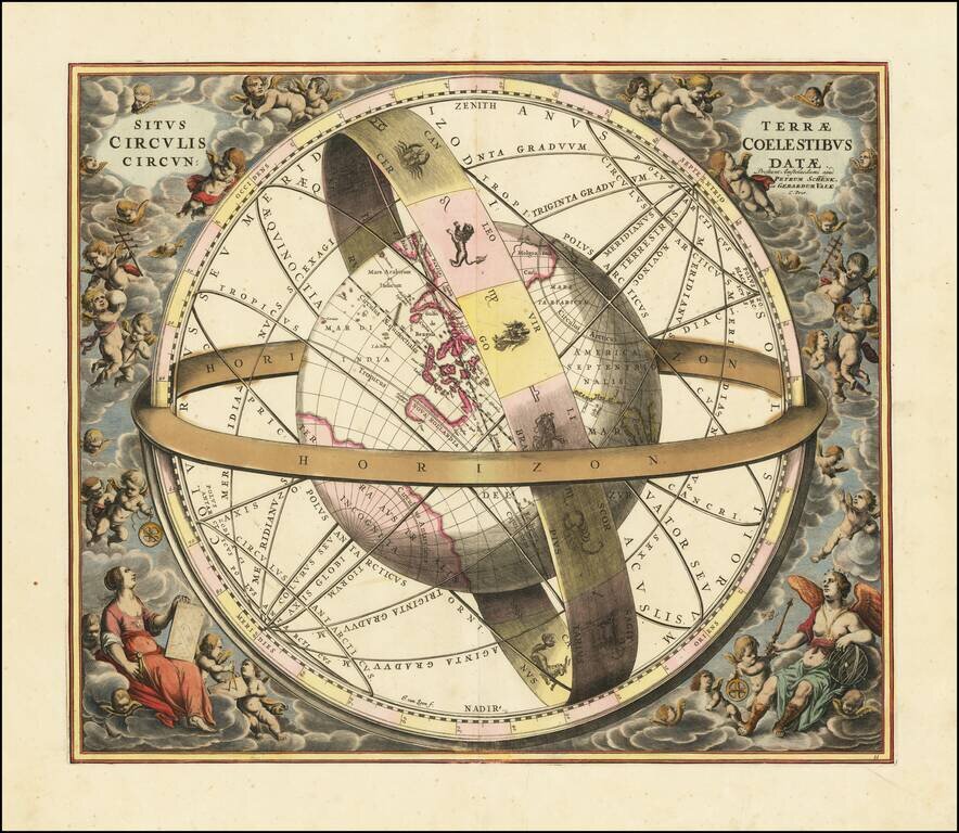
Striking original hand-color celestial chart, showing a Ptolemaic model of the Universe, with the earth in its relation to the plane of the ecliptic, from the 1708 Valk & Schenk edition of Andreas Cellarius' Harmonia Macrocosmica seu Atlas...

Fine example of Johannes Van Loons' sea chart of the Pacific Ocean, extending from Australia, New Zealand and Japan to California. Van Loon's chart is among the earliest regional maps to focus on the Dutch discoveries in New Zealand and Australia. Van...