
Rare old maps of the United States.
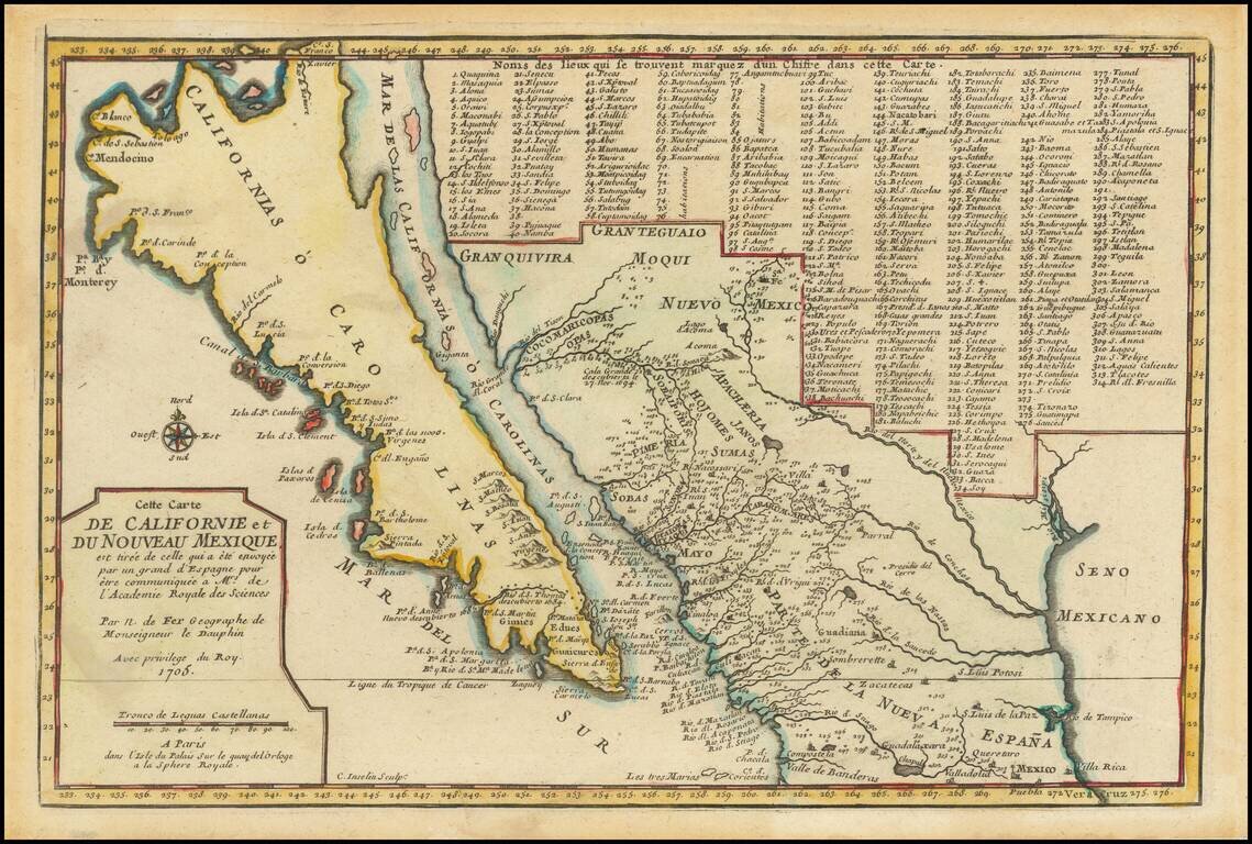
De Fer’s Map of the Southwest Based Upon the Earliest Reports of Father Kino -- One of the Few Regional Maps to Show the Island of California Scarce second state of De Fer's map of California, bearing the date 1705. This is one of a select few...
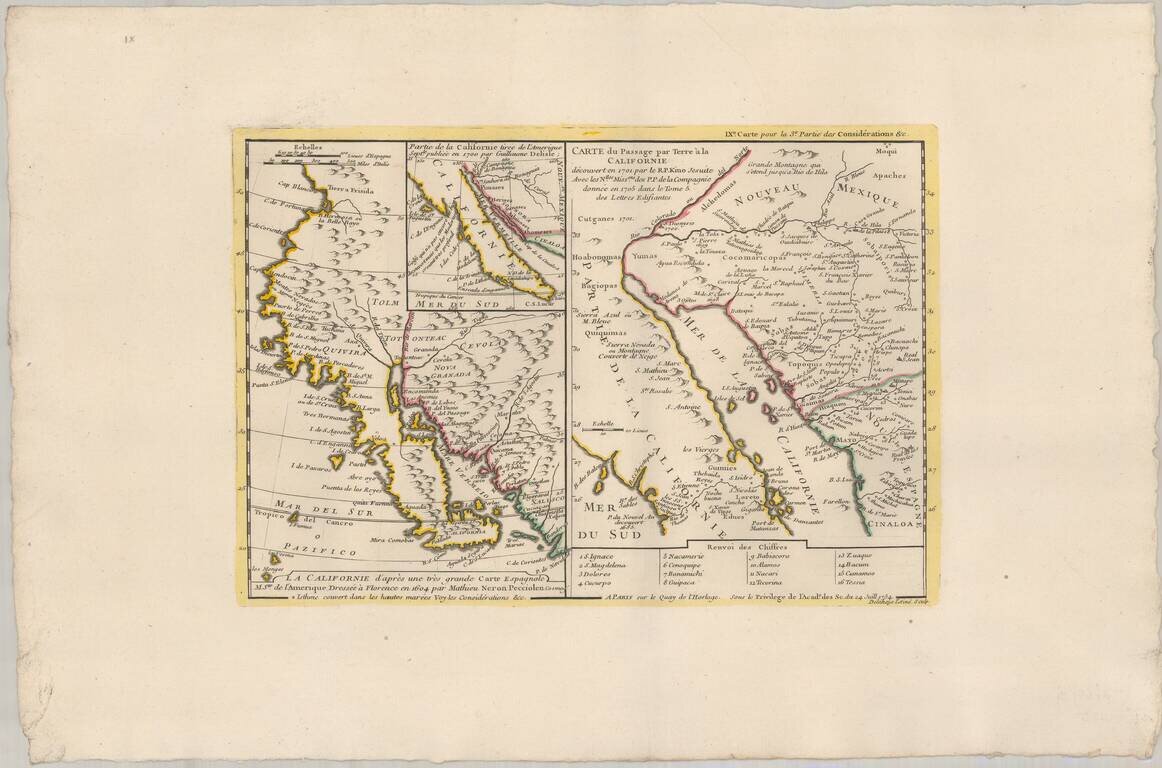
Truly beautiful example of a historically important 18th century map of California. Bauche's mapsheet comprises three mappings of California as a peninsula, following the discoveries of Eusebio Kino, the Italian Jesuit missionary. Bauche includes the...
![[The 5 Californias] Carte De La Californie Suivant 1. La Carte manuscrite de l'Americque de Mathieu Neron Pecci olen dressee a Florence en 1604, 2. Sanson 1656 . . .](/map/small/67157.jpg)
Survey of the Fine Early Maps of California A historically important depiction of the 5 most influential cartographic depictions of California, showing the evolution of how California was mapped between 1604 and 1767. The earliest map is (upper...
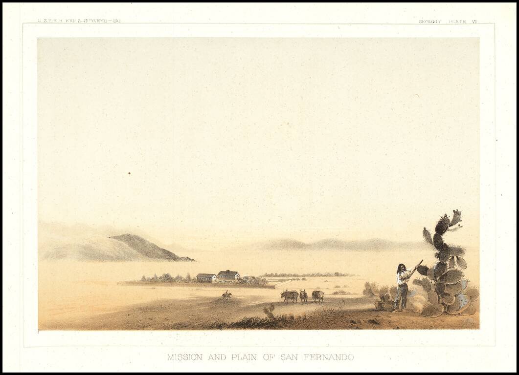
The earliest view of the Mission of San Fernando and the Valley, which accompanied Vol. V of the Reports of Explorations and Surveys to Ascertain The Most Practicable Route To the Pacific.
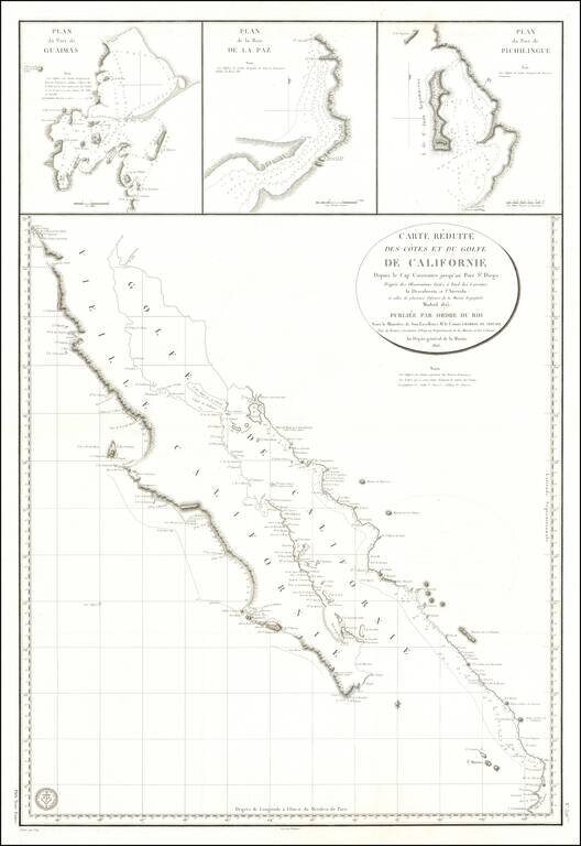
Baja California Immediately After Mexican Independence Rare large scale map Baja California, prepared by the French Government, based upon a Spanish Chart published the preceding year. In addition to all of Baja California, the map depicts the area...
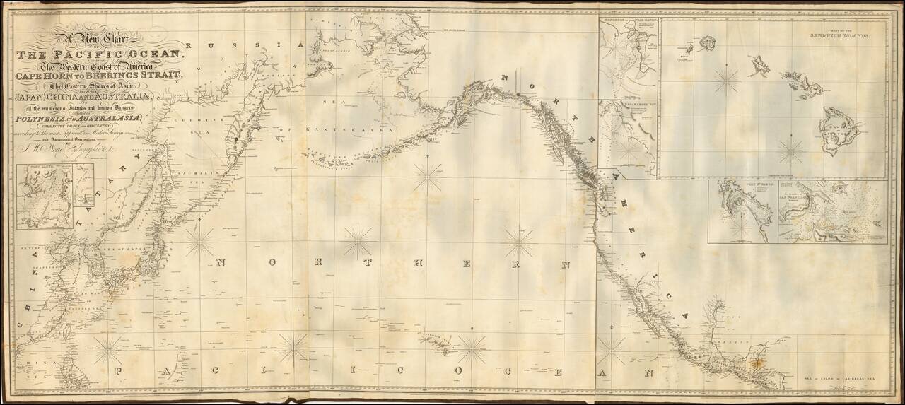
![[Pacific Whaling] A New Chart of The Pacific Ocean, Exhibiting The Western Coast of America from Cape Horn to Beerings Strait, The Eastern Shores of Asia Including Japan, China . . . according the most Modern Surveys . . . Additions to 1836 (Large Insets](/map/small/56007.jpg)
With Manuscript Tracks Showing the Course of An American Whaler in the Pacific. Fine example of Norie's monumental sea chart of the Pacific Ocean. The chart is noteworthy for the large insets maps of San Francisco, San Diego, Hawaii, Honolulu and...
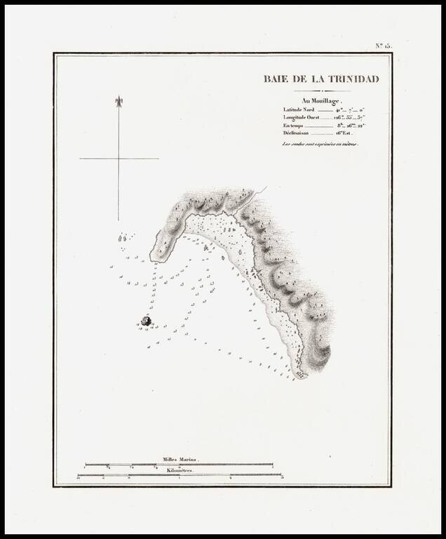
The earliest separately issued map of Trinity Bay, which appeared in Duflot de Mofras' report of his travels on the West Coast of North America. In 1839, Eugene Duflot de Mofras, was assigned to the embassy in Mexico City and instructed to visit the...
The earliest separately issued map of Trinity Bay, which appeared in Duflot de Mofras' report of his travels on the West Coast of North America. In 1839, Eugene Duflot de Mofras, was assigned to the embassy in Mexico City and instructed to visit the...
Fine example of Norie's monumental sea chart of the northern part of the Pacific Ocean. The chart is noteworthy for the large inset views of San Francisco, San Diego, Hawaii, Honolulu and Karakakoa Bay in Hawaii. Issued with revisions up to 1844,...
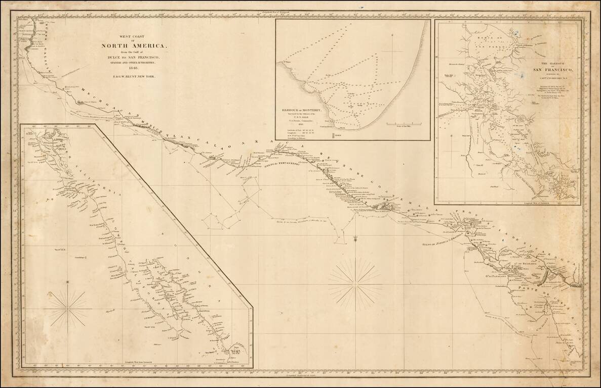
Rare sea chart of California, Mexico and Central American coastline, showing the southern sea route to San Francisco printed on the eve of the California Gold Rush. This fine chart depicts the length of the Pacific Coast of North and Central America,...
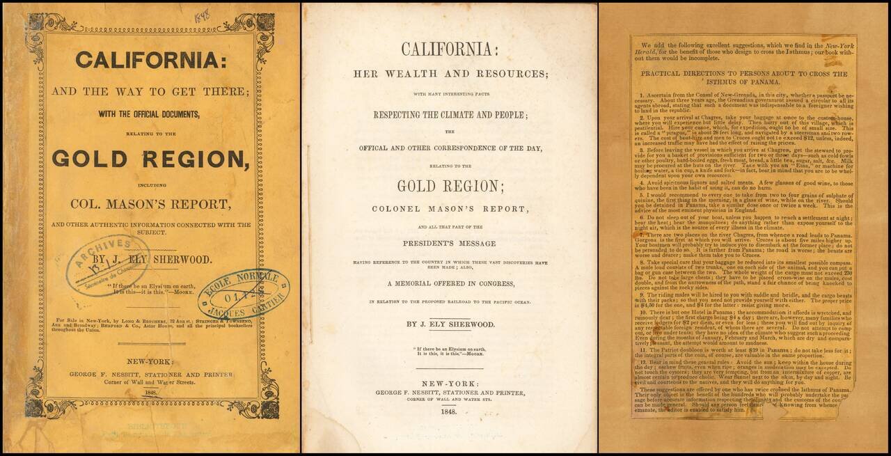
The First Edition of One of the First Publications On The Discovery of Gold in California. The First Guidebook Aimed at Gold Rushers. This is one of the first printed guides to California, issued after the gold discovery became known in the East. It...
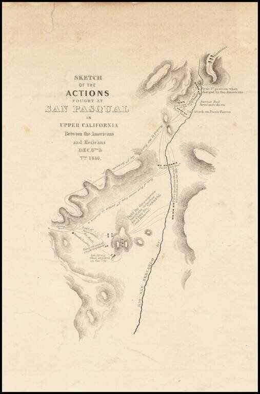
Nice example of Emory's map of the Battle of San Pasqual, in North San Diego County, one of the earliest military battles fought in Upper California. The Battle of San was fought during the Mexican-American War in what is now the San Pasqual of San...
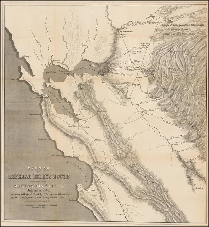
Important early map of the gold region in California, published shortly after the discovery of gold in California. Striking map of the gold region, showing region from San Francisco and Monterey Bays in the west to the western slope of the Sierras....
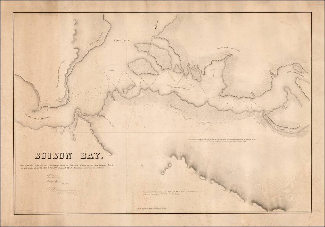
The Earliest Privately Surveyed Navigational Chart of the California Gold Rush Era -- Surveyed By William Tecumseh Sherman Rare and very early navigational chart of Suisun Bay from Carquinez Strait to the confluence of the Sacramento and San Joaquin...
![Chart of the Coast of California from San Blas to San Francisco Drawn chiefly from the Spanish Surveys, the Charts of Vancouver &c. the whole much improved by recent observations made by English and French Naval Officers . . . 1854 [Additions to 1862]](/map/small/58999.jpg)
An Early Sea Chart of the Coast of California with Manuscript Annotations From Early Use at Sea Striking large scale blue-backed sea chart of the California, significantly revised and improved from the 1849 edition. Visually striking and rare sea...
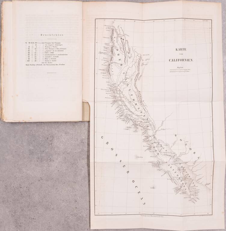
With a Rare 1849 Map of California. This early German description of California was published to take advantage of the keen European interest in the California gold discovery. Like many such publications, the author drew heavily upon previous travel...