Map size in jpg-format: 1.07051MiB
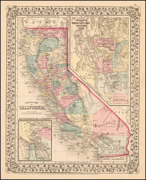
Fine early example of Mitchell's map of California, colored by county.
Shows towns, railroads, roads, mountains, lakes, dry lakes, rivers, forts, etc. Insets of San Francisco Bay and the area around Salt Lake, with counties. Decorative border.
Includes early county configurations in California. Still lacks Riverside, Orange, Imperial and Ventura Counties. Shows early wagon routes, railroad lines, an early immense Owens Lake and Tulare Lake. An excellent Civil War vintage map of the region.
Samuel Augustus Mitchell Jr. inherited the Mitchell Company from his father in 1860. For over thirty years, the company had specialized in the production of school atlases and wall maps of America. They were one of the pioneers on engraving on steel plates. In 1860, Samuel Jr. released the New General Atlas, which had been compiled in house and replaced a previous atlas by Tanner. The elder Mitchell died in 1868 and Samuel Jr. continued the business until the 1890s. At its height, the Mitchell Company employed 250 people and sold 400,000 publications annually.
If you are a student, write to us in telegram: @antiquemaps and indicate what material you need and for what work you need a map in high detail. We are ready to provide material on special terms. For students only!


