
![[First map of Michigan Territory published in Europe] Carte Geographique, Statistique et Historique De Michigan](/map/small/61757.jpg)
Highly important early map of Michigan Territory, being the first separate map of Michigan Territory published outside of the United States. Virtually no settlements in the interior and the upper peninsula, with most of the towns concentrated on the...
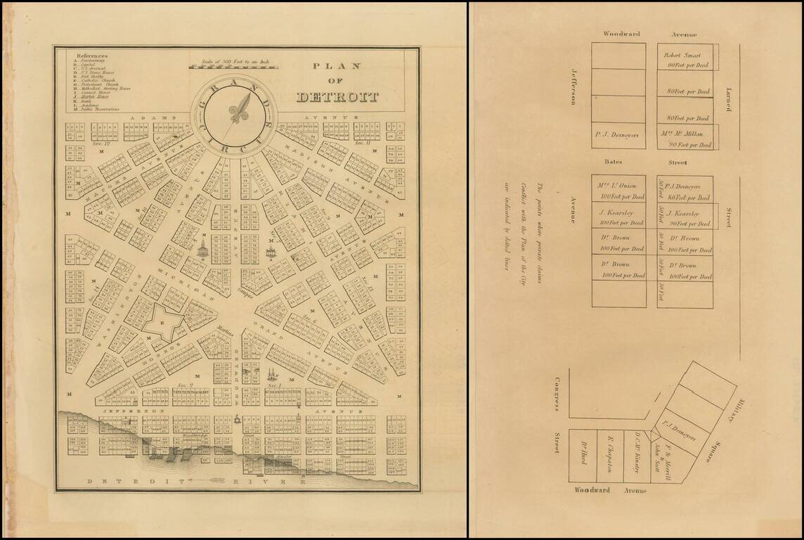
Rare early plan of Detroit from the first edition of the American State Papers. A highly desirable early plan of Detroit. With the additional leaf showing plots off of Larned Street and Bates Street.
![[Michigan Territory] A New Map of Michigan with its Canals, Roads & Distances by H.S. Tanner](/map/small/68804.jpg)
Michigan 4 Years After Statehood Scarce early example of Tanner's map of Michigan Territory, with interesting early/primitive counties, Indian Lands, etc. Some of the northern counties are not yet completely formed.
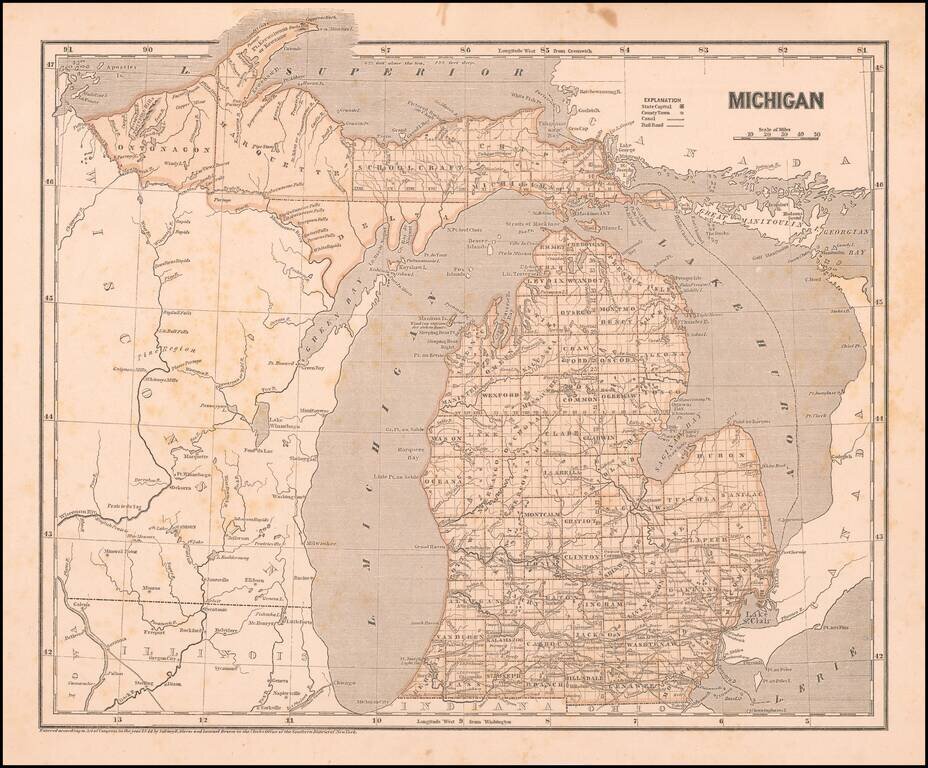
Marvelous and highly detailed map from Morse's important Atlas of North America, the first cerographic atlas. Shows towns, roads, rivers, townships, etc. Morse & Breese's North American Atlas was a landmark in American Cartography, being the first...
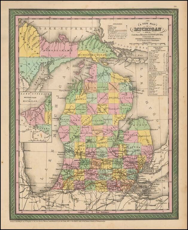
Detailed and interesting map of Michigan, hand colored by county and showing towns, rivers, bays, lakes, railroads, roads, distances, etc. Tables of Steam Boat routes and distances. A nice example of this increasingly difficult map to obtain, from an...
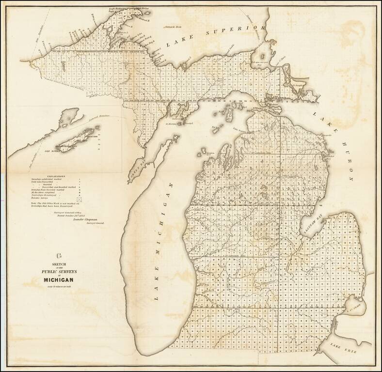
Lithographed map of the progress of the government surveys in Michigan up to 1853. The map has the statement of authority of Leander Chapman, Surveyor General of the Detroit Office, October 28th 1853. This state of the map includes the inset of Isle...
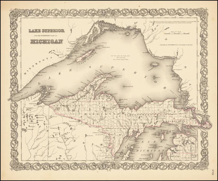
Rare outline color example (first state) of Colton's map of Lake Superior and the Upper Peninsula. Detailed map of the region, showing towns, townships, rivers, lakes, etc. Still no railroad service. JH Colton was one of the pre-eminent American map...
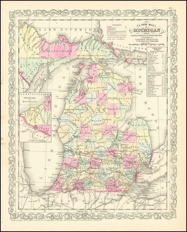
Scarce Charles Desliver map of Michigan, hand colored by county and showing towns, rivers, bays, lakes, railroads, roads, distances, etc. Tables of Steam Boat routes and distances. A number of Michigan Counties still not yet formed. Railroads are...
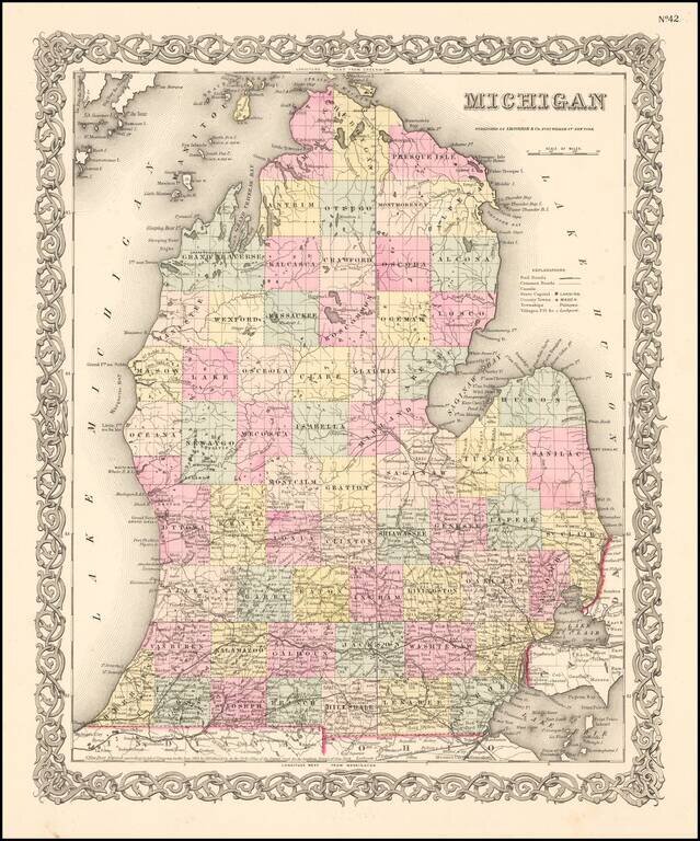
Flawless example of Colton's map of Michigan, colored by county, showing towns, roads, railroads, lakes, rivers, etc. Beautiful decorative border.
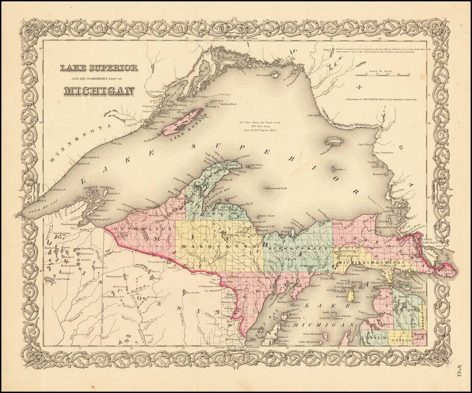
Detailed map of the region, colored by counties and showing towns, townships, rivers, lakes, etc. Still no railroad service. JH Colton was one of the pre-eminent American map publishing firms in the mid-19th Century.
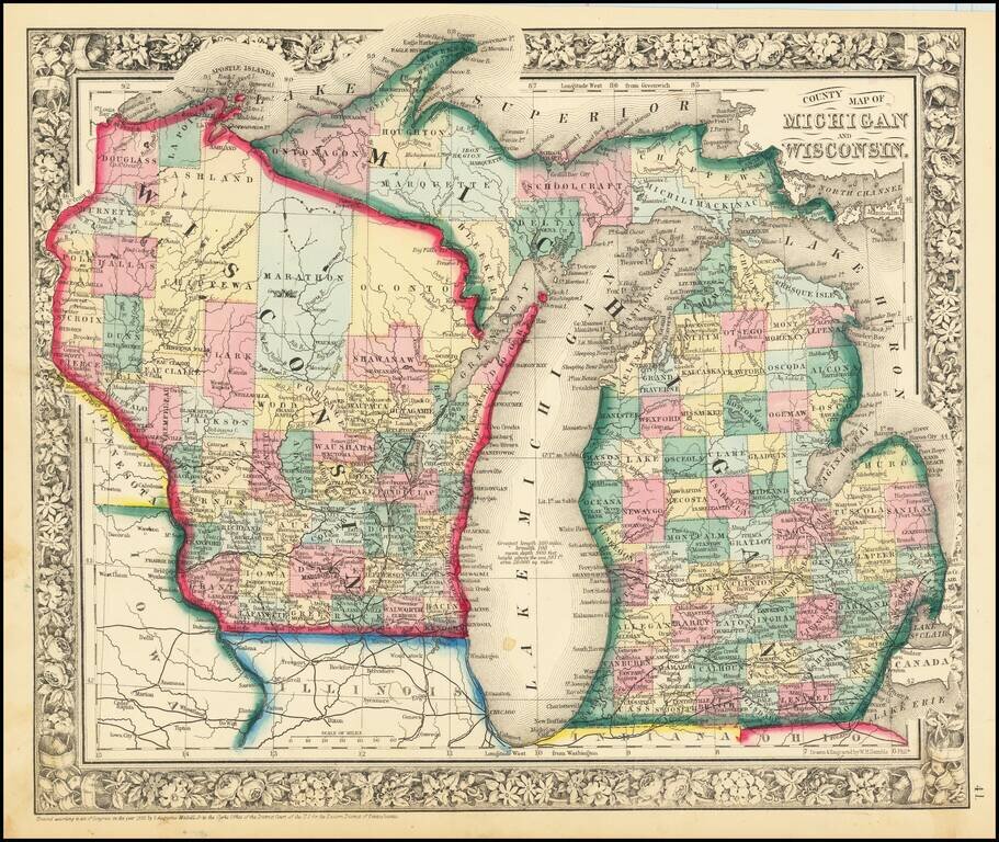
Attractive map of Michigan and Wisconsin, published by SA Mitchell Jr. The map is colored by counties. Shows early railroads, proposed railroads, towns, rivers, Indian region, etc. Decorative floral border.
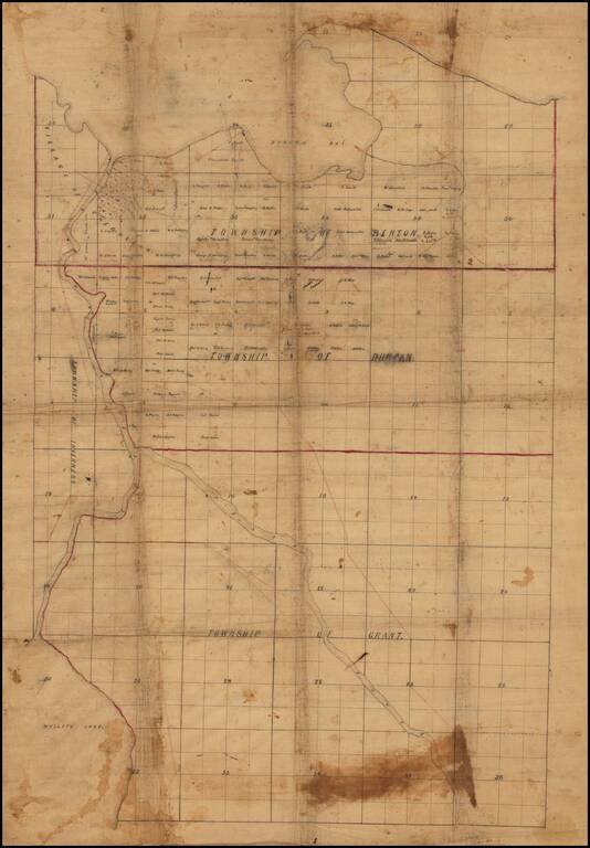
Finely drafted map of part of Cheboygan County in northern Michigan, likely drafted by a local surveyor. Place names include: Village of Cheboygan Township of Benton Township of Duncan Township of Grant Township of Inverness Information on...
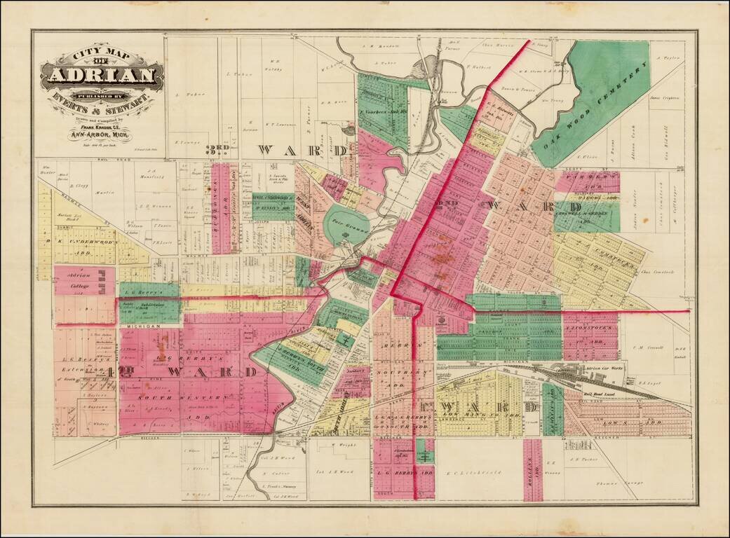
Detailed cadastral map of Adrian Michigan. The map shows wards, subdivisions, railroads, streets, etc.
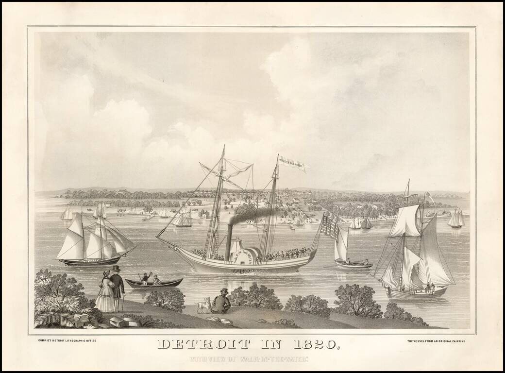
Fine example of this rare early view of Detroit, published in Detroit by Corrie's Detroit Lithographic Office, based upon a painting from 1820. This is one of the earliest birdseye views of Detroit we have seen.
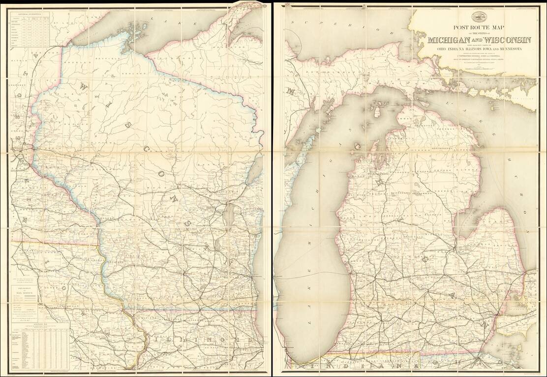
Superb and very rare official post route map of Michigan and Wisconsin from 1871. The map shows all of Michigan and Wisconsin, with coverage to adjacent areas including Chicago, the Twin Cities, and Toledo. The map differentiates between seven kinds...
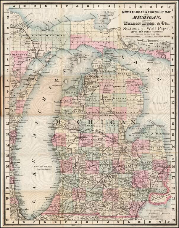
A Michigan Rarity Rare separately published pocket map of Michigan, published by Nelson Bros. & Co. of Grand Rapids Michigan. The map licensed from George F. Cram of Chicago, as noted in the copyright to the left of the title, dated 1878. Cram...