
![[Manuscript Survey of the a portion of the State Road from New Albany to Princeton, Indiana in 1831]](/map/small/21225.jpg)
Fascinating manuscript map with contemporary annotations, showing a portion of the proposed route of the State Road between New Albany, Indiana and Princeton, Indiana, prepared by John L. Smith at the direction of the Indiana General Assembly (and in...
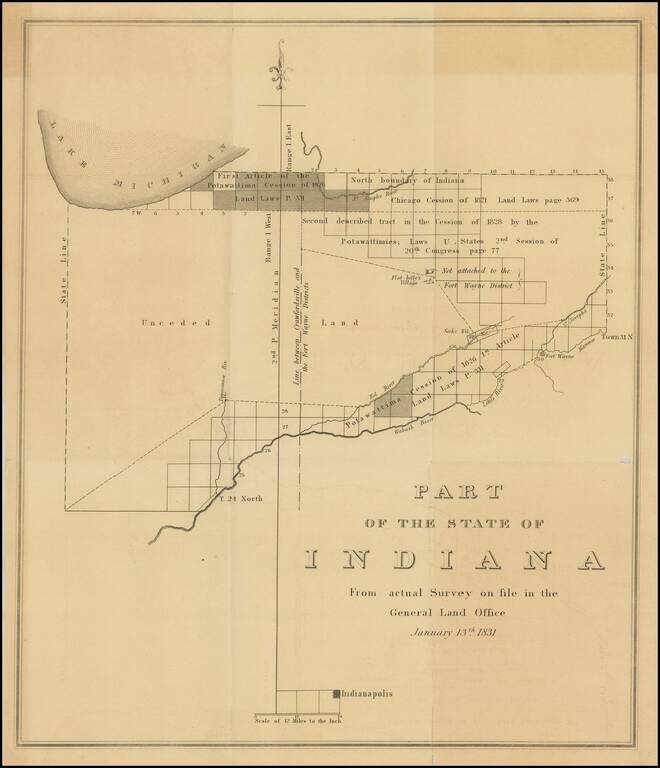
Important early survey map of Indiana, published by the General Land Office. Shows the area from Indianapolis north to Lake Michigan. The map identifies on a regional basis a number of early Indian Treaties and the lands impacted thereby, along with...
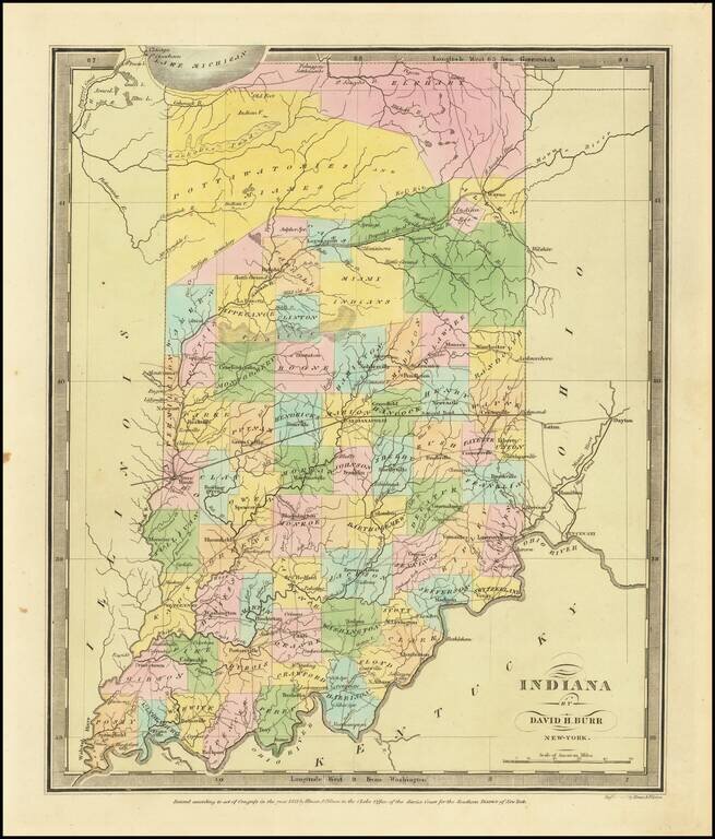
Full color example of the first edition David Burr's map of Indiana, which appeared in his Universal Atlas, first issued in 1836. Includes fascinating primitive counties, including massive regions designated for the Pottawatomies and Miamis Indians,...
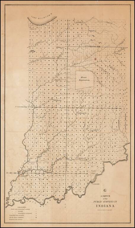
One of the earliest obtainable government survey maps of Indiana. The map is divided into surveyed townships and includes notes as to whether the field notes of the survey have been transcribed and/or recorded, township plats recorded and proposed new...
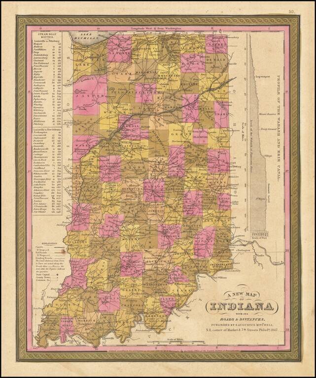
Detailed and interesting map of Indiana, hand colored by county. Shows towns, rivers, lakes, railroads, roads, distances, forts, etc. Includes table of steamship routes, distances, etc.
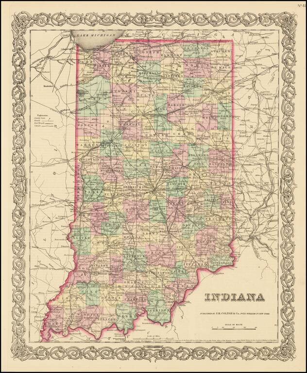
Detailed map of Indiana, published by JH Colton. The map is colored by counties and showing towns, townships, roads, railroads, canals, post offices, rivers, lakes, etc. From the first edition of JH Colton's New General Atlas. JH Colton was one of...
![[Map Letterhead] Office of the Ohio Falls Car Company. Jeffersonville, Ind. . . .](/map/small/59325.jpg)
Business letter on written on stationary with a marvelous birdseye view masthead for the Ohio Falls Company of Jeffersonville, Indiana. The Ohio Falls Car & Locomotive Company was founded at Jeffersonville, Indiana, June 1, 1864. It was likely...

Decorative and unusual trading card map from this famous series. Map is surrounded by decorative vignettes.
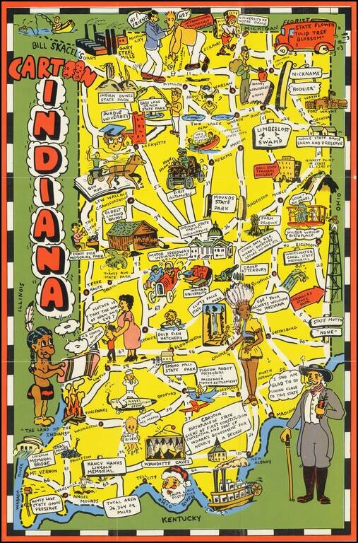
Scarce pictorial map of Indiana. The map provides a whimsical image of Indiana's tourists and other important sites, with roads and distances noted. On verso: photos of scenic views, landmark and text.
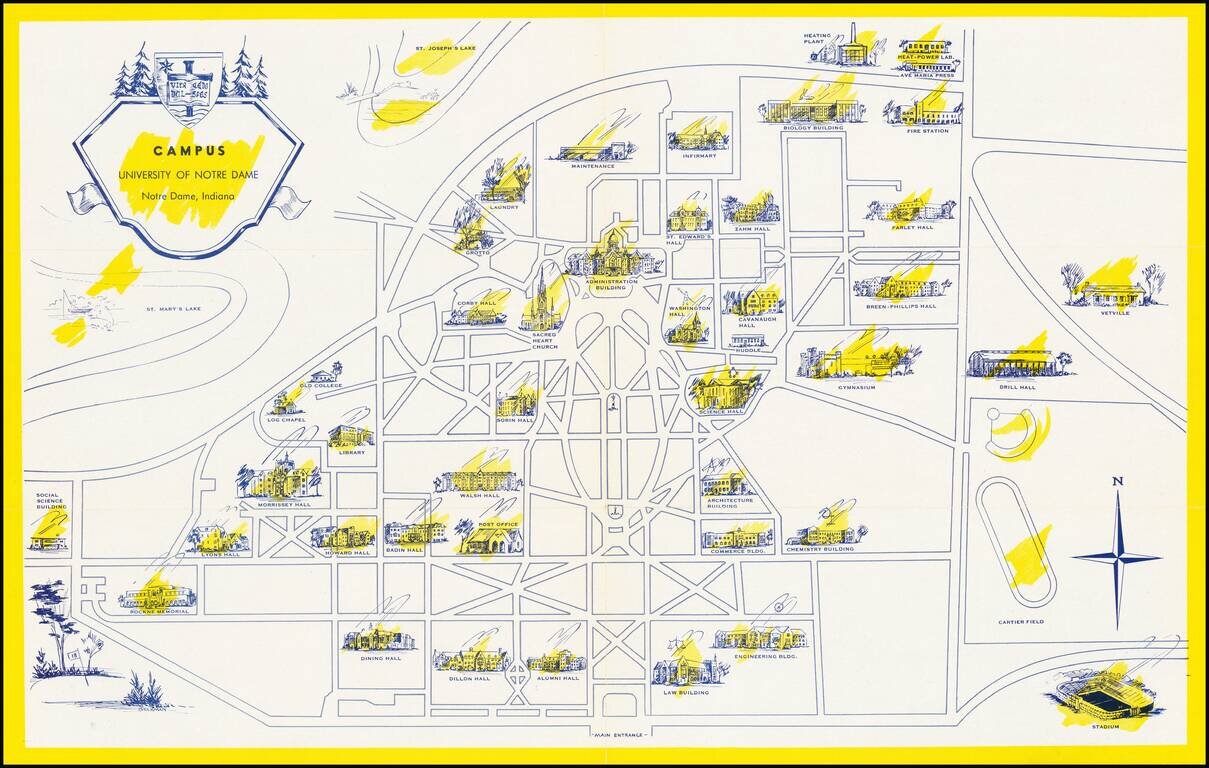
Scarce pictorial map the University of Notre Dame campus in South Bend, Indiana. The recto shows the campus with important buildings, including Notre Dame Stadium (opened in 1930), scattered around the grid of pathways and roads. On the verso, the...
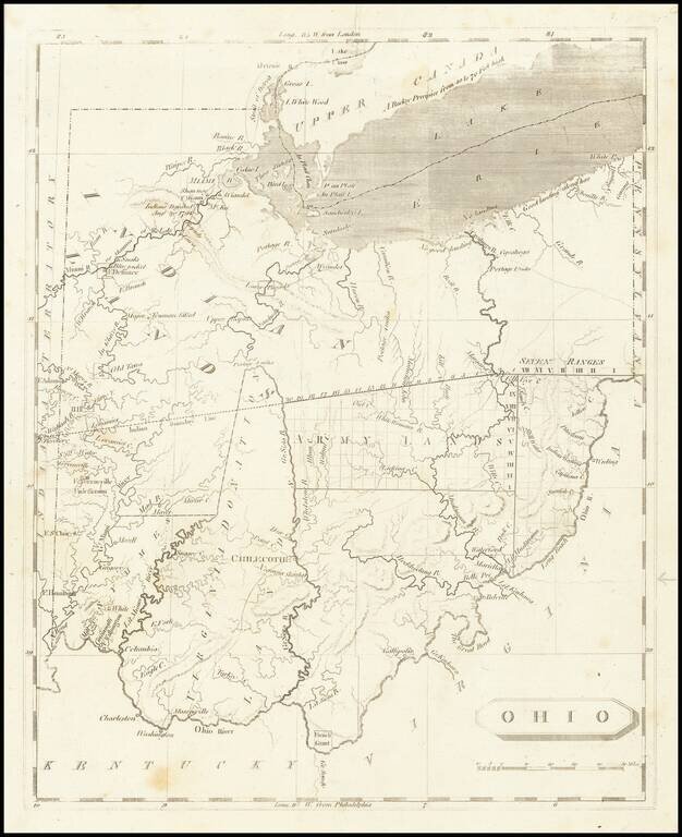
One of the First Printed Maps of Ohio -- Published Just Months After Ohio Statehood Important early map of Ohio from Arrowsmith & Lewis' New and Elegant General Atlas. The map appeared only months after Ohio became a state on March 1, 1803. The...
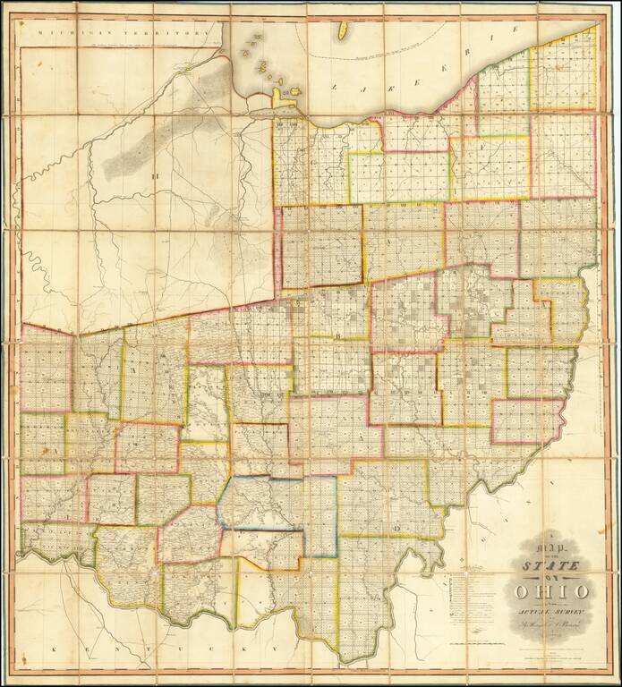
The First Great Map of Ohio Fine example of the Hough & Bourne map of Ohio, published in Chillicothe, Ohio, prepared by John Melish and printed by Benjamin Tanner in Philadelphia in 1815. Hough & Bourne's map of Ohio is the second large...
![[Edwinburgh, Ohio] (Millsboro Township, Richland County)](/map/small/66072.jpg)
An Early Ohio Town Plan Produced For An Early (Failed) Ohio Bank Proprietor Hand drawn town plat and testimonial for the town of Edwinburgh, in Richland County, Ohio, which would later become Millsboro, on the Clear Fork branch of the Mohickan River....
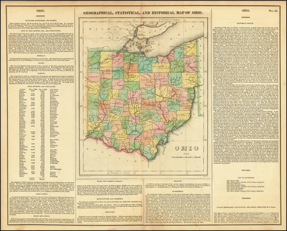
Striking old color example of the first edition of Carey & Lea's map of Ohio. Includes wonderful contemporary details concerning the topography, indigenous lands, rivers, climate, towns, manufacturing, commerce, education, history, population by...
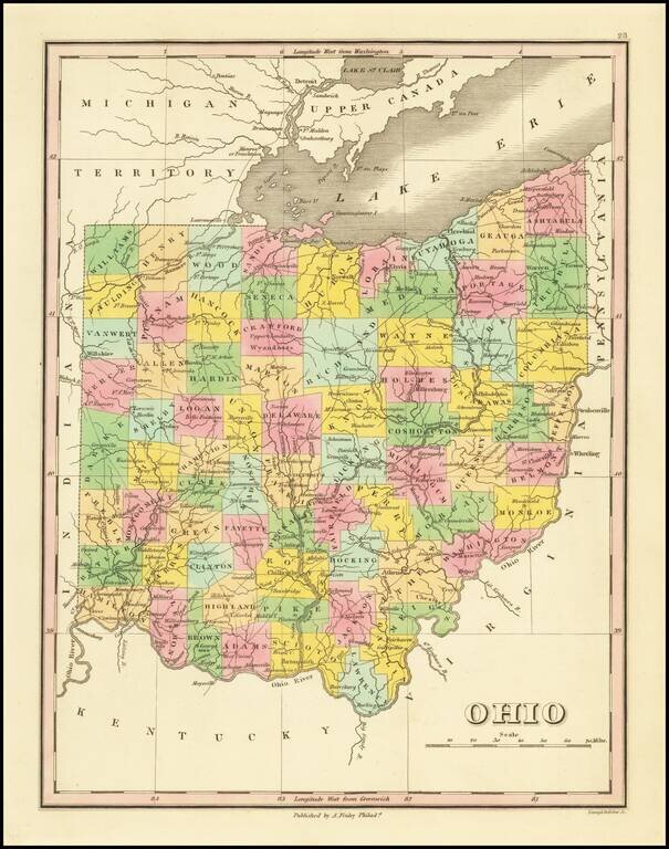
Nice map of Ohio from an early edition of Finley's New General Atlas, colored by counties and showing towns, roads, rivers, mountains and other geographical features. The western portion of the state lacks several counties. One of the best maps of the...
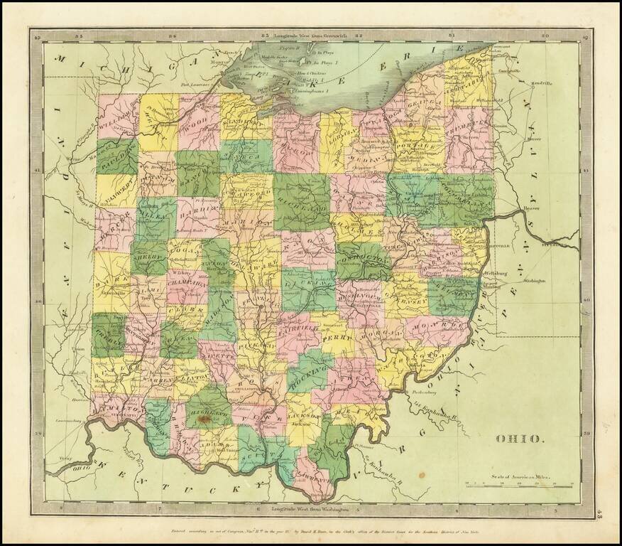
Full color example of the first edition David Burr's map of Ohio, which appeared in his Universal Atlas, first issued in 1836. Burr's Atlas was perhaps the most elegant American commercially published atlas of its time, utilizing wonderful wash colors...