logo

1841. [Michigan Territory] A New Map of Michigan with its Canals, Roads & Distances by H.S. Tanner

  • [Michigan Territory] A New Map of Michigan with its Canals, Roads & Distances by H.S. Tanner

[Michigan Territory] A New Map of Michigan with its Canals, Roads & Distances by H.S. Tanner information:

Year of creation: 
Resolution size (pixels): 
 7994x9876 px
Disk Size: 
 20.605MiB
Number of pages: 
 1
Place: 
 Philadelphia
Author: 

Print information. Print size (Width x height in inches):
Printing at 72 dpi 
  111.03 х 137.17
Printing at 150 dpi 
 53.29 х 65.84
Printing at 300 dpi 
 26.65 х 32.92

An example of detailing the file of this map of in a printable high-resolution:

Click to open in high resolution (open in new tab).
Attention! this is just the central piece (central area 960x960 px) of the map file!
This is an example, so that you can see and study the level of detail of a given map. The entire Map will be fully available after payment!

[Michigan Territory] A New Map of Michigan with its Canals, Roads & Distances by H.S. Tanner

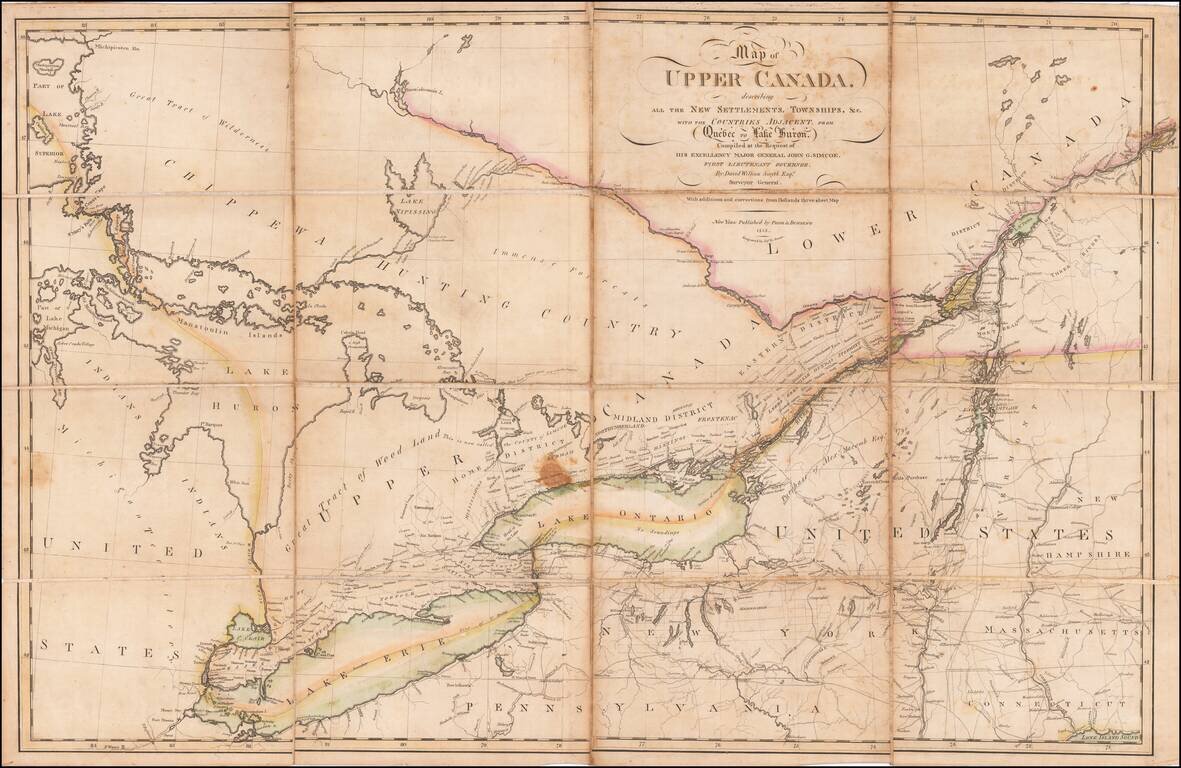
Michigan 4 Years After Statehood

Scarce early example of Tanner's map of Michigan Territory, with interesting early/primitive counties, Indian Lands, etc.

Some of the northern counties are not yet completely formed.


Special conditions for students!

If you are a student, write to us in telegram: @antiquemaps and indicate what material you need and for what work you need a map in high detail. We are ready to provide material on special terms. For students only!

Item information:

Year of creation:
Size:
7994x9876 px
Disk:
20.605MiB
Number of pages:
1
Place:
Philadelphia
Author:
Henry Schenk Tanner.
$14.99

Related item