logo

1852. A New Map Of Michigan with its Canals, Roads & Distances

  • A New Map Of Michigan with its Canals, Roads & Distances

A New Map Of Michigan with its Canals, Roads & Distances information:

Year of creation: 
Resolution size (pixels): 
 1410x1721 px
Disk Size: 
 833077B
Number of pages: 
 1
Place: 
 Philadelphia

Print information. Print size (Width x height in inches):
Printing at 72 dpi 
  19.58 х 23.9
Printing at 150 dpi 
 9.4 х 11.47
Printing at 300 dpi 
 4.7 х 5.74

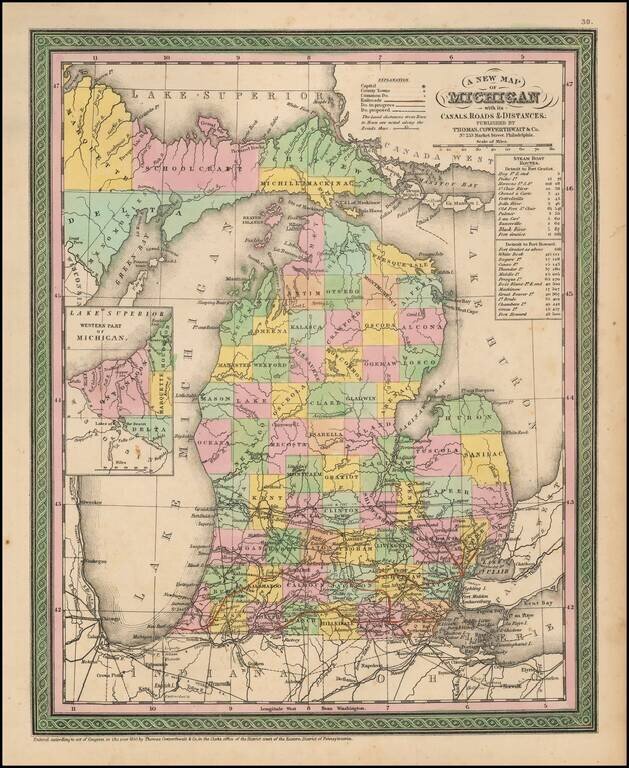
Detailed and interesting map of Michigan, hand colored by county and showing towns, rivers, bays, lakes, railroads, roads, distances, etc.

Tables of Steam Boat routes and distances.

A nice example of this increasingly difficult map to obtain, from an early edition of the Thomas Cowperthwait version of Mitchell's Universal Atlas.


Special conditions for students!

If you are a student, write to us in telegram: @antiquemaps and indicate what material you need and for what work you need a map in high detail. We are ready to provide material on special terms. For students only!

Item information:

Year of creation:
Size:
1410x1721 px
Disk:
833077B
Number of pages:
1
Place:
Philadelphia
Author:
Thomas Cowperthwait & Co..
$9.99

Related item