logo

1831. Plan of Detroit

  • Plan of Detroit

Map size in jpg-format: 583434B

Download "Plan of Detroit", in high resolution.

Plan of Detroit information:

Year of creation: 
Resolution size (pixels): 
 2101x1410 px
Disk Size: 
 583434B
Number of pages: 
 1
Place: 
 Washington
Author: 

Print information. Print size (Width x height in inches):
Printing at 72 dpi 
  29.18 х 19.58
Printing at 150 dpi 
 14.01 х 9.4
Printing at 300 dpi 
 7 х 4.7

An example of detailing the file of this map of in a printable high-resolution:

Click to open in high resolution (open in new tab).
Attention! this is just the central piece (central area 960x960 px) of the map file!
This is an example, so that you can see and study the level of detail of a given map. The entire Map will be fully available after payment!

Plan of Detroit

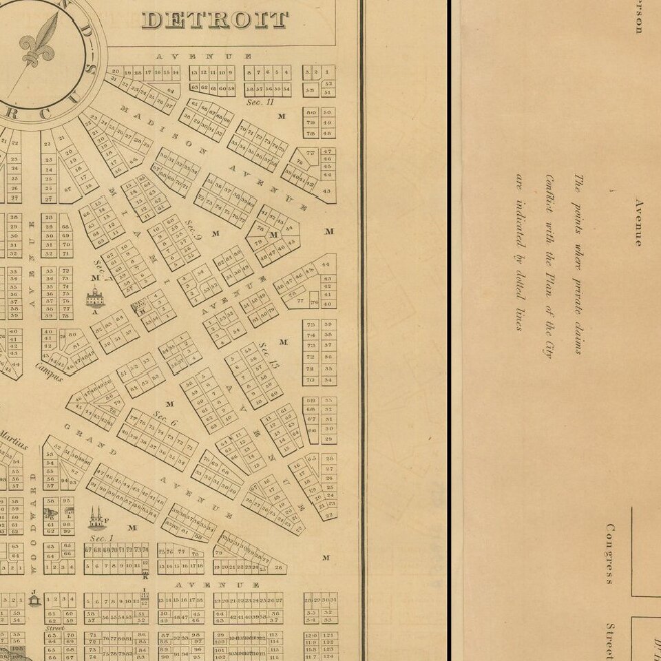
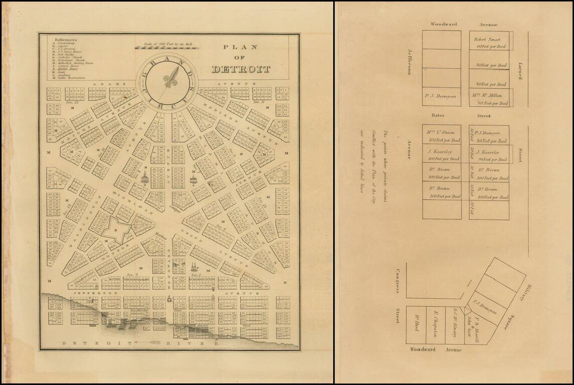
Rare early plan of Detroit from the first edition of the American State Papers.

A highly desirable early plan of Detroit.

With the additional leaf showing plots off of Larned Street and Bates Street.


Special conditions for students!

If you are a student, write to us in telegram: @antiquemaps and indicate what material you need and for what work you need a map in high detail. We are ready to provide material on special terms. For students only!

Item information:

Year of creation:
Size:
2101x1410 px
Disk:
583434B
Number of pages:
1
Place:
Washington
Author:
J.O. Lewis.
$9.99

Related item