Map size in jpg-format: 19.0518MiB
Click to open in high resolution (open in new tab).
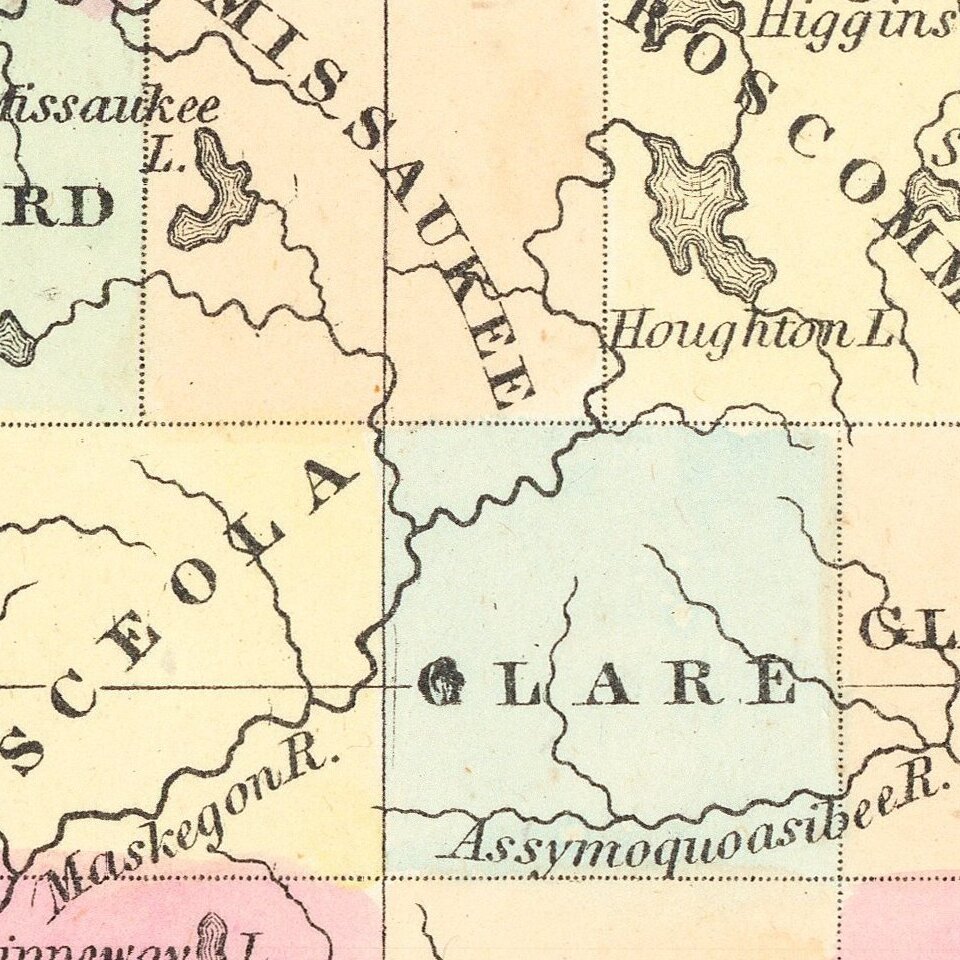
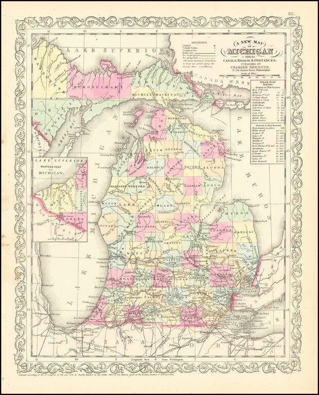
Scarce Charles Desliver map of Michigan, hand colored by county and showing towns, rivers, bays, lakes, railroads, roads, distances, etc. Tables of Steam Boat routes and distances.
A number of Michigan Counties still not yet formed. Railroads are shown in Red and Canals in Blue
A nice example of this increasing difficult to obtain map, from Thomas Cowperthwait's version of Mitchell's Universal Atlas.
An unusually clean fresh example.
If you are a student, write to us in telegram: @antiquemaps and indicate what material you need and for what work you need a map in high detail. We are ready to provide material on special terms. For students only!