
![Crookston. Polk Co. Minnesota. 1882. [Stereoview]](/map/small/64687.jpg)
Minnesota Bird's Eye View - Not Recorded by Reps. Small stereoview of Crookston, Minnesota, comprised of two photographic reproductions of an unrecorded bird's eye view of the city. An interesting record of a very rare Minnesota bird's eye, which...
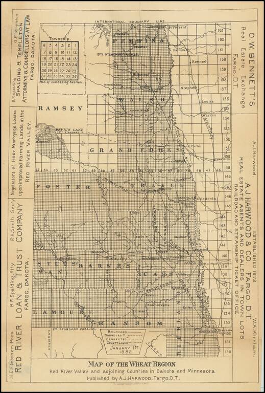
Scarce promotional map of the "Wheat Region" of the Red River Valley, published by A.J. Harwood in Fargo, Dakota Territory. The map illustrates the so-called Wheat Region, along with promotional information for three other Fargo based professionals,...
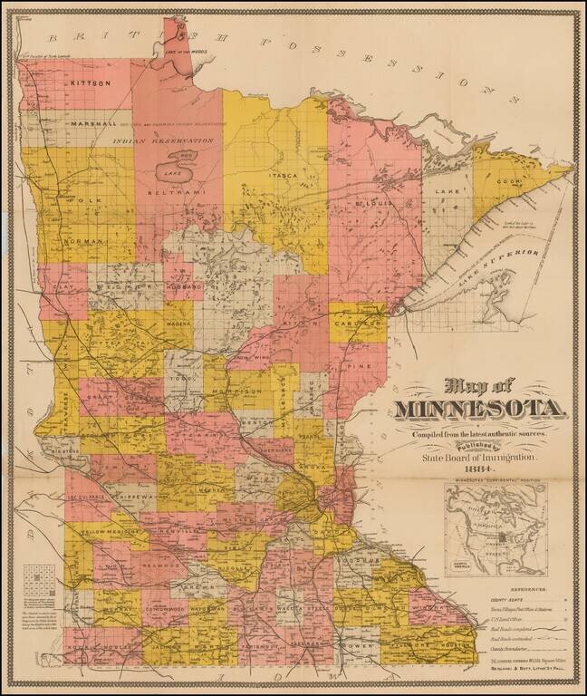
Interesting separately issued map of Minnesota, published by the State Immigration Board. The map is colored by counties and showing County Seats, towns, villages, post offices, railroads, railway stations, townships, lakes, etc. The Northern...
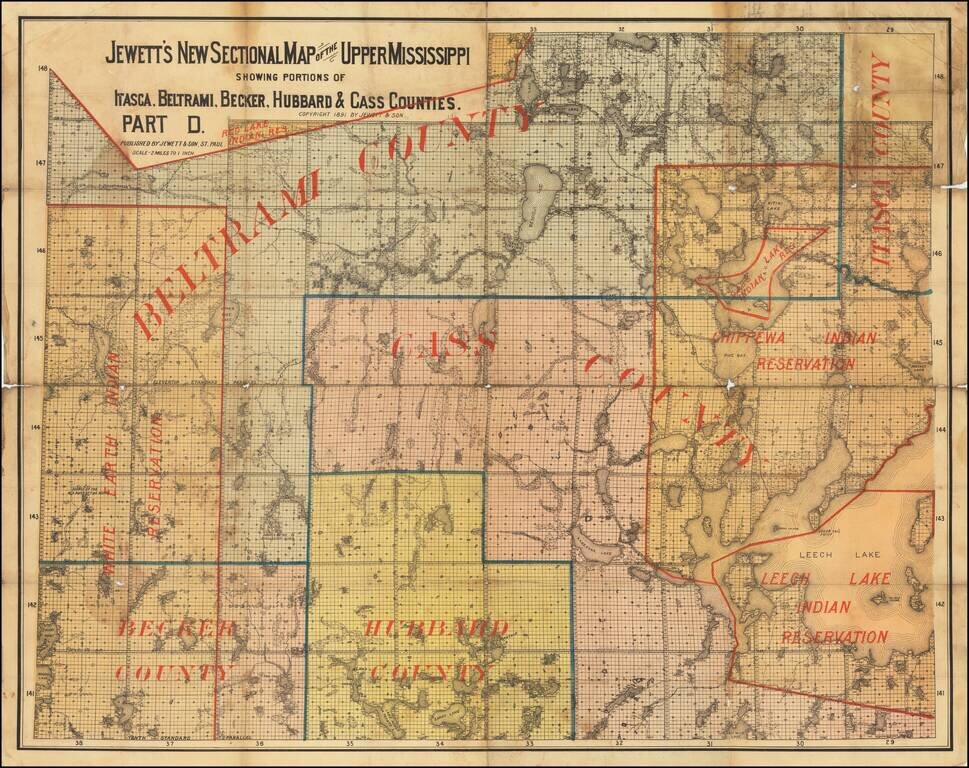
The Headwaters of the Mississippi. Interesting and very scarce Minnesota-published map of the headwaters of the Mississippi River (Lake Itasca) and the surrounding region. The map shows the White Earth Indian Reservation, Chippewa Indian Reservation,...
Detailed railroad map of Minnesota, published in Chicago by George Cram. The map shows counties, railroad lines, towns, rivers, lakes, post offices, railroad depots, Indian Reservations, and a host of other information. The map shows nearly 30...
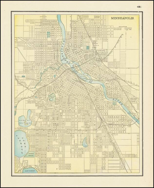
Detailed city plan of Minneapolis, showing streets, buildings, train lines, public places, rivers etc. Cram was one of the pre-eminent American Mapmakers of the late 19th Century, relying upon a cerographic printing process first applied to maps by...
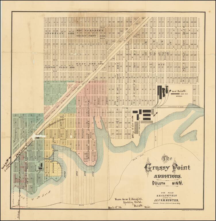
Rare 19th century Duluth, Minnesota, cadastral map, focusing on a burgeoning industrial and worker housing area in West Duluth. The factories of the Duluth Iron & Steel Co., Minnesota Car Co's Works (crossed out to read: "West Duluth Car Co.'s...
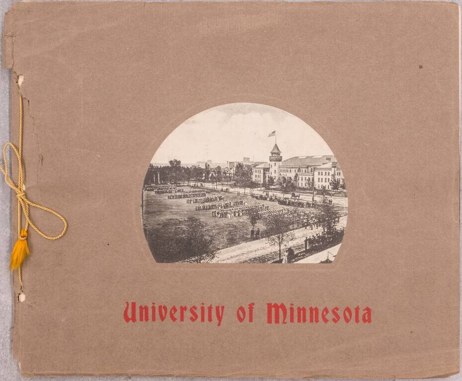
Rare book of 24 black and white photographs of the University of Minnesota. OCLC gives a date of 1907 - this example with ink annotations to after 1913 (one image notes that a building was burned down that year). The best image is probably that of an...
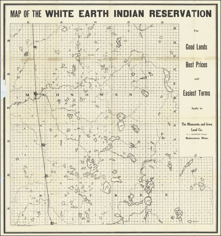
The Continued Dispossession of Native Americans in 20th-Century Minnesota. Interesting map of the White Earth Indian Reservation in northwestern Minnesota, printed for the Minnesota and Iowa Land Co. to promote the sale of "surplus" reservation land...
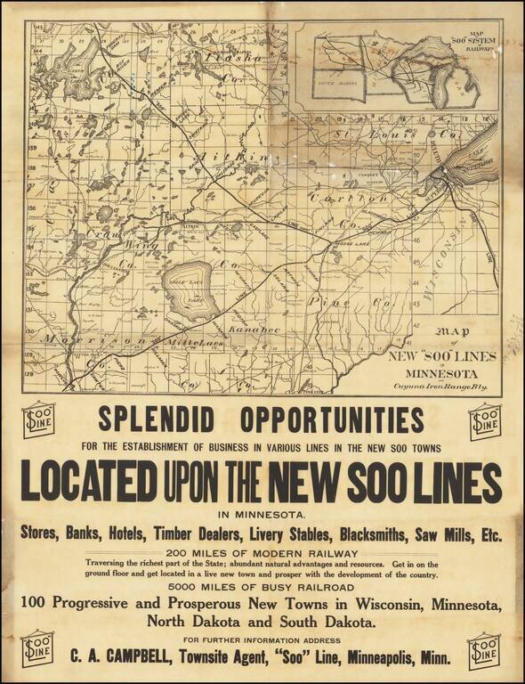
Ephemeral separately issued antique Minnesota Iron Range promotional railway map, issued by the Minneapolis, St. Paul and Sault ["SOO"] Ste. Marie Railroad. The map focuses on northern Minnesota between Lake Superior, Mille Lacs Lake, and Leech Lake,...
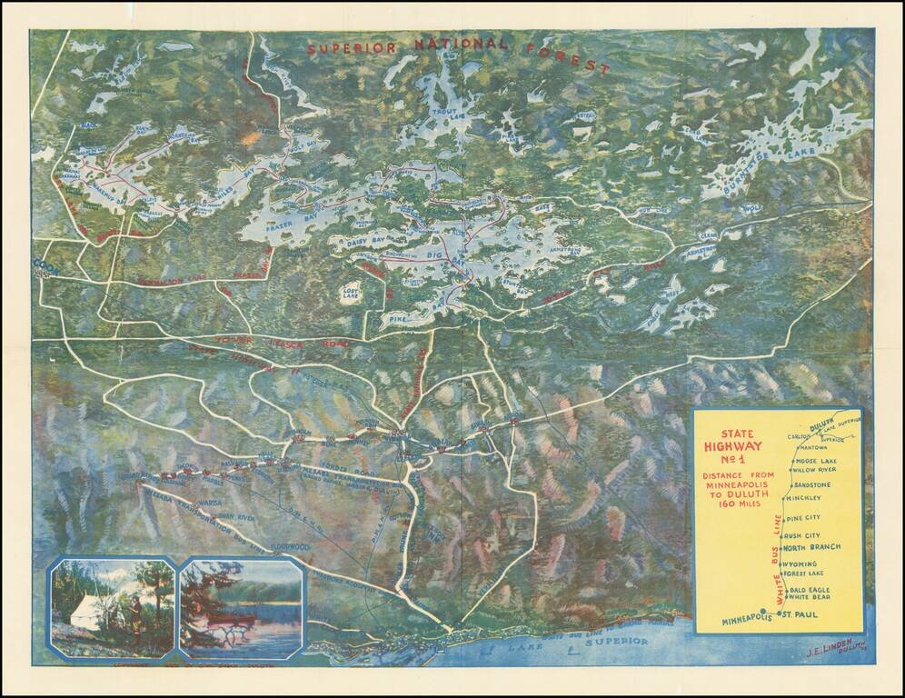
Rare color bird's-eye view of northern Minnesota, produced in Duluth by J.E. Linden. The map was produced to entice vacationers from the Twin Cities to travel to Lake Vermilion in the summer. Lake Superior and Duluth occupy the bottom of the map, and...
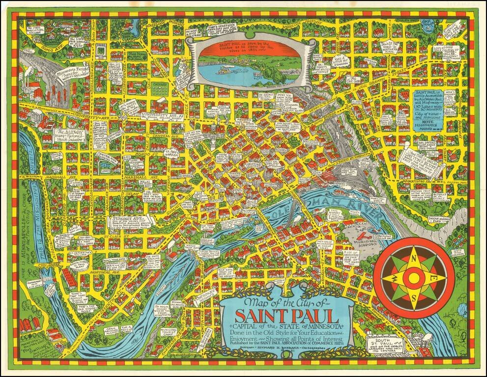
Scarce pictorial map of St. Paul, Minnesota, drawn by Richard Burbank for the Saint Paul Association of Commerce. Includes "Dramatic Moments in Saint Paul's Yesterday" on the verso, along with tourist and promotional text and a fine small birdseye...
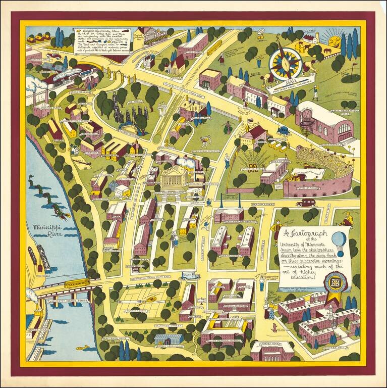
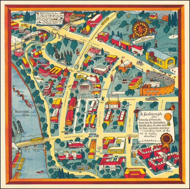
Nadine Semans's 1935 Map of the University of Minnesota. The Biggest of Her University of Minnesota Pictorial Maps. Excellent pictorial map covering the University of Minnesota's original "East Bank" campus. Published by the Dayton Company to promote...
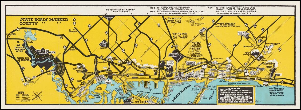
Aiding The Visitor Who Seeks The Beautiful and Desires The Thrill of Stupendous Enterprise and Achievement. Pictorial map of the area around Duluth, Minnesota, promoting local tourism and business, drawn by Nelson A. Long for the Duluth Chamber of...
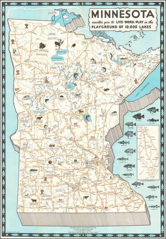
Attractive Vintage Pictorial Map of Minnesota, Featuring the State's Local Fish, Livestock, and Agriculture. The map illustrates fourteen species of fish and across the state the local produce and livestock species are illustrated pictorially. The...
Nadine Semans's Map of the University of Minnesota. Excellent pictorial map covering the University of Minnesota's original "East Bank" campus. Published by the Dayton Company to promote Dayton's University Store, a note in the upper left corner...