
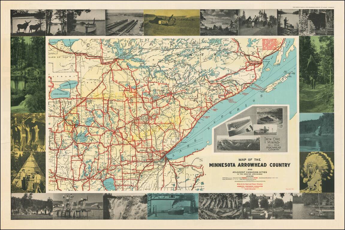
Attractive pictorial map of Minnesota's Arrowhead Region with numerous carte-a-figure photographs of local tourist attractions, wildlife, Native Americans, etc. The map includes inset photos of Iron Ore mining operations in northeast Minnesota. The...
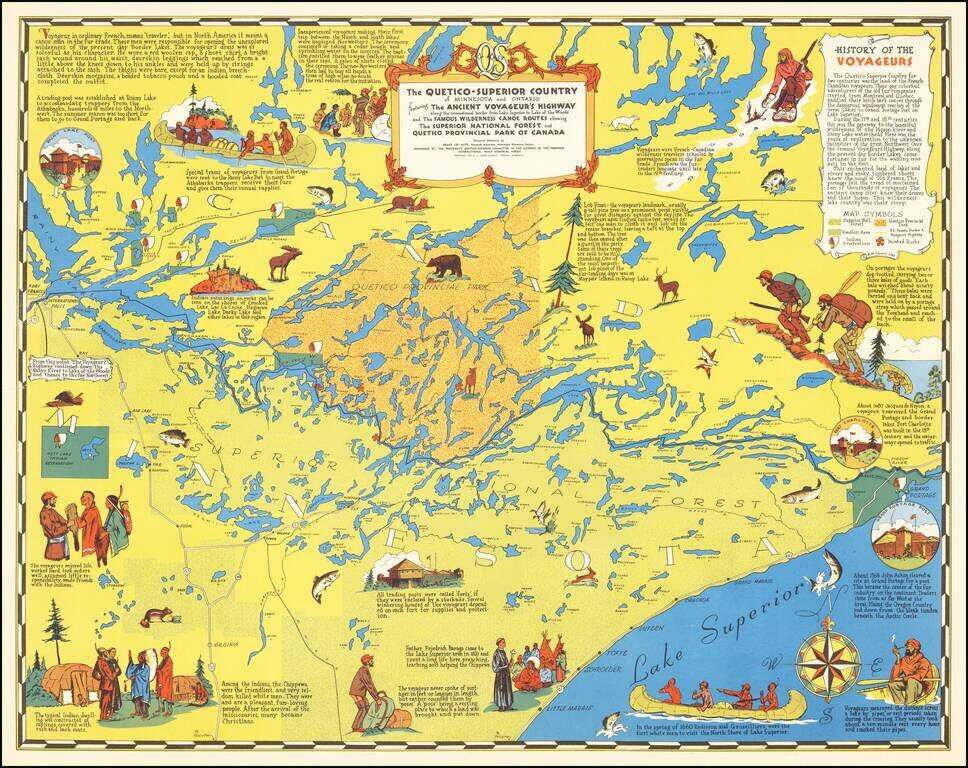
"Voyageur, in ordinary French, means 'traveler', but in North America it meant a canoe-man in the fur trade." Nice pictorial map of Minnesota's "Arrowhead" and Boundary Waters regions. The map focuses on the history of the French-Canadian Voyageurs...
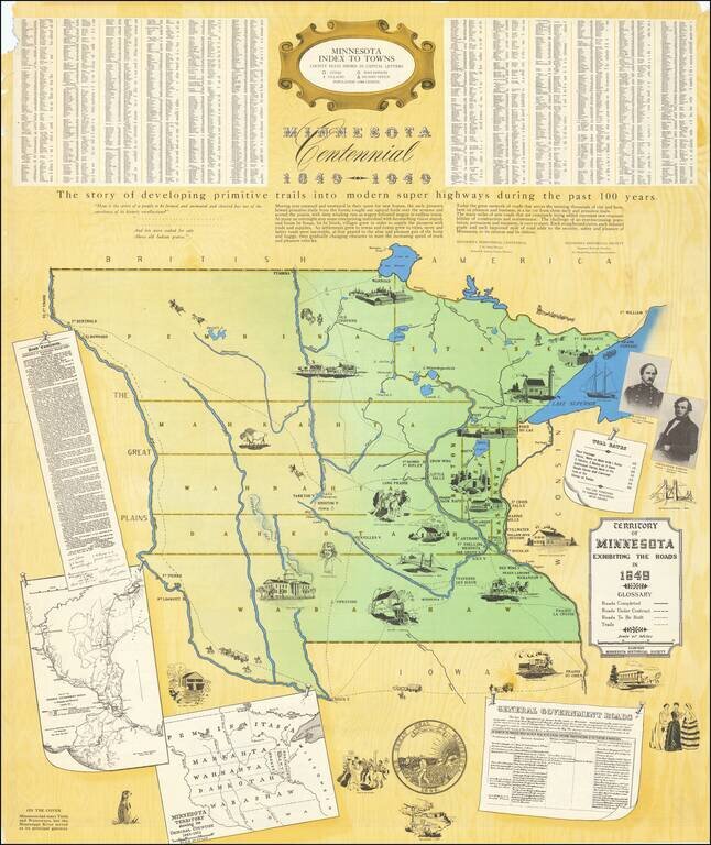
Large Minnesota Historical Society pictorial map depicting the Territory of Minnesota in 1849. The main map focuses on the roads in the Territory in 1849, an inset map shows the original counties, and another shows the roads in eastern Minnesota in...
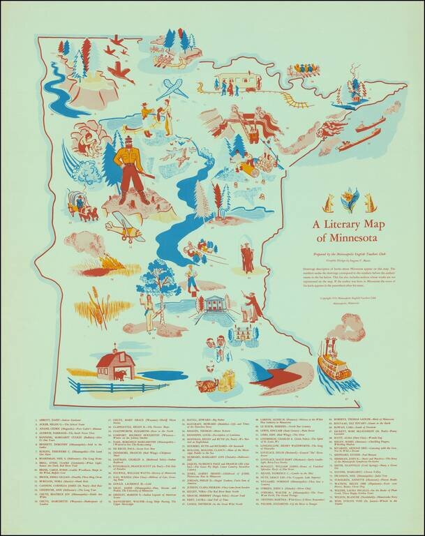
Scarce vintage pictorial of Minnesota, focusing on the state's literary heritage. The map was published by the Minneapolis English Teachers Club in 1954. "Drawings descriptive of books about Minnesota appear on this map. The numbers under the drawings...
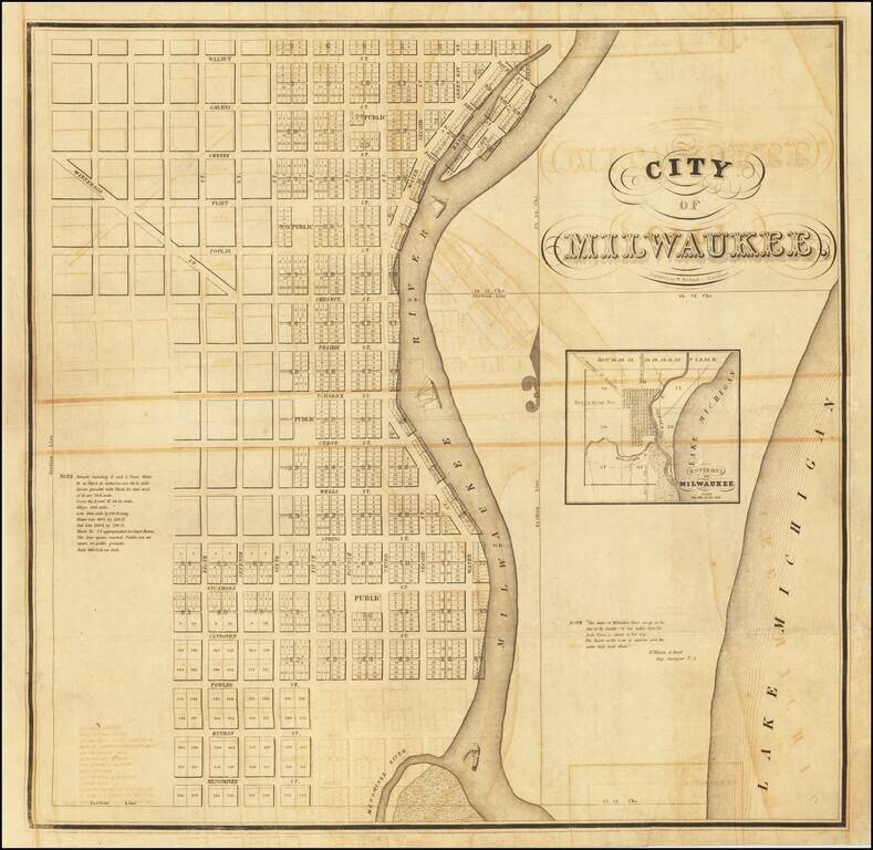
The Exceptionally Rare First Printed Map of Milwaukee, Wisconsin. Unseen on the Market Since 1934. An important American map, being the first printed map of Milwaukee, Wisconsin, executed by Increase Lapham and Byron Kilbourn in 1835-36, and engraved...
![Map of Milwaukee | Population in 18[35] None | In 1843 6068.](/map/small/68734.jpg)
First State of the Second Map of Milwaukee, with Contemporary Property Ownership Annotations. This is an exceedingly rare early map of Milwaukee, made by the important Milwaukee cartographer Increase Lapham. This is the first printed map to show a...
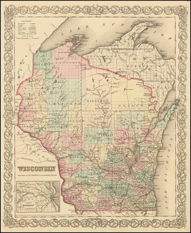
Detailed map of Wisconsin, colored by Counties, with massive Oconto, Marathon, La Point, Douglas, Polk, Burnett and Chippewa counties dominating the north. Inset of Milwaukee. Shows towns, townships, lakes, rivers, post offices, etc. JH Colton was one...
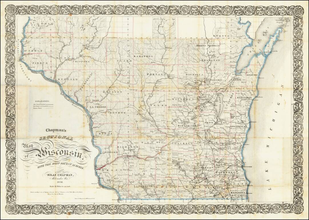
Identifying the Major Sites from the Blackhawk War: The Battle of Wisconsin Heights, The Battle of Bad Axe, and Fort Atkinson. Early Silas Chapman sectional map of Wisconsin, focusing on the lower half of the state and illustrating the extent of major...
![Milwaukee City and Environs Engraved expressly to accompany the City Directory for 1858 & 9. [with:] Milwaukee City Directory. 1858-9.](/map/small/57977.jpg)
Detailed, early lithographed map of Milwaukee, published in Milwaukee by Lipman and Riddle. The map features rail lines and the street grid in downtown, with almost all of the streets named. It also details subdivisions that are beginning to extend...
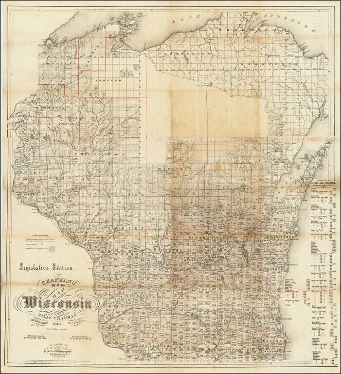
Unrecorded "Legislative Edition" Rare (unique?) separately published "Legislative Edition" of Silas Chapman's map of Wisconsin. The map noted that it is "Engraved & printed by L. Lipman, Practical Lithographer" in Milwaukee, with additional...
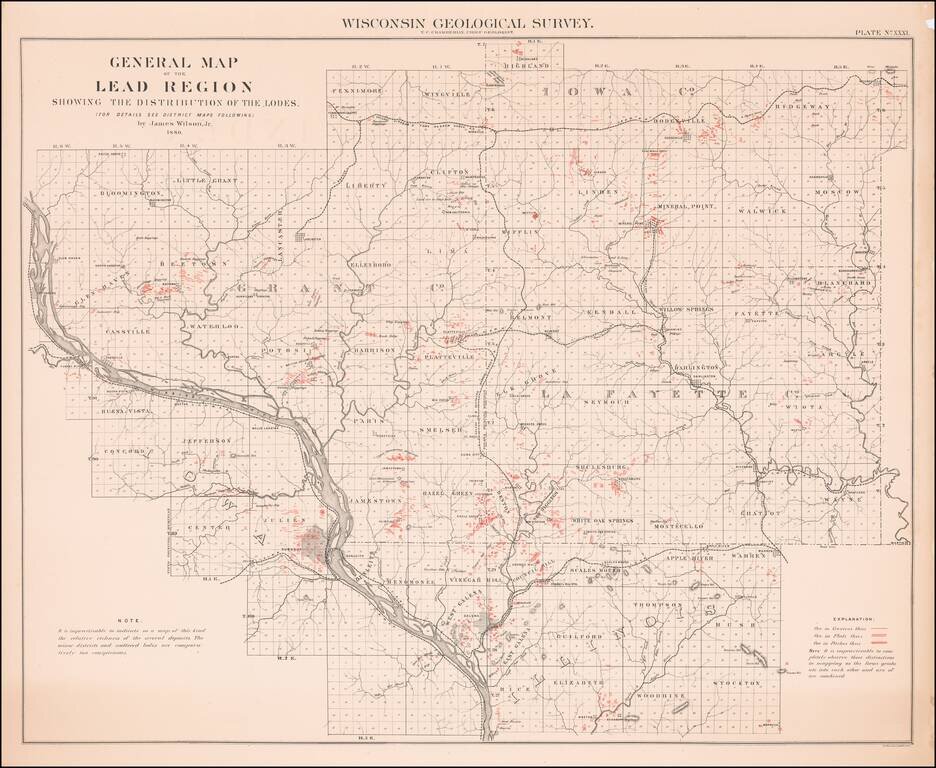
Scarce map of the Lead Region, including parts of Wisconsin, Illinois and Iowa, from the 1880 Geological Survey of Wisconsin. The map was included in a Geological Atlas by T.C. Chamberlin and Chief Geologist R.D. Irving.
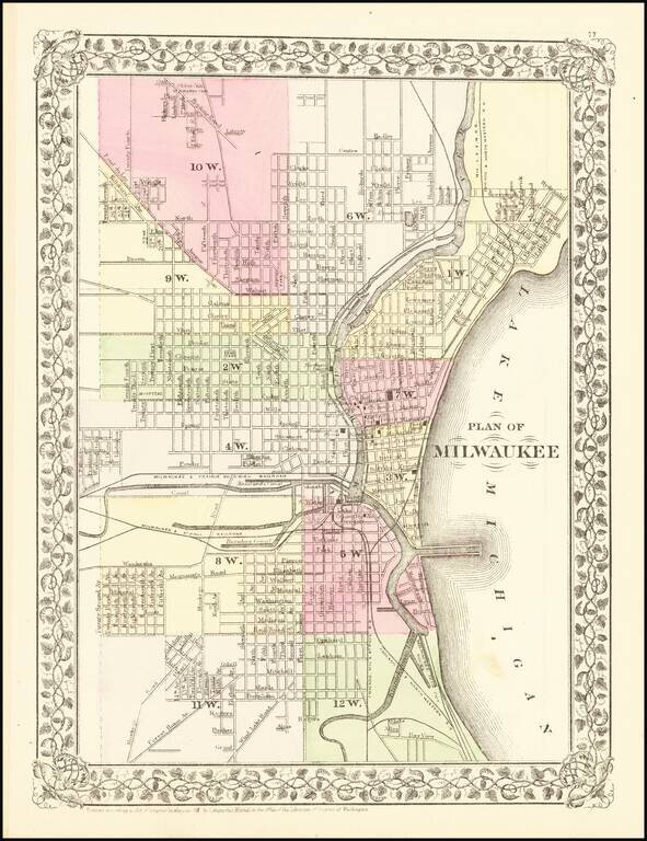
Detailed map of the city of Milwaukee, hand colored by wards. Shows the Milwaukee & St. Paul RR, the Milwaukee & Prairie Du Chien RR, the Chicago & Northwestern RR, the Mil. L.S& W. RR, the Chicago, Milwaukee & St. Paul RR and...
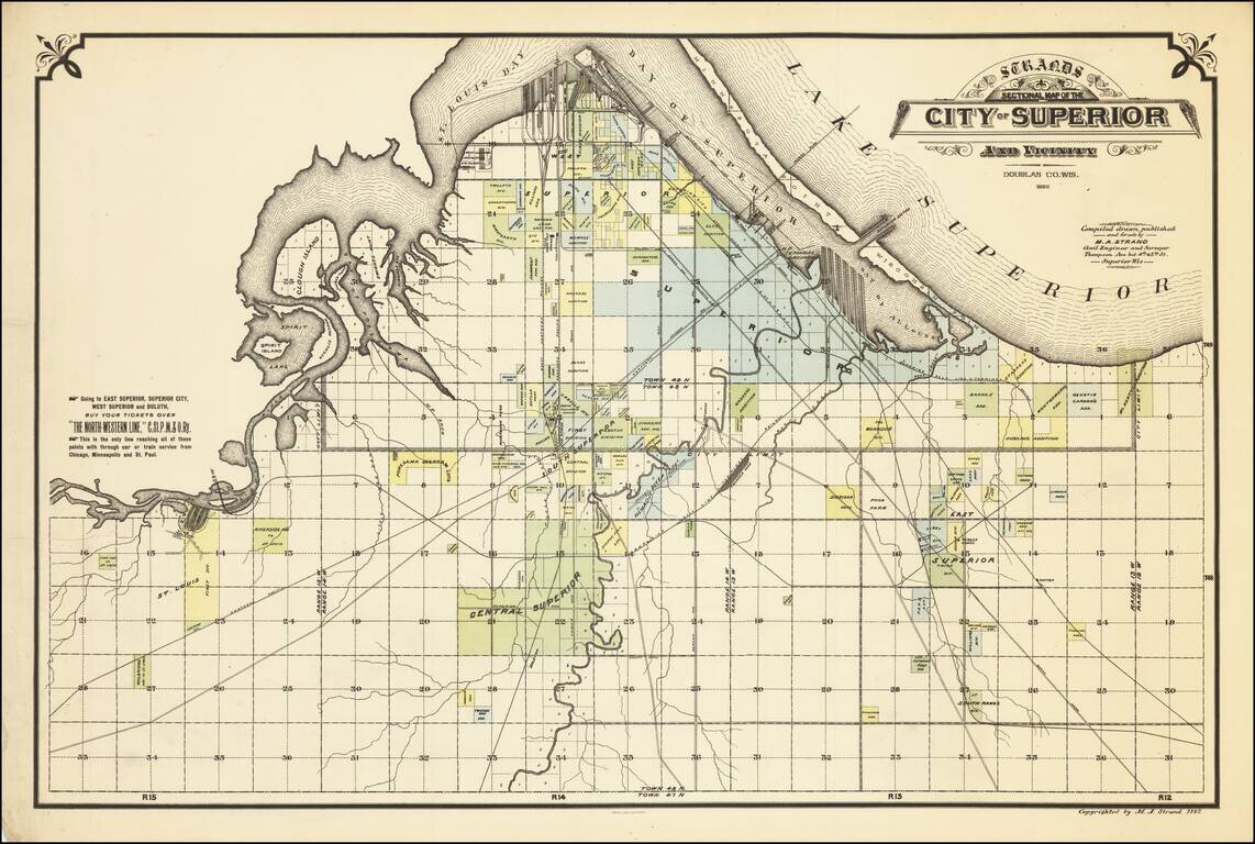
Rare separately issued map of the City of Superior, Wisconsin, published during Superior's second boom period (1888 to 1892). Shows railroads, railroad yards, main roads, additions, and selected buildings in Superior and parts of the Towns of...
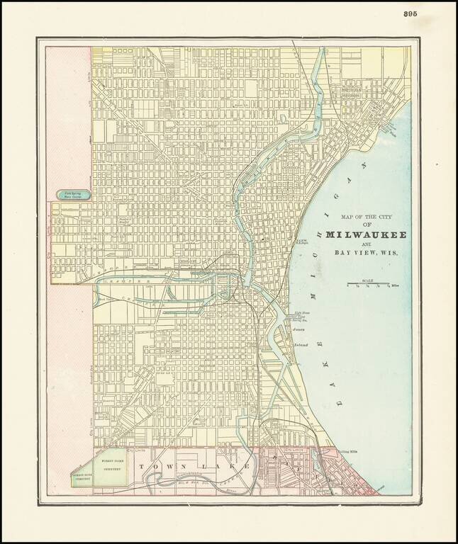
Detailed city plan of Milwaukee and environs by George Cram. The map show streets, buildings, train lines, public places, rivers etc.
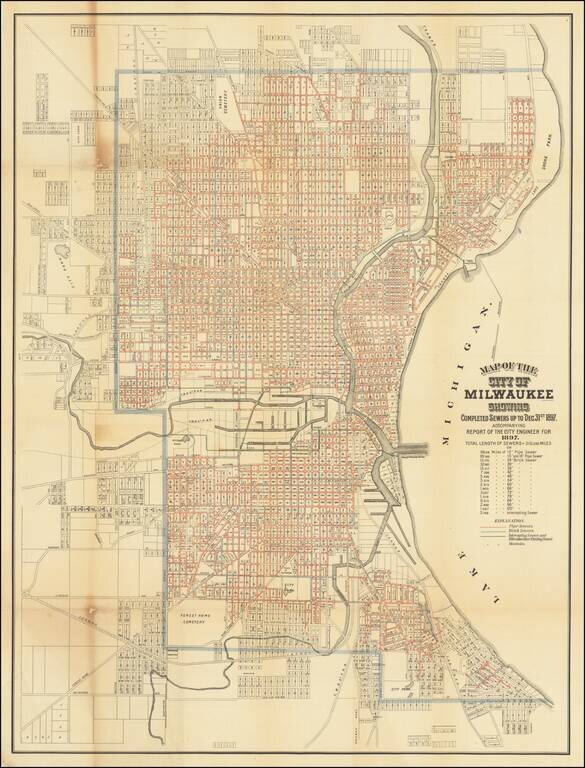
Rare map of the City of Milwaukee, published by the city to illustrate a report of the City Engineer. The map shows the progress of public works up to the end of 1897, showing sewers, intercepting sewers, manholes, block numbers, streets, railroads,...