
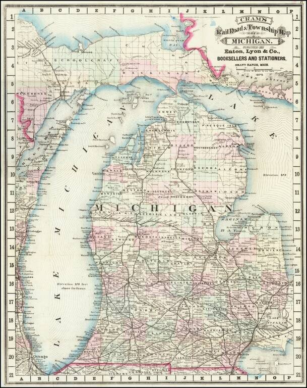
Cram's rare 1879 railroad map of Michigan, based on his first edition of 1875. Michigan prospered after the Civil War, with the lumber, dairy, and railroad industries taking off. This map reflects the booming economy, as the railroads stretched across...
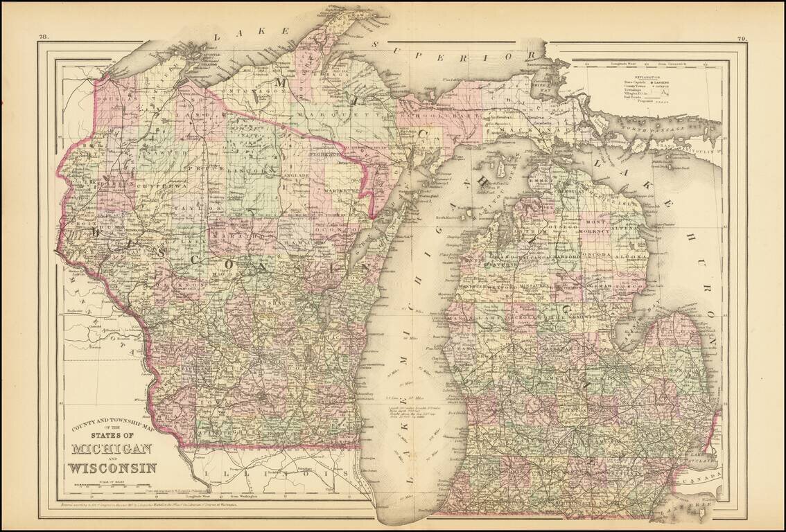
Detailed map of Michigan and Wisconsin, hand-colored by counties. The map was published in S.A. Mitchell Jr.'s New General Atlas, one of the most popular American atlases of the second half of the 19th century.
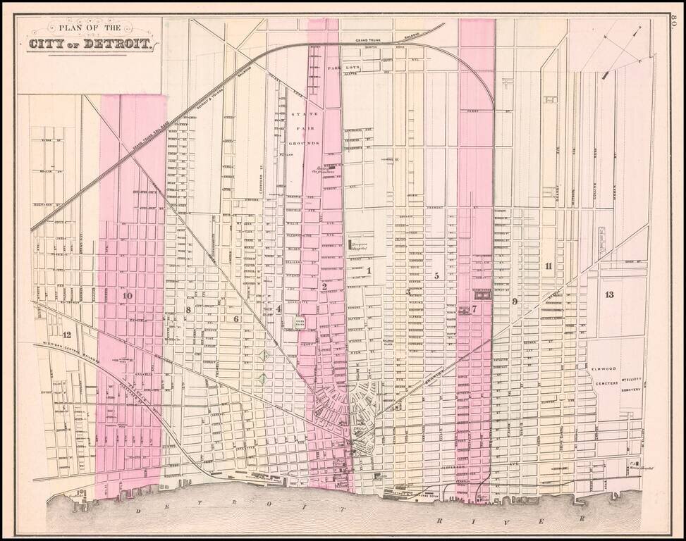
Detailed map of the city of Detroit, hand colored by wards. Shows the Michigan Central RR and Depot, Detroit & Milwaukee RR and Depot, Michigan Exchange, Biddle House, Post Office, Masonic Hall, Board of Trade, Water Works, Harper Hospital,...
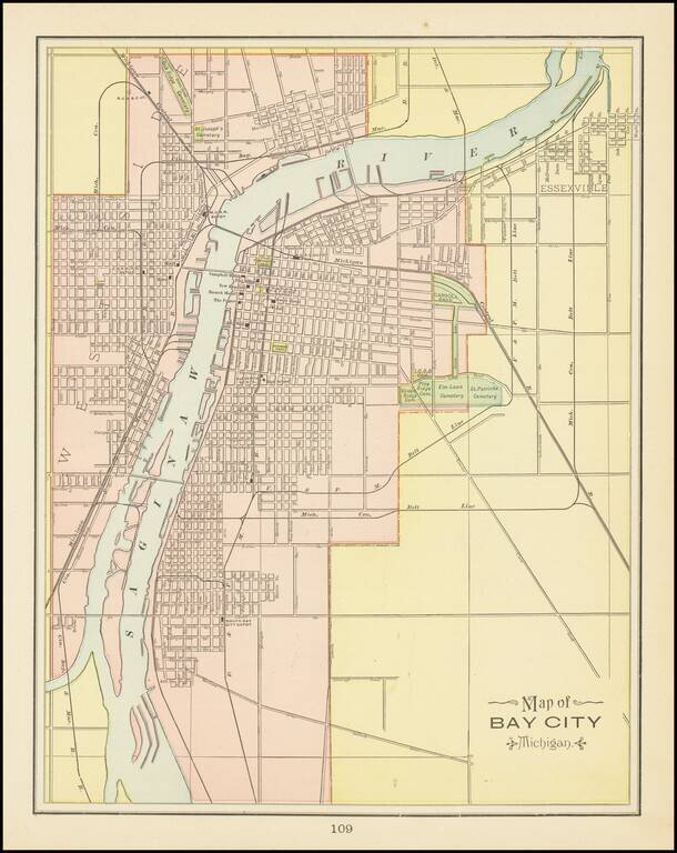
Detailed map of Bay City, Michigan, from George Cram's Family Atlas. The maps shows streets, buildings, train lines, public places, rivers etc. Cram was one of the pre-eminent American Mapmakers of the late 19th Century, relying upon a cerographic...
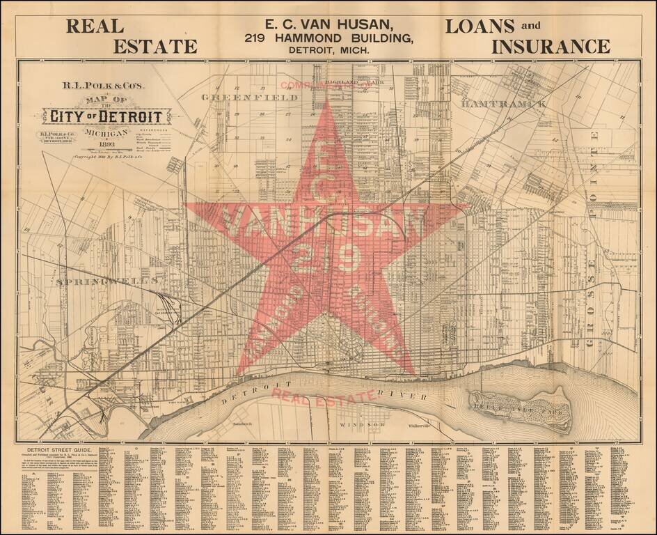
Scarce promotional map of the City of Detroit, advertising for EC Van Husan Real Estate (219 Hammond Building). This is apparently the first state of the map--F.B. Streeter also notes an edition of 1894. Oriented with north toward the upper right....
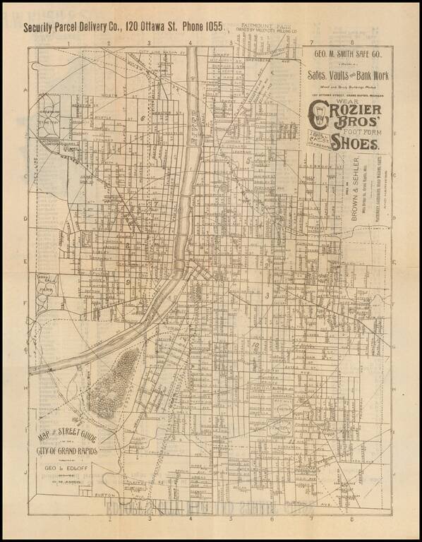
Advertising city map promoting Nelson Matter & Co. Furniture and The Reed Engraving Company on the outside and George M. Smith Safe Co and Crozier Bros' Shoes on the map. This is the first map of Grand Rapids we have handled.
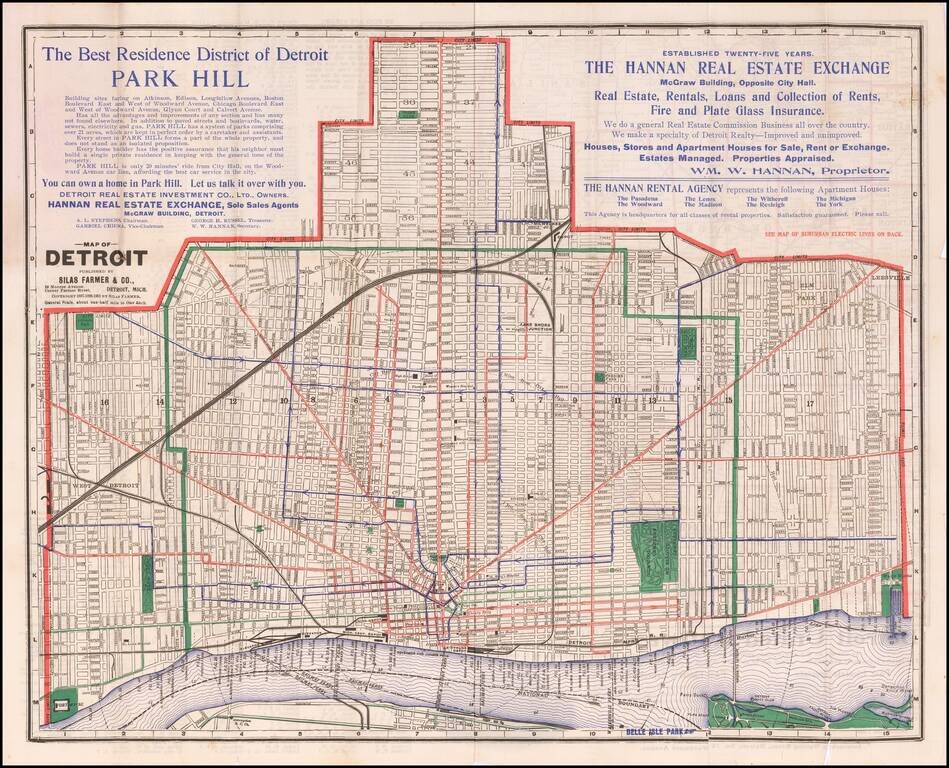
Scarce map of Detroit, with a transit map of Southeastern Michigan on the verso, published by Silas Farmer & Co. The map is printed in black, red, green, and blue ink on white paper and shows streets, street names, railroad lines, streetcar lines,...
![[Kensington Metropolitan Park / Kent Lake] Scouting To Adventure Gold Rush of '48 Detroit Area Council Boy Scouts of America . . . 1948](/map/small/63032.jpg)
A Gold Rush Themed Scouting Retreat in 1948 Pictorial map of the Kensington Metropark area of Kent Lake, prepared in conjunction with the Detroit area Boy Scouts of America regional council, June 25, 26 and 27, 1948. The map provides a lively image...
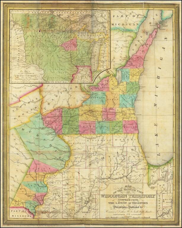
A Foundational Wisconsin Map. This is an important early map of Wisconsin, published only two years after the territory was incorporated. The map centers on the areas now part of southwestern Wisconsin and eastern Iowa. In this area, the most...
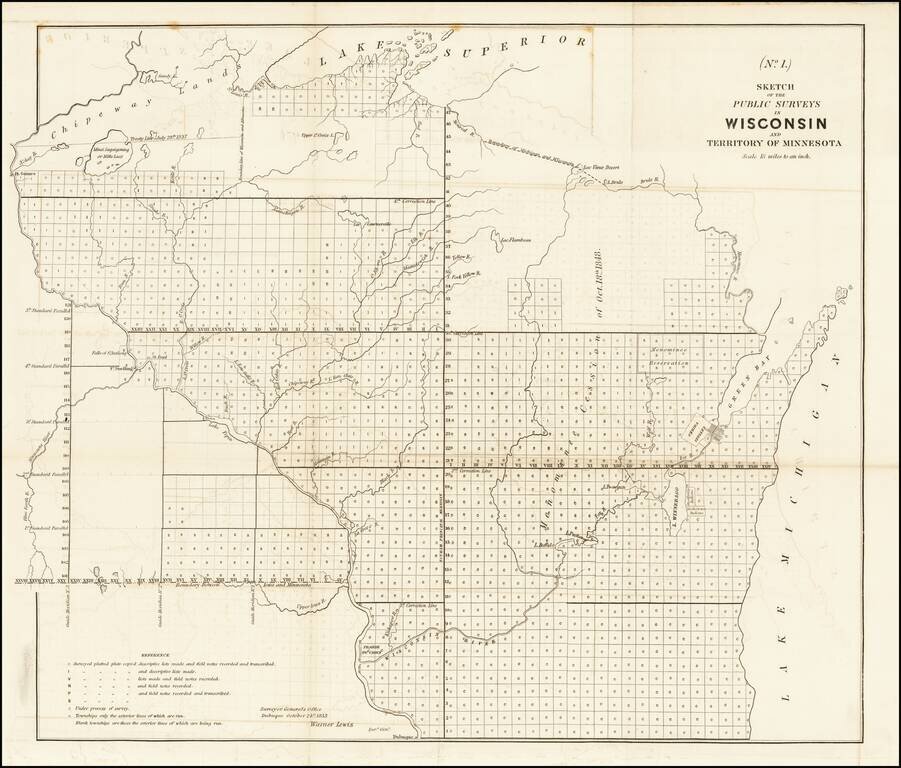
Antique map of Wisconsin and part of Minnesota Territory, produced by Warner Lewis, Surveyor General of the Dubuque Office, on October 21, 1853. The map shows the plats which had been surveyed and those which were in the process of being surveyed....
![The Minnesota Handbook, for 1856-7 [with] Minnesota Published by J.H. Colton & Co... 1857.](/map/small/68854.jpg)
1857 Edition of Parker's Handbook to Minnesota, along with the Special Edition of Colton's Map, with "Corrections Furnished by N.H. Parker." This Example from the James J. Hill Library. First and only edition of Parker's important early treatment of...
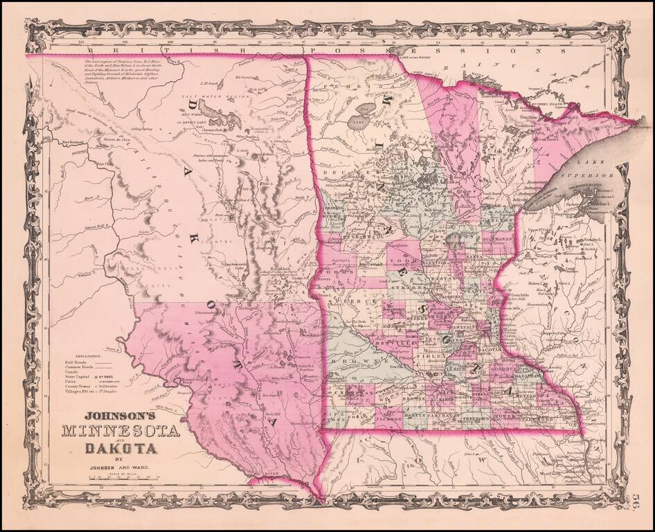
Detailed map of Minnesota and Dakota Territory, colored by county, with only two counties in Dakota and 4 large counties in northern Minnesota. Many Indian Tribal names and notes. Minneapolis is named.
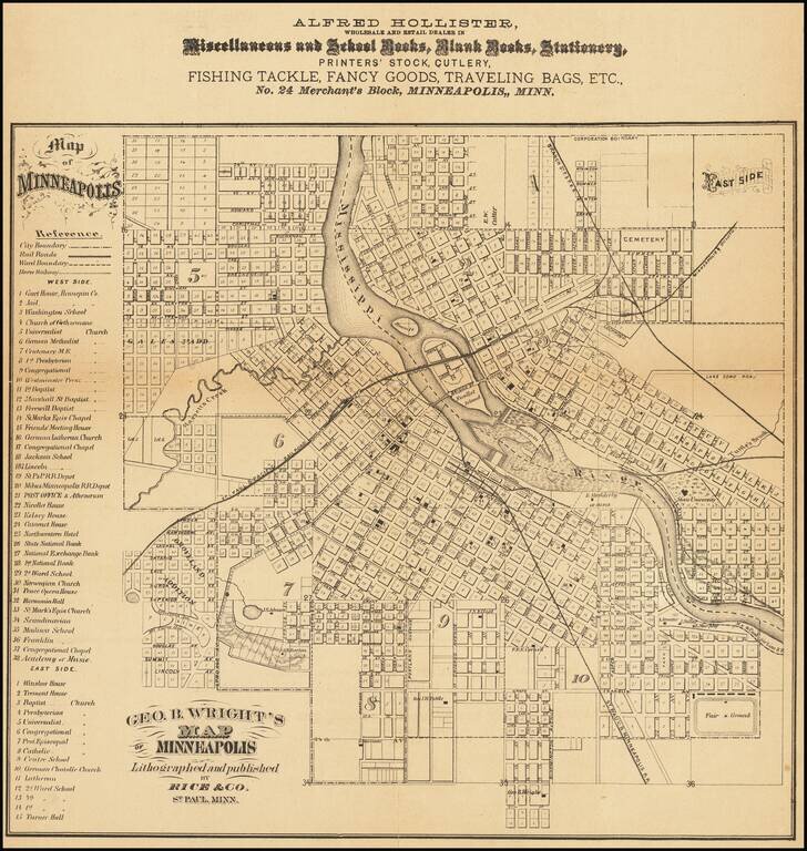
Rare Early Map of Minneapolis The Year After Annexation of St. Anthony Detailed map of Minneapolis, published by Rice and promoting Alfred Hollister, Wholesale Dealers in Miscellaneous and School Books, Blank Books, Stationery, Printers' Stock,...
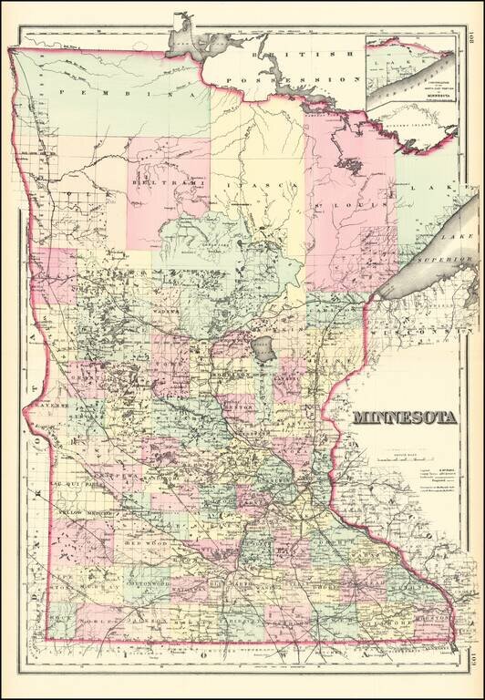
Detailed map of the state of Minnesota, colored by townships and showing counties, towns, rivers, canals, etc. An excellent large format map of the period from one of the major American map publishers of the 1870s.
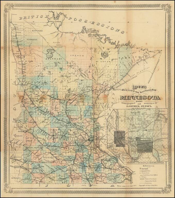
Final? Edition of Rice's Important Map of Minnesota. Rare 1880 St. Paul-published map of Minnesota, by the state's foremost early map publisher. The map includes an inset titled "Vicinity of St. Paul, and Minneapolis." The inset shows local train and...
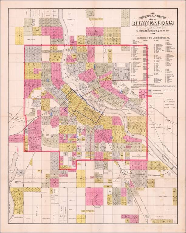
Detailed, locally-published antique map of Minneapolis, lithographed by Johnson, Smith & Harrison in Minneapolis in 1881. Three types of boundaries are shown on the map: Fire Limits, Ward Boundaries, and City Limits. Wards are identified with...