
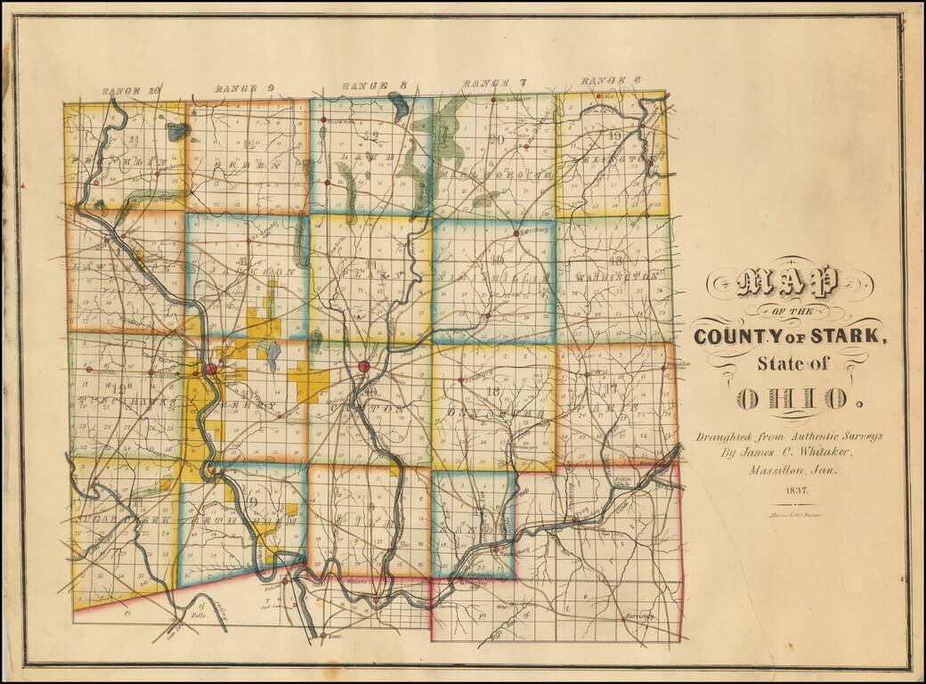
Rare Early Map of Stark County, Ohio -- One of the Earliest Obtainable Ohio County Maps. James C. Whitaker was apparently a local map maker, who was then active in Massillon, Ohio.The following article appeared in the January 25, 1936 edition of the...
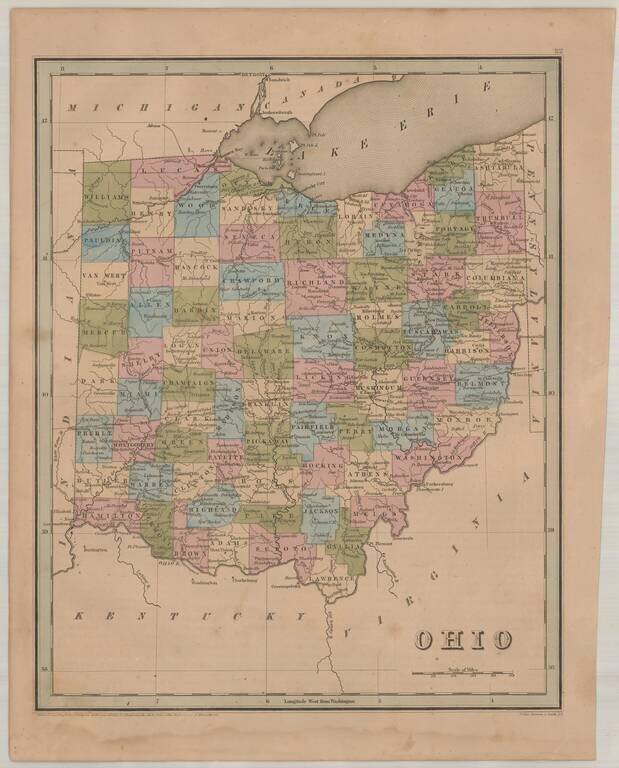
Interesting and detailed map of Ohio, from an early edition of Bradford's Atlas. The map is colored by counties and shows towns, rivers, lakes, roads and other important details.
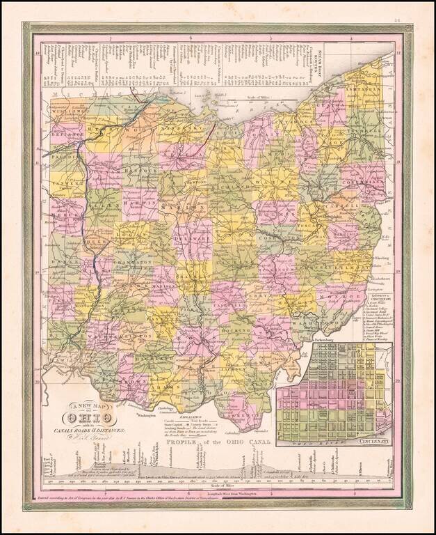
Nice example of Tanner's map of Ohio, hand colored by county, showing roads, canals, towns, steamship routes and other interesting details. An inset shows the city plan for Cincinnati and a profile of the Ohio Canal. One spot in the border at the...
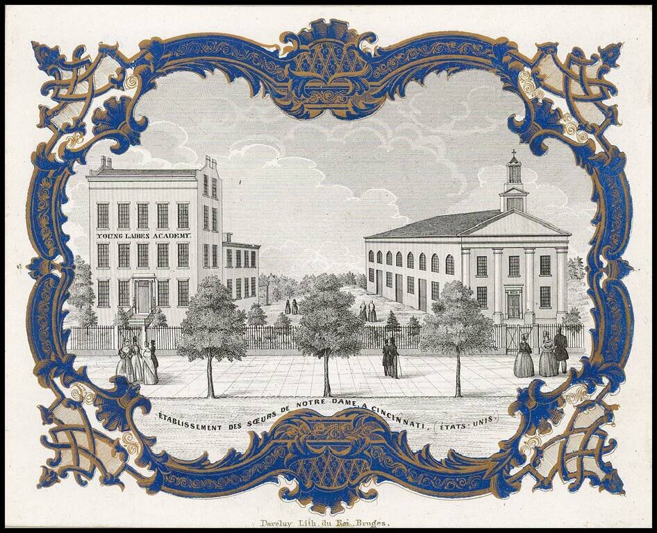
Rare " Porseleinkaart", showing the "Instituut der Soeurs de Notre-Dame te Cincinnati" (Young Ladies Academy of the Sisters of Notre Dame in Cincinnati. Archdiocese of Cincinnati established the Young Ladies Literary Institute and Boarding School in...
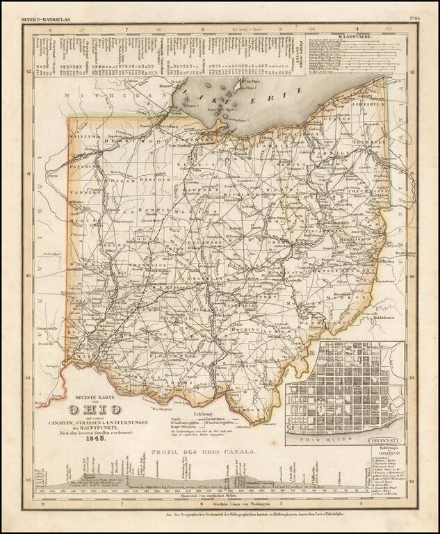
Elegantly engraved and detailed map of Ohio, with an inset map of Cincinnati and profiles of the Ohio Canals, taken based upon Tanner's work in the early 1840s. Shows counties, towns, roads, canals, lakes, etc. While often referred to as the German...
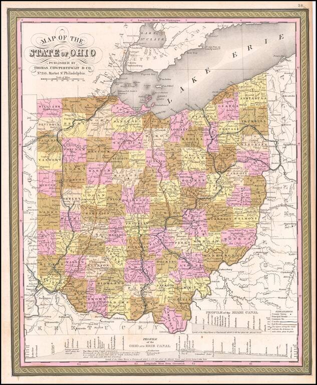
Rare first state of the Thomas Cowperthwait & Co. map of Ohio. Detailed and interesting map, hand colored by county and showing towns, rivers, lakes, railroads, roads, distances, forts, etc. Profile of Miami, Ohio and Erie Canals shown.
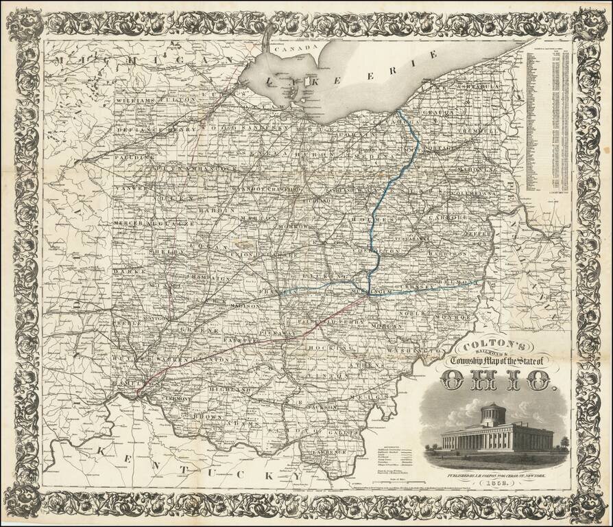
First Edition! Detailed engraved folding map of Ohio, issued by J.H. Colton in 1852. The map shows the "new" Ohio Statehouse building. Ohio had planned to build a new statehouse building for years, but the project took on urgency in 1852 when the old...
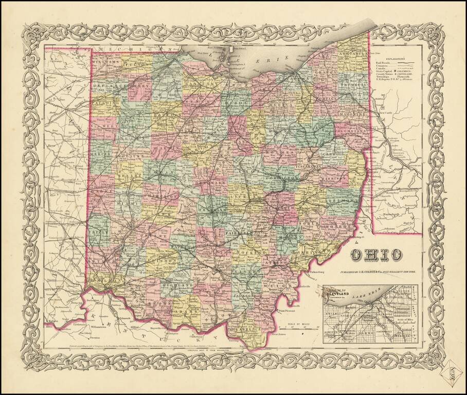
First Edition of JH Colton's Map of Ohio Detailed map of Ohio, published in New York by J.H. Colton. The map is colored by counties, and shows roads, railroads, towns, villages, post offices, canals, rivers, lakes, stations and a host of other...
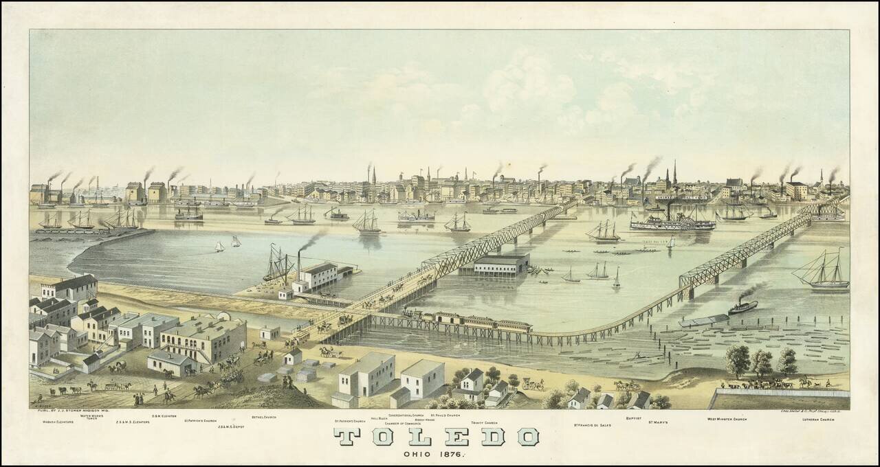
Rare early view of Toledo, Ohio, drawn by Albert Ruger, published by J.J. Stoner of Madison, Wisconsin, and printed in Chicago by Charles Shober & Company. As note on the Library of Congress website: This panoramic map shows Toledo, Ohio, as it...
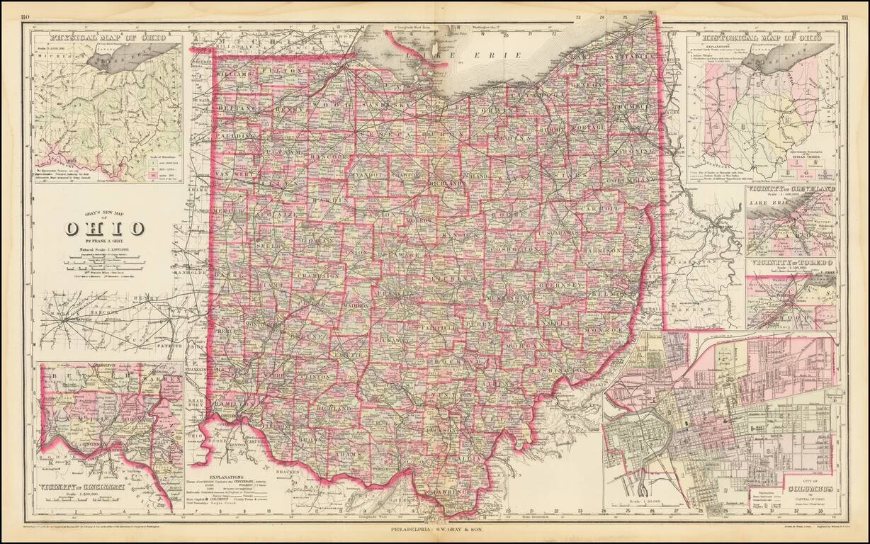
Highly detailed map of Ohio, published by OW Gray. The map is colored by townships and showing towns, roads, railroads, Post Offices, etc. Insets of Cleveland, Toledo, Columbus, Cincinnati and two smaller maps of the state.

Decorative and unusual trading card map from this famous series. Map is surrounded by decorative vignette, showing Wool raising and the Garfield Monument. Includes population statistics.
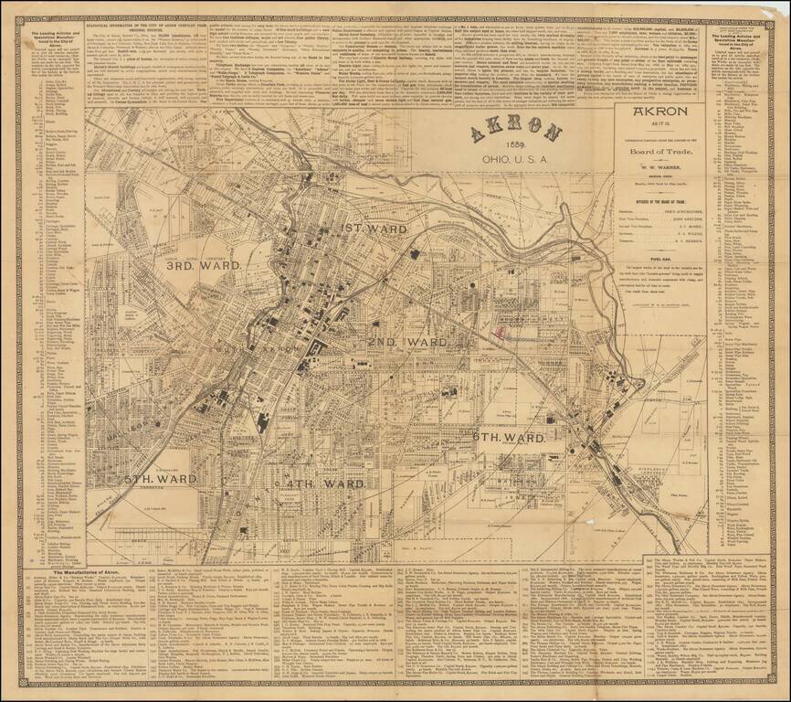
Great early map of Akron, Ohio by W.W. Warner, produced under the auspices of the Akron Board of Trade. The map shows the city divided into wards, with fine plot-level detail throughout the covered area. Some neighborhoods and landowners are named....
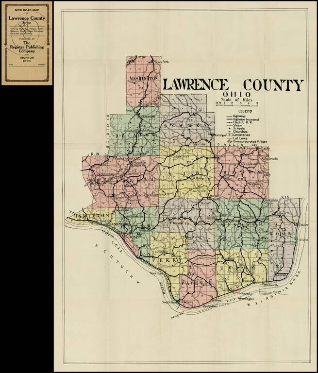
Detailed pocket map of Lawrence Ohio, published by the Register Publishing Company. Shows highways, electric railway lines, steam rail road lines, schools churches, cemetaries, etc.
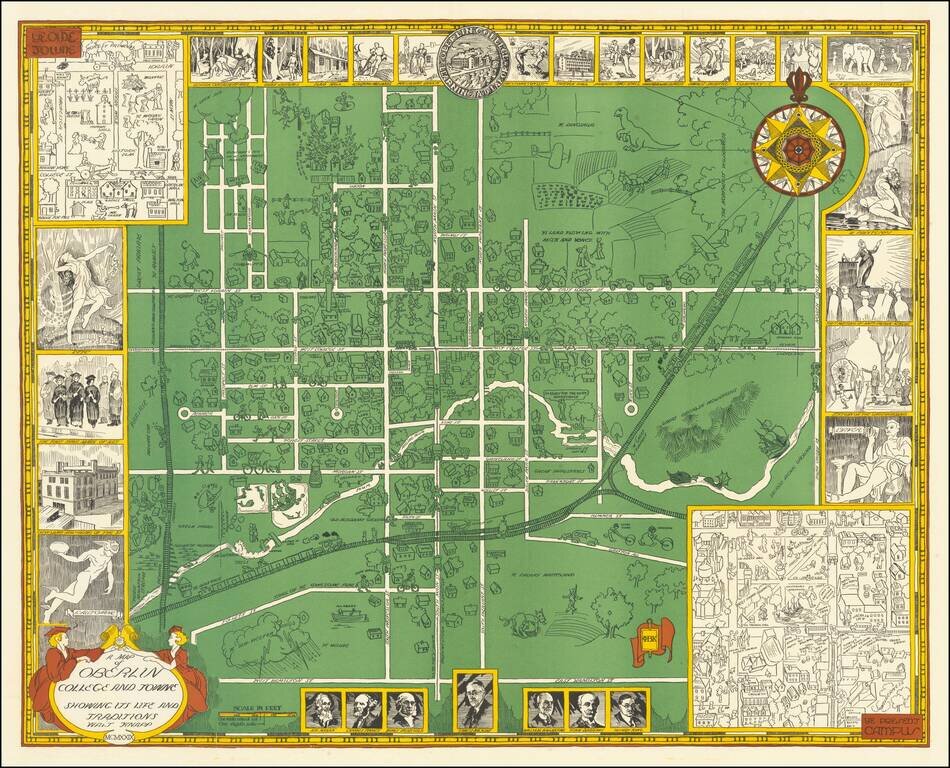
Rare vintage pictorial map of Oberlin College and the town of Oberlin, Ohio. The map was made by Walter Knapp in 1929, during the Golden Age of Pictorial Mapmaking, and it relies on many of the themes embodied in that movement. The map includes...
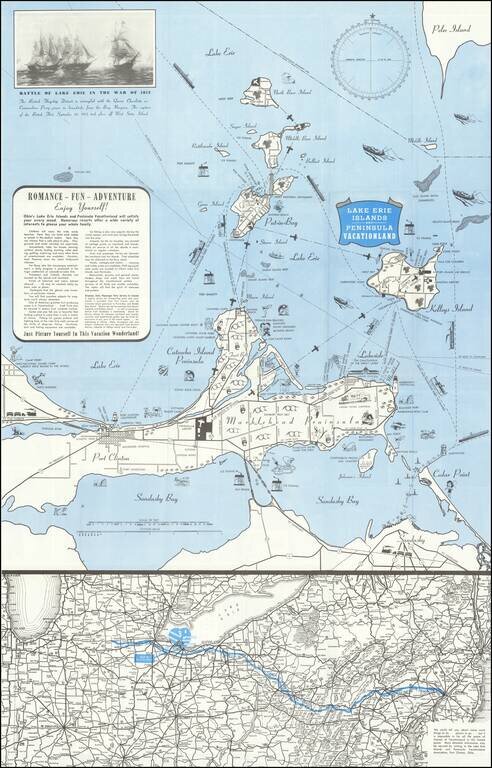
Lively pictorial map of the Lake Erie and Peninsula Vacationland, near Port Clinton Ohio, between Toledo and Cleveland on Lake Erie. The main map focuses on recreational opportunities on Marblehead and Catawba Island Peninsulas, with Port Clinton....
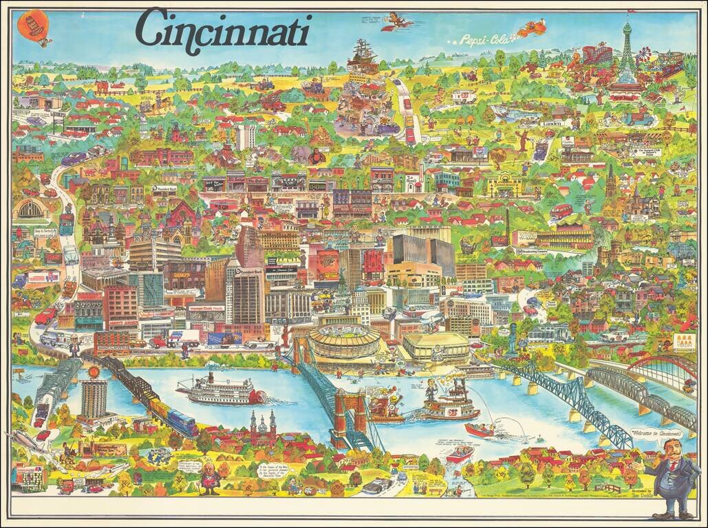
Lively pictorial map of Cincinnati, published by City Design Print and illustrated by Tom Dodds. The map includes advertising for dozens of Cincinnati's local businesses, including a number of local landmarks, providing an entertaining an informative...